
McCool










Caution! We do not provide turn-by-turn directions in our GPX files. Those are auto-generated by your bike computer and are usually less than 70% accurate. Learn more.
For help loading a GPX file onto your bike computer, go here.
DownloadThis is a new feature, and it will become a paid feature in the future as we pursue membership.
Open Ride With GPSWhen We Like to Ride This
Late spring through early summer, and fall. Two factors: (1) The route tops out at 5300 feet, thus the winter snows need to melt out before riding and (2) the route needs moisture in the ground, otherwise you will encounter soft and sandy conditions.
Terrain & Riding
Davis Creek Sector / Mile 0 to 6
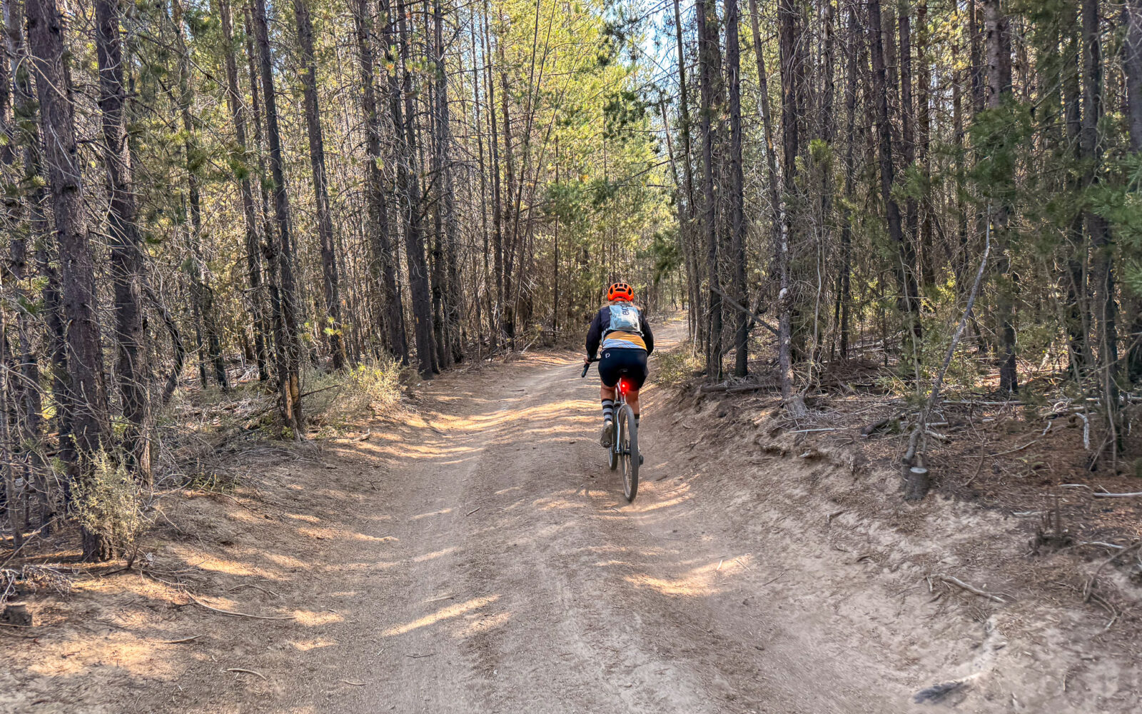
A mostly flat sector of double-track, occasionally sandy, that follows the edge of Davis Creek. The landscape alternates between dense lodgepole pine and creekside stretches of willows, sedges, and grasses. Absolutely gorgeous!
Davis Mountain Sector / Mile 6 to 14
A forested sector that opens up about halfway through into a burn scar, offering distant but vivid views of Davis Lake. The forest is a mix of mature ponderosa pine and Douglas-fir, while the burn scar is dominated by manzanita. The roads alternate between dirt double-track and chunky volcanic gravel, making this a slower-going sector. This sector has the one major climb of the day, about 850 feet over 3.7 miles.
Black Rock Sector / Mile 14 to 25
A mostly fast-riding sector on well-maintained gravel roads, with the exception of the descent to the Black Rock lava flow, which follows a dirt double-track. Don’t miss the lava flow—it is the highlights of the sector. The route is mostly forested, with a mix of lodgepole pine and ponderosa pine.
Met-Win Sector / Mile 25 to 31
A short climb on a red cinder road, leading to a dirt double-track road that can be technically difficult due to ruts and washout. Then a short wooden bridge crossing over O’Dell Creek where you pick up the Met-Win single-track trail for 2.5 miles. This is old school, limited sight line, limited width single-track, but it is gorgeous.
Wolf Alley Sector / Miles 31 to Finish
A fast proper gravel road. Initially, it is a bit sparse and barren as it has been cut back and masticated (i.e., mowed). But near the end you happen upon big red Ponderosa trees and volcanic flows and vents. It undulates but never climbs. The last hard right turn brings you to a dirt road / trail that butts up against the lava flow, but also highlights the origin of Davis Creek where it percolates out of the lava flow.
Why did we name this the Wolf Alley sector? Several years ago, early in the morning, along this sector we saw the Davis wolf pack. Super cool! It was all at a distance.
The Start
When coming from the north on Cascade Lakes Highway, just after crossing Davis Creek, look for a small road to the right. It is a partially paved pullout.
Route Notes
This is not a fast-riding route; most riders will average around 10 mph. The route includes extensive dirt double-track, rocky volcanic gravel roads, and a several miles of Met-Win singletrack. Because of the rough surfaces and technical terrain, we have rated the route’s technical difficulty as Demanding. And this is also why we recommend 50 mm tires, especially for the Davis Creek sector.
Note: Miles 9.2 to 9.8 are on a road that is not shown on some maps, but yes, it exists and is rideable.
Route Options
Shorter
Davis Creek Bypass @ Mile 0.9
This option bypasses the Davis Creek sector, a highly scenic stretch of double-track that can also be sandy. To take the bypass, continue straight at mile 0.9 on South Wickiup Reservoir Road. This shortens the route by just over 4 miles, with no change in elevation gain.
Ringo
This route traverses much of the same terrain, but with a variety of different roads. It is x miles and x feet of gain.
Longer
Ranger Butte Option. This version adds only 2 miles in total but with an additional 500 feet of climbing. 2.5 miles of this sector descend a rugged double-track road.
- Route Map: McCool (Ranger Butte Option)
- GPX File: Download
Ridden and Reviewed by:


- Route Views: 287
- Route Downloads: 24


Have you ridden this route? Got a question? Join the discussion!