






Dirty Freehub
Favorites Sign In Search
  • Search
  • Donate
  • Gravel Rides
    • Explore by Region
    • Explore by Route Type
    • Explore by Collection
  • Programs
    • All Access®
    • Dirty Roads Crew
    • Gravel Champs
    • Passport Challenge
    • Route Stewardship
  • Stories
    • Bike Life
    • Culture & History
      • Central Oregon
      • NE Oregon
      • Bend Trails
      • Death Valley
    • People & Places
    • Lands
      • Arizona
      • Central Oregon
      • NE Oregon
    • Love Where You Ride
  • Events
    • Rides, Races & More
    • Submit Your Event
  • Help
    • Route Types
    • The Route Development Process
    • How We Rate Routes
    • Using the Searchable Map
    • Loading a GPX File
    • GravelPlex Maps
    • Glossary
    • FAQs
  • About
    • The Team
    • Our Missions
    • Impact Reports
    • Jobs + Volunteer
    • Press
    • Sponsors
    • Contact Us
  • Store
    • Gravel Guides
    • Merch
  • Donate
  • Cart
  • Sign In
  • Favorites

Conductor Willy

5 Star (Quick Build) Route / ~ Eugene, Oregon / Published: Aug 2026 / Directions
Save to Favorites Remove from Favorites
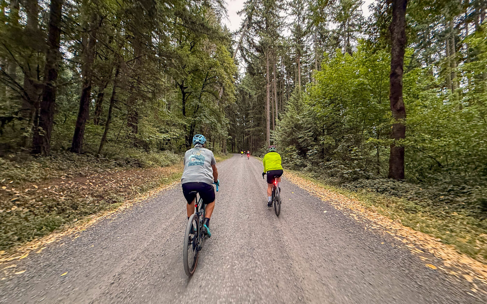
Leading out / July 2026
The rail line.
The turn-around at the covered bridge.
The parking area.
*
Route:
Out & Back | 35 mi
*
Gain:
2,000 ft
*
Surface:
~ 85% gravel, 15% paved
*
Technical Difficulty:
Easier
*
Navigation:
Straightforward
*
Locale:
Remote
*
Tire Suggestion:
40 mm+
*
Options:
Longer

Toot! Toot! Conductor Willy gets its name from the historic railroad that parallels the Willamette River between Lowell and Westfir. For decades, these tracks formed the final link between one of Oregon’s largest timber operations and the rest of the country. While logging roads and temporary rail spurs brought timber out of the surrounding forests, it was this mainline that carried finished lumber and plywood west toward Eugene and beyond. During the 1950s, when the Westfir mill was among the nation’s largest wood products facilities.

Starting at Signal Point Day Use Area, the route hugs the shoreline of Lookout Point Lake and then the Middle Fork Willamette River before weaving across the tracks five times.

The route culminates in the historic company town of Westfir, established in 1923 to serve the lumber industry. You ride through the former mill site—where only the street grid hints at the enormous operation that once stood here—before crossing the iconic Office Bridge, the longest covered bridge in Oregon. On the opposite side sits the former headquarters of the Western Lumber Company now home to the Westfir Lodge.

If you’re riding between late May and early September, the Westfir Lodge Mountain Market is a favorite stop for coffee and pastries. Outside the summer season, we recommend continuing a few more miles to neighboring Oakridge and refueling at SweetVine Bakery. See the Notes & Options tab for routing details.

Read More
Map
Brown = gravel / dirt road
Blue = single track
Red = paved road
Purple = paved bike path
GPX Download
(Version 1.0)

Caution! We do not provide turn-by-turn directions in our GPX files. Those are auto-generated by your bike computer and are usually less than 70% accurate. Learn more.

For help loading a GPX file onto your bike computer, go here.

Download

⚠️ GPX download won’t work in this browser

You’re viewing this in Facebook’s built-in browser, which blocks GPX file downloads. To download the file, use either of these options:

  • Tap the ••• (or ≡) menu in the top corner of the screen and select Open in External Browser.
  • Open the route guide directly in Chrome or Safari.

Once the route guide is open in your browser, tap the GPX Download button again.

Got it
Help
Ride Details

When We Like to Ride This

Jan
Feb
Mar
Apr
May
Jun
Jul
Aug
Sep
Oct
Nov
Dec
Not Rideable
Possibly Rideable
Rideable

Almost any time of year. This route rarely holds snow during the winter.

We like it in the spring when when the reservoir is full and the river is running strong; in the summer, when the forest provides shade and coolness; in the fall with autumn colors and soft light; and in the winter when looking for a reliable ride.

Terrain & Riding

From Signal Point to Westfir, West Boundary Road follows the north shore of Lookout Point Lake through classic West Cascades forest. The reservoir/lake occupies the former Middle Fork of the Willamette River valley and is surrounded by densely forested slopes that rise several thousand feet above the water.

You’ll spend much of the ride beneath a canopy of Douglas-fir and western hemlock, with bigleaf maple and red alder appearing in wetter draws and along streams. Western red cedar becomes more common in cool, shaded areas. The forest floor is covered with sword ferns, salal, Oregon grape, vine maple, moss-covered logs, and seasonal wildflowers. The dense canopy provides shade for much of the route.

West Boundary Road begins as a two-lane county maintained gravel road before transitioning at the halfway point into a narrow one-lane Forest Service gravel and dirt road. Rather than long, sustained climbs, the route features rolling terrain and frequent bends as it follows the shoreline and crosses small drainages that feed the lake. The dense forest often limits long-distance views, with occasional openings overlooking Lookout Point Lake. As you approach Westfir, the terrain gradually transitions from steep forested slopes to the broader Middle Fork Willamette River valley and adjacent wetlands.

The result is a remote ride through one of Oregon’s temperate forests. The scenery is defined more by dense forest, cool mountain air, and the surrounding landscape than by expansive viewpoints.

The Start

Signal Point Day Use Area
Lat / Long: 43.88441, -122.68840

Paved parking day use area and boat launch. At entrance keep left for the day use parking. Pit toilet. No fee.

Food & Water

  • ~ mile 17 / Westfir Lodge and Mountain Market. Seasonal. Check hours.
  • ~ turnaround point + 3 miles / Sweetvine Cafe
Notes & Options

Route Notes

  1. We have tagged this as a remote ride. However, you will most likely encounter fisherman, campers, and a vehicle or two. However, this is very limited cell phone service.

Route Options

Westfir / Oakridge Loop
This loop exits the route proper just as you drop into the community of Westfir. You can ride it in either direction to Oakridge. The southern option has a bit more traffic but less climbing. The northern version is has one significant hill of 500 feet at a 4 to 6% gradient.

  • Route Map: Westfir / Oakridge Loop
  • GPX File: Download

Longer Optin
Lookout Point dam start. 45 miles, 2300 feet of gain, 70% gravel, 30% paved. There is a park and parking area just past the dam. It is signed as Meridian Park. Pit toilets. This option adds 5 miles (10 in total) of quiet paved roads to the start and finish.

  • Route Map: Wallowa Barn Tour (Joseph Start)
  • GPX File: Download
  • Start Lat/Long: 43.917150, -122.751600

Comments

Have you ridden this route? Got a question? Join the discussion!

This is a Quick Build Route Guide

A Quick Build route is a fully vetted Dirty Freehub route that meets the same high standards as our Premiere 5-Star routes. The difference isn’t the ride—it’s the route guide.

A Quick Build guide includes everything you need to confidently ride the route, but it doesn’t yet include all of the rich content found in a Premiere 5-Star guide, such as detailed ride stories, points of interest, local history, photography, community highlights, and expanded planning information.

Why do we publish Quick Build routes?

We’ve identified hundreds of exceptional 5-Star routes that deserve to be shared. Creating a full Premiere guide takes significant time and resources, and we don’t want great rides waiting behind a lengthy production process. By publishing Quick Build guides, we can make more outstanding routes available sooner while continuing to work toward their full Premiere editions.

Our goal is to upgrade every Quick Build guide into a Premiere 5-Star guide.

Why? Because a Premiere guide does more than help you navigate. It connects you to the places you ride—the landscapes, history, culture, businesses, and people that make each destination unique. Riders who engage with these stories are more likely to stay longer, explore more, and support local restaurants, lodging, bike shops, and other small businesses—creating a greater economic impact in rural communities.

Your donation makes that happen. Every contribution helps fund the writers, photographers, researchers, editors, and route specialists who transform Quick Build guides into immersive Premiere 5-Star guides.

If you believe in connecting people to great rides and strengthening rural communities, please donate today. Together, we can publish more world-class route guides and bring more exceptional gravel routes to riders everywhere.

Keep it Local! Learn More

Our Favorites in Westfir / Oakridge

Please support the communities that make rides like this possible. For small towns like Oakridge and Westfir, visitor spending helps sustain local businesses and strengthens the local economy. Whether it’s a cup of coffee, a burger and beer, or a night’s lodging, every purchase makes a difference. Three of our favorite places in the Westfir/Oakridge area are:

Westfir Inn and Mountain Market – This is just on the other side of the covered bridge. The inn has 8 rooms and can accommodate you on your solo trip, romantic getaway or your group adventure. The Mountain Market (seasonal) offers house-made deli sandwiches, baked goods, draft beer, drinks, and breakfast items.

The next two are in Oakridge, an additional 3 miles one-way or so, but both are great places to go. See the Ride Notes for the map and GPX file.

SweetVine Cafe and Bake Shop – Known for fresh scratch-made breakfast items, French toast, breakfast burritos, unique pastries, and specialty espresso. Open until noon most days.

Three Legged Crane – English style pub and cask ale brew house established in 2008. Open fermented European and American style lagers and ales brewed in house. Classic pub food: burgers, grilled sandwiches, and salads.

Travel Lane County – for more ideas of where to eat, stay and do we recommend the Travel Lane County webiste.

Ridden and Reviewed by:

LindaE (aka Gravel Girl)

LindaE (aka Gravel Girl) / Team Dirty Freehub

She loves a good day of gravel, like most people like a good book. She’s always amused by the outdoors and the wild adventures. Gravel Girl is a Co-Founder of Dirty Freehub.

KevinE

KevinE / Team Dirty Freehub

He should have “Never Stop Exploring” tattooed on his chest! He loves adventures on bikes and is a Co-Founder of Dirty Freehub.

Danielle Doelling

Danielle Doelling / Team Dirty Freehub

Danielle Doelling is a paraplegic hand cyclist, adaptive sports advocate, occupational therapist, and proud mom who calls Bend, Oregon, home. After a 2011 rock-climbing accident left her paralyzed at T6, Danielle found a new path through adaptive sports. She’s a Dirty Freehub Gravel Champ.

Explore Similar Routes:

Adaptive Cyclist Review Rivers

Sign Up for the Dirty Freehub Newsletter

info@DirtyFreehub.org
Terms of Service Privacy EEO Policy Our Values
Dirty Freehub is 501(c)3 non-profit organization.
©2026 Dirty Freehub :: Website Design
Cleantalk Pixel

Tell Us How We’re Doing

Gravel rider on a rural Dirty Freehub route

From ride guides to rural economies — your answers shape what we do next.

Do our guides match reality? Do you trust what we publish? And when you drive to ride, how much does that trip put into the small towns along the way? Your answers help us improve — and help us prove gravel cycling’s real value to rural communities.

Ten minutes, confidential if you’d like, and it sets our direction for 2027.

Take the Survey