Dirty Freehub
Favorites Sign In Search
  • Search
  • Donate
  • Gravel Rides
    • Explore by Region
    • Explore by Route Type
    • Explore by Collection
  • Programs
    • All Access®
    • Dirty Roads Crew
    • Gravel Champs
    • Passport Challenge
    • Route Stewardship
  • Stories
    • Bike Life
    • Culture & History
      • Central Oregon
      • NE Oregon
      • Bend Trails
      • Death Valley
    • People & Places
    • Lands
      • Arizona
      • Central Oregon
      • NE Oregon
    • Love Where You Ride
  • Events
    • Rides, Races & More
    • Submit Your Event
  • Help
    • Route Types
    • The Route Development Process
    • How We Rate Routes
    • Using the Searchable Map
    • Loading a GPX File
    • GravelPlex Maps
    • Glossary
    • FAQs
  • About
    • The Team
    • Our Missions
    • Impact Reports
    • Jobs + Volunteer
    • Press
    • Sponsors
    • Contact Us
  • Store
    • Gravel Guides
    • Merch
  • Donate
  • Cart
  • Sign In
  • Favorites

Opal

5 Star (Premiere) Route / ~ Prineville, Oregon / Published: May 2026 / Updated: Aug 2026 / Directions
Save to Favorites Remove from Favorites

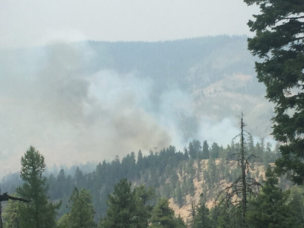
This route had major damage due to the 2026 fires. See the Notes section for the impact of the 2026 fires.

Leading out! / August 2022
The short pavement warm-up sector, ~ mile 1.
Beginning the first climb of the day, 4.5 miles 1300 feet.
At ~ mile 4.
Yes! There is open grazing, use caution.
The second paved sector, ~ miles 10.5 to 16.5.
Opal Mountain, ~ mile 22.5
Yep! Some spots are a bit chuncky.
The spot to detour to the mine, ~ mile 29.
Beginning the last climb, ~ mile 30.
The summit of th climb.
Finishing up with a bit more single-track.
Captain O's ride metrics.
The parking area.
*
Route:
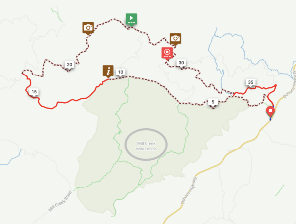
Loop | 38 mi
*
Gain:
4,200 ft
*
Surface:
~ 75% gravel, 25% paved
*
Technical Difficulty:
Moderate
*
Navigation:
Attention Required
*
Locale:
Remote
*
Tire Suggestion:
45 - 50mm+
*
Options:
---

You will like this route if you like: up gravel down pavement riding, beautiful forests with big trees, vista views of the rounded mountain tops of the Ochocos and few people. But before you hit the download, look at the hill profile closely. The route starts with a tough climb and ends with an even tougher climb. The roads are rugged, the area remote. But the views of the surrounding area are beautiful and the quietness of the woods is memorable. And with those big climbs also comes fun two different downhills that are paved, the dreamy kind. Just don’t plan for this to go down speedy …Rockhounders love this area.

—

This is a development route and is still in the process of being fully documented. The mapping is accurate, and the Dirty Freehub Team has ridden and verified the route. That said, come prepared and expect a bit of extra adventure along the way.

We are working to secure the funding needed to complete the full documentation, and your donation would directly support that effort.

Any feedback you have would be much appreciated. You can leave it in the comments block below.

Read More
Map
Brown = gravel / dirt road
Blue = single track
Red = paved road
Purple = paved bike path
GPX Download
(Version 1.2)

Caution! We do not provide turn-by-turn directions in our GPX files. Those are auto-generated by your bike computer and are usually less than 70% accurate. Learn more.

For help loading a GPX file onto your bike computer, go here.

Download

⚠️ GPX download won’t work in this browser

You’re viewing this in Facebook’s built-in browser, which blocks GPX file downloads. To download the file, use either of these options:

  • Tap the ••• (or ≡) menu in the top corner of the screen and select Open in External Browser.
  • Open the route guide directly in Chrome or Safari.

Once the route guide is open in your browser, tap the GPX Download button again.

Got it
Help

Highlights & Remarkable Spots

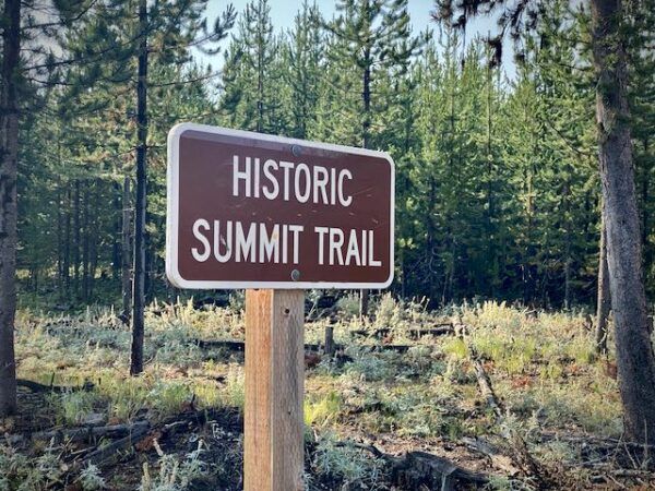
Summit Trail / Miles 1 to 16

Summit Trail

It was the first main travel route through the Ochocos, built between 1907 and 1909. The trail was initially a 3-foot-wide trail that served as the main stock driveway by which ranchers could move cattle across the mountains to their allotted range. Keeping the herds of stock up high along the ridgetops served to keep the animals from trampling the lower, wetter areas during their travels. [Pamplin Media]

Mill Creek Wilderness / Miles 3 to 12

Mill Creek Wilderness

Mill Creek Wilderness resides within the 40 million year old Wildcat Mountain Caldera. Two eroded volcanic spires distinguish the area: Twin Pillars (to the north), with vertical walls rising 200 dramatic feet above the forest is a rhyolite intrusion into the caldera, and 400-foot Steins Pillar, just outside the southwestern boundary. [US Forest Service]

Mill Creek Wilderness Fires / Miles 8 to 10

Mill Creek Wilderness fire

In 2017, the Desolation fire burned more than 4,500 acres; in 2000, the Hash Rock fire burned 18,000 acres; and in 1995 a prescribed burn – meant to lessen the effects of wildfire – burned 1,250 acres before rain put it out. Summit Trail used as a fire break.

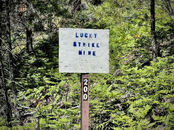
Lucky Strike Mine / ~ Mile 29

Lucky Strike mine sign post.

Lucky Strike Mine is a remote fee-digging area that is known for Thundereggs(the Oregon state rock). This site was discovered and then claimed by a famous miner Leonard Kopinsky in the 1930s and since remains popular among enthusiastic rockhounds. To get to the mine, you need to take a short detour of 1.5 miles with 500 feet of climbing.

Stephenson Mountain

Stephenson Mountain

The long distant ridge to the east is Stephenson Mountain which is part of the Opal Mountain Ranch owned by Lyme Timber. They are focused on optimizing forest health and generating cash flow by selling carbon offsets, harvesting timber, and/or monetizing conservation values. Atop Stephenson Mountain is a fire lookout. And, if you look closely you can see beautiful basalt columns about mid-way up the peak. (See podcast in right sidebar.)

Ride Details

When We Like to Ride This

Jan
Feb
Mar
Apr
May
Jun
Jul
Aug
Sep
Oct
Nov
Dec
Not Rideable
Possibly Rideable
Rideable

We like this route best just after the snow in the high country has melted, while it still lingers on peaks like Mt. Jefferson and the Three Sisters. Spring brings vibrant wildflowers, while fall offers equally stunning riding with soft light and rich seasonal colors.

Terrain & Riding

A mix of paved and rugged dirt forest service roads. The paved sectors are in good repair, with the road being narrow double wide. The dirt forest service roads vary from chunky embed to lose railbed grade rock, to rutted and tracked dirt.

The terrain is rolling and undulating through beautiful mature ponderosa forest. Big trees with red bark. Darting rays of sunshine. Green grasses lining the forest floor. There are many vista views along the way, including peaks in the Ochocos and the big Cascade mountains like Mt. Jefferson and Mt. Hood.

The route has two great gavel climbs. Early in the beginning when it climbs up through the forest and then opens up with views to the south of the Ochocos. And near the end, where there is a real honest climb of 1400+ feet that is very continuous at 6 to 8% grade, with gradients of 10%+ near the top. It rewards you with big views to the north.

The route has two super-fun downhill paved descents. NF 27 about midway through the route and again NF 27 near the end.

The start and finish are on single-track through lovely forest with big Ponderosa trees and grasses. It is a very beautiful section and keeps you off the highway.

The last hill of the day is the longest and steepest climb of the day. Near the top it is the steepest.

The Start

Bandit Springs Rest Area
Lat / Long: 44.486565, -120.396905

Pit toilets.

Food & Water

  • None
Notes & Options

Route Notes

  1. This route had extensive damage due to the 2026 fires. Typically the Forest Service will close roads after a major fire, however, this has changed frequently. If you try to ride this route, please let us know the status by leaving comments in this route guide.

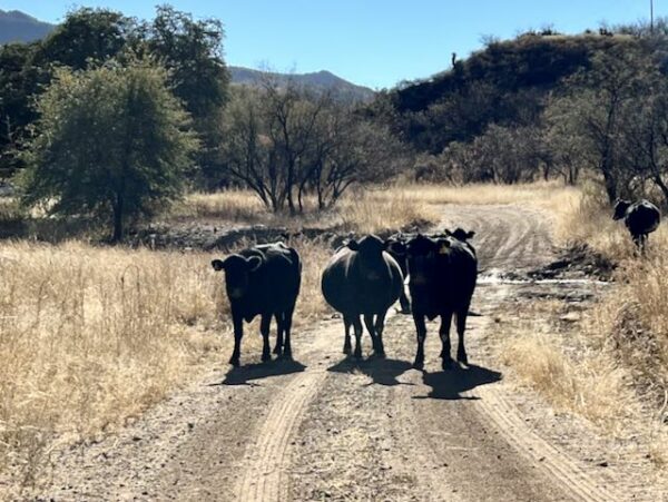
  2. Expect open cattle grazing on Summit Road. See the resource page (Cows!) in the right sidebar on how to approach and pass cattle. It could save you a big bump!

  3. At the very start, head directly across the grass, to the right of the bathrooms by about 20 yards, to catch the old forest service road.

Comments

Have you ridden this route? Got a question? Join the discussion!

Love Where You Ride! Learn More

Partners: Ochoco Trails / Discovery Your Forests

Podcasts: Lucky Strike Mine / The Geology of the Ochocos / Old Growth Ponderosas / Mill Creek Wilderness

Podcasts

All About Basalt with the Rock Doctor

You will find these rocky columnar cliffs in Eastern and Central Oregon, but what exactly happened to form these unique structures? In this podcast, we talk with our resident rock doctor, Dr. Kim Ely.

Be Informed!
Cows in the road

Cows!

This route crosses through open grazing lands where you may encounter cows and cattle. Learn how to handle this situation the right way. Whooping and hollering are not it!!

Read More »

Ridden and Reviewed by:

LindaE (aka Gravel Girl)

LindaE (aka Gravel Girl) / Team Dirty Freehub

She loves a good day of gravel, like most people like a good book. She’s always amused by the outdoors and the wild adventures. Gravel Girl is a Co-Founder of Dirty Freehub.

KevinE

KevinE / Team Dirty Freehub

He should have “Never Stop Exploring” tattooed on his chest! He loves adventures on bikes and is a Co-Founder of Dirty Freehub.

Explore Similar Routes:

Crickets Geology

Sign Up for the Dirty Freehub Newsletter

info@DirtyFreehub.org
Terms of Service Privacy EEO Policy Our Values
Dirty Freehub is 501(c)3 non-profit organization.
©2026 Dirty Freehub :: Website Design
Cleantalk Pixel

Tell Us How We’re Doing

Gravel rider on a rural Dirty Freehub route

From ride guides to rural economies — your answers shape what we do next.

Do our guides match reality? Do you trust what we publish? And when you drive to ride, how much does that trip put into the small towns along the way? Your answers help us improve — and help us prove gravel cycling’s real value to rural communities.

Ten minutes, confidential if you’d like, and it sets our direction for 2027.

Take the Survey