
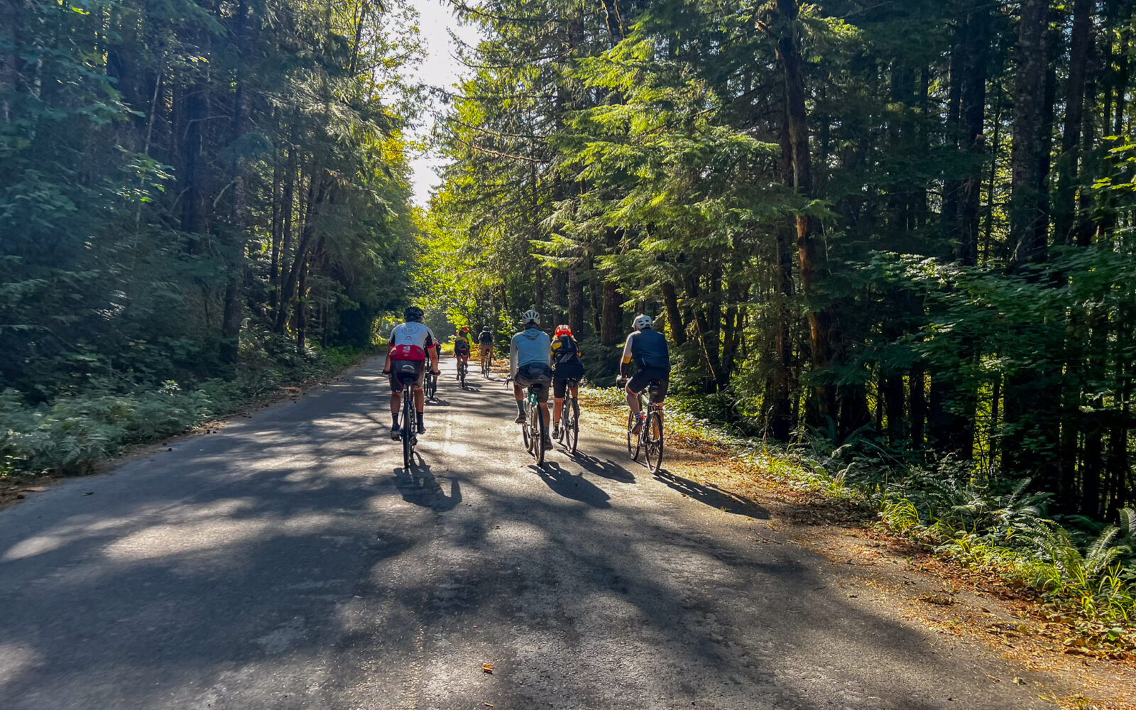











Dirty Freehub
Favorites Sign In Search
  • Search
  • Donate
  • Gravel Rides
    • Explore by Region
    • Explore by Route Type
    • Explore by Collection
  • Programs
    • All Access®
    • Dirty Roads Crew
    • Gravel Champs
    • Passport Challenge
    • Route Stewardship
  • Stories
    • Bike Life
    • Culture & History
      • Central Oregon
      • NE Oregon
      • Bend Trails
      • Death Valley
    • People & Places
    • Lands
      • Arizona
      • Central Oregon
      • NE Oregon
    • Love Where You Ride
  • Events
    • Rides, Races & More
    • Submit Your Event
  • Help
    • Route Types
    • The Route Development Process
    • How We Rate Routes
    • Using the Searchable Map
    • Loading a GPX File
    • GravelPlex Maps
    • Glossary
    • FAQs
  • About
    • The Team
    • Our Missions
    • Impact Reports
    • Jobs + Volunteer
    • Press
    • Sponsors
    • Contact Us
  • Store
    • Gravel Guides
    • Merch
  • Donate
  • Cart
  • Sign In
  • Favorites

Motown

5 Star (Premiere) Route / ~ Detroit, Oregon / Published: Jul 2018 / Updated: Oct 2026 / Directions
Save to Favorites Remove from Favorites
Cyclists on paved road next to Detroit Lake, Oregon.
Leading out! / September 2026
Road sign for burn scarred area.
Woman gravel cyclist on gray gravel road.
Cyclist on Forest Service road with Coffin Mtn in the distance.
Coffin Mtn in the distance.
Blowout creek.
Blowout Creek!
Single lane gravel road in Willamette Forest.
Picture of elevation profile from bike computer.
A Christmas Tree climb. All those colors!
Cyclist on gravel road in forest.
Slug
Gravel Girl climbing up gravel road.
Double track dirt road with grass in center and a cyclist.
The needles basalt columns near Detroit, Oregon.
The Needles
Red fall colors alongside gravel road.
Two cyclists descending single lane gravel road in forest.
On the descent.
Single cyclist on gravel road in forest.
Mushrooms.
Two cyclists descending gravel road between two fallen rocks.
Red Alders at creek crossing.
Three cyclists on single lane paved road in forest.
Woman gravel cyclist on proper gravel road in Willamette National Forest.
Bike rider on bike dressed in blue kit.
Cyclist on paved road in forest.
Detroit Lake
Detroit Lake
Two women cyclists on quiet paved road in forest.
Dirt parking area along road with kiosk.
The parking area.
*
Route:
Lollipop | 40 mi
*
Gain:
3,900 ft
*
Surface:
40% gravel road, 60% paved
*
Technical Difficulty:
Moderate
*
Max Gradient:
+12% / -10%
*
Sustained Gradient:
5% over 8.5 miles
*
Climb Ratio:
1.0
*
Effort:
3 out of 5
*
Navigation:
Attention Required
*
Locale:
Remote
*
Tire Suggestion:
45 mm+
*
Options:
---

Motown Records was founded in 1959 in Detroit. Not quite the same as Detroit, Oregon but this ride takes on such a split personality that the first and last part will have you singing Motown’s mellow pop hit, “Ain’t No Mountain High Enough” by Diana Ross and the middle loop will have you embarrassingly gasping to “Brickhouse” by the Commodores.

“Ain’t No Mountain High Enough”
No wind, (no wind)
No rain, (no rain)
Nor winter’s cold
Can stop me, babe
(Oh, babe) baby (baby)
If you’re my goal.

“Brickhouse”
Make an old man wish for younger days, yeah, yeah
She knows she’s built and knows how to please
Sure enough to knock a strong man to his knees

This is a 5-Star route, but we have not had the opportunity and funding to completely update the guide with highlights, points of interest, local places to go after your ride, etc. Hopefully soon! Keep the comments and ideas coming.

Read More
Map
Brown = gravel / dirt road
Blue = single track
Red = paved road
Purple = paved bike path
GPX Download
(Version 1.2)

Caution! We do not provide turn-by-turn directions in our GPX files. Those are auto-generated by your bike computer and are usually less than 70% accurate. Learn more.

For help loading a GPX file onto your bike computer, go here.

Download

⚠️ GPX download won’t work in this browser

You’re viewing this in Facebook’s built-in browser, which blocks GPX file downloads. To download the file, use either of these options:

  • Tap the ••• (or ≡) menu in the top corner of the screen and select Open in External Browser.
  • Open the route guide directly in Chrome or Safari.

Once the route guide is open in your browser, tap the GPX Download button again.

Got it
Help

Highlights & Remarkable Spots

Town of Detroit / ~ Near Start
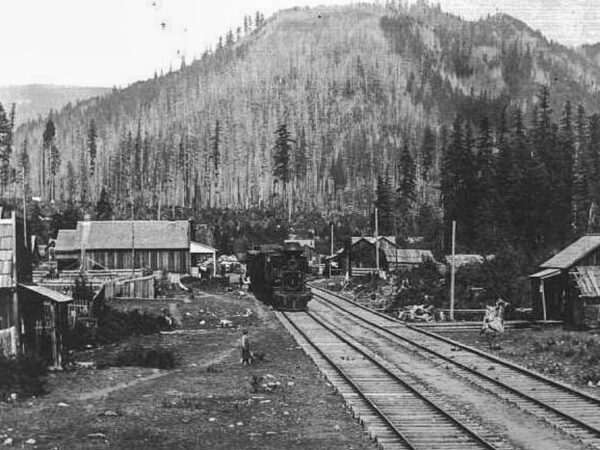
Town of Detroit

Long before Detroit Lake existed, Detroit began in 1889 as a work camp for the Oregon Pacific Railroad. The ambitious railroad was intended to cross the Cascades, but bankruptcy stopped construction just a few miles east of town. The railroad later became important for moving timber out of the Santiam Canyon.

Did You Know? Detroit’s post office was established in 1891, more than 60 years before the reservoir bearing its name was completed.

Detroit Lake / ~ Miles 0 to 6
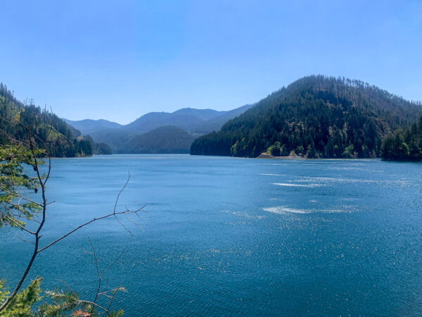
Detroit Lake

Detroit Lake may look like a natural Cascade lake, but it is actually a reservoir created when the U.S. Army Corps of Engineers built Detroit Dam between 1949 and 1953. The dam provides flood-risk management and hydropower, with the reservoir deliberately lowered during wetter months to make room for heavy rainfall and snowmelt. Its two generating units can produce up to 100 megawatts of electricity.

Did You Know? Creating Detroit Lake required relocating the entire town of Detroit. Nearly 200 residents moved to higher ground about a mile north as the original community disappeared beneath the reservoir.

Coffin Mountain / ~ Mile 9
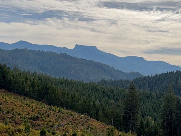
Coffin Mountain

Did You Know? Coffin Mountain’s broad summit is essentially a surviving remnant of an ancient volcanic landscape that erosion has stripped away around it. A resistant cap of volcanic rock protected the summit while softer material around and beneath it was gradually worn away, leaving the distinctive tabletop profile visible today. That shape is likely what inspired the mountain’s memorable name. Coffin Mountain is part of the Western Cascades, an older and more deeply eroded volcanic landscape than the younger High Cascade peaks visible to the east.

Welded Volcanic Ash-Flow Tuff / ~ Mile 16.5X
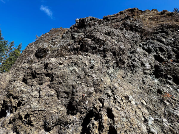
Welded volcanic tuff rock

These rugged cliffs and outcroppings are remnants of explosive volcanic eruptions in the ancient Western Cascades. Hot clouds of ash, pumice and broken volcanic rock settled here and welded together, creating a hard, erosion-resistant rock composed largely of volcanic ash, plagioclase feldspar, pyroxene and fragments of andesite and dacite. The rocks in the Blowout Creek area are roughly 12–13 million years old. (Click on image for a closer view.)

Aspen Grove / ~ Mile 17
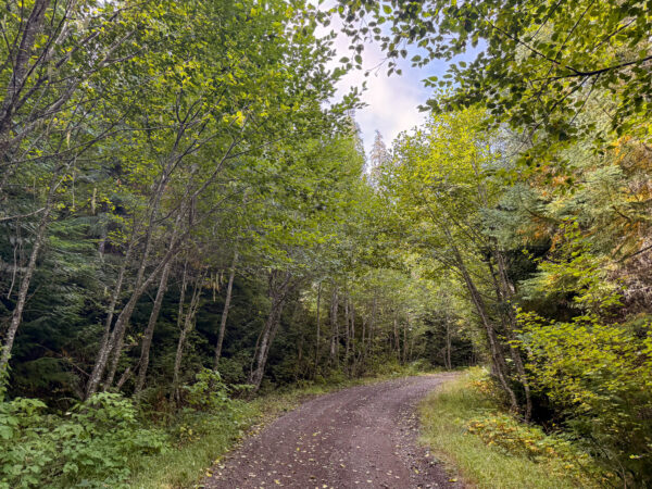
Aspen Grove

Quaking Aspen is the most widely distributed tree species in North America, yet it is surprisingly uncommon in western Oregon. Here, aspens occur in scattered pockets, making a grove tucked among the dark conifers of the Willamette National Forest an unexpected sight.

What looks like a grove of individual aspens may actually be one organism. Aspen commonly reproduces by sending new shoots, called suckers, upward from an interconnected root system. The resulting group of genetically identical trunks is known as a clone.

The Needles Basalt Towers / ~ Mile 19

Town of Detroit

Erosion can create a mountain by subtraction. Rather than being pushed upward, these rock towers were revealed over immense spans of time as weathering, streams, landslides, freeze-thaw cycles, and gravity gradually removed the weaker rock surrounding the more resistant volcanic formations.

Did you know: The Needles are part of the Western Cascades and are considerably older than nearby High Cascade volcanoes such as Mount Jefferson.

Mt Jefferson Viewpoint / ~ Mile 20
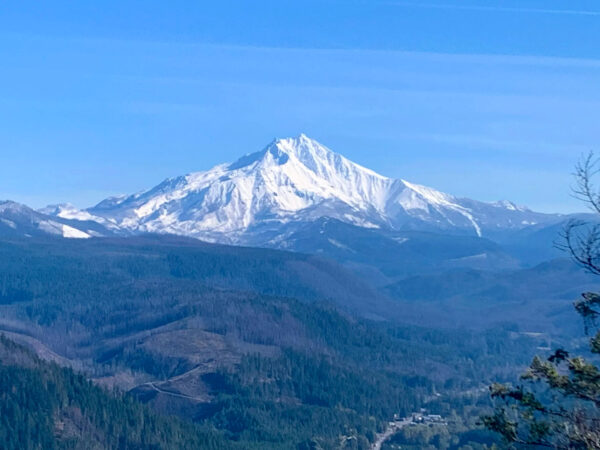
Mt Jefferson

At 10,495 feet, Mount Jefferson is Oregon’s second-highest mountain, surpassed only by Mount Hood. Mount Jefferson is a stratovolcano, built layer by layer through repeated eruptions of lava and other volcanic material. Construction began roughly 300,000 years ago, with much of the mountain forming during the past 100,000 years.

Red Alder Grove / ~ Mile 26.5
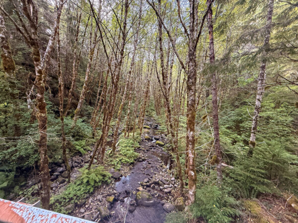
Red Alder trees at creek.

Red Alder thrives where soil stays moist during the growing season. It commonly occupies streambanks, floodplains, moist valley bottoms, and lower mountain slopes.

Red Alder has a remarkable partnership with Frankia bacteria living in nodules on its roots. These bacteria capture nitrogen from the atmosphere and convert it into forms plants can use, allowing alder to grow in nutrient-poor soils while enriching the ground around it.

Ride Details

When We Like to Ride This

Early Summer through Fall

Terrain & Riding

For seven miles you roll along on glorious paved roads, playing peakaboo with the aqua colored Detroit Lake. You’ll pass by several campground signs that you will “buzz by” because you are lulled into thinking this is so “easy smeasy”, that why bother to stop for a break. But patience . . . your time will come.

Paved roads evolve into gravel and then back into paved. You continue to roll along … admiring fields of ferns and huge pines. Wild rhododendrons start to appear.

At the start of the loop, at mile 13, the party just begins: The hill is one tough climb, because of the steepness and because of the squishy gravel spots that mop up the power in your legs. It’s 2,600 feet of climbing … at least five different lung-sucking spots will convince your that you are at the top …. you are close to the top when you see the Basalt Cliffs, which are jagged rocks that loom over the road.

After the Basalt Cliffs, you climb just a smidge more to enjoy a scenic ridge showcasing snowcapped Jefferson and Mt. Hood.

Take a breath and get ready for the downhill. There’s nothing relaxing about it: squishy gravel spots on 10% grades will test out your grip strength. Twisting and winding down ….

Then you hit a glorious paved road that sends you blasting back to the start of the loop.

Now, you can change that radio dial right back to Diana Ross …the gravel evolves back to paved as you roll along the shores of Detroit Lake.

If you have any energy left just pop down to one of the campgrounds to see the lake.

This route is tremendous during the summer because most of the ride you are well protected from the sun. But that also means we don’t recommend it during bad weather.

The Start

Dirt Pull Out Kiosk area
Lat / Long: 44.70806, -122.11178

Right hand side of the road. No services. But, just up the road by 0.25 miles is Hoover campground that has pit toilets and water. Parking is also available there.

Food & Water

  • None
Notes & Options

Route Notes

  1. Sept 2023. We have changed the start location to a pullout kiosk area, just up the original route by ~ 0.5 miles.


Comments

Have you ridden this route? Got a question? Join the discussion!

Love Where You Ride - Support Detroit

The 2020 Beachie Creek and Lionshead fires devastated communities throughout the Santiam Canyon, including Detroit. Homes and businesses were lost, and the town has spent years rebuilding.

When you ride here, you are not just passing through a beautiful landscape—you are visiting a small rural community still working its way forward. One of the simplest ways to help is to spend where you ride.

Grab a meal in town. Buy your snacks, coffee, or fuel locally. Camp nearby or stay for the night. Small purchases add up, and in communities like Detroit, they can make a meaningful difference.

Ride the route. Enjoy the place. Support the people who call it home.

Keep it Local! Learn More

Papos Bar & Grill

Here are some our favorites in Detroit.

Papo’s Bar & Grill is a mobile food cart with a full liquor bar, serving breakfast and dinner along with rotating smoked specials such as brisket, BBQ ribs, key lime BBQ chicken, and smoked meatloaf.

Ollie Rues is a seasonal food truck serving wood-fired pizza, halibut fish and chips, burgers, chicken sandwiches, and more. Open limited days.

Korner Burgers & More is a casual seasonal food truck serving grilled burgers, crispy tater tots, and other comfort-food favorites. Open limited days.

Mountain High Grocery Store is a convenient stop for groceries, snacks, drinks, and ride supplies.

Ridden and Reviewed by:

KevinE

KevinE / Team Dirty Freehub

He should have “Never Stop Exploring” tattooed on his chest! He loves adventures on bikes and is a Co-Founder of Dirty Freehub.

LindaE (aka Gravel Girl)

LindaE (aka Gravel Girl) / Team Dirty Freehub

She loves a good day of gravel, like most people like a good book. She’s always amused by the outdoors and the wild adventures. Gravel Girl is a Co-Founder of Dirty Freehub.

Sign Up for the Dirty Freehub Newsletter

info@DirtyFreehub.org
Terms of Service Privacy EEO Policy Our Values
Dirty Freehub is 501(c)3 non-profit organization.
©2026 Dirty Freehub :: Website Design
Cleantalk Pixel

WHY WE’RE DIFFERENT!

Eight scouting rides. Two community rides. More than a dozen mapped variations.

We just published the McCool route—but getting it ready took time. We rode it again and again, tested multiple options, and refined every mile before publishing it.

That’s the Dirty Freehub difference: routes that are vetted, curated, and maintained. If you value that kind of fieldwork, please support Dirty Freehub with a donation.

Donate Today

