
Old Yellowstone Trail














Caution! We do not provide turn-by-turn directions in our GPX files. Those are auto-generated by your bike computer and are usually less than 70% accurate. Learn more.
For help loading a GPX file onto your bike computer, go here.
DownloadThis is a new feature, and it will become a paid feature in the future as we pursue membership.
Open Ride With GPSHighlights & Remarkable Spots
Pronghorn / ~ Miles 1 to 6
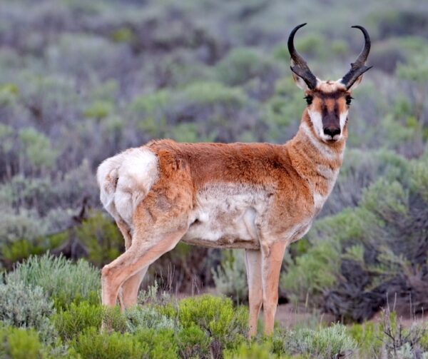
The American Pronghorn is North America’s fastest land animal, capable of reaching 55-60 mph. While native to North America, its closest living relatives are the giraffe and okapi. Once thought doomed to extinction, through conservation efforts the Pronghorn have recovered from only 13,000 individuals in the 1930s to more than half a million today.
Restoring the Range Kiosk / ~ Mile 4
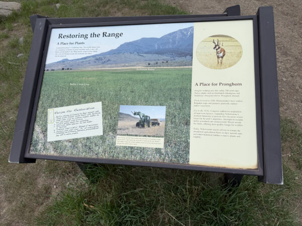
President Hoover added 7,000 acres of land to Yellowstone National Park in 1932, and Park managers have been working to rehabilitate the area with native plants over the past few decades. You may see fenced areas, temporary exclosures to keep ungulates such as deer, elk, bison, and pronghorn out while the newly seeded native plants take root. Once they start to flourish, the fence will be removed.
Gardiner Cemetery / ~ Mile 6
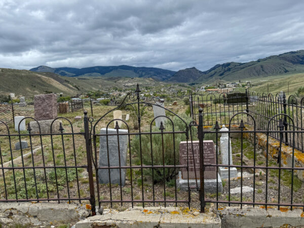
Also known as Tinkers Cemetery, this final resting place for folks was established in the 1880s. Lore has it that the cemetery is named after John Hartz, a tin worker (called a tinker), who may have been the first person buried here. An interesting thing to note is that Montana was granted statehood in 1889, which means this cemetery predates the state.
Yellowstone Heritage and Research Center / ~ Mile 7
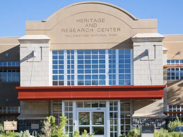
Open Monday thru Friday, 9-4, the Yellowstone Heritage and Research Center houses an incredible collection of objects, specimens, and archival materials related to Yellowstone’s natural and cultural history. A state-of-the-art storage facility with over 6 million items, visitors can check out small curated exhibits for public viewing. Visit the website for updates on the current exhibit and viewing hours.
Roosevelt Arch / ~ Mile 8
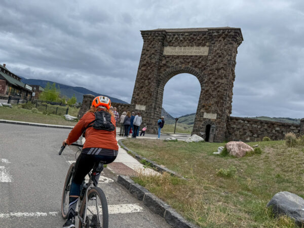
President Theodore Roosevelt laid the cornerstone of Roosevelt Arch in 1903. Inscribed with the quote “For the Benefit and Enjoyment of the People,” Roosevelt Arch serves as the north entrance to Yellowstone National Park. This entrance was the first major entrance to this first National Park, and remains the only one of the park’s five entrances to remain open year-round.
Gardiner Jail / ~ Mile 8
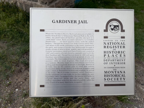
Gardiner in the late 1800’s has been described as a “wild west” town, with general lawlessness as the rule of the land. That is until the first jail was built in 1887, along with a constable to tame the unruly. After that jail burned down in 1898, the town again fell into lawlessness. As the first trains of tourists arrived in Gardiner in the summer of 1902 to lewd displays, the residents rallied to build the sandstone jail by the fall of 1903. It still stands today with the original three-cell block, and five decades of graffiti.
Town of Gardiner / ~ Mile 9
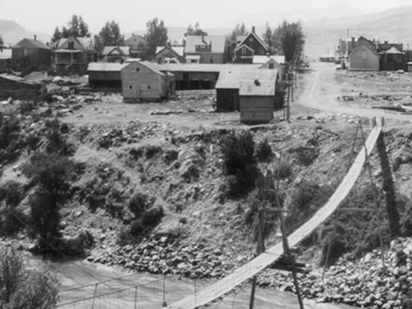
Sitting at the junction of the Gardner and Yellowstone Rivers, and sandwiched between the Absaroka and Gallatin mountains, Gardiner was integral to many Indigenous peoples for millenia, including the Nez Perce, Crow, Blackfeet, Shoshone, and Bannock. Ancient evidence of use dates back more than 11,000 years. More recently, the town gained its name from a fur trader named Johnson Gardner, who worked the region in the 1830s. Gardiner continues to maintain its frontier charm, blending a rich past with modern tourism.
Gardiner Basin Kiosk / ~ Mile 12
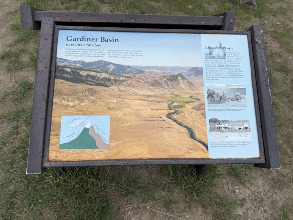
The Madison and Gallatin mountains to the west and the Absarokas to the east shelter Gardiner Basin, a geologically complex area to the north of Yellowstone Valley. Rain falls heavy in the mountains, leaving little moisture for Gardiner Basin, where less than 10 inches of precip falls each year.
When We Like to Ride This
We love this route in spring and fall. Because the grasslands offer little shelter from wind and sun—and summer brings more vehicle traffic—we recommend starting early if you’re riding during the summer months.
Terrain & Riding
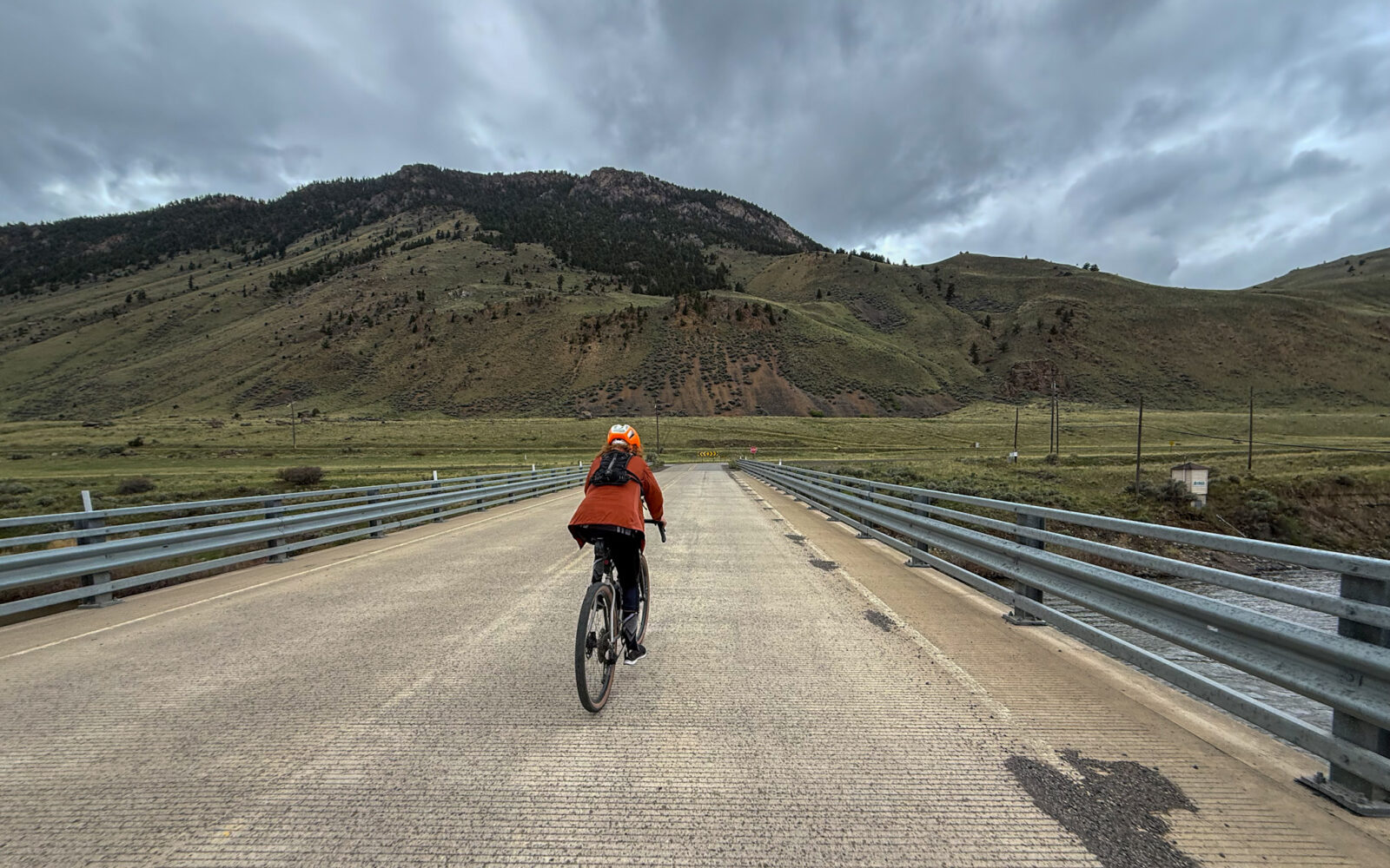
You’ll roll through Montana’s Paradise Valley, a broad, sunlit river corridor framed by big mountains on both sides—the Absaroka Range rising rugged and jagged to the east and the Gallatin Range forming a darker, forested wall to the west.
The route threads past working ranchland and open meadows with long views, with the Yellowstone River never far away and frequent glimpses of cottonwood-lined bottoms and creek drainages cutting down from the mountains.
Expect classic high-country valley vegetation—sagebrush and grasses out in the open, and thicker pockets of cottonwood, willow, and riparian shrubs wherever water gathers, with scattered evergreens climbing the foothills as you look toward the ranges.
Riding is quick and satisfying: this is a wide, smooth, hard-packed gravel road that encourages a steady pace, with gentle rollers and mostly predictable traction.
Traffic is typically light compared to Highway 89, but you’ll still want to stay alert for the occasional vehicle and a few sections where the surface can corrugate.
The Start
Large gravel lot with public bathrooms. Note that this may be busy in the summer months with raft guide companies.
Food & Water
- ~ mile 8 / Arch Park. Open seasonally.
- ~ mile 9 / Town of Gardiner.
Route Notes
We recommend a red, blinking light with a radar detector for this route as this area can have light traffic.
As gravel cyclists, we think our impact on wildlife is minimal to none. That is not always the case! Even though we may not see the wildlife, they may see, hear or smell us, all resulting in an increase in their awareness and anxiety level. But, we can take steps to minimize this impact.
- Understand that you do have an impact on wildlife when riding.
- When encountering big game animals (deer, elk, bear, mountain lions, wolves), stop and put a foot down. Wait! and wait some more! As soon as you stop riding, the big game animal will feel that it is no longer being chased. When you stop, most likely, what will happen is that the animal will continue to run for a bit, stop, turn and look at you, observe you, and then wander off. This observation period may last for 5 to 10 minutes. Be patient. After the animal wanders off, wait for another 5 to 10 minutes and then proceed. Proceed as a group at slow to moderate speed and sing at moderate volume until you are several hundred yards clear of the encounter site.
- Ride together as a group, don’t disperse! From last person to first person, there should be no more than 100 yards of separation. This usually means keeping your group size small, like 4 or fewer riders.
Route Options
Longer Options
There are two options for lengthening the route, both start further north of the town of Gardiner. The longest options starts at Donahue Creek (45 miles, 2200 feet of gain) and the other option starts at Carbella (36 miles, 1800 feet of gain).
- Route Map: Old Yellowstone Tail (Longer Option)
- GPX File: Download
- Donahue Creek Start Lat/Long: 45.264710, -110.864040
- Carbells Start Lat/Long: 45.203913, -110.897649
Love Where You Ride! Learn More
 The Greater Yellowstone Ecosystem (GYE) is globally significant as one of the planet’s largest nearly intact temperate ecosystems, crucial for preserving vast biodiversity, iconic wildlife like bison, wolves, and grizzly bears, and natural processes like migration. As the headwaters for major Western rivers, the GYE supplies water to millions, and features unique geothermal wonders. The Greater Yellowstone Coalition “works with all people to protect the lands, waters, and wildlife of the Greater Yellowstone Ecosystem, now and for future generations. Their work starts small, in conversations and connections. They keep Greater Yellowstone protected and wild by working together.” From trash cleanup to prevent conflicts with grizzly bears to installing beaver analog dams along Wyoming Creek to working with private landowners in an agreement to provide habitat for elk, the Greater Yellowstone Coalition strives to protect the land, waters, and wildlife of this amazing ecosystem.
Videos
The Entire History of Yellowstone National Park
From Wild America comes the story of Yellowstone, a place where geology, history, and politics intertwine in an epic narrative of discovery and conservation. A place that reminds us that, in a world defined by constant change, some things are valuable enough to be preserved exactly as they are.
The Effects of a Changing Climate on Greater Yellowstone
Scientists are documenting significant changes in the amount of snow that falls in the Greater Yellowstone area as well as the intensity and timing of spring runoff. These trends could affect [...]
Podcasts
Wildlife Impact Part 1
As a cyclist, I usually think I don’t have much of an impact on my natural surroundings when I ride. I’m on a bike, it’s not motorized, it’s fairly quiet. Join our conversation as we learn about the impact we as cyclists have on wildlife and how we can mitigate this impact. Our guest [...]
Be Informed!
Keep it Local! Learn More
Ridden and Reviewed by:


- Route Views: 87
- Route Downloads: 6


Have you ridden this route? Got a question? Join the discussion!