
Geronimo Trail
Notice: The late-summer monsoons of 2026 have made this winter’s riding more rugged. Many routes now ride a full category harder. Get the latest conditions and tire advice →










Caution! We do not provide turn-by-turn directions in our GPX files. Those are auto-generated by your bike computer and are usually less than 70% accurate. Learn more.
For help loading a GPX file onto your bike computer, go here.
DownloadThis is a new feature, and it will become a paid feature in the future as we pursue membership.
Open Ride With GPSWhen We Like to Ride This
We would ride this all year except in the summer when it’s hot. There is minimal shade and at this low elevation it would be quite toasty. Going in the spring when the cacti are flowering would make this route even more magical. Please do not ride this route after it rains, riding on wet trails will damage them!
Terrain & Riding
This route begins approximately 23 miles (about 40 minutes) east of Douglas, Arizona. During the ride, you will cross into New Mexico before returning to Arizona. Along the way, you’ll also ride near sections of the U.S.–Mexico border wall constructed during the Trump administration. Seeing the wall in person provides valuable context for understanding the region and its recent history.
On your drive to the start, consider stopping at two points of interest:
1) Slaughter Ranch
The ranch offers a fascinating look at Arizona history, along with beautiful scenery and abundant wildlife. Admission is $5 for adults; children are free.
2) San Bernardino National Wildlife Refuge
The refuge protects one of the most biologically diverse wetland habitats in the Southwest. It’s an excellent place for birdwatching and wildlife viewing before or after your ride.
Initial Terrain
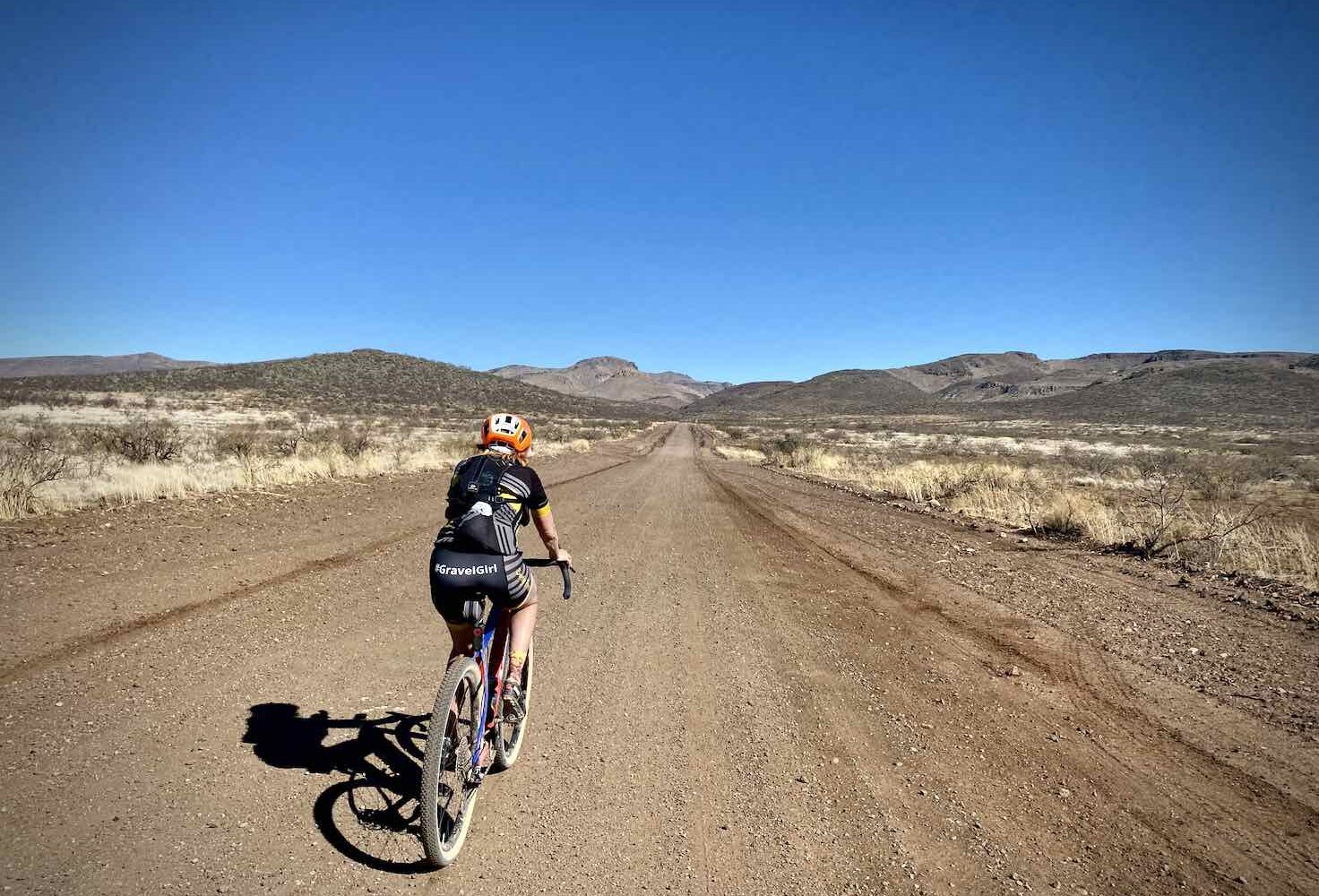
The ride begins in the low desert, where the landscape feels harsh and exposed. Vegetation consists primarily of dry shrubs with surprisingly few cacti. The terrain is rocky, dry, and strikingly barren.
Change of Terrain / ~ Mile 5.1
Around mile 5.1, the landscape begins to change. Ocotillo and prickly pear cactus become more common, and the desert takes on a more rugged appearance with scattered shrubs and cacti replacing the sparse vegetation of the opening miles.
Change of Vegetation / ~ Mile 6.7
By mile 6.7, the desert becomes more diverse, with yucca, creosote bush, and mesquite appearing throughout the landscape. To the south, you’ll have views of the San Luis Mountains in Mexico.
Also visible is the Sierra El Tigre, a classic Sky Island mountain range—an isolated mountain range rising from the surrounding desert “sea.” According to the National Park Service, Sky Islands support remarkable biodiversity because their elevation changes create conditions similar to five different world biomes.
Abandoned Ranch / ~ Mile 8.4
After passing an abandoned ranch, the route enters a canyon filled with large boulders and rocky outcrops. Several washes support stands of cottonwood and willow trees, creating a noticeable contrast with the surrounding desert.
Outlaw Mountain / ~ Mile 10
Outlaw Mountain rises to your left. This area is also an excellent place to watch for birds of prey soaring overhead. After entering Coronado National Forest around mile 10.5, you’ll encounter a more natural road surface.
Climbing Begins / ~ Mile 12
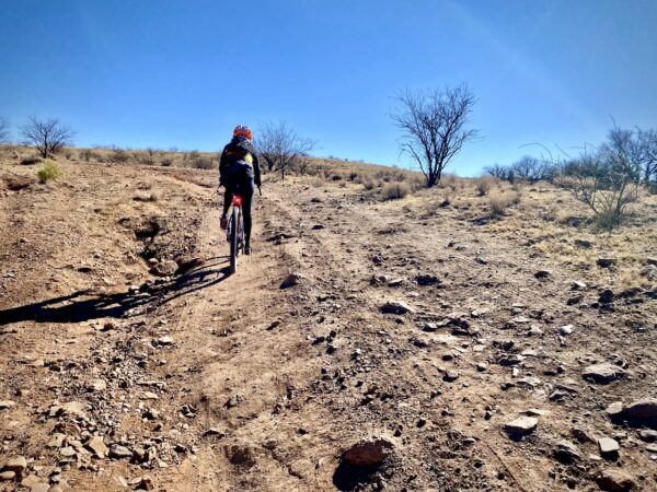
The sustained climb begins around mile 12, with grades increasing to 6 to 8%. The vegetation transitions from desert plants to larger trees, including pines and Arizona ash.
Arizona-New Mexico Border / ~ Mile 14
You’ll cross into New Mexico at approximately mile 14. Here is the historic state line monument: “This road was constructed under a cooperative agreement between Cochise County and the US Forest service in 1932-1933.”
As you continue climbing, the road becomes steeper, looser, and rougher than earlier sections. Larger pine trees become increasingly common. Arizona ash also thrive in the nearby riparian canyons and washes. At this point, you’ll catch your first glimpse of the ride’s high point. Near the summit the climbing eases and at mile 15.5 you will find a kiosk with this history.
History of the Trek Through the Mountains: On November 29, 1846, the Mormon Battalion of the U.S. Army crossed these mountains near this summit while traveling to California during the Mexican-American War. Colonel Philip St. George Cooke sent scouts ahead to locate the best route. During the search, their guide, Charbonneau, was attacked by three grizzly bears and killed one, providing meat for the troops. Lieutenant Stoneman and 21 men were unable to find a suitable descent and instead began cutting a road through the mountains—a slow and difficult task. Colonel Cooke eventually ordered the wagons unloaded, with supplies packed onto horses and mules. The empty wagons were lowered down slopes approaching 40% grade using ropes. One wagon was destroyed when its ropes broke, sending it crashing into the canyon below. Battalion member Henry Bigler later wrote, “No other man but Cooke would attempt to cross wagons at such a place. Cooke had the spirit of Bonaparte.” This monument is dedicated to the soldiers of the U.S. Mormon Battalion.
Cottonwood Cemetery / ~ Mile 24
Near mile 24, you’ll pass Cottonwood Cemetery, a small historic cemetery that reflects the ranching and mining history of this remote corner of southeastern Arizona. It serves as a reminder of the families and communities that once called this rugged landscape home.
The Start
At the intersection of Geronimo Trail and Guadalupe Canyon Road. This is not a formally designated trailhead parking lot, but it is commonly used by cyclists, maintenance crews, and others.
Food & Water
- None.
Route Notes
By riding in this area you will have an impact on wildlife, even if you don’t see the wildlife! To minimize your impact we recommend the following guidelines:
- If you see large game animals, give them space and distance to wander off. If they run, you have disturbed them and raised their anxiety level. (Stopping and giving spaces is by far most important thing you can do.)
- Limit your group size to 6 or less.
- Keep your group together, limit the distance from the first ride to the last rider to 50 yards or less.
- Limit noise disturbance by using your something between your library voice and conversational voice.
- Do not bring your dog with you. Dogs have a significant and detrimental impact to wildlife.
- Wear clothing that blends into the natural surroundings.
- Listen to the Wildlife Impact podcasts, just to the right.
- If you feel threatened by a big game animal there are steps you can take to protect yourself. Give a listen to the podcast to the right on High Anxiety Wildlife Encounters.
Route Options
Longer
An optional start is from the 5th Street City park in Douglas. 76 miles, 4200 feet of gain, 14 miles paved.
- Route Map: Geronimo Trail (Douglas Start)
- GPX File: Download
- Start Lat/Long: 31.339682, -109.537082




Have you ridden this route? Got a question? Join the discussion!