






Dirty Freehub
Favorites Sign In Search
  • Search
  • Donate
  • Gravel Rides
    • Explore by Region
    • Explore by Route Type
    • Explore by Collection
  • Programs
    • All Access®
    • Dirty Roads Crew
    • Gravel Champs
    • Passport Challenge
    • Route Stewardship
  • Stories
    • Bike Life
    • Culture & History
      • Central Oregon
      • NE Oregon
      • Bend Trails
      • Death Valley
    • People & Places
    • Lands
      • Arizona
      • Central Oregon
      • NE Oregon
    • Love Where You Ride
  • Events
    • Rides, Races & More
    • Submit Your Event
  • Help
    • Route Types
    • The Route Development Process
    • How We Rate Routes
    • Using the Searchable Map
    • Loading a GPX File
    • GravelPlex Maps
    • Glossary
    • FAQs
  • About
    • The Team
    • Our Missions
    • Impact Reports
    • Jobs + Volunteer
    • Press
    • Sponsors
    • Contact Us
  • Store
    • Gravel Guides
    • Merch
  • Donate
  • Cart
  • Sign In
  • Favorites

Roaring Buffalo

5 Star (Quick Build) Route / ~ Oakridge, Oregon / Published: Jun 2026 / Directions
Save to Favorites Remove from Favorites
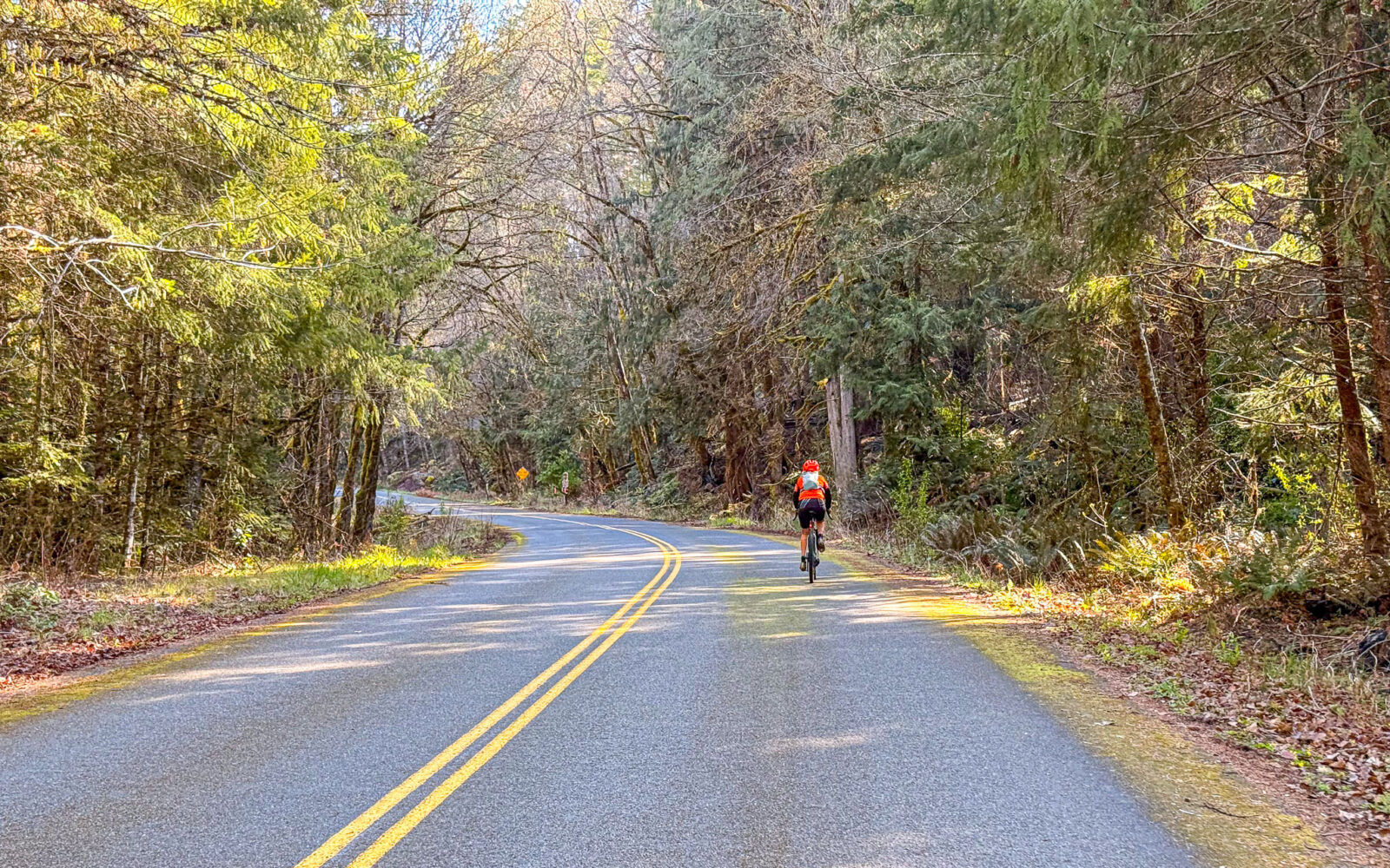
Cyclist on paved road along the Aufderheide Drive.
Leading out! / April 2026
North Fork of the Middle Fork of the Willamette River
Sign stating one-lane road.
Gravel road with tall surrounding trees.
Cyclist on gravel road with rock outcropping.
Gravel road, tall trees.
Bike on bridge next to mossy concrete curb.
Cyclist on gravel road riding towards a puddle.
Woman gravel cyclist on gravel road with grassy center.
Cyclist riding Aufderheide Drive in Oregon.
Person taking picture of Buffalo Peak.
Buffalo Peak in the distance.
Woman cyclist on Aufderheide drive cycling away.
Pickup truck on dirt pull-out of FS 19 in Oregon.
The parking area.
*
Route:
Loop | 40 mi
*
Gain:
3,500 ft
*
Surface:
~ 65% gravel, 35% paved
*
Technical Difficulty:
Moderate
*
Navigation:
Attention Required
*
Locale:
Remote
*
Tire Suggestion:
45 mm+
*
Options:
---

If you’re looking for a remote gravel ride with excellent road conditions and quiet solitude, this route delivers. The 38.5-mile loop gains 3,500 feet of elevation, with nearly all of the climbing packed into the first 23 miles. After that, the route transitions into a long descent, including an enjoyable ride down Forest Service Road 19 (the Aufderheide) to the finish.

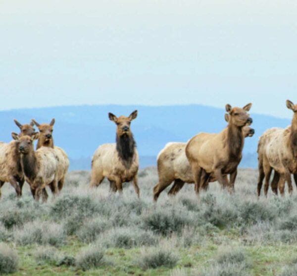
The route travels through quiet forested terrain with plenty of shade, making it a good option during the warmer months. Wildlife sightings are common. During a recent ride, we observed elk, deer, spotted owls, a barred owl, and abundant bear signs. Wildflowers were also beginning to bloom along the roadside.

Riders should be prepared for a few challenges. Navigation requires attention, as several intersections could lead to wrong turns. Early-season riders may also encounter lingering snow at higher elevations, particularly between miles 15 and 20.

This is a route best enjoyed at a relaxed pace. The scenery, wildlife, and quiet forest setting are the highlights here, making it worth taking the time to stop, look around, and enjoy the experience.

Do this ride if love West Cascade Forest with Doug-firs, cedars, red alders, creeks, mossy rock, beargrass, wild rhododendrons, sword ferns…. flowing creeks, spackled sunlight through the trees, … solitude. This entire ride is just that.

—
This is a First Draft of the route guide …. see the panel at right for more detail.

Read More
Map
Brown = gravel / dirt road
Blue = single track
Red = paved road
Purple = paved bike path
GPX Download

Caution! We do not provide turn-by-turn directions in our GPX files. Those are auto-generated by your bike computer and are usually less than 70% accurate. Learn more.

For help loading a GPX file onto your bike computer, go here.

Download

⚠️ GPX download won’t work in this browser

You’re viewing this in Facebook’s built-in browser, which blocks GPX file downloads. To download the file, use either of these options:

  • Tap the ••• (or ≡) menu in the top corner of the screen and select Open in External Browser.
  • Open the route guide directly in Chrome or Safari.

Once the route guide is open in your browser, tap the GPX Download button again.

Got it
Learn More

Credits & Acknowledgements

This route guide was funded in part by Travel Lane County.

Ride Details

When We Like to Ride This

Jan
Feb
Mar
Apr
May
Jun
Jul
Aug
Sep
Oct
Nov
Dec
Not Rideable
Possibly Rideable
Rideable

We really like this route in spring, when the creeks run full and are roar through the ravines. It’s also a great summer escape from the heat, with much of the ride shaded beneath the forest canopy. In fall, changing leaves add another layer of beauty.

We rode this on April 4th of a low snow year. Encountered just a bit of snow, but all the roads were rideable.

Terrain & Riding

Terrain
Classic West Cascades forest and terrain. Red alders along the creeks, cedars, doug-firs. Plentiful creeks. Sword ferns, wild rhododendrons, beargrass, mossy covered rocks, Proper gravel roads, not dirt FS roads. Most of the forest is second growth, scattered big old doug-fir trees.

Riding
In opening climb, in 3.3 miles gain 1200 feet. Max gradient 12%. Once gain the ridge after the intial climb at ~ mile 5.5, super fun, rolls up and down.

Mile 16 steepest pitch of day, max gradient 14%. 0.4 mile in length, 200 feet in total gain.

Love the Grasshopper descent starting at mile 23. Not to steep, serpentine turns, super fun! Watch for potholes and rutted.Thus, the moderate technical rating.

Last 10 miles are absolutely gorgeous. Along the river. 20+ creeks that come down from Huckleberry Mountain to the east that come into the North Fork of the Middle Fork of the Willamette River. View of Buffalo Peak.Big, big old growth trees standing and fallen.

The Start

Dirt Pullout
Lat / Long: 43.869785, -122.400236

A small dirt pull-out on the left hand (west) side of the road as driving in from Oakridge/Westfir.

Food & Water

  • None.
Notes & Options

Route Notes

  1. Wildlife impact.

Comments

Have you ridden this route? Got a question? Join the discussion!

This is a Quick Build Route Guide

A Quick Build route is a fully vetted Dirty Freehub route that meets the same high standards as our Premiere 5-Star routes. The difference isn’t the ride—it’s the route guide.

A Quick Build guide includes everything you need to confidently ride the route, but it doesn’t yet include all of the rich content found in a Premiere 5-Star guide, such as detailed ride stories, points of interest, local history, photography, community highlights, and expanded planning information.

Why do we publish Quick Build routes?

We’ve identified hundreds of exceptional 5-Star routes that deserve to be shared. Creating a full Premiere guide takes significant time and resources, and we don’t want great rides waiting behind a lengthy production process. By publishing Quick Build guides, we can make more outstanding routes available sooner while continuing to work toward their full Premiere editions.

Our goal is to upgrade every Quick Build guide into a Premiere 5-Star guide.

Why? Because a Premiere guide does more than help you navigate. It connects you to the places you ride—the landscapes, history, culture, businesses, and people that make each destination unique. Riders who engage with these stories are more likely to stay longer, explore more, and support local restaurants, lodging, bike shops, and other small businesses—creating a greater economic impact in rural communities.

Your donation makes that happen. Every contribution helps fund the writers, photographers, researchers, editors, and route specialists who transform Quick Build guides into immersive Premiere 5-Star guides.

If you believe in connecting people to great rides and strengthening rural communities, please donate today. Together, we can publish more world-class route guides and bring more exceptional gravel routes to riders everywhere.

Be Informed!

Wildlife Impact

Wildlife Impact

Learn about the impact we have as gravel cyclists on wildlife. And yes, we have an impact, more than we think or see.

Read More »

Keep it Local! Learn More

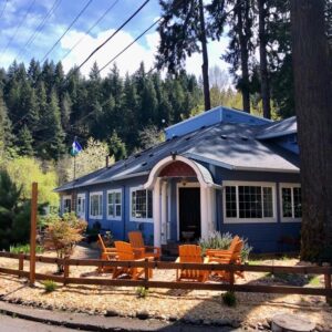
Westfir Lodge

Westfir/Oakridge

Here are some of our favorite places in the Westfir/Oakridge area.

Lodging
Westfir Lodge – upscale, quiet, and convenient. 8 rooms, small market, and lunch and breakfast available.

Food and Drink
Dinks market!! Locally owned. They have homemade chocolate dipped ice cream, mango lassi and aside from the normal convenience mart hot case, they make Indian food on the weekends, which always comes out hot and fresh. Made to order. It’s my favorite place to eat in Oakridge.

Authentic Winnie. Thai food- very good green curry.

The Campfire. Burritos, bowls, etc. Can accommodate a lot of dietary restrictions/preferences.

Sweet Vine Cafe & Bake Shop. Amazing baked goods, delicious breakfast. A must stop for us!

Ridden and Reviewed by:

LindaE (aka Gravel Girl)

LindaE (aka Gravel Girl) / Team Dirty Freehub

She loves a good day of gravel, like most people like a good book. She’s always amused by the outdoors and the wild adventures. Gravel Girl is a Co-Founder of Dirty Freehub.

KevinE

KevinE / Team Dirty Freehub

He should have “Never Stop Exploring” tattooed on his chest! He loves adventures on bikes and is a Co-Founder of Dirty Freehub.

Sign Up for the Dirty Freehub Newsletter

info@DirtyFreehub.org
Terms of Service Privacy EEO Policy Our Values
Dirty Freehub is 501(c)3 non-profit organization.
©2026 Dirty Freehub :: Website Design
Cleantalk Pixel

Tell Us How We’re Doing

Gravel rider on a rural Dirty Freehub route

From ride guides to rural economies — your answers shape what we do next.

Do our guides match reality? Do you trust what we publish? And when you drive to ride, how much does that trip put into the small towns along the way? Your answers help us improve — and help us prove gravel cycling’s real value to rural communities.

Ten minutes, confidential if you’d like, and it sets our direction for 2027.

Take the Survey