Huck & Heidi


Highlights & Remarkable Spots
Paved, Hillside Climb / ~ Miles 0 to 8
From the Office Covered Bridge head east. The road immediately climbs with some sharp kicks, nothing sustained. The road is lined with scattered homes and pockets of forest with dense undercover and big, mossy trees. Pines. Maples. Oaks.
Just after mile 3 you get a nice right looking view back over the town of Oakridge. After 6.5 miles the first climb concludes at “High Prairie” with a gain of 1400 feet. There are fields of tall grass and some small farms and some distant views.
The city was originally a community called “Hazeldell”, and its post office was established on July 26, 1888. When a station on the Southern Pacific Railroad opened in May 1912, it was named “Oak Ridge” by a railroad executive for the surrounding topography, and on July 19 of that year the name was changed to be spelled as a single word. [Wikipedia]
At mile 9 you cross through a small housing development. Several dogs came out to check on us. We had no problems, but you should be prepared.
Gravel, Deep and Shady / ~ Miles 9 to 17
Just after the housing development, the road turns to gravel and you enter the Willamette National Forest. The road is wide and hard packed with a very slight uphill grade . The forest is thick and dense with Douglas fir and Vine maples. And … the ares is filled with wild pink rhododendrons (in mid June). This road is the access point to Huckleberry Mountain Lookout and the Huckleberry Flats OHV staging area. Because of this, we expected to see some vehicles and people. We saw no on.
The lookout offers sweeping views from the tip of Mt. Hood to the north to Mt. Scott and Thielsen to the south. The Sisters are close and sharp, Diamond Peak equally so. The view to the east is primarily of the western slope wilderness areas. To the west lie High Prairie, Salmon Creek, and the hills surrounding Oakridge. [US Forest Service]
Near mile 15, a significant downhill begins. The grade is sustained, at 8% or more. You lose 725 feet in just over 2.1 miles. At the bottom of the hill turn right onto Aufderheide Scenic Byway (paved).
Paved, Along the Willamette River / ~ Miles 17 to 24
The Aufderheide bumps and winds its way along with the North Fork Middle Fork of the Willamette River to your left. To your right creeks and streams cut under the road dumping into the river. The trees make a canopy over the road and the undergrowth is green, dense and lush. The road is a narrow 2-lane passageway with a few sections giving way to the undercurrents of slow moving soils. At mile 23.4 you cross over the river. A mile beyond this go left onto NF 1940 (gravel).
Aufderheide Drive was named after Robert Aufderheide, the Willamette National Forest Supervisor from 1954 to 1959. Previously it was known as Forest Road 19 and sometimes called the “Box Canyon Road”. The Aufderheide is considered to be one of Oregon’s most beautiful drives. [City of Westfir, Oregon]
Gravel in Tall Trees / ~ Miles 24 to 33
The road begins to climb, but gradually. This forested area is different than anything ridden so far today. It looks to have been thinned in the last 10 years or so, making for open, distant views. Something the ride has yet to have. At mile 27, the road steepens, but not for to long. The trees are tall and the road twists and turns.
By mile 28, the climbing is done and the terrain is rolling. But the road continues to twist and turn. For us, this was a really enjoyable section of the route.
Paved, Big Downhill then Slight Downhill / ~ Miles 33 to Finish
Boom! Then there is pavement … in the middle of nowhere. The remaining ride metrics: 20 miles, 0 feet of gain, 2600 feet of descent! The road is narrow, single lane with turnouts. Visibility is limited. The tree canopy is thick. The first part of the descent is moderate. Then it gets steep, 11% or better. Watch out for a couple of short gravel sectors, 100 to 200 yards in length.
At mile 38.5 cross over the Willamette river again. Back onto the Aufderheide Scenic Byway. From here it is a little less than 13 miles back to the Office Covered Bridge, all slightly downhill. The river gushes between large bounders, into and out of canyons, and flows calmly through the flats. Spin easy and enjoy what nature has to offer up.
The upper tributaries of the Willamette originate in the mountains south and southeast of Eugene, Oregon. Formed by the confluence of the Middle Fork Willamette River and the Coast Fork Willamette River near Springfield, the main stem Willamette meanders generally north for 187 miles (301 km) to the Columbia River. [Wikipedia]
When We Like to Ride This
Early summer when the pink rhododendrons and beargrass are in full bloom. Fall with change of colors.
Terrain & Riding
This route combines a sweet climb up to Huckleberry Road (the Huck) with two sections of the Aufderheide (the Heidi) broken up with a loop up to Christy Flats. The route is loaded with wild rhododendrons and bear-grass. Thick moss coats many of the trees. And the Aufderheide sections are often so close to the river that you can hardly hold a conversation. And then there’s the bonus of the Office Covered Bridge, the longest covered bridge in Oregon, which is where you park.
High waters washed out the original bridge, so a second was built in 1941 to provide access from the mill to the Westfir Lumber Company’s administrative offices. This bridge lasted only four years before a storm took it out too. The third and current bridge was built higher to avoid storm waters and was designed to handle the size and load of logging trucks. [Eugene, Cascades and Coast]
The Start
Office Covered Bridge parking area. Water. Flush toilets.
Lat / Long: 43.758933, -122.496094
Food & Water
- None.
Route Notes
40 mm tires are more than adequate for this ride. Since the gravel is limited to 35% of the route and it is in good condition, we recommend a bit more air pressure than for your average gravel ride.
We recommend a red blinky safety light for the ride. We particularly like those with a rear looking radar.
You may also want to consider dog repellent, dependant on your fear factor with dogs.
Route Options
For a longer ride, consider adding in Huckleberry Lookout. 67 miles, 6900 feet of gain. Check with the Middle Fork Ranger district to ensure access to the lookout.
Love Where You Ride! Learn More
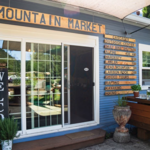
 If you’re looking for a bike shop, consider Oregon Bike Shop and Willamette Mountain Mercantile.
Keep it Local! Learn More
Ridden and Reviewed by:


Have you ridden this route? Got a question? Join the discussion!