











Dirty Freehub
Favorites Sign In Search
  • Search
  • Donate
  • Gravel Rides
    • Explore by Region
    • Explore by Route Type
    • Explore by Collection
  • Programs
    • All Access®
    • Dirty Roads Crew
    • Gravel Champs
    • Passport Challenge
    • Route Stewardship
  • Stories
    • Bike Life
    • Culture & History
      • Central Oregon
      • NE Oregon
      • Bend Trails
      • Death Valley
    • People & Places
    • Lands
      • Arizona
      • Central Oregon
      • NE Oregon
    • Love Where You Ride
  • Events
    • Rides, Races & More
    • Submit Your Event
  • Help
    • Route Types
    • The Route Development Process
    • How We Rate Routes
    • Using the Searchable Map
    • Loading a GPX File
    • GravelPlex Maps
    • Glossary
    • FAQs
  • About
    • The Team
    • Our Missions
    • Impact Reports
    • Jobs + Volunteer
    • Press
    • Sponsors
    • Contact Us
  • Store
    • Gravel Guides
    • Merch
  • Donate
  • Cart
  • Sign In
  • Favorites

Path of Totality

5 Star (Premiere) Route / Madras, Oregon / Published: Aug 2017 / Updated: Oct 2026 / Directions
Save to Favorites Remove from Favorites
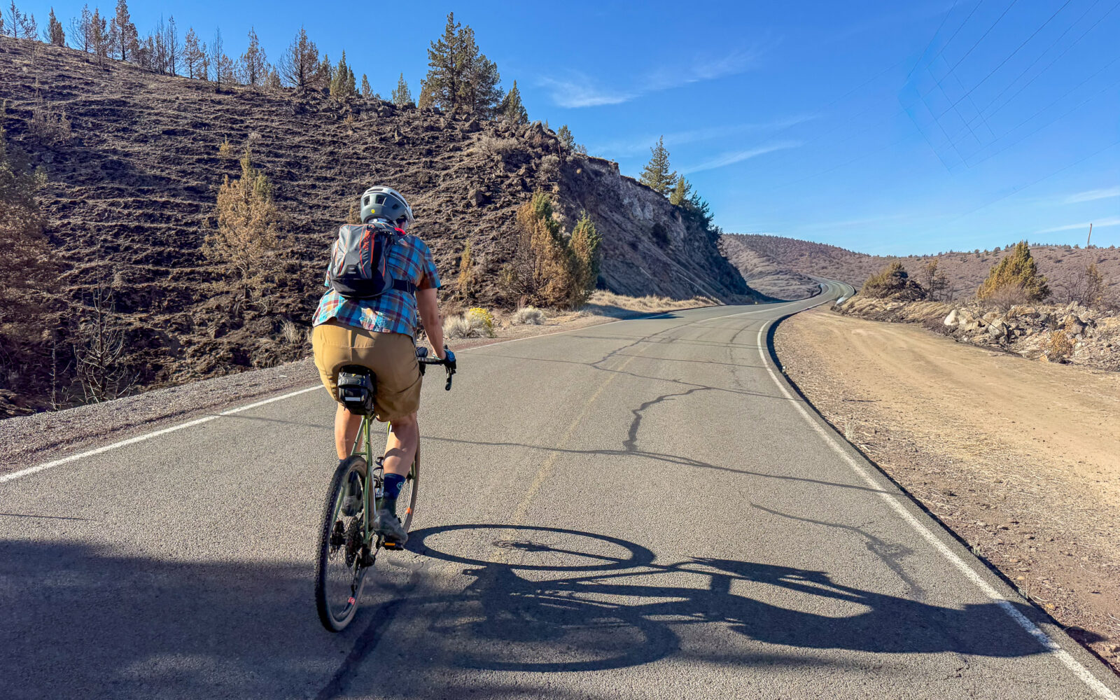
Cyclist on road approaching Lake Simtustus.
Leading out! / September 2026
Cyclists on road near Simtustus Dam.
Nearing the Simtustus Dam
Simtustus Dam
Group of cyclists along the shores of Lake Simtustus.
Along the shores of Lake Simtustus
Lake Simtustus.
Looking back over right shoulder
Woman cyclist on doube track gravel pathway.
Willow Creek Trail Sign
Willow Creek trail
Cyclist on a section of rugged, rocky single-track.
A short section of rugged
Single-track trail in a basalt canyon.
Cyclists riding a trail through old railway cut.
The old railway cut
Cyclists climbing pathway up M Hill.
Climbing M Hill
Cyclists at top of M Hill in Madras, Oregon.
At the top
Rose compass showing mountains at M Hill.
Couple on tandem bike with Mt Jefferson in background.
Looking at Mt Jefferson with hay field in foreground.
Mt Jefferson
Two cyclist on gravel road.
Green field being irrigated.
Working ag lands
Cove Corner Store
National Grasslands sign
Person looking at Round Butte Dam from overlook.
Round Butte Dam Overlook
Two cyclists on paved road.
Sign for steep downhill.
The steep descent back to Lake Simtustus
Cyclist rounding curve on downhill paved road.
Cyclist with white cliffs to right of road.
Nearing the end
Parking area at Pelton Wildlife refuge.
The parking area
Person at picnic table overlooking Lake Simtustus.
The picnic area
*
Route:
Lollipop | 42 mi
*
Gain:
2,800 ft
*
Surface:
10% gravel, 15% double track, 75% paved
*
Technical Difficulty:
Moderate
*
Max Gradient:
+20% / -15%
*
Sustained Gradient:
2.5% over 5 miles
*
Climb Ratio:
0.7
*
Effort:
3 (out of 5)
*
Navigation:
Straightforward
*
Locale:
Urban Backcountry
*
Tire Suggestion:
45 mm+
*
Options:
Shorter

Path of Totality is a tour through the Madras–Culver landscape—part canyon country, part high desert farmland, part rugged backroad adventure.

The ride begins along the steep, rocky shores of Lake Simtustus before turning up Willow Creek Canyon, where the route progressively narrows from gravel road to double track to single track following the historic Oregon Trunk railroad line. From there, you climb out of the canyon and tackle the notorious “M” Hill—a paved bike path with a pitch approaching 20%. It’s short!

Then the landscape opens up.

You roll through the irrigated farmlands surrounding Madras and Culver, circle around Round Butte, and ride the rim high above Lake Billy Chinook, with broad views across a landscape shaped by basalt flows, deep river canyons, and water. The finish is pure Central Oregon drama: a long, steep descent back toward Lake Simtustus.

Don’t let the amount of gravel (or should we say, lack of gravel) fool you. The route’s gravel/dirt sectors are relatively short, but they bring the adventure—rutted double track, sections of single track, loose rock, and some chunk. And, the paved sectors along Lake Simtustus can provide a bit of punch with grades in excess of 10%.

And the name? We discovered this route during the 2017 total solar eclipse, when Madras sat directly in the path of totality. For a few unforgettable days, hay fields turned into a Woodstock event and the airport filled with a steady stream of stream of fancy jets landing every minute or two. People arrived from around the world to watch daylight disappear in the middle of the morning.

We came for the eclipse. We left with a route.

Read More
Map
Brown = gravel / dirt road
Blue = single track
Red = paved road
Purple = paved bike path
GPX Download
(Version 4.0)

Caution! We do not provide turn-by-turn directions in our GPX files. Those are auto-generated by your bike computer and are usually less than 70% accurate. Learn more.

For help loading a GPX file onto your bike computer, go here.

Download

⚠️ GPX download won’t work in this browser

You’re viewing this in Facebook’s built-in browser, which blocks GPX file downloads. To download the file, use either of these options:

  • Tap the ••• (or ≡) menu in the top corner of the screen and select Open in External Browser.
  • Open the route guide directly in Chrome or Safari.

Once the route guide is open in your browser, tap the GPX Download button again.

Got it
Help

Highlights & Remarkable Spots

Willow Creek and its Canyon
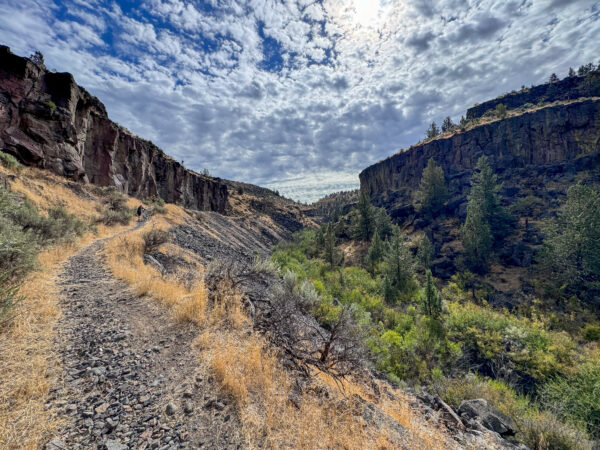
Willow Creek Canyon

Willow Creek has a geological and hydrological history deeply tired to the region’s volcanic activity and erosional processes. The creek flows through a landscape shaped by layers of basaltic lava flows, primarily from the Miocene and Pliocene epochs, which were later capped by Rimrock Basalt during the Pleistocene. Over the millennia, Willow Creek carved into the land, exposing these layers of geological history. Hydrologically, the creek has been influenced by the semi-arid climate of central Oregon. From its source at Foley Butte in the Ochocos to its confluence with the Deschutes, its flow patterns reflect seasonal precipitation and snowmelt.

Irrigation in the Desert
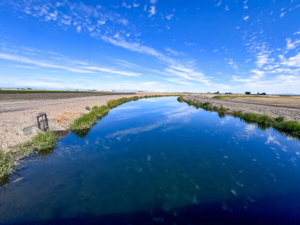
Irrigation canal

The history of irrigation in Madras is integral to the development of its agricultural landscape. In the early 20th century, settlers recognized the need for a reliable water source to support farming. This led to the establishment of irrigation districts, such as North Unit, which began delivering water from the Deschutes River in the 1940s. The construction of reservoirs, canals, and diversion systems transformed the dry, grasslands into productive farmlands. Crops such as wheat, carrots, and alfalfa flourished, and irrigation became the backbone of the local economy.
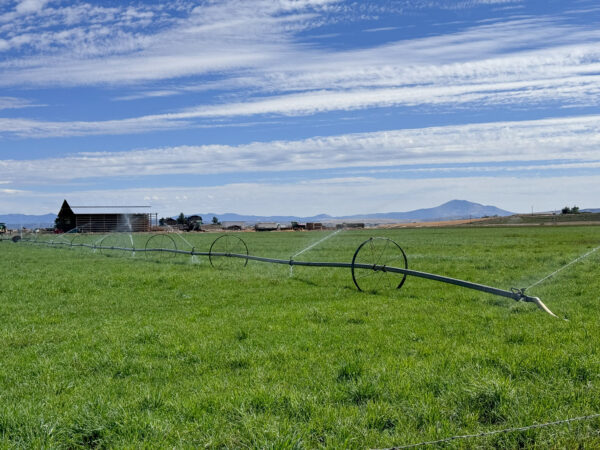
Irrigated field

But for a land so defined by water, both in the carving of its landscape and the development of its economy, there is a scarcity of it. Continuing droughts has reduced the amount of irrigation water by half. Improvements in infrastructure and water management are being developed and implemented to allow farmers to adapt to the challenges of water scarcity and climate variability in the hopes of sustaining agriculture in Madras.

On this ride, you will see the canals that transport irrigation water hundreds of miles, the arterial ditches that continue its journey, the ponds that store it, and the sprinklers that finally release it onto the crops.

Round Butte and Rimrock Basalt
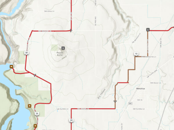
Map of Round Butte area

Around 2-3 million years ago, during the transition from the Pliocene to the Pleistocene Epoch, volcanic activity resumed after a period of geological stillness in the Deschutes Basin. Basaltic lavas erupted from local volcanic vents, including Round Butte, filling low lying areas and cavities and capping the older Dalles sediments. These lavas, collectively referred to as Rimrock basalt, now define the edges of the canyons in the area. Round Butte itself began as a volcanic shield and continued to evolve, culminating in explosive activity that created two small summit cinder cones.

This ride will take you fully around Round Butte, notice its shape as you encircle it and how it protrudes from surrounding farm and range land.

Ride Details

When We Like to Ride This

Jan
Feb
Mar
Apr
May
Jun
Jul
Aug
Sep
Oct
Nov
Dec
Not Rideable
Possibly Rideable
Rideable

This route is rideable year-round! We especially recommend riding on a summer Friday when the Round Butte Dam Visitor Center is open. Although the visitor center is open Friday through Sunday, Fridays tend to have less traffic, making for a more enjoyable ride.

The Start

Pelton Wildlife Overlook
Lat / Long: 44.72236, -121.24233

Gravel lot. Picnic tables. Pit toilet.
Seasonal – open mid-May to mid-September. Use the alternate start location detailed below outside of these months.

Alt Start / Dirt parking lot
Lat / Long: 44.706275, -121.232897

This is a designated dirt parking lot alongside the road with a viewpoint.

Food & Water

  • ~ Mile 24: The Cove General store. Seasonal, open mid-May to mid-September
Notes & Options

Route Notes

  1. Note, at the entrance to Willow Creek trail you will see signs stating “no trespassing”. Jefferson County has easement rights to the dirt road for those on foot, bike or horseback, thus use of the dirt road up to and past Canyon Kids camp is legal and permitted.

  2. The route rides well in both directions. In the opposite direction (counter-clockwise), you have a big, steep uphill climb at mile 5, but then the old railway grade sector is slightly downhill.

  3. Updates:

    • Oct 2026 / Route updated. We changed the start location to Pelton Wildlife park from the makeshift dirt parking area along Highway 97.
    • Jan 2023 / Route updated. We updated the route to exclude the climb up Round Butte and instead venture out to Round Butte Dam Overlook. The road up and over Round Butte has been closed and marked private.

Route Options

Shorter
Alternate starts are available in Madras (mile 11) and at Crooked River Campground (mile 25). From either location, the route rides as a true loop at 35 miles and 2,400 feet of elevation gain. What you forgo is the scenic sector along Lake Simtustus, the “stick of the lollipop.”
Comments

Have you ridden this route? Got a question? Join the discussion!

Love Where You Ride! Learn More

One of the highlights of this ride isn’t on the road—it’s a stop at the Round Butte Dam Visitor Center. We highly recommend taking the time to explore. From the overlook, you’ll get an impressive view of the dam and the surrounding landscape. Interpretive displays tell the story of its construction, history, and impact on the region.

Did You Know?

– That’s one big dam! Standing 440 feet tall, it is taller than a 40-story building.

– Three rivers, one lake. Lake Billy Chinook was created when the dam backed up the waters of three major rivers: the Deschutes, Metolius, and Crooked.

– How do salmon get past a 440-foot dam? In 2009, a 273-foot-tall Selective Water Withdrawal structure was installed to help guide migrating juvenile salmon and steelhead toward a collection facility. From there, the fish are transported around the dams to continue their journey to the Pacific Ocean.

– Powering the region. Completed in 1964, Round Butte Dam is part of the three-dam Pelton Round Butte Hydroelectric Project. Together, the three dams have approximately 456 megawatts of generating capacity—enough to power roughly 150,000 homes.

Keep it Local! Learn More

Keep it Local!

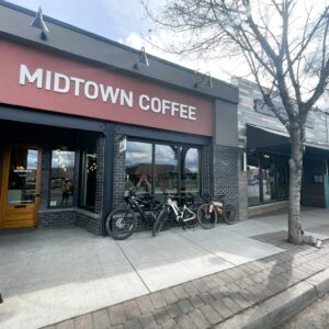
Part of riding in small communities is supporting those small communities via their locally owned businesses. So, before or after your ride, skip the new Starbucks and swing by Midtown Coffee in downtown Madras where the baristas know how to make a proper latte and their baked goods are made inhouse daily. Plus, the owner is a big fan of cyclists, having spent his younger days cycling around his home state of Virginia. If he’s in, strike up a conversation with him! For a more complete meal, check out Rio’s Distinctive Mexican Cuisine owned and operated by the very friendly Raul. Or pop into the newly opened The Spot.

Related Guidebook

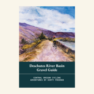
  • Deschutes River Basin Gravel Guide (Collector's Edition!)

    Deschutes River Basin Gravel Guide (Collector’s Edition!)

    $12.50
    A 64-page pocket-sized gravel guide. Featuring gravel routes, art, culture and local history. A one of a kind guide that…
    Add to cart

Ridden and Reviewed by:

KevinE

KevinE / Team Dirty Freehub

He should have “Never Stop Exploring” tattooed on his chest! He loves adventures on bikes and is a Co-Founder of Dirty Freehub.

LindaE (aka Gravel Girl)

LindaE (aka Gravel Girl) / Team Dirty Freehub

She loves a good day of gravel, like most people like a good book. She’s always amused by the outdoors and the wild adventures. Gravel Girl is a Co-Founder of Dirty Freehub.

Sign Up for the Dirty Freehub Newsletter

info@DirtyFreehub.org
Terms of Service Privacy EEO Policy Our Values
Dirty Freehub is 501(c)3 non-profit organization.
©2026 Dirty Freehub :: Website Design
Cleantalk Pixel

WHY WE’RE DIFFERENT!

Eight scouting rides. Two community rides. More than a dozen mapped variations.

We just published the McCool route—but getting it ready took time. We rode it again and again, tested multiple options, and refined every mile before publishing it.

That’s the Dirty Freehub difference: routes that are vetted, curated, and maintained. If you value that kind of fieldwork, please support Dirty Freehub with a donation.

Donate Today


