
Desert Queen









Caution! We do not provide turn-by-turn directions in our GPX files. Those are auto-generated by your bike computer and are usually less than 70% accurate. Learn more.
For help loading a GPX file onto your bike computer, go here.
DownloadThis is a new feature, and it will become a paid feature in the future as we pursue membership.
Open Ride With GPSWhen We Like to Ride This
Fall, winter, spring is ideal. Summer can be brutally hot, but an early start at sunrise makes the ride doable and enjoyable. As a bonus … you will have great lighting on the rocks!
Terrain & Riding
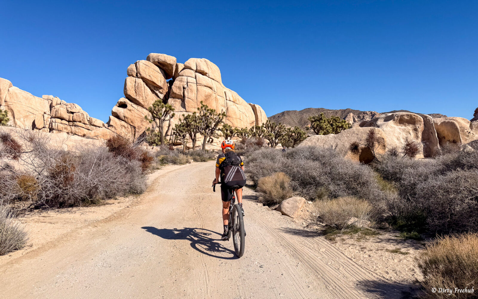
Queen Valley Road along with Bighorn Pass Road are part of a 13.4-mile network of unpaved roads crossing Queen Valley. This is classic high-desert Joshua Tree scenery: broad valleys, scattered Joshua trees, enormous granite boulder formations, and views toward Queen Mountain. Rides at just over 4000 feet for elevation. Rock outcroppings. Big drop boulders. Distant mountain ridges.
Riding considerations: Expect unpaved surfaces that can include sandy or washboard sections. Light sugar sand over hardpack. Rainstorms can also damage or temporarily close desert roads, so current conditions matter.
Desert Queen road is single-lane, light sugar sand over hardpack. Other roads are double-lane, two way traffic.
The Start
Large paved parking area with access to some short walking trails. Restrooms.
Route Notes
Bring a bike lock and hiking shoes to do the Desert Mine and Boulder House hike.
Do not touch anything. [This needs to be in the Love Where You Ride block.]
There is a very special place here at Eagle Cliff Mine, an old miner’s cabin built into the boulders called the Boulder House. I hesitated to include this hike on the website because I’ve seen items stolen from the cabin over the years, and it’s sad. But if you don’t find the directions here, you’ll find them somewhere else, so I have the directions with a small request. As a HikingGuy reader, I’m guessing you probably know this already, but if you’re new to the site (and/or hiking), please don’t touch, move, or take anything from the cabin. You’ll have to poke around to find the Boulder House, and this is what it looks like.
Can only ride in this direction as the Desert Queen road is one-way, east to west.
We classified the remoteness as Urban Backcountry. It is not necessarily urban but it is also not remote. You will see other vehicles and hikers.
Route Options
Hike to Desert Queen Mine
The hike is about 1.5 miles round trip, with roughly 150 feet of elevation change.
Hike to Eagle Cliff Boulder House, round-trip
The hike is about 3.5 miles round-trip, with roughly 600 feet of elevation change. The mileage is total, not in addition to Desert Queen mine hike
Ref: https://hikingguy.com/hikes/desert-queen-mine-joshua-tree/
GPX file
Shorter Ride
Start at the optional parking area. We like to do this if we want to do some of the hikes from the area.
Longer Rides
Add ??? to view point
Add ??? Geology tour
Ridden and Reviewed by:

- Route Views: 5
- Route Downloads: 0
- Published: Nov 2026

Have you ridden this route? Got a question? Join the discussion!