
Oregon Outback (Re-imagined)
This route had major damage due to the 2026 fires. See the Notes section for the impact of the fires.









Caution! We do not provide turn-by-turn directions in our GPX files. Those are auto-generated by your bike computer and are usually less than 70% accurate. Learn more.
For help loading a GPX file onto your bike computer, go here.
DownloadThis is a new feature, and it will become a paid feature in the future as we pursue membership.
Open Ride With GPSWhen We Like to Ride This
The OC&E Trail is rideable for most of the year. However, it’s important to remember that this region was originally wetlands, long before the construction of canals as part of the Klamath Basin reclamation project. Because of this, the trail can become muddy and difficult to ride in the spring—especially after winters with heavy mountain snowfall and spring rain. That’s why trail condition reports are so helpful during this time of year.
In early spring (April and early May), you may notice the trail surface has a rough, uneven texture. This is caused by a natural freeze-thaw process over the winter called frost heaving. As moisture in the soil freezes and expands, it gradually lifts the ground. When temperatures fluctuate, the cycle repeats, breaking up the surface—almost like slow-motion tilling. The result is a soft, lumpy tread that can be challenging to ride until it firms up with warmer weather and more trail use.
Perfect early season long-distance route. Less snow concern. Less fire concern.
Terrain & Riding
Oregon Outback is an unofficial term generally used to reference the high desert Basin and Range country of the central southern portion of the U.S. state of Oregon and covers most of Lake County, Klamath County, Malheur County, and Harney County and parts of Deschutes and Crook County.
The region is arid with an average of about ten inches of annual rainfall, though some mountain areas may receive as much as thirty inches, mostly in the form of winter snow and summer thunderstorms. Winters are cold and windy with periodic snowfalls; spring brings warm days and cold nights with snow possible into late April. Summer is warm with cool nights and occasional thunderstorms, with fall bringing crisp weather that can be interrupted by snow as soon as late October.
The region is a high desert plateau averaging roughly 4,000 feet (1,200 m) in elevation, periodically broken by sometimes massive fault-block mountains.
The Outback Sector is roughly from Cowboy Diner Train to Prineville Reservoir.
Ref: https://www.tripcheck.com/Pages/Scenic-Byways-Outback
Look here for comments:
—
Trip Report / by CarrieT
May 3-5 KF to HWY 20
3 days/2nights/200 miles
Day0: Amtrak from Eugene. Maverick Motel was great, clean, quiet and close to the station. Heads up almost everything in KF is closed on Sunday mornings. There looks to be a bike shop, outdoor gear shop, and some good coffee/bakery options but it was Sunday. There is a small public park with benches and bathroom. The museum looks neat, has bike parking, and benches, it was also closed. The grocery store was open and has a bike rack.
Day1: KF —> Horse Glade Campground
Big ups and big downs.
* Top of the first big climb out of town has a picnic shelter and table. Potentially water but it was off as of 5/2. This is at the intersection of Old Fort rd with North Ridge Drive).
* Around mile 43 I suggest getting on the OC&E and taking it all the way to Sprague River. There are a few gates, one short wet section but it’s 100% rideable and enjoyable. The Double Switchback Trailhead has a vault toilet, picnic tables and a bench. There was water just past this at the Double Switchback Spring, this would appear to be semi developed, seasonal, and needs to be filtered/treated.
* 🛒Sprague River Store has a bench and picnic table off to one side. If paying cash they appreciate small bills. The public park/playground is dry no services. Get the vibe that no one would care if you camped there but didn’t ask at the store. There is a bench around the side of the library it was closed when I was there. There appeared to be a water spigot outside the church/community center but there was a gathering and I didn’t want to interrupt to use it.
* OC&E to Beatty was 50% enjoyable, 50% slow and 100% gorgeous and rideable. If you are a bird person you will not be disappointed!
* 🛒🚏🚽Beatty is very quiet, unless you need to stop there I’d save yourself the detour. I missed the store hours. The community center has an unlocked outhouse and a bus shelter with bench. No services available if store is closed.
* Ride from Beatty to Horse Glade campground was beautiful and fast. Some of the best gravel of the whole trip.
* 🏕️🚽Horse Glade has a vault toilet and picnic tables. Easy 2 paved miles from main route. Dry. No trash pack it in pack it out.
Day 2: Horse Glade —> Silver Marsh Campground
* The gravel this section was washboard or deep. I was also very tired so maybe I felt worse than conditions actually were. Beautiful nonetheless.
* While there were a few spots that appeared to have water the number of cows made it very questionable (Sycan Creek). 💧💦💧There is one reliable source that flows from Nature Conservancy Owned property (no grazing) this was Long Creek at the intersection of NF-288 and FS-27 ( )This was a very welcome find. I maxed out my 7.5L capacity and drank some too.
* 🏕️🚽Thompson Reservoir Campground is super pleasant with tables and campsites on the edge of the reservoir. Clean maintained outhouses. There may sometimes be water there but it did not appear on yet for the season. Pump style water when on. No trash pack it in pack it out.
* 🏕️🚽Silver Marsh Campground was quiet and maybe wins the cleaned outhouse I’ve ever been in. Dry (but there may be water after 5/15? You should call and verify this if planning on it). No trash pack it in pack it out. A few cars passed and you fall asleep to the sounds of birds and cows.
Day 3: Silver Marsh Camp Ground —> Hwy 20
* Fun fast and essentially all down hill into Silver Lake.
* 🏕️Looks like a nice dispersed camp site next to clean wild water. If I’d known I probably would have camped here. That said LEAVE NO TRACE.
* 🍽️🤠Cowboy Dinner Tree missed this and now have to go back!
* Silver Lake has two main businesses
* 🛒Silver lake store, minimal options but open and friendly. Uncrustables, chocolate milk, ramen, local beef. The cashier lives in the home between the store and motel and said it was ok to fill water from her yard tap.
* 🛒🚽🍩🍦🚮Fast break at the gas station: your bike snack dreams come true here. Slushy machine (reason to bring a hydroflask on this trip), soda/ice machine, coffee, pickles, ice cream, clean bathroom, bench and chairs out front. Trash can by the pumps. Nice staff.
* ℹ️🚽🚮Silver Lake Ranger Station has bathrooms and trash when open. Unsure about water. I was trying to make miles so I didn’t detour. (541) 576-2107
* Fort Rock Museum looked neat but it was closed. Looks neat and worth a stop if open.
* 💧💦💧🚽Fort Rock State Park itself has bathrooms/sinks with running water (year round per the host). Outdoor spigot is seasonal but on now. Great tables, shade, and bike parking. No overnight camping. Host on duty.
* Gravel out of Fort Rock was smooth but it is 100% exposed to the sun and dusty from occasional (mostly courteous) cars and wind. Uphill grind back into the national forest.
* ⛺️Did not stop to investigate but possible camping a/near the Cabin Lake Bird Blinds/defunct ranger station (dry no services). Another possible option I wanted to check out was the South Ice Caves Day Use Area (unconfirmed vault toilet and table?).
* My original plan was to camp at Pine Mountain but due to prescribed burning ( ) I opted to exit at hwy 20 via the Trans Am.
* ⛺️From Sand Spring Campground (no services) the Trans Am is in good condition, slightly sandy. Worst problem are late in the day head winds. There is currently water in the fenced spring (keeps the cows out…) should you need it filter/treat.
Part 2 of this trip to be continued towards the end of May. Will report back.
💦💧💦I would recommend 5 1/2-7 1/2 L of water capacity. Water is sparse and I did this when it was relatively cool. Warmest temps were in the 70’s. For water I had a 1.5L Nalgene, a 40oz hydroflask, a 2L camel back, a 2L platypus bladder, a sawyer squeeze water filter and one standard 18oz bike bottle. Should the water be turned on at Thompson Reservoir or Silver Marsh Camp ground this could be reduced.
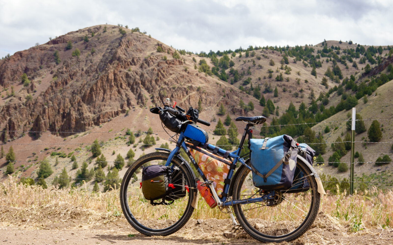
🛞 Tires: 2.2×29 Teravail Sparwoods tubeless. No complaints would ride again. Fast enough on the pavement and handled the deep gravel and sand just fine.
—
Here are some of the key stops along the way, south to north. There may be more.
– Klamath Falls (the start) (Camping, Lodging, Store)
– Sprague River (store, can we find camping? lodging?)
– Beatty (store, can we find camping? lodging?)
– Cowboy Diner (dining + lodging)
– Fort Rock (dining, store, can we find lodging?)
– Pine Mountain Observatory (Camping)
– Prineville (lodging, store, can we find camping?
– Antelope (Camping / Lodging)
– Shaniko (Hotel, store)
– Maupin (Camping, Lodging, Stores)
– Tygh Valley & Fairgrounds (Camping, Store)
– Dufur (Camping, Lodging, Store)
– Deschutes Rec area (the end) (Camping)
Route Notes
This route had extensive damage due to the 2026 fires. Specifically, the damage is north of Prineville; we recommend you stop in at Good Bike in Prineville before you tackle on the next section of the route. They ALWAYS have the latest info on this area.
Water. Be very careful in filtering water. Agriculture (pesticides, fertilizers, and cattle grazing) run-off. Very true in Ashwood.
Route Options
Start in Portland
Amtrak to K-Falls. At end, bus from The Dalles to Portland.
Should we finish in The Dalles?
Columbia Gorge Express – Providing a fixed schedule between Hood River and Portland. From there, transfer to the Hood River to The Dalles bus run by Columbia Area Transit and The Link. Use Google Maps transit directions for real-time information.
Greyhound Bus – Service from Portland to The Dalles. Bus does not allow bikes.
Ref: https://www.ridecatbus.org/columbia-gorge-express/


Have you ridden this route? Got a question? Join the discussion!