
Dirty Freehub
Favorites Sign In Search
  • Search
  • Donate
  • Gravel Rides
    • Explore by Region
    • Explore by Route Type
    • Explore by Collection
  • Programs
    • All Access®
    • Dirty Roads Crew
    • Gravel Champs
    • Passport Challenge
    • Route Stewardship
  • Stories
    • Bike Life
    • Culture & History
      • Central Oregon
      • NE Oregon
      • Bend Trails
      • Death Valley
    • People & Places
    • Lands
      • Arizona
      • Central Oregon
      • NE Oregon
    • Love Where You Ride
  • Events
    • Rides, Races & More
    • Submit Your Event
  • Help
    • Route Types
    • The Route Development Process
    • How We Rate Routes
    • Using the Searchable Map
    • Loading a GPX File
    • GravelPlex Maps
    • Glossary
    • FAQs
  • About
    • The Team
    • Our Missions
    • Impact Reports
    • Jobs + Volunteer
    • Press
    • Sponsors
    • Contact Us
  • Store
    • Gravel Guides
    • Merch
  • Donate
  • Cart
  • Sign In
  • Favorites

Major Enoch

5 Star (Premiere) Route / ~ Prineville, Oregon / Published: Jun 2019 / Updated: Aug 2026 / Directions
Save to Favorites Remove from Favorites

This route was impacted by the 2026 fires. See the Notes section for our most current status.
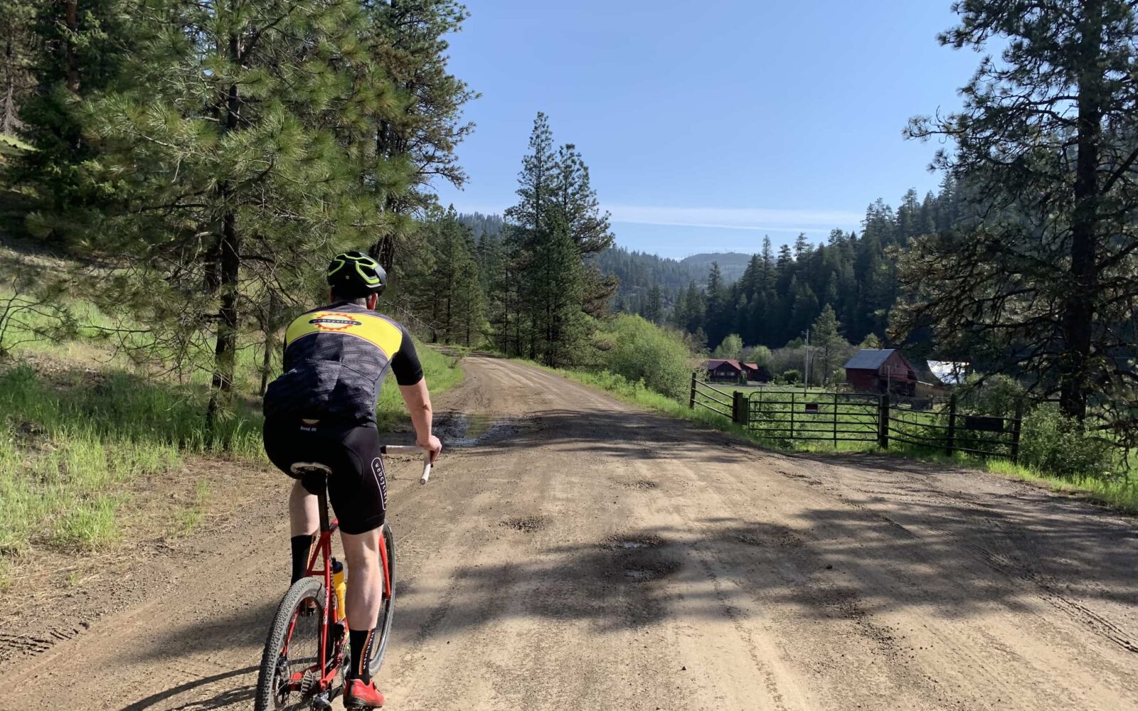
Riding out on a hard-packed gravel road in the Ochocos.
Leading out on hard-packed gravel.
Big views just beyond Harvey Gap.
Looking east - the Twin Pillars in the distance.
After climbing 2300 feet ... you find tarmac!!
When the pavement ends ... you back on the historic Summit Trail.
Riding through and around water puddles.
Early season conditions.
A majestic prairie along the historic Summit Trail.
The prairie turns to mature forest along the Summit Trail.
Get ready for some downhill fun! 1800 feet down.
Riding gravel just after leaving Highway 26.
Just after leaving Highway 26.
Deep into the lush forests of the Ochocos.
The Big Summit wild horse heard.
Nearing the second, and final, crossing of Highway 26 on bike.
Nearing the second, and final, crossing of Highway 26.
Spring time = Flowers!! In the Ochoco Mountains.
Spring time = Flowers!!
Beginning the last climb of the day. 1350 feet over 6 miles. On gravel bikes.
Beginning the last climb of the day. 1350 feet over 6 miles.
The sharp left onto primitive road.
One of the short, steep pitches on gravel bikes.
One of the short, steep pitches.
Riding good gravel in the Ochoco Mountains.
Back to "good" gravel!
The entrance to the abandoned section of road.
The exit of the abandoned section of road.
The exit!
Rolling into the finish. Steins Pillar.
Some history of the Steins Pillar area.
Some history of the area.
The parking area at Steins Pillar viewpoint.
The parking area.
*
Route:
Loop | 54 mi
*
Gain:
5,900 ft
*
Surface:
85% gravel/primitive roads, 15% paved
*
Technical Difficulty:
Moderate
*
Navigation:
Attention Required
*
Locale:
Remote
*
Tire Suggestion:
40 mm+
*
Options:
---

“Like much of Central Oregon, the Ochoco Mountains were born from a violent past that includes massive mudslides, volcanic eruptions and storms that left the land piled with ash up to 1,000-feet deep. Today, it’s a place of secluded canyons, dancing creeks, whispering meadows and open forests that invite exploration. The only thing missing is the crowds.” by Eric Flowers / Bend Magazine.

Yes! That is this ride. A geological journey through the Ochocos where the riding is never too demanding, never too steep, but still makes for a big day in the saddle.

The ride circumnavigates the 40 million-year-old Wildcat Mountain Caldera. Within the caldera lie two eroded volcanic spires: Twin Pillars to the north, rising 200 feet above the forest and Steins Pillar to the south, rising 400 feet above the forest. Within the caldera boundary is the Mill Creek Wilderness.

In 2000, a lightning-caused wildfire burned over half of the 17,400 acre wilderness. Though much of the fire burned at a high intensity, the area is quickly recovering and there are still some examples of a climax forest (one that has reached its peak of growth) of ponderosa pine, providing habitat for elk, mule deer, bobcats, mountain lions, and the occasional black bear.

Along the ride, you will also see signs for the Lucky Strike Mine. It is one of the most famous locations for mining and collecting thundereggs in the Ochoco Mountains. The thunderegg is the state rock of Oregon.

Read More
Map
Brown = gravel / dirt road
Blue = single track
Red = paved road
Purple = paved bike path
GPX Download
(Version 1.1)

Caution! We do not provide turn-by-turn directions in our GPX files. Those are auto-generated by your bike computer and are usually less than 70% accurate. Learn more.

For help loading a GPX file onto your bike computer, go here.

Download

⚠️ GPX download won’t work in this browser

You’re viewing this in Facebook’s built-in browser, which blocks GPX file downloads. To download the file, use either of these options:

  • Tap the ••• (or ≡) menu in the top corner of the screen and select Open in External Browser.
  • Open the route guide directly in Chrome or Safari.

Once the route guide is open in your browser, tap the GPX Download button again.

Got it
Learn More
Ride Details

When We Like to Ride This

Jan
Feb
Mar
Apr
May
Jun
Jul
Aug
Sep
Oct
Nov
Dec
Not Rideable
Possibly Rideable
Rideable

Late spring through fall. Especially beautiful in the late spring / early summer with the creeks running full and the wild flowers.

Terrain & Riding

From the start, at the Steins Pillar overlook, you get several miles of “flattish” gravel for a good warm up. The route then “kicks up” as you climb to Harvey Gap … and beyond to NF 27, a paved forest service road. Along the way, to the right, you can see the Twin Pillars in the distance. In the first 12 miles you climb ~ 2300 feet.

NF 27 is paved, rolling and fun and leads into the next sector of gravel, historic Summit Trail. The road feels more like a forest road than a gravel road. It has a tendency to hold water (and / or be a drainage for spring runoff) and sections of it have been filled with shale rock. Pick your line carefully to avoid the dreaded sidewall cut.

After traversing along high prairies and beautiful, mature forests the road returns to pavement. Yippee!! Get ready for a fast, but not to fast descent. The grades are initially 4 to 6% downhill, but back off to 1 to 2%. Look out for debris (i.e. rocks and sticks) on the road but don’t forget to look left for the big views! A descent of 1800 feet over 7 miles.

At mile 26, turn west on Highway 26. After a quick, slightly downhill mile, it is a left turn back into the National Forest and soon back to gravel.

For the next 14 miles, the route traverses through lush forests with a moderate climb of ~ 1000 feet and a similar descent. This area is home to the Big Summit wild horse herd. In the spring of 2019, we were lucky enough to see the heard, 12 horses and 2 foals.

At ~ mile 35 you can make a 5.5-mile detour (with 350 feet of loss and 750 feet of gain) to the old Ochoco ranger station to get water. The ranger station no longer exists, but there is a hand pump on the south side of the parking lot for water.

Cross Highway 26 and begin climbing, again! About 1350 feet over 6.5 miles. Just beyond mile 45, there is a sharp left onto a decommissioned road. (We have reports that the turn is now at a green gate, just beyond what we have mapped in the GPX file.) The first and last 150 yards are tilled and soft. Maybe rideable on the edge, maybe not. You will also need to dismount several times to hop over trees. Very easy to do. But, 90% of the old primitive hard-packed road is in place. The sector does roll up and down with several short, steep pitches of 15%.

After ~ 1.5 miles the road transitions back to “good” gravel and then at mile 50, it looks as if the road dead ends. It does not! Ride into the thicket, you will find an old abandoned road … possibly decommissioned due to rock fall. This sector lasts for about 300 yards and then you pop back onto good gravel. From here it is mostly downhill (1650 feet lost in 4.5 miles). At Mill Creek road, turn right, spin the legs and take in the great views of Steins Pillar.

The Start

Steins Pillar viewpoint parking area
Lat / Long: 44.417175, -120.618701

Designated dirt parking lot. No services.

Alternate Start - Old Ochoco Ranger Station parking lot
Lat / Long: 44.396166, -120.426081

Some people find this start a little less remote. There is no longer a ranger station here, just a paved parking lot, water and pit toilets. To connect with the route take NF 2610 Coyle Creek road to the north. This start adds about 5.5 miles and an additional 750 feet of climbing.

Food & Water

  • ~ mile 35 / Old Ochoco Ranger Station parking lot. ~ 5.5 mile round trip diversion off course (750 ft gain / 350 ft loss). There is a hand pump on the south side of the parking lot. Potable water.
Notes & Options

Route Notes

  1. This route had significant fires in 2026. If you do ride this route, please post pictures and comments on the Ride Guide so we can all benefit.

  2. Bonus points: Why the name “Major Enoch”?

Comments

Have you ridden this route? Got a question? Join the discussion!

Ridden and Reviewed by:

KevinE

KevinE / Team Dirty Freehub

He should have “Never Stop Exploring” tattooed on his chest! He loves adventures on bikes and is a Co-Founder of Dirty Freehub.

Sign Up for the Dirty Freehub Newsletter

info@DirtyFreehub.org
Terms of Service Privacy EEO Policy Our Values
Dirty Freehub is 501(c)3 non-profit organization.
©2026 Dirty Freehub :: Website Design
Cleantalk Pixel

WHY WE’RE DIFFERENT!

Eight scouting rides. Two community rides. More than a dozen mapped variations.

We just published the McCool route—but getting it ready took time. We rode it again and again, tested multiple options, and refined every mile before publishing it.

That’s the Dirty Freehub difference: routes that are vetted, curated, and maintained. If you value that kind of fieldwork, please support Dirty Freehub with a donation.

Donate Today








