
Meatloaf
This route has been damaged due to the 2026 fires. See the Notes section for the impact of the fires.














Caution! We do not provide turn-by-turn directions in our GPX files. Those are auto-generated by your bike computer and are usually less than 70% accurate. Learn more.
For help loading a GPX file onto your bike computer, go here.
DownloadHighlights & Remarkable Spots
Post / Near Start
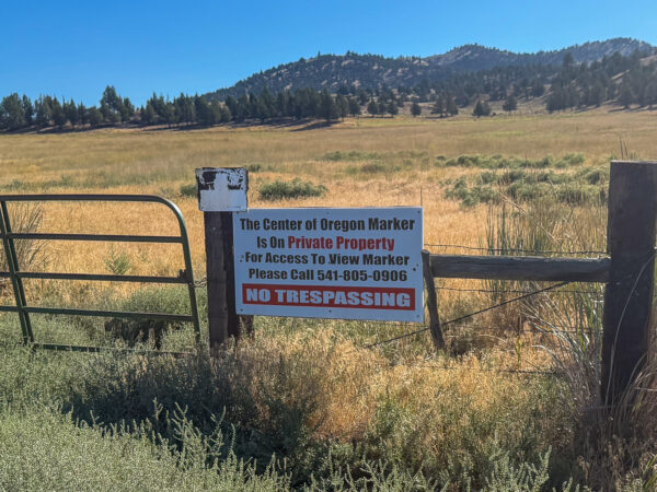
The name “Post” is kind of funny. Just north of the Post general store, there’s a wooden post in the ground that supposedly marks the geographic center of Oregon. The community itself, though, was named for Walter H. Post—the first postmaster of the Post post office, established in 1889 [per Oregon Geographic Names].
You can walk out to see the post in the ground, but you’ll need permission first. Click on image to left for details.
Santiam Wagon Road / ~ Miles 0 to 5
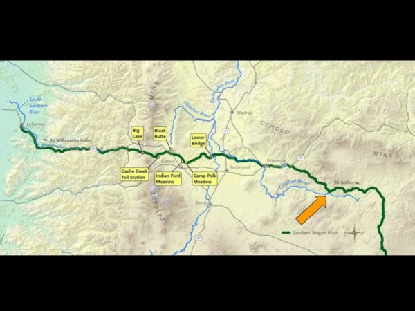
The Santiam Wagon Road (later known as the Central Oregon Wagon Road) served as a livestock trail and the only freight route over the central Cascades for most of the 74 years (1865-1939) it was in use. It spanned a distance of almost 400 miles on today’s roads and provided passage for around 5,000 wagons during the first 15 years of its existence.
In this area (click on image to left), the wagon road closely followed the Crooked River. The Deschutes Land Trust has an excellent, well-researched write-up on the route. Read it!!
Shotgun Ranch / ~ Miles 5 to 9
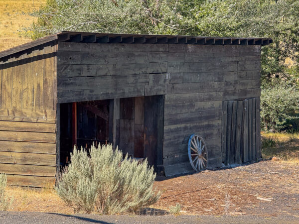
While the specific history of Shotgun Ranch is sparse, the area around Post and the Crooked River has a long ranching and settlement history.
Central Oregon ranching expanded in the late 1800s and early 1900s with cattle and sheep operations along the Crooked River basin. Cattle dominated valley bottoms and river corridors. Sheep often used higher, drier uplands and moved seasonally. Wool and beef were shipped out via wagon routes to Prineville and later by rail connections.
Post - Paulina Valley Viewpoint / ~ Mile 11

These lands were traditionally used by the Northern Paiute. The Northern Paiute historically lived a nomadic lifestyle following animal migration patterns and seasonal food sources. The first recorded Euro-Americans began settling in the Post-Paulina Valley in the 1870s. This was around the same time that the Willamette Valley and Cascade Mountain Wagon Road Company received its first patent to build a wagon road that would connect the Willamette Valley, across the mid-Cascades and through Eastern Oregon, to the Idaho border. This road would eventually become the Santiam Wagon Road, and it ran, in part, along the Crooked River past what is now Aspen Valley Ranch. Since the homesteading era of the late 19th century, the communities of Post and Paulina have predominantly revolved around farming and raising livestock.
Ochoco Mountains Views / ~ Mile 24
The descent here provides broad north-facing views across the valley to the main Ochoco Mountain range. The Ochocos stretch 60 miles east to west and 40 miles north to south. Elevations rise from around 3,000 feet to more than 9,000 feet at Lookout Mountain, the range’s highest point. While smaller than the Cascades, the Ochocos form a clear climatic and ecological boundary in central Oregon, catching more moisture than the lowlands and supporting surprisingly lush forests.
Lower slopes: western juniper, sagebrush, and high-desert bunchgrasses
Mid-elevations: open, park-like ponderosa pine forests
Upper elevations: mixed conifer stands—Douglas-fir, grand fir, white fir, lodgepole pine
Wolf Moss / ~ Mile 18
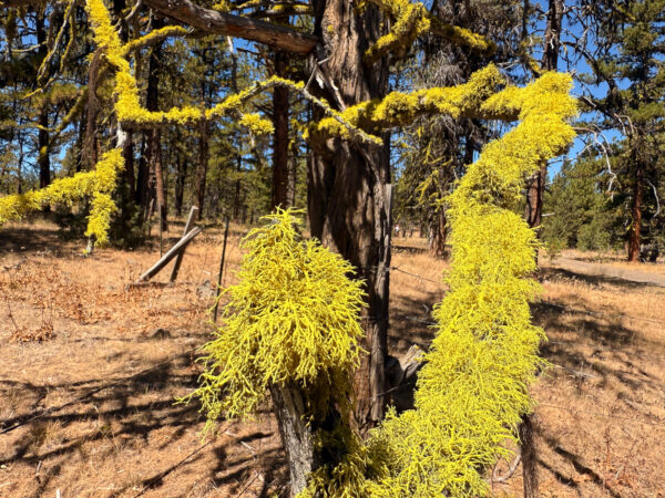
{rough draft} Wolf moss, a lichen, has had varied uses. Because of its unique colors, it was often used to make yellow dye. In addition, it was also used to make poison. It was from one of the uses of this poison that its name was derived, as it was often mixed with glass and meat before being fed to wolves in an attempt to cleanse an area of wolves. [Garden Guides]
Wolf moss is also indicative of a very health air environment.
Credits & Acknowledgements
This route guides was funded in part by Visit Central Oregon.

When We Like to Ride This
Late spring to mid summer when the flowers are in bloom and the fields are green or fall when the colors are changing. Creeks full and running in spring.
Terrain & Riding
The route starts at the Post General store and heads southeast along the Crooked River for 5 miles on good pavement, with light traffic, and great views. Turn right onto Pine Creek Road / NF 17, a gravel road. This is a public road, but it is bounded by the Shotgun ranch on each side. The “No Trespassing” signs can be a bit deceiving. At ~ mile 9, you enter the Ochoco National Forest which is marked by a prominent sign.
As you turn off the paved road onto the gravel sector (near mile 5), the route passes through public lands bounded by the Shotgun Ranch. You may see ranch gates or signage as you pass through a corridor of private ranch land before entering the National Forest proper.
doug firs – a few / Ponderosa’s many. Good, hard-packed gravel roads. Wiley Flat Fire, was first reported on September 2, 2024 in the Ochoco National Forest, near Wiley Creek, about 10 miles southeast of Post, Oregon off Highway 380.
🔥 Size & Behavior
The fire burned over 30,000 acres of forest and wildland. Miles 10 to 16.
Ponderosa pine is the dominant tree species in most parts of the Ochocos. These pines are common at elevations from 3,000 to 6,000 feet (910 to 1,830 m) above sea level. Manzanita, antelope bitterbrush, and ceanothus are common shrubs in the pine-dominated areas with Idaho fescue and Ross’ sedge as the main ground cover. [Wikipedia]
NF 17 marks the beginning of the climb. 7 miles and 1900 feet. It is quite consistent in grade, 4 to 6%, but does pitch up to 8% or more for a couple of short sections. Follows Pine Creek.
NF 17 follows along Pine Creek from the start of the gravel until a left hairpin bending turn at mile 10. Keep an eye out for wildlife near the creek. There is also a small waterfall that flows in the spring at mile 8.
After crossing Pine Creek, there are scattered views across the valley to the Ochoco mountains. (Note – this ride is in the Ochoco National forest, but in the Maury mountains. The Ochoco National forest is a non-contiguous forest with several ranges of mountains.)
Just before mile 13, go right onto NF-300. This is a more primitive forest service road that drops 200 feet, but then begins to climb, 750 feet over 4 miles, with a couple of short pitches in excess of 10%. It offers up some sneaker views to the right of the Post-Paulina valley.
At mile 18.3 junction with NF-1750, the Maury Mountain road. The route goes right on NF1750. However, if it is wet and has standing water, continue straight on NF-300 and in about a mile junction with NF-16. Take this west and reconnect with the original route in 4 miles. Trust us on this, NF-1750 can be a sticky, muddy mess denigrating into a hike-a-bike fiasco.
NF-1750, in the right conditions, is a blast to ride. An undulating, but downhill trending, primitive forest service road with loamy soil, through forest, but with some big views. The green Wolf moss and the black Wila moss in the trees creates an eerie, almost haunting site if the light is right.
At mile 24, make a right hand turn onto NF 16. The road descends 2000 feet over 11 miles with some fantastic views back over the valley and into the Ochoco mountains. If the conditions are right, this is almost a brake free descent. Near the bottom of the downhill, you will pass by a few ranches and watering holes. When you reach pavement, go left and ride the last mile in along the Crooked River.
—
Fire scarred terrain.
The Start
Highway 380, 25 miles southeast of Prineville. Park at the far east end of the parking lot. This is a private parking lot, so it is imperative that you get permission from the store management to park there. Also, for the courtesy or parking there, we recommend dropping some coin in the store. Maybe getting one of their shakes, or a meatloaf sandwich, or a ballcap!
Food & Water
- None.
Route Notes
This route had extensive damage due to the 2026 fires. You will be riding through areas that were burned. Leave us photos and comments so others can benefit.
We made a significant revision to the route in May 2020, starting at mile 13 until the beginning of the big downhill on NF-16. Mile 24 on the map. This eliminates a lot of the washboard and the views and riding, we think, are better.
This ride was formerly listed as Post 35.
We recommend a red blinky light for the section on the highway, even though the traffic is light.
Wildlife Impact. Our ride +
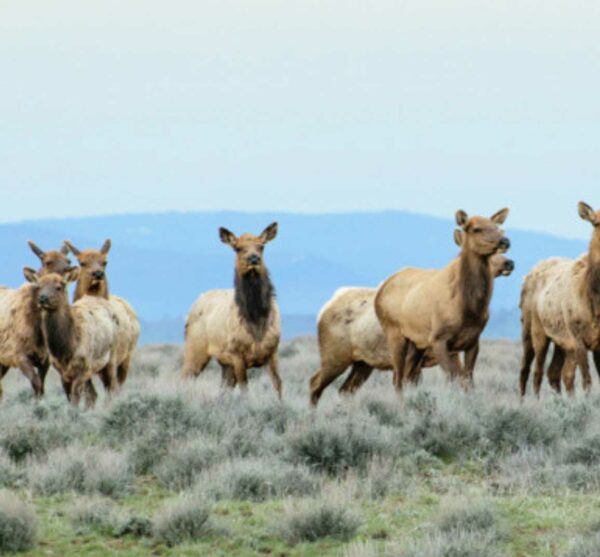
Riders in this area commonly see:Mule deer moving between timber and open flats
Pronghorn antelope in lower, open sections
Raptors (red-tailed hawks, golden eagles) riding thermals above the ridges
Ground squirrels and coyotes near road edges
Much of this ride crosses or skirts open range, meaning:
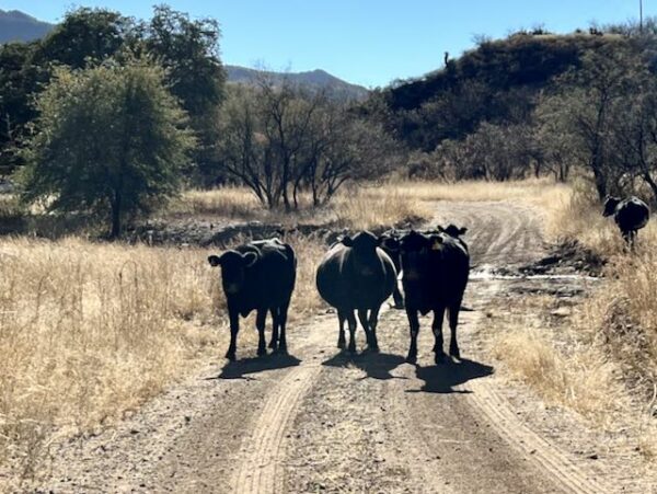
Cattle may be on or near the road
Gates and cattle guards are common
Roads exist primarily to serve ranch access, not recreation
This is living history — the same land-use patterns that shaped central Oregon over a century ago are still active today.
In the fall this is an active hunting area, thus we recommend the following:
- Wear bright, high viz colors like orange.
- Carry a whistle to alert hunters to your presence.
- Ride in a group, keeping your group relatively close bound.
Route Options
Longer Option / Meatloaf and Chips
This option adds 6 miles and 800 feet of climbing, bringing the total to 43 miles with 4,000 feet of gain. It features a scenic ridge ride with sweeping views down into the Bear Creek and Little Bear Creek watersheds, where the Skydog and Bonanza routes run—you’ll be just 2 miles from them. The route finishes with an terrific 10-mile gravel descent: not too steep, but steep enough to keep you moving with not much pedaling.
- Route Map: Meatloaf and Chips
- GPX File: Download
Love Where You Ride! Learn More
 For the first five miles, this route borders land trust properties to the north: the Juniper Hills Preserve and the Aspen Valley Ranch. These two privately held / protected properties are an important complement to National Forests and BLM lands because they fill critical gaps that public land agencies can’t always address due to legal mandates, funding constraints, and multiple-use requirements.
Why they matter alongside public lands:
– They can protect land permanently and precisely.
– They focus on conservation first, not multiple use.
– They safeguard private lands that public agencies can’t.
– They act as buffers and connectors for wildlife.
– They can experiment, innovate, and adapt quickly.
– They provide stability during political and policy shifts.
– They bring in private funding and partnerships.
Podcasts
Wolf Lichen: It's not a Harry Potter spell ... it's Letharia Vulpina
Do you ever see some bright green, shrubby looking creature on a gravel ride? This organism is likely Letharia Vulpina (and no it does not have magic or poisonous powers like a spell) which is also knows as Wolf Lichen. Bryologist, mycologist, and lichenologist Tim Wheeler works to [...]
Be Informed!
Keep it Local! Learn More
Ridden and Reviewed by:




Have you ridden this route? Got a question? Join the discussion!