Milk & Honey
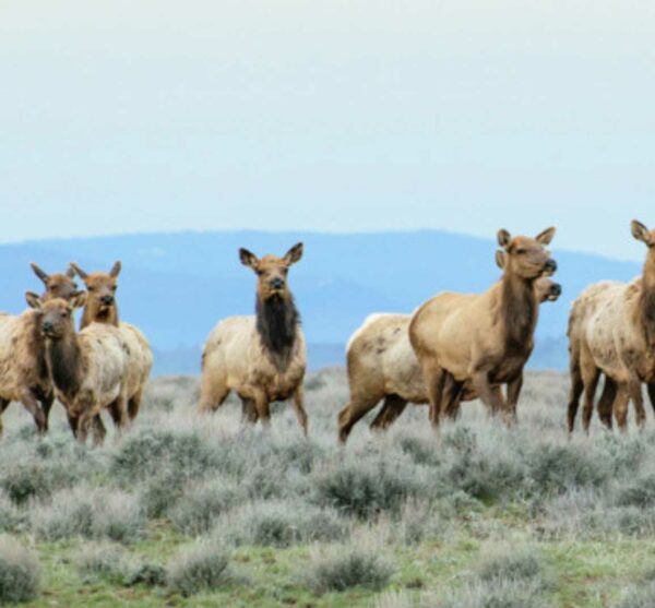
Limit group size to 4 due to wildlife impact considerations.


Highlights & Remarkable Spots
Paisley / ~ start
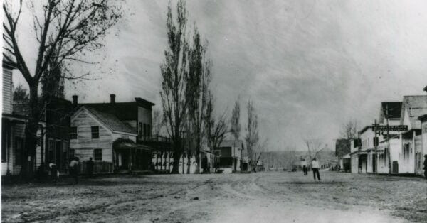
Paisley was once the site of a seasonal Northern Paiute and Klamath Indians who came to the Chewaucan Marsh and River to harvest local resources. M.M. Gillespie brought cattle to the area in 1871 and started the valley’s first ranch. Ranching and logging quickly became the primary source of income for early residents and is still true today.[Historical Marker Database]
Chewaucan River / ~ miles 2 to 11
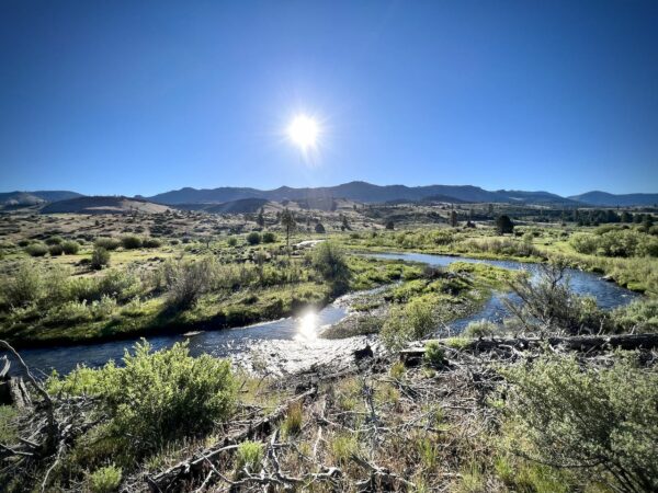
In its natural state, Great Basin redband trout moved freely from the river’s headwaters (south of Paisley by ~ 20 miles) to the Chewaucan Marsh (just north of Paisley). In the late 19th century, cattlemen turned the Chewaucan Marsh into pasture land by building a series of dams, weirs, and canals to provide irrigation. Over time, the stock of native trout dwindled.In 2002, the Forest Service partnered with the Paisley community and local ranchers to restore the river. Old culverts along the Chewaucan river and the town weirs were replaced with new fish-friendly ones.[Wikipedia]
Bootleg Fire Views / ~ miles 23 to 29

This 2021 lightning caused fire is the third-largest fire in the history of Oregon since 1900. At the fire’s fastest growth in mid July , it grew at about 1,000 acres per hour, and it became the second largest wildfire in the United States of the 2021 wildfire season. At one point, over 2,200 personnel were fighting the fire.[Wikipedia]
Terrain & Riding
The start, miles 0 to 5, are the most rugged of the day; primitive forest service dirt road with some chunk. Thereafter it is a mix of single-lane and double-lane forest service gravel roads until 7 miles from the finish where you transition to a single lane paved with a rough texture and some in broken spots. Most of the climbing is moderate at 3 to 5%, the back-half of the route has a few steep, but short pitches, approaching 10%.
The riding is rolling and undulating (void of long climbs) with big vista views and. The terrain is creeks, meadows, pine and ponderosa forests, a bit of high desert scrub of sage and juniper and some rugged basalt rock outcroppings. The entirety of the ride encompasses the many creeks that meadowns that join together to form the Wauchucan River.
In looking at the map, you may be inclined to skip the serpentine section of miles 23 to 32, do not! The riding is flowy, fast and fun. Some of the best of the day!
The Start
A circular pullout (gravel) on the west side of the road.
Lat / Long: 42.551677, -120.618155
Food & Water
- None
Route Notes
By riding this route, you will have an impact on wildlife. Please review the resource page (to the right) on wildlife impact before riding.
Much of this area is open grazing for cattle. Use caution when passing. Bring your group together, slow your speed, and talk to them in a normal voice. Do not shout or hoot or holler. The goal is to keep the anxiety of the animals to a minimum.
Route Options
There are several bail out points / shorter options (at miles 15, 22, and 32) along the route. They are marked on the map.
Love Where You Ride! Learn More
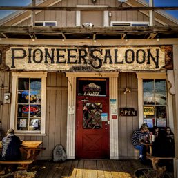 Paisley is a small town that survives through agriculture and tourism. As a visitor to the area, we encourage you to drop some coin at either the Pioneer Saloon and Restaurant, the Paisley Mercantile, Adventure Paisley (Bicycle Tours and Repairs), or one of the local RV Parks and hot springs.
Videos
The Ride! Milk & Honey
A quick 2-minute video of what to expect on your ride!
Podcasts
Mosquito Festival
Have you ever driven through Paisley, Oregon and noticed the advertisement for the Paisley Mosquito Festival? Is it really a festival about mosquitos? Today we talk with one of the festival’s organizers, Amy Davis, to learn about a festival that may very well involve mosquitoes. Sure [...]
Be Informed!
Ridden and Reviewed by:


Have you ridden this route? Got a question? Join the discussion!