
Dirty Freehub
Favorites Sign In Search
  • Search
  • Donate
  • Gravel Rides
    • Explore by Region
    • Explore by Route Type
    • Explore by Collection
  • Programs
    • All Access®
    • Dirty Roads Crew
    • Gravel Champs
    • Passport Challenge
    • Route Stewardship
  • Stories
    • Bike Life
    • Culture & History
      • Central Oregon
      • NE Oregon
      • Bend Trails
      • Death Valley
    • People & Places
    • Lands
      • Arizona
      • Central Oregon
      • NE Oregon
    • Love Where You Ride
  • Events
    • Rides, Races & More
    • Submit Your Event
  • Help
    • Route Types
    • The Route Development Process
    • How We Rate Routes
    • Using the Searchable Map
    • Loading a GPX File
    • GravelPlex Maps
    • Glossary
    • FAQs
  • About
    • The Team
    • Our Missions
    • Impact Reports
    • Jobs + Volunteer
    • Press
    • Sponsors
    • Contact Us
  • Store
    • Gravel Guides
    • Merch
  • Donate
  • Cart
  • Sign In
  • Favorites

Kloochman

5 Star (Premiere) Route / Prineville, Oregon / Published: Jun 2019 / Updated: Aug 2026 / Directions
Save to Favorites Remove from Favorites

This route was impacted by the 2026 fires. See the Notes section for more information.
*
Route:
Loop | 92 mi
*
Gain:
4,400 ft
*
Surface:
40% gravel road, 60% tarmac
*
Technical Difficulty:
Very Demanding
*
Navigation:
Attention Required
*
Locale:
Remote
*
Tire Suggestion:
40 mm
*
Options:
---

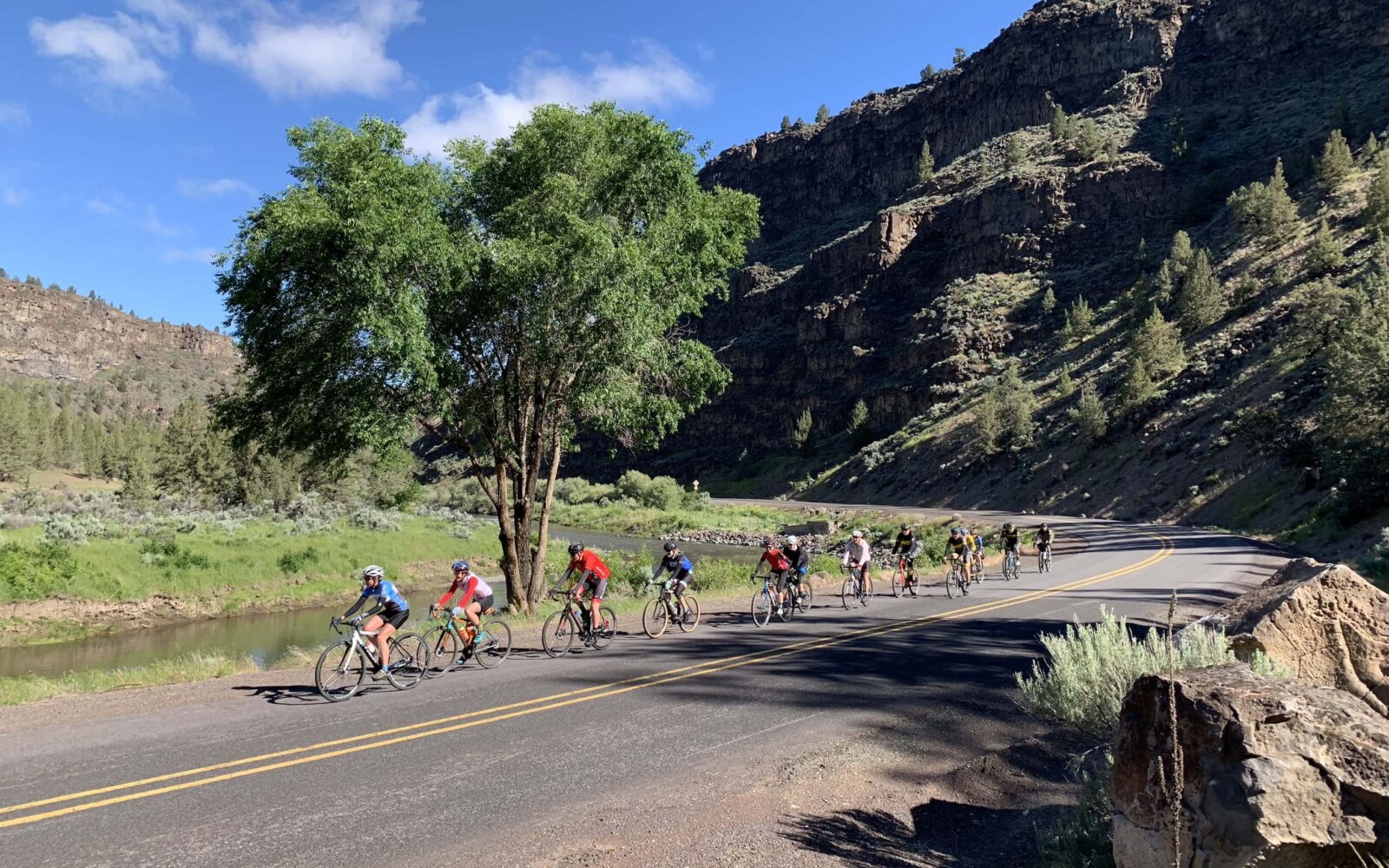
A mixed gravel century (almost a century) that includes the Crooked River Canyon scenic bikeway, the Maury Mountains, and the Post / Paulina road. The ride links two of the best paved roads in Central Oregon with a gravel segment through ranching and farming country and some national forest.

Read More
Map
Brown = gravel / dirt road
Blue = single track
Red = paved road
Purple = paved bike path
GPX Download
(Version 1.0)

Caution! We do not provide turn-by-turn directions in our GPX files. Those are auto-generated by your bike computer and are usually less than 70% accurate. Learn more.

For help loading a GPX file onto your bike computer, go here.

Download

⚠️ GPX download won’t work in this browser

You’re viewing this in Facebook’s built-in browser, which blocks GPX file downloads. To download the file, use either of these options:

  • Tap the ••• (or ≡) menu in the top corner of the screen and select Open in External Browser.
  • Open the route guide directly in Chrome or Safari.

Once the route guide is open in your browser, tap the GPX Download button again.

Got it
Learn More
Ride Details

When We Like to Ride This

Jan
Feb
Mar
Apr
May
Jun
Jul
Aug
Sep
Oct
Nov
Dec
Not Rideable
Possibly Rideable
Rideable

Spring through Fall. Best in the spring. Summer can be hot. Fall is hunting season.

Note that this ride tops out at 5300 feet of elevation in the Ochoco forest. Thus, snow is always a consideration. Thus, we have marked in yellow those months that you need to check snow levels before you go.

Terrain & Riding

The first paved sector is from downtown Prineville out the Crooked River Canyon to the top of the grade above Prineville Reservoir and down the other side. The climb of the grade is a little over 4 miles and about 900 feet. The steepest pitches are at the start. The descent of the other side is a bit shorter and less steep.

At mile 28 the gravel begins. Ride through rolling farm and ranch country, up and over the Maury Mountains and down into Post. At Post, refuel at the General Store on milkshakes and meatloaf sandwiches. From mile 28 to mile 54 is uphill at 1 to 2% until the turn onto Kloochman Creek road, where the grade steepens to 5%. The descent into Post is 11 miles with a loss in elevation of 2000 feet.

From Post, it is paved until the finish, 27 more miles. Ride along the scenic Crooked River for a bit, climb some (900 feet over 4 miles), and then drop back down into Prineville.

The Start

Lat / Long: 44.302686, -120.844650

Good Bike Co bike shop in downtown Prineville.. Flush toilets, water, beer and bike parts!

Food & Water

  • ~ Mile 65: Post General Store
Notes & Options

Route Notes

  1. The Ochoco National Forest, south of Post, had a major fire in 2026. This may result in road closures and in charred areas. We appreciate your comments and photos (add them to the Comments section so we can all benefit.).

  2. One helpful hint for this ride. Start with your tires at a higher pressure, like 50 to 60 psi, at the gravel drop the pressure down to 20 to 30 psi, and back at the Post General Store air your tires back up to 50 to 60 psi.

  3. The only aide station is at the Post General Store (mile 66). Also, there is very limited cell phone service along the route. You should plan on being self sufficient.

Comments

Have you ridden this route? Got a question? Join the discussion!

Keep it Local! Learn More

Good Bike Co.

Finish with a beer at Good Bike Co.

Ridden and Reviewed by:

KevinE

KevinE / Team Dirty Freehub

He should have “Never Stop Exploring” tattooed on his chest! He loves adventures on bikes and is a Co-Founder of Dirty Freehub.

Sign Up for the Dirty Freehub Newsletter

info@DirtyFreehub.org
Terms of Service Privacy EEO Policy Our Values
Dirty Freehub is 501(c)3 non-profit organization.
©2026 Dirty Freehub :: Website Design
Cleantalk Pixel

WHY WE’RE DIFFERENT!

Eight scouting rides. Two community rides. More than a dozen mapped variations.

We just published the McCool route—but getting it ready took time. We rode it again and again, tested multiple options, and refined every mile before publishing it.

That’s the Dirty Freehub difference: routes that are vetted, curated, and maintained. If you value that kind of fieldwork, please support Dirty Freehub with a donation.

Donate Today







