Fifty 50


Caution! We do not provide turn-by-turn directions in our GPX files. Those are auto-generated by your bike computer and are usually less than 70% accurate. Learn more.
For help loading a GPX file onto your bike computer, go here.
DownloadHighlights & Remarkable Spots
Brooks Scanlon Haul Road / ~ Mile 2.5
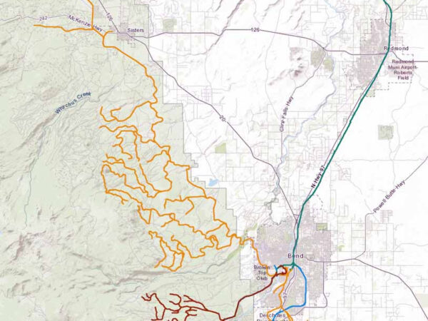
Bend was once a world exporter of timber. Mile 2.5 marks the location of one of the old haul roads used to bring timber into the Bend mills along the Deschutes River.This map highlights many of the old haul roads. Click on it for a larger view. Yellow = Brooks-Scanlon Lumber Company. Brown = Shevlin-Hixon Lumber Company.
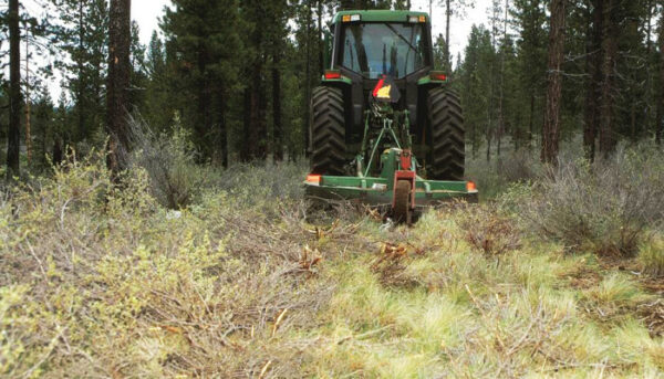
West Bend Forest Project / Miles 2.5 to 12.5
Along this section of trail you are riding through the West Bend Project, a 15-year forest management effort that includes tree thinning, brush mowing, and controlled burns. The project received Congressional funding through the federal Collaborative Forest Landscape Restoration Act. There are only 20 such demonstration sites nationwide. The goals of the Project are: to restore forest ecosystems, reduce the potential of high-severity wildfires, and provide economic and social benefits to local communities. For more information, see the resource page in the right sidebar (desktop) or towards the bottom of page (mobile).
Tetherow Resort / Mile 16
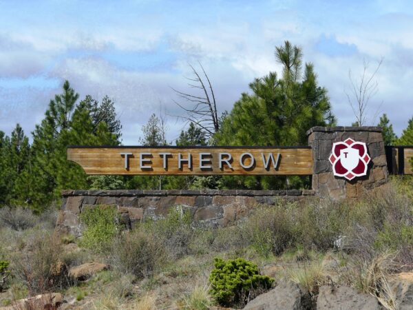
At one point, this high-end resort and golf community was a struggling endeavor that was on the brink of failure. As reported in 2009, “Only 59 of 302 plots have sold and just ‘a handful’ of homes have been built on them. The master developer, Arrowood Tetherow, had to unload most of its residential lots, plus the property where it planned to build a hotel and the golf course itself. Now it’s getting pressure from another one of the developers, Virtual Realty Enterprises of St. Louis, which has filed a notice of default for failure to pay $12 million on an $18 million line of credit.” [Bend Bulletin]
Phil's Trailhead / ~ Mile 19
“We started riding out in this area on dirt roads,” Phil Meglasson said at the trailhead last week. “We spotted a deer trail up here, which eventually became Phil’s Trail. We just followed it through. You didn’t use any tools in those days; you just rode, and rode the trail in that way.”
As Meglasson and his friends started using tools and building and developing trails, their efforts led to the formation of the Central Oregon Trail Alliance in 1992. Since then, COTA volunteers have worked closely with the U.S. Forest Service in building and maintaining area trails. The Phil’s Trail System is now nationally known because of its wide assortment of singletrack trails. [Bend Bulletin]
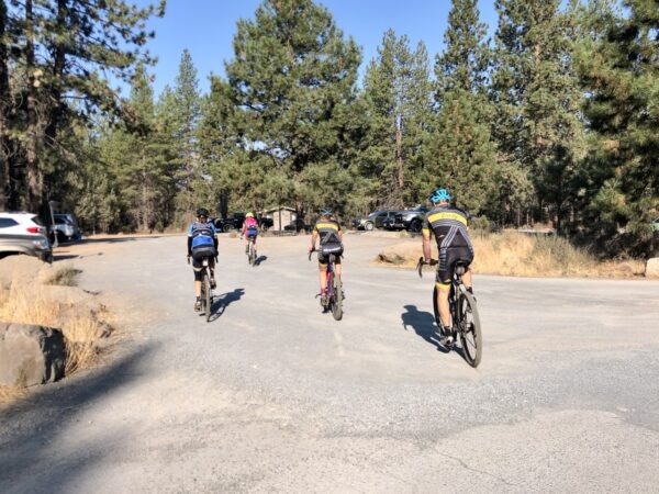
When We Like to Ride This
Our favorite time to ride this route is early spring and late fall. Not too much climbing, not too much descent. During the summer months, it can get busy and dusty.
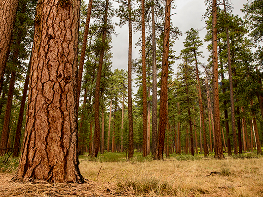
Terrain & Riding
A great sampler of terrain typical to the Bend, Oregon area including some bumpy red gravel, twisting singletrack, and return-to-start fast doubletrack. It is classic eastside Cascades Forest with ponderosa pine, manzanita and basalt rock outcroppings.
There are ~ 2.5 miles on single-track that is rated mountain bike easy+. Those with good technical bike handling skills will ride it “clean”; others may need to put a foot down once or twice.
The Start
Northwest Crossing roundabout. At the Grove Market.
Route Notes
On the paved bike path, be sure to check your speed as this is a very popular trail with users of all abilities.
Love Where You Ride! Learn More
![]() This route includes a significant amount of single-track trail. The Central Oregon Trails Organization (COTA) manages and maintains these trails for riding. Like Dirty Freehub, they are a non-profit. We encourage you to give back with time, money or talent to COTA or your local trails organization. It is easy to forget that trails and routes require your ongoing support.
This route includes a significant amount of single-track trail. The Central Oregon Trails Organization (COTA) manages and maintains these trails for riding. Like Dirty Freehub, they are a non-profit. We encourage you to give back with time, money or talent to COTA or your local trails organization. It is easy to forget that trails and routes require your ongoing support.
Podcasts
Ben’s Trail (It was a downhill trail? What?)
Here more about the original design of Ben’s trail from author, Ben Husaby. This podcast is about trails that are located in Bend, Oregon.
Single-Track Trail Etiquette (Who has the right of way?)
Ever wonder who has right of way on those single-track trails? Downhill rider? Uphill rider? The runner? Who? In this episode of The Connection, we speak with Emmy Andrews the Executive Director of the Central Oregon Trails [...]
Be Informed!
Keep it Local! Learn More
Ridden and Reviewed by:


 Behind every route is scouting, mapping, storytelling, and a whole lot of pedal power.
Have you ridden this route? Got a question? Join the discussion!