Experimental Rattlesnake


Caution! We do not provide turn-by-turn directions in our GPX files. Those are auto-generated by your bike computer and are usually less than 70% accurate. Learn more.
For help loading a GPX file onto your bike computer, go here.
DownloadHighlights & Remarkable Spots
Haystack Resevoir / Mile 0
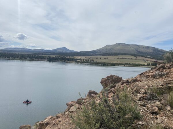
Haystack Reservoir was created in the mid-1950s by constructing an earth-filled dam. Named after the nearby Haystack Butte, the reservoir is a crucial irrigation storage facility. Spanning approximately 240 acres, it offers year-round fishing for rainbow trout, kokanee salmon, black crappie, and largemouth bass. The Oregon Department of Fish and Wildlife (ODFW) manages the reservoir’s fish populations through both hatchery production and natural reproduction.
North Unit Irrigation District Canal / ~ Mile 1
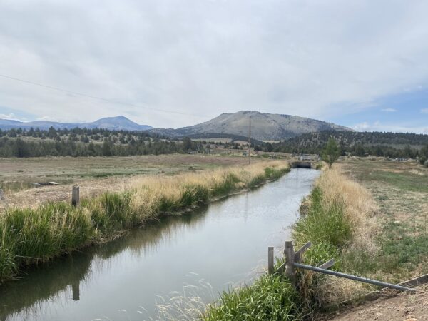
Canals are vital to Central Oregon’s agriculture, supplying water to farms in this dry region, which receives just 8 to 12 inches of annual precipitation—far less than the 24 to 48 inches needed annually for crops like hay, alfalfa, and carrot seed. They transport water from rivers like the Deschutes to where it’s needed most. The canal system took shape in the early 1900s, driven by the Carey Act of 1894, which encouraged private companies to build irrigation networks on public land to support settlement. Today, Central Oregon boasts over 1,000 miles of canals. Click here to learn more about the history of the canals.
Canal Piping Project / ~ Mile 1
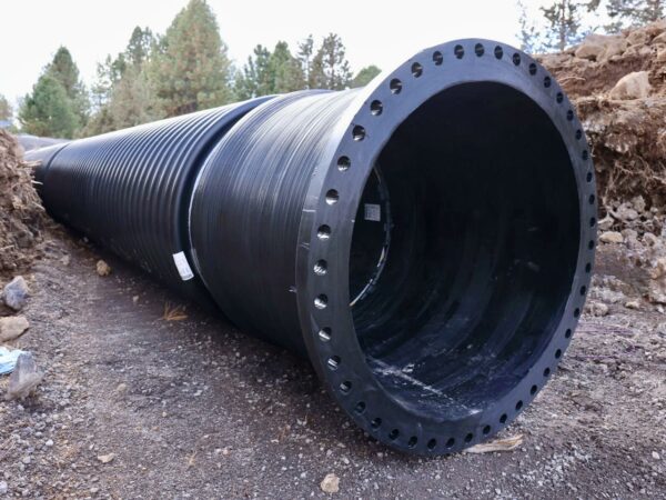
Here you are riding over the North Unit Irrigation District Lateral 43 canal that was piped and burried in April 2025. It carries water from Haystack reservoir to local farmers. This is Phase 2 of a project that will pipe 26 miles of open irrigation canals. By piping a canal, 7000 gallons of water per minute is saved from leaking into the soil or evaporating into the air. Yes, per minute!! The water is also delivered to farmers pressurized, saving $20K to $150K per farmer per year in electricity cost to run their pumps to irrigate fields. Learn more in this video.
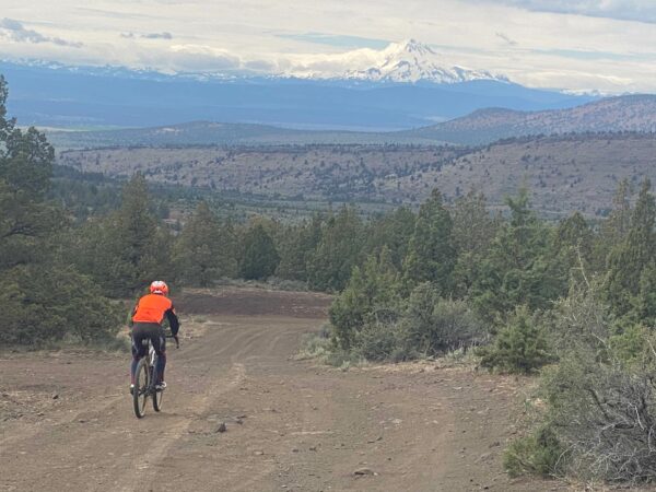
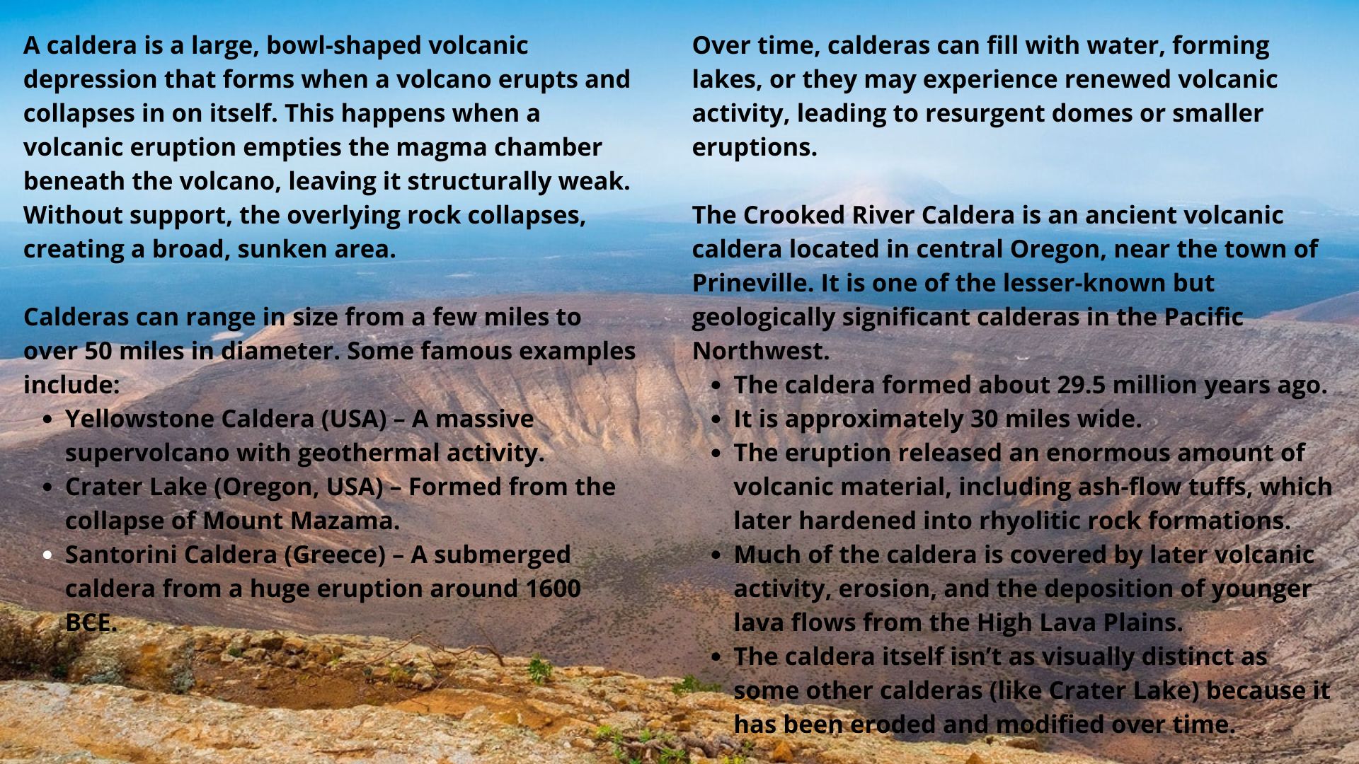
Grizzly Mountain and Gray Butte / ~ Mile 7
Grizzly Mountain (5,629 feet) and Gray Butte (5,108 feet) are prominent volcanic landmarks along the route. As you ride south, Grizzly Mountain rises to your left, while Gray Butte stands ahead. These peaks sit atop the eroded remains of the Crooked River Caldera—a vast, 25-by-17-mile, bowl-shaped volcanic depression that formed when the volcano erupted and collapsed in on itself. This caldera, one of Central Oregon’s significant geological features, was created approximately 29.5 million years ago.
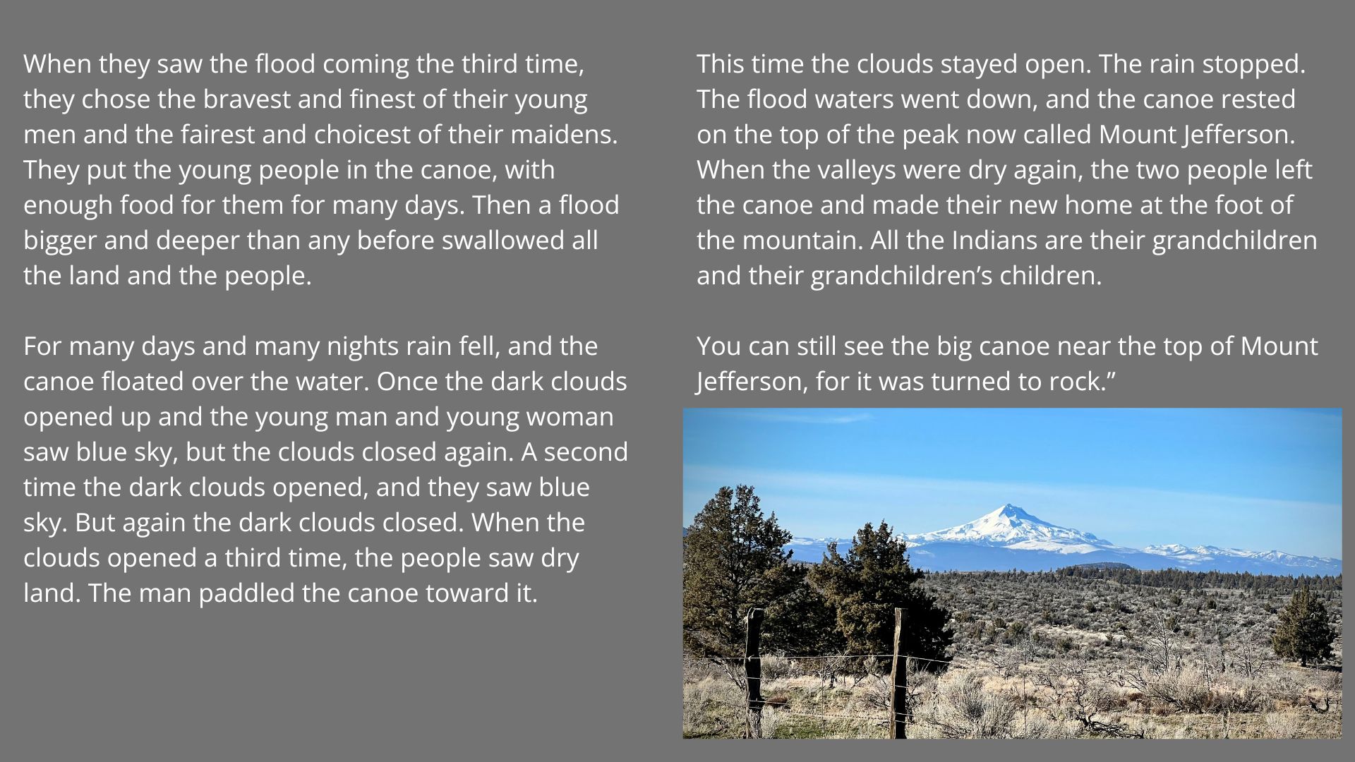
Mt Jefferson / ~ Mile 7.5
The following excerpt is from Indian Legends of the Pacific Northwest, titled Mount Jefferson and the Great Flood.
“A great flood covered the land. Then the waters flowed away, and the land became dry again. A second time a flood covered the land, and a second time the waters went away. Afraid that another and greater flood might come, the people cut the biggest cedar they could find and made the biggest canoe any of them had ever seen. Click to read the rest of the story.
Gray Butte Cemetary / ~ Mile 10
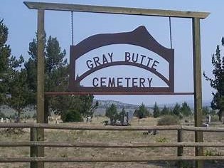
The earliest recorded burial is that of Harry B. McMeen, born September 8, 1887, who passed away at age three on November 20, 1890, making him the first known interment. Today, the cemetery remains a historical resting place for many early settlers and their descendants. Just a short detour off the main route, we find the cemetery well worth a visit. Read the headstones and reflect on the hardships, resilience, and way of life of the early pioneers who shaped this region.
Western Juniper Management / ~ Mile 13
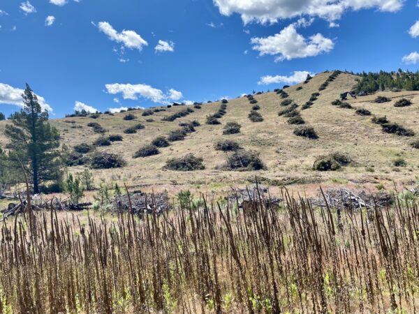
Juniper reduction programs aim to restore ecosystem balance by controlling the overgrowth of Western juniper, which depletes groundwater, reduces stream flows, and outcompetes native vegetation, leading to habitat loss for species like the sage grouse. By selectively removing junipers, these programs seek to improve water availability, enhance rangeland productivity, and support biodiversity. However, the initiative is not without controversy. While widely supported by conservationists and land managers, concerns exist about its effectiveness and potential unintended consequences, such as increased fire risk from invasive grasses. Listen to our podcast.
Haystack Butte / ~ Mile 14
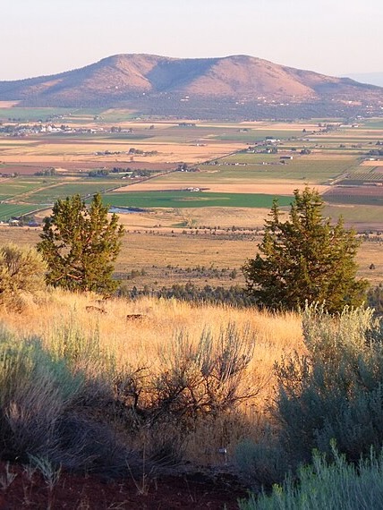
Haystack Butte (to your left at an elevation of 4,015 feet) is a classic example of a butte, a landform with steep sides and a flat or narrow top that rises above the surrounding landscape. Unlike sharp mountain peaks or broad mesas, buttes are smaller, isolated formations created by erosion over time.
A butte forms through a process that begins with deposition, where layers of rock—such as sandstone, volcanic ash, shale, or siltstone—gradually accumulate. The top layer, known as the caprock, is typically made of a harder, more resistant material.
Over time, erosion from wind, water, and freeze-thaw cycles gradually wears away the softer surrounding rock outside of the durable caprock. As the landscape continues to erode, the butte remains standing as an isolated, freestanding feature, rising prominently above its surroundings.
Buttes are common in arid and semi-arid regions, like Central Oregon.
Credits & Acknowledgements
This development of this ride guide was funded in part by a grant from Travel Oregon and the Deschutes Trails Coalition.

When We Like to Ride This
Spring when the Cascade mountains are snow capped. Fall when the colors are changing. The route is rideable almost anytime of the year, but the area can be very busy in the summer. Avoid when wet.
Terrain & Riding
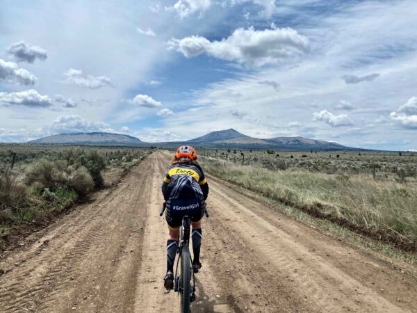
This ride takes you through rolling hills and open landscapes, offering sweeping views of the Cascade Mountains to the west. The route features a mix of paved roads, county-maintained gravel, and some rough Bureau of Land Management (BLM) dirt roads.
Route Notes
- ~ Mile 0.7 – Cross Jericho Lane and take a sharp left onto the dirt road running parallel to the canal. Stay on the right side of the canal. The road on the left side of the canal is private.
- ~ Mile 9.8 – Continue straight for 0.2 miles to reach the Gray Butte Cemetery—a worthwhile detour! After visiting, backtrack 0.2 miles and turn south onto a BLM dirt road. You are now in the National Grasslands, where you may encounter open grazing livestock.
- ~ Mile 12.8 – Exit the National Grasslands and return to county-maintained gravel roads. This section is typically fast and downhill.
- Final 2 miles – Transition onto paved roads for a smooth and flat finish.
The Start
Pit toilets. Between April 1st and October 31st there is a $7 vehicle / group fee.
Food & Water
- None
Route Notes
You will be riding through a working, rural environment. The roads are used by farmers and ranchers to move large equipment, crops and livestock. The following are things you can do to ensure both safety and that future users are welcome on these rural roads.
- Always yield to farm equipment. Large equipment like combines can take up most of the road. Move to the side, stop, and put a foot down.
- Make it easy for vehicles, such as tractors hauling hay, to pass safely. Keep your group small and together. Don’t override your sight lines.
- Use a flashing rear light with a radar detector.
- Free-range cattle may be encountered on this route. Avoid startling animals.
- Don’t whoop or holler. Sudden movements or loud noises can cause injuries or stress.
- Walk your bike past, keeping it between you and the cattle.
- Remove your helmet and sunglasses to appear less threatening.
- Watch for signs of aggression, such as raised heads, perked ears, pawing, or bellowing. If a bull or other cattle show these behaviors, retreat and reassess your route.
- Consider your attire. Wearing baggy shorts and a flannel shirt can help you fit in with the local culture.
- Be friendly! A simple wave or a brief chat with a farmer or rancher is often appreciated and can make your experience even more enjoyable.
In April 2025, the canal at the start was piped. Thus, it is now a dirt road, still good, but no water to see ride along.
Route Options
Longer
At approximately mile 10.7, turn left and head further south into the National Grasslands. This extended route adds 3.5 miles and 500 feet of elevation gain. Around mile 15, you’ll encounter a steep 15% descent, which can be rugged and rutted. This version of the route is does not meet the All Access criteria.
Despite the challenge, this section offers some of the best, if not the best, views of the Cascade Mountains in Central Oregon.
- GPX File: Download
Love Where You Ride! Learn More
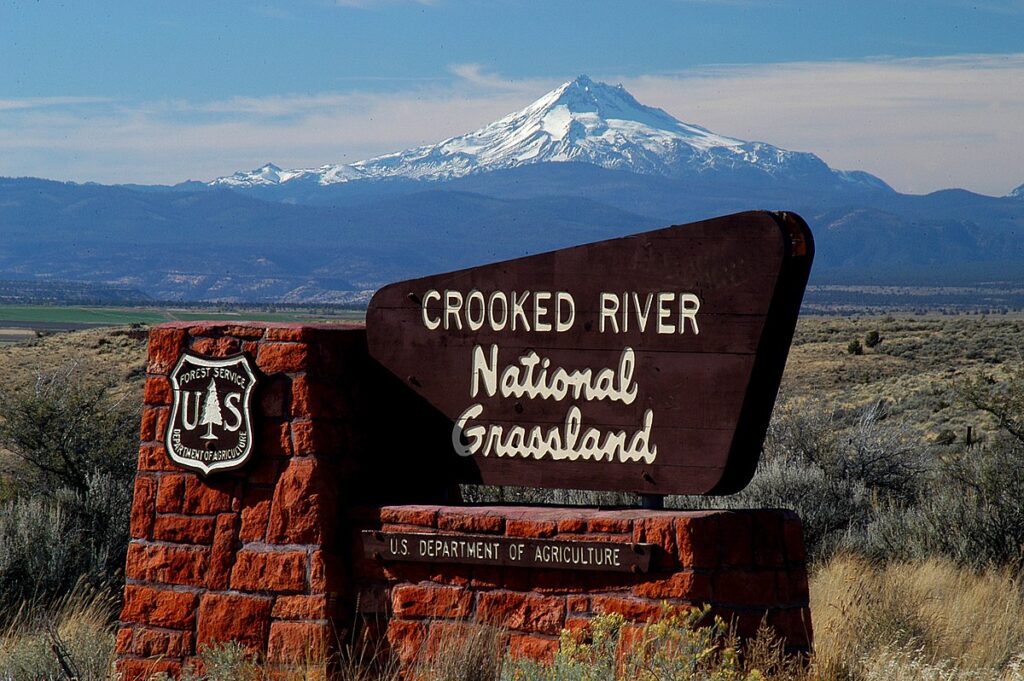 The southen sector of this ride is through the Crooked River National Grasslands.
The grasslands provides habitat for 375 species of wildlife including deer, elk, antelope, mountain lion, songbirds, waterfowl, and raptors including the threatened Northern Bald Eagle and the endangered Peregrine Falcon.
It is believed that the Grassland was originally vegetated with bluebunch wheatgrass and Idaho fescue, and some sagebrush, rabbitbrush, bitterbrush, and juniper. Because much of the area was cultivated and the native vegetation removed during the homesteading era, it is difficult to determine the original vegetation patterns.
One of the lead organizations working to protect these lands and others like it is Discovery Your Forests. Check them out!
Videos
The Ride! Experimental Rattlesnake
A quick 2+ minute video of what to expect on your ride.
Piping Canals, Why?
In this 2.5-minute video, learn about the 2025 canal piping project near Madras . Once completed, the project will conserve 7,000 gallons of water per minute by preventing seepage and evaporation. It will also save the average farmer between $20,000 and $150,000 per year in irrigation pump [...]
Podcasts
Controversial Juniper Trees
The juniper tree is an iconic tree across Central and Eastern Oregon and yet, in some places they are being removed. Find out the real scoop about this unique tree from Gena Goodman-Campbell who is the Stewardship Director at ONDA (Oregon Natural Desert Association) where she works to engage [...]
Tractors, Bulls and Lycra
In this podcast, we talk with Daarla K who is a rancher and farmer in northeast Oregon. She and her husband operate a 1000-acre farm that has been in his family since 1886. Learn how to safely pass by big tractors and combines, how to get through a cattle drive, and what aggressive behavior [...]
Keep it Local! Learn More
Related Guidebooks
-

All Access Gravel Guide Eastern Oregon (Collector’s Edition!)
$12.50Now shipping! A 64-page pocket-sized gravel guide. Featuring gravel routes, art, culture and local history. A one of a kind…Add to cart -

All Access Gravel Guide Western Oregon (Collector’s Edition!)
$12.50Now shipping! A 64-page pocket-sized gravel guide. Featuring gravel routes, art, culture and local history. A one of a kind…Add to cart
Ridden and Reviewed by:


Have you ridden this route? Got a question? Join the discussion!