Bunchgrass


Caution! We do not provide turn-by-turn directions in our GPX files. Those are auto-generated by your bike computer and are usually less than 70% accurate. Learn more.
For help loading a GPX file onto your bike computer, go here.
DownloadHighlights & Remarkable Spots
Santiam Wagon Road / @ Start
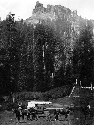
According to the Forest service, the Santiam Wagon road was active for 75 years, starting in 1865. While most roads during this period were focused on moving settlers east to west, the Santiam Wagon Road allowed livestock to be moved from west to east and was important for facilitating trade, commerce and communications. For a 7-year period in the late 1800s the Santiam Wagon road moved ~ 100,000 cattle per year from the Willamette Valley to Idaho, Montana, and Wyoming.
This road is listed on the National Register of Historic Places. Learn more about it’s history here.
The Husband / ~ Mile 8.5
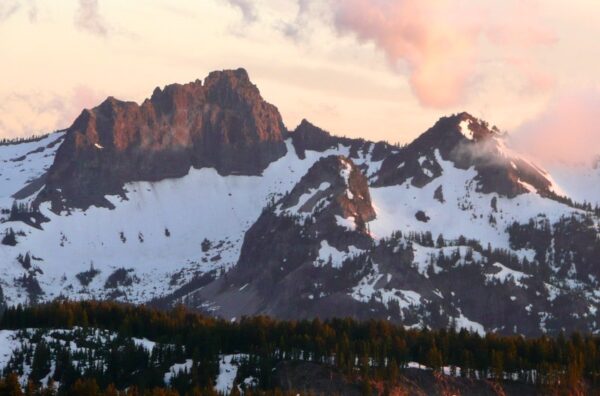
The patriarch of the Cascades family, The Husband rises to 7524 feet and is set just west of his three daughters (South, Middle, and North Sister). Just to the southeast and within yelling distance is his Wife while his Little Brother is tucked up safe to the north. His best friend, the Bachelor is on the other side of The Wife to the southeast (she likes to stay in between the bad influence). [Summit Post]
Deer Creek Bridge / ~ Mile 11.5
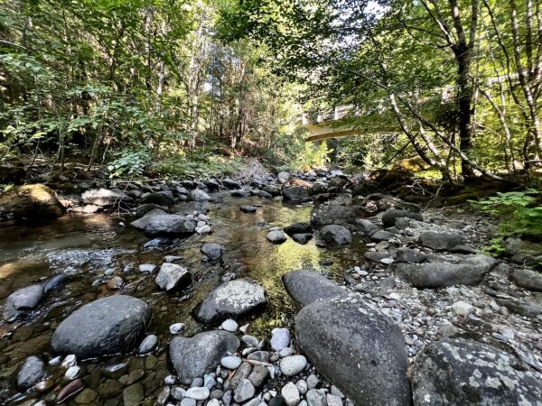
Just after crossing the bridge, to your right there is a dirt “road” leading to the edge of deer creek, about a 25-yard detour. Go! You will see an outstanding grove of aspen trees, but also get context for how important the restoration of lower Deer Creek is for the re-introduction of endangered fish like the Spring Chinook Salmon and Bull Trout. [The Story of Deer Creek]
Knoll Fire 2021 / ~ Mile 16.5
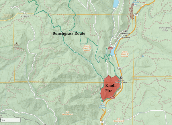
Most of you will have no recollection of the Knoll Fire of 2021 which you pass by for a brief section on your ride. Burning only 600 acres, this fire came a year after the disastrous Holiday Farm Fire of 2020 which burned 173,393 acres and destroyed the town of Blue River.
But the Knoll Fire, which was caused by lightning, was given high priority and was quickly contained. The McKenzie River, Highway 26, and Deer Creek helped in rapidly surprising this fire.
Deer Creek Flood Plain Enhancement / ~ Mile 17
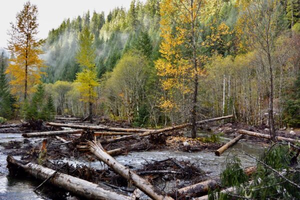
The forest service has restored this important flood plain, which at first glance might feel chaotic. Why harvest over 200 trees and toss them into a creek? It’s all about creating better habitat for fish, specifically the endangered Spring Chinook Salmon and the Bull Trout. These dead trees provide critical areas for fish to hide, rest, and spawn. See the Forest Service details on the entire restoration project. See this storyboard for a lot more information.
McKenzie River Trail / ~ Miles 17.5 to 20.5
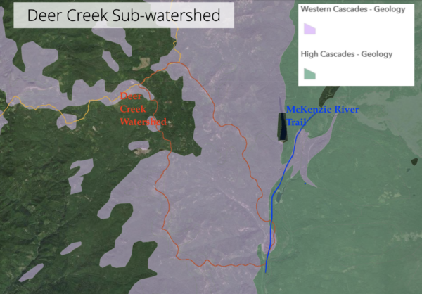
This section of the MacKenzie River Trail parallels the divide between the High Cascades and Western Cascade lava flows. The older Western Cascade mountains were formed about 30 million years ago. The younger High Cascades are 5 to 10 million years old. They are characterized by characterized by young, porous volcanic rocks that allow snowmelt and rainfall to percolate into a deep underground aquifer before emerging at various springs at lower elevations like the Blue Pool (Tamolitch Falls).
Trail Bridge Reservoir / ~ Mile 20.8
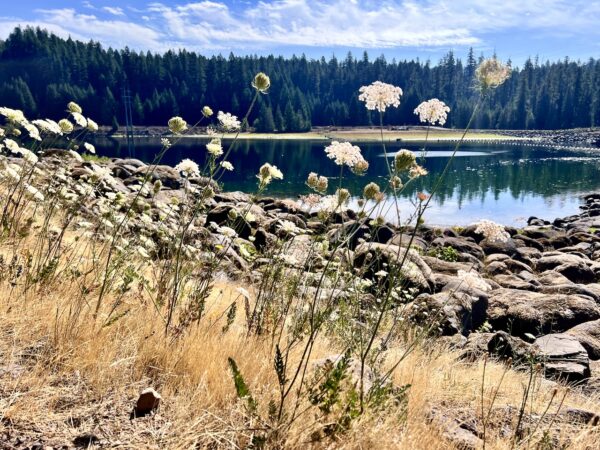
The Trail Bridge Reservoir is a perfect midway point to take a break. The Reservoir, located on the McKenzie River, was built in 1963 by the Eugene Water and Electric Board as one of the three reservoirs in the Carmen-Smith Hydroelectric Development.
In 2019, Carmen-Smith acquired a new 40-year license from the Federal Energy Regulatory Commission (FERC). In return for the license to operate, they will be creating a fish passage past Trail Bridge dam, which will give federally threatened salmon and trout access to historic spawning areas upstream of the dam. There are several other projects they will be working on including campground restoration and preservation of artifacts.
Girdled Trees / ~ Mile 21.2
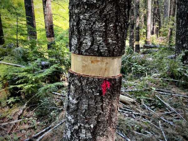
Just after coming out of the reservoir, you will see girdled trees, which is a fancy way to say a ring of bark was stripped around the entire tree. Girdling, which can also be called ring barking, will kill the tree if done lower on the base of the tree. This process is used in forestry to thin a forest, but can also be a sign of vandalism.
Wolf Rock / ~ Mile 27.5
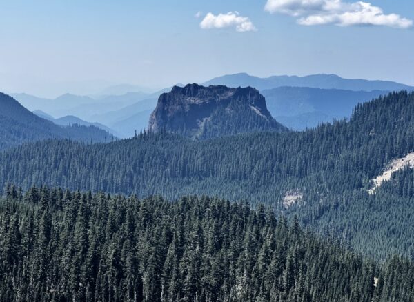
The crown jewel of this route is the amazing view of Wolf Rock, which towers in the distance above the treeline. It’s the largest monolith in all of Oregon (or the largest block of rock.) For an intimate view of this center of an old volcano, check out this video.
Wolf Rock is a known destination for rock climbers which you’ll find the details on how to scale the various routes at Summit Post.
When We Like to Ride This
Spring, summer or fall. Spring and summer for flowers. Summer when looking for something cool and shady to ride and to avoid the moon dust of other areas. Fall for colors.
Terrain & Riding
What we loved about this route was the big old trees and the transitions between different types of trees (firs, cedars, hemlocks, Doug-fir, aspen, and maples, by reservoir). There were also enough ridge-lines that offered up great views of the whole area including views of the Three Sisters, Mt Washington, Three Fingered Jack and Mt Jefferson. The route is often lined with wild rhododendrons and fields of bear grass which in the spring will turn this five star route into a bucket-lister.
As for hills, the start and finish are rolling good fun, the stick of the lollipop. All paved single-lane road.
For miles 5 to 17, you will descend 2500 feet over variable pitched terrain. It is never super steep and the later portion is along Deer Creek canyon which is quite scenic.
Miles 17.5 to 20.5 are on the McKenzie River Trail, one of Oregon’s most renowned mountain biking trails, requiring advanced skills to navigate. Luckily for you, we’ve snuck in 3 miles of the less technical parts of the trail.
The real challenge comes when you climb out of the reservoir for 2,700 feet of gain in a little over 10 miles. None of it was in the “push your bike category” … the route offered up just a continuous grade that kept us working.
So, don’t burn all your matches early, this is a backloaded route!
The Start
The Start is at Iron Mountain Trailhead which is NOT the same as Tombstone Sno Park parking area. They are near each other and it would be easy to park at the wrong one. Northwest Forest Pass required.
Food & Water
- None
Route Notes
This route can be ridden in either direction—clockwise or counterclockwise. In the mapped (counterclockwise) direction, the descent to the McKenzie River is more gradual, but the climb afterward is more challenging. In the clockwise direction, the descent is steeper and more demanding, while the climb away from the river is more gradual.
Route Options
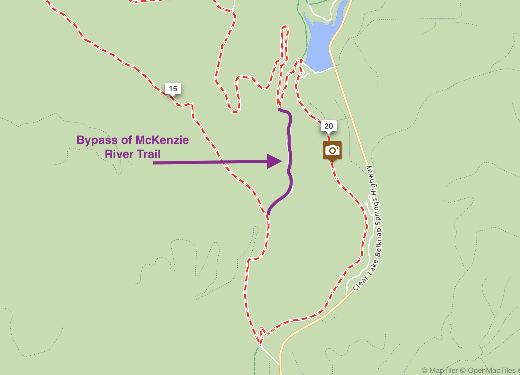
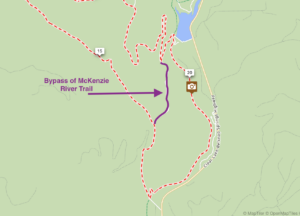 If single-track is not your style, you can bypass it by going left on Forest Service Road 2655 (gravel) at mile 16.4. You will intersect the original route back at mile 21.2. This will bypass the Deer Creek Flood Pain Enhancement project and Trail Bridge Reservoir.
- This route could start and end at the Trail Bridge Reservoir which is easy access off Highway 126. Just realize that you are starting with a long climb and absolutely no warm up. It’s also an easy way to take the stick of the lollipop off the route, reducing your distance by 10 miles and 1,000 feet of climbing.
- The Tidbits route intersects this route so if you are looking add distance to the route, you could easily use Tidbits to head over to Clear Lake which has a store and plenty of amenities or over to McKenzie Bridge which also has a store. At McKenzie Bridge you can also pick up the O’Leary Landslide route.
Videos
Living with Fire: An Oregon Story
In this 7-minute video (a great watch!) we take a look to the landscape to better understand wildfires in Oregon and ensure our favorite places thrive for generations to come.
Risk Takers: Forest Firefighters
See what it is really like to battle a forest fire in this 52-minute on-the-ground video with Canadian Forest Firefighters.
Wolf Rock
Wolf Rock is the largest monolith in Oregon. The rock is about 900ft tall. The summit has an elevation of 4535ft. The rock is an old volcanic plug that had its surrounding soil erode away. Video by McKenzie River Drone Photography.
Ridden and Reviewed by:


 Behind every route is scouting, mapping, storytelling, and a whole lot of pedal power.
Have you ridden this route? Got a question? Join the discussion!