






Dirty Freehub
Favorites Sign In Search
  • Search
  • Donate
  • Gravel Rides
    • Explore by Region
    • Explore by Route Type
    • Explore by Collection
  • Programs
    • All Access®
    • Dirty Roads Crew
    • Gravel Champs
    • Passport Challenge
    • Route Stewardship
  • Stories
    • Bike Life
    • Culture & History
      • Central Oregon
      • NE Oregon
      • Bend Trails
      • Death Valley
    • People & Places
    • Lands
      • Arizona
      • Central Oregon
      • NE Oregon
    • Love Where You Ride
  • Events
    • Rides, Races & More
    • Submit Your Event
  • Help
    • Route Types
    • The Route Development Process
    • How We Rate Routes
    • Using the Searchable Map
    • Loading a GPX File
    • GravelPlex Maps
    • Glossary
    • FAQs
  • About
    • The Team
    • Our Missions
    • Impact Reports
    • Jobs + Volunteer
    • Press
    • Sponsors
    • Contact Us
  • Store
    • Gravel Guides
    • Merch
  • Donate
  • Cart
  • Sign In
  • Favorites

Kangaroo Bay

5 Star (Premiere) Route / Hobart, Tasmania / Published: Dec 2018 / Directions
Save to Favorites Remove from Favorites
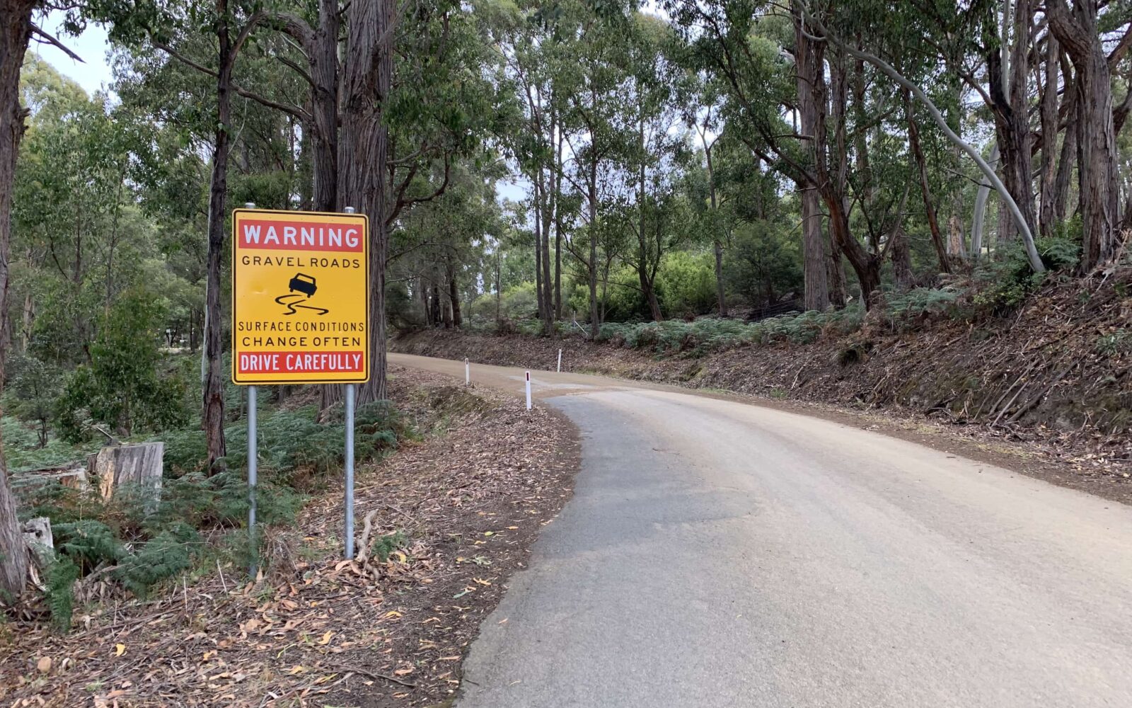
Gravel road cycling in Tasmania
Signs that we like!
Cycling by water by Kangaroo Bay
~ 60% of the ride is along the water
Gravel road cycling through farms in Tasmania
Throughout the route there are small working farms
Cycling route in Tasmania gravel roads by Kangaroo Bay
One of the many soft rollers.
Bike riding by Huon River and Kangaroo Bay
Dirt + Water views = Fantastic!
Riding bikes in forest at Cradoc Hill
Deep forest near the summit of Cradoc Hill.
Gravel riding by Kangaroo Bay in Tasmania
Kangaroo Bay in the distance.
Cycling back to Cygnet
Spinning into the finish!
*
Route:
Loop | 25 mi
*
Gain:
2,400 ft
*
Surface:
40% gravel, 60% paved
*
Technical Difficulty:
Easier
*
Navigation:
Straightforward
*
Locale:
Rural
*
Tire Suggestion:
40mm +
*
Options:
---

A lovely ride along Kangaroo Bay and the Huon river followed by a short, but intense climb of Cradoc hill. A go to ride in the winter and when the weather is less than ideal.

Read More
Map
Brown = gravel / dirt road
Blue = single track
Red = paved road
Purple = paved bike path
GPX Download
(Version 1.0)

Caution! We do not provide turn-by-turn directions in our GPX files. Those are auto-generated by your bike computer and are usually less than 70% accurate. Learn more.

For help loading a GPX file onto your bike computer, go here.

Download

⚠️ GPX download won’t work in this browser

You’re viewing this in Facebook’s built-in browser, which blocks GPX file downloads. To download the file, use either of these options:

  • Tap the ••• (or ≡) menu in the top corner of the screen and select Open in External Browser.
  • Open the route guide directly in Chrome or Safari.

Once the route guide is open in your browser, tap the GPX Download button again.

Got it
Learn More
Ride Details

When We Like to Ride This

Route is rideable all year long.

Terrain & Riding

For the first 2/3rds of the ride along Kangaroo Bay and the Huon river you are challenged by a series of soft rollers. Try to keep it in the big ring and maintain the momentum from rise to rise! The last 1/3 along the water is relatively flat and on paved road.  Here is a chance to find rhythm in your spin!

After a short section on B68, you make a right turn onto Cradoc Hill road. In just over 2 miles (3 Km’s) you gain 850 feet (260 meters) on a nondescript gravel road. The average gradient is about 6%, but there are several short pitches in excess of 10%. Cresting over the summit the terrain becomes more interesting and the road steepens on the descent.  As you descend, try to take in the one of the big views of Kangaroo Bay in the distance.

Nearing the end of the descent the roads again become paved with a slight downward gradient of 1 to 2%. Spin out the legs and enjoy!

By Tasmanian standards this is an easier route, but by standards elsewhere it is a bit more stiff than our typical “easier” standard.

The Start

Lat / Long: -43.164053, 147.079777

Cygnet. Just after turning onto C639 there is a dirt parking lot on the south side of the road for access to Burtons Reserve.

Food & Water

  • None
Notes & Options

Route Notes

  1. Food and water at the start in Cygent are several cafes and coffee shops.

  2. There is still a bit of climbing on this route with one significant hill.

  3. We recommend a red blinky light with rear looking radar detector (i.e. Garmin Varia)

Comments

Have you ridden this route? Got a question? Join the discussion!

Ridden and Reviewed by:

KevinE

KevinE / Team Dirty Freehub

He should have “Never Stop Exploring” tattooed on his chest! He loves adventures on bikes and is a Co-Founder of Dirty Freehub.

LindaE (aka Gravel Girl)

LindaE (aka Gravel Girl) / Team Dirty Freehub

She loves a good day of gravel, like most people like a good book. She’s always amused by the outdoors and the wild adventures. Gravel Girl is a Co-Founder of Dirty Freehub.

Sign Up for the Dirty Freehub Newsletter

info@DirtyFreehub.org
Terms of Service Privacy EEO Policy Our Values
Dirty Freehub is 501(c)3 non-profit organization.
©2026 Dirty Freehub :: Website Design
Cleantalk Pixel

Tell Us How We’re Doing

Gravel rider on a rural Dirty Freehub route

From ride guides to rural economies — your answers shape what we do next.

Do our guides match reality? Do you trust what we publish? And when you drive to ride, how much does that trip put into the small towns along the way? Your answers help us improve — and help us prove gravel cycling’s real value to rural communities.

Ten minutes, confidential if you’d like, and it sets our direction for 2027.

Take the Survey