Dirty Freehub
Favorites Sign In Search
  • Search
  • Donate
  • Gravel Rides
    • Explore by Region
    • Explore by Route Type
    • Explore by Collection
  • Events
    • Rides, Races & More
    • Submit Your Event
  • Stories
    • Bike Life
    • Culture & History
      • Central Oregon
      • NE Oregon
      • Bend Trails
      • Death Valley
    • People & Places
    • Lands
      • Arizona
      • Central Oregon
      • NE Oregon
    • Love Where You Ride
  • Stewardship
    • Route Scouts
    • Dirty Roads Crew
  • Programs
    • All Access®
    • Gravel Champs
    • Passport Challenge
  • Help
    • Route Types
    • The Route Development Process
    • How We Rate Routes
    • Using the Searchable Map
    • Loading a GPX File
    • GravelPlex Maps
    • Glossary
    • FAQs
  • About
    • The Team
    • Our Missions
    • Impact Reports
    • Jobs + Volunteer
    • Press
    • Sponsors
    • Contact Us
  • Store
    • Gravel Guides
    • Merch
  • Donate
  • Cart
  • Sign In
  • Favorites

Bare Naked Gravel

5 Star (Quick Build) Route / Hood River, Washington / Published: Aug 2019 / Updated: Sep 2026 / Directions
Save to Favorites Remove from Favorites

Closed due to High Lava Fire restoration efforts. See the Notes & Options tab for details.

Cyclist on Little Soda Springs road, paved, near Carson, WA.
Leading out from the parking area on quiet paved roads.
Cyclist on the paved section of NF-64 near Stabler, WA and Carson, WA.
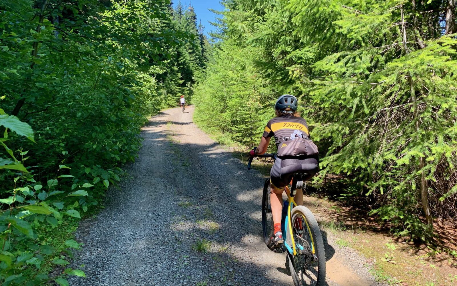
Bike rider climbing the gravel section of NF-64 in the Gifford Pinchot National Forest.
Climbing the gravel on NF-64.
Gravel cyclist on the more primitive NF-58 in Gifford Pinchot National forest in Washington State.
Just after the turn onto NF-58, a bit more primitive. ~ Mile 12.
Flowers in bloom in the Gifford Pinchot National forest in July.
In mid July the flowers were in full bloom.
White daisy in bloom in the Gifford Pinchot National forest near Carson, WA.
Cyclist on gravel road nearing Bare Mountain.
Mile 14. Done with the big climb. Traversing just below the ridge.
Gravel cyclist on near Bare Mountain and Observation Peak in Gifford Pinchot National forest.
The most primitive section of road. Still on the traverse.
Cyclist on gravel road with flowers in bloom near Trapper Creek Wilderness.
A slight downhill leading into the final climb!
Gravel cyclists on climb of NF-311 near Bare Mountain in Gifford Pinchot National Forest.
The Bare Naked climb (550 ft, 2 miles).
Flowers in bloom along NF-311 near Carson, WA in Washington State.
Mt Adams from NF-311 near Bare Mountain in Gifford Pinchot National Forest.
At ~ mile 19.5, a view of Mt. Adams. To the left of this, and out of the picture, is Mt. St Helens.
Cyclist descending gravel road NF-5407, near Soda Peak trailhead.
The descent starts on gravel ...
Cyclist descending paved portion of NF-54 near Carson, WA.
... and then transitions to pavement quickly.
Bike rider descending paved portion of NF-54 in Gifford Pinchot National Forest.
Use some caution on the descent. Watch for cracks, dips, and debris.
Cyclist on paved portion of NF-54 near the intersection with NF-34 near Stabler, Washington.
Low down on the descent, no brakes needed.
Cyclists on gravel road near Wind River in Gifford Pinchot National forest.
The last sector of gravel. Hard packed and fast and beautiful!
Wahoo metrics for Gravel Girl.
Gravel Girl's ride metrics.
*
Route:
Loop | 31 mi
*
Gain:
3,400 ft
*
Surface:
50% gravel, 50% paved
*
Technical Difficulty:
Moderate
*
Navigation:
Attention Required
*
Locale:
Remote
*
Tire Suggestion:
40 mm
*
Options:
---

Bear Naked Granola. Barenaked Ladies. And now … Bare Naked GRAVEL. Why? Because this route includes one hell of a good climb up to Bare Mountain. And you’ll be going plenty slow to see the awesome wildflowers and the views and everything the woods wants to offer up…..

But before the climb comes a nice warm up … five miles of quiet paved road that gradually kicks up. And after the climb is one wide-smile, twisting downhill … long enough to sing all the Barenaked Lady songs you can remember. Let’s get you started ….

“If I had a million dollars
Well I’d buy you a house
And if I had a million dollars
I’d buy you furniture for your house (maybe a nice chesterfield or an ottoman)
And if I had a million dollars (if I had a million dollars)
I’d buy you a ripping fast gravel bike”

Read More
Map
Brown = gravel / dirt road
Blue = single track
Red = paved road
Purple = paved bike path
GPX Download
(Version 2.0)

Caution! We do not provide turn-by-turn directions in our GPX files. Those are auto-generated by your bike computer and are usually less than 70% accurate. Learn more.

For help loading a GPX file onto your bike computer, go here.

Download

⚠️ GPX download won’t work in this browser

You’re viewing this in Facebook’s built-in browser, which blocks GPX file downloads. To download the file, use either of these options:

  • Tap the ••• (or ≡) menu in the top corner of the screen and select Open in External Browser.
  • Open the route guide directly in Chrome or Safari.

Once the route guide is open in your browser, tap the GPX Download button again.

Got it
Ride with GPS
(Open Route)

This is a new feature, and it will become a paid feature in the future as we pursue membership.

Open Ride With GPS
Learn More
Ride Details

When We Like to Ride This

Spring to Fall

Terrain & Riding

When traversing just below the ridge-line, near mile 18.5 you will see Mt Adams to the left in the distance and at the 7 o’clock position Mt. St. Helens.

The last climb of the the day, near Bare Mountain, is short, but noticeable (2 miles, 550 feet of gain). When you reach the top at mile 20+, you come down a bit on gravel …. but soon enough you are one ripping fast downhill paved road. One of the best in the Gifford Pinchot National forest. We did see a few cars coming up the road and there’s a few career-ending cracks that you should think about as you open up your brakes.

We were all in awe at how long we came down. But soon enough you are back at the cars … after another short section of gravel …. with a shit eating grin and a big craving for a whole lot of junk food.

The Start

Lat / Long: 45.86805, -121.97346

Carson National Fish Hatchery Visitor Center

Food & Water

  • None.
Notes & Options

Route Notes

  1. FS Road 54 and most of the area west of Trapper Creek Wilderness is closed until further notice due to heavy equipment operations and tree felling related to the High Lava Fire. The closure took effect on September 6, 2026, with no specified end date.

    Read the full Forest Service notice here: High Lava Fire Closure

Route Options

We made a major revision (v2.0) to the route in 2022. The beginning single-track sector was not an open trail to the bikes. Thus, the route now starts at the fish hatchery and meets up with the original route at mile 4.5. FYI. If you are riding any sinlge-track on your ride, you do not have the latest route loaded.

Comments

Have you ridden this route? Got a question? Join the discussion!

This is a Quick Build Route Guide

A Quick Build route is a fully vetted Dirty Freehub route that meets the same high standards as our Premiere 5-Star routes. The difference isn’t the ride—it’s the route guide.

A Quick Build guide includes everything you need to confidently ride the route, but it doesn’t yet include all of the rich content found in a Premiere 5-Star guide, such as detailed ride stories, points of interest, local history, photography, community highlights, and expanded planning information.

Why do we publish Quick Build routes?

We’ve identified hundreds of exceptional 5-Star routes that deserve to be shared. Creating a full Premiere guide takes significant time and resources, and we don’t want great rides waiting behind a lengthy production process. By publishing Quick Build guides, we can make more outstanding routes available sooner while continuing to work toward their full Premiere editions.

Our goal is to upgrade every Quick Build guide into a Premiere 5-Star guide.

Why? Because a Premiere guide does more than help you navigate. It connects you to the places you ride—the landscapes, history, culture, businesses, and people that make each destination unique. Riders who engage with these stories are more likely to stay longer, explore more, and support local restaurants, lodging, bike shops, and other small businesses—creating a greater economic impact in rural communities.

Your donation makes that happen. Every contribution helps fund the writers, photographers, researchers, editors, and route specialists who transform Quick Build guides into immersive Premiere 5-Star guides.

If you believe in connecting people to great rides and strengthening rural communities, please donate today. Together, we can publish more world-class route guides and bring more exceptional gravel routes to riders everywhere.

Ridden and Reviewed by:

KevinE

KevinE / Team Dirty Freehub

He should have “Never Stop Exploring” tattooed on his chest! He loves adventures on bikes and is a Co-Founder of Dirty Freehub.

LindaE (aka Gravel Girl)

LindaE (aka Gravel Girl) / Team Dirty Freehub

She loves a good day of gravel, like most people like a good book. She’s always amused by the outdoors and the wild adventures. Gravel Girl is a Co-Founder of Dirty Freehub.

Explore Similar Routes:

Adaptive Cyclist Review
  • Route Views: 3,386
  • Route Downloads: 174

Sign Up for the Dirty Freehub Newsletter

info@DirtyFreehub.org
Terms of Service Privacy EEO Policy Our Values
Dirty Freehub is 501(c)3 non-profit organization.
©2026 Dirty Freehub :: Website Design
Cleantalk Pixel

WHY WE’RE DIFFERENT!

Eight scouting rides. Two community rides. More than a dozen mapped variations.

We just published the McCool route—but getting it ready took time. We rode it again and again, tested multiple options, and refined every mile before publishing it.

That’s the Dirty Freehub difference: routes that are vetted, curated, and maintained. If you value that kind of fieldwork, please support Dirty Freehub with a donation.

Donate Today