Whiskey & Gold 40


Caution! We do not provide turn-by-turn directions in our GPX files. Those are auto-generated by your bike computer and are usually less than 70% accurate. Learn more.
For help loading a GPX file onto your bike computer, go here.
DownloadHighlights & Remarkable Spots
Haines (the town) / @start
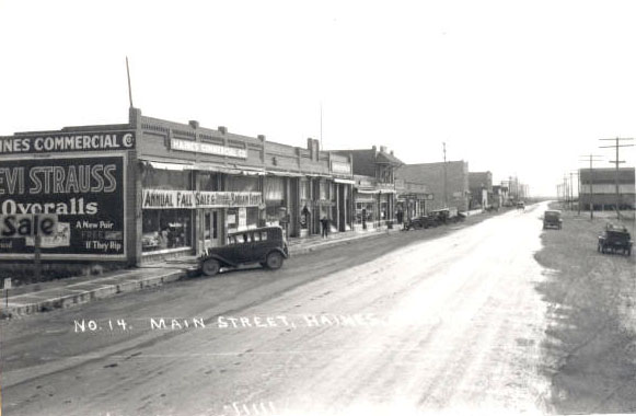
The construction of the Oregon Railway & Navigation Line spurred the town’s growth. By the late nineteenth century, Haines was a major exporter of agricultural goods, shipping as many as 104 railroad carloads of cattle and hogs to Portland every week. Remnants of the thriving days in Haines are scattered throughout the town. The railroad depot is now a museum, and the Chandler Cabin, built in 1861, serves as a roadside historical marker. [Oregon Encyclopedia]
Elkhorn Mountains / ~ Mile 11
The Elkhorn Mountains are situated in the central portion of the extensive Blue Mountains that extend from southeast Washington into adjacent Oregon in a northeast to southeast orientation. The central dividing ridge of the Elkhorns is referred to as the Elkhorn Crest (~ 24 miles in length) and forms the divide between the Powder River basin to the east and south that flows into the Snake River and the John Day River basin to the west. Ultimately, both drain into the mighty Columbia River. [Summit Post]
Wingville (the town) / ~ Mile 16
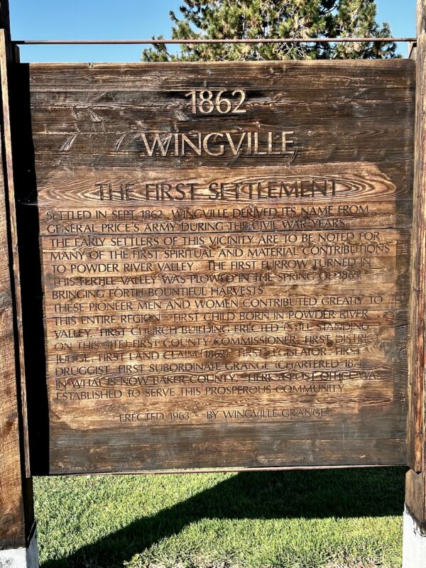
Wingville was first settled in September 1862 and is noted for many firsts in the Powder River Valley. The first field tilled in 1863, the first childbirth and the first church. The “town” now consists of the antiquated church turned grange. This sign marks the location of the original town. [onsite kiosk]
Wingville Cemetery / ~ Mile 18.5
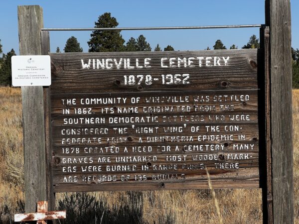
This is an Oregon Historic Cemetery. The cemetery officially originated in 1878 in response to a diphtheria epidemic. Many of the graves are unmarked due to age and range fires. There is a small gate left of the kiosk sign that allows entry to the cemetery. It is well worth a moment of your time and a short walk.
Kerns Rainbow Ranch / ~ mile 22
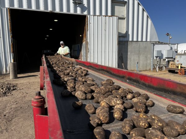
The Kerns Rainbow Ranch and Farm is a regenerative ranch — “naturally raising beef and other farm products while being ecologically stable“. Tim Kerns, one of the owners, provided us with an impromptu 45-minute tour of the potato harvest operations. A highlight of the ride. Give a wave as you go by!
Rock Creek Cemetery / ~ Mile 25
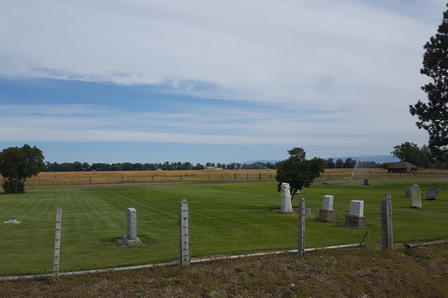
This is an Oregon Historic Cemetery. There is very little left of the once bustling township of Rock Creek. Legend has it that in 1917 the exit of Lake Killimacue was dammed to allow for additional irrigation storage. A huge gust of wind blew, resulting in the dam being breached. A wave of water tore down Killimacue Canyon and demolished at least six businesses as well as homes, barns and livestock. The town was not rebuilt due to the automobile, change of industry and the extent of the destruction. The cemetery at Rock Creek features unique stones and locally mined granite fence posts. You will need to go a few hundred feet west of the route.[Oregon Geneology]
Muddy Creek School / ~ Mile 29

Muddy Creek was a small community northwest of Haines. The only physical reminder of the past is the school marker. In 1891, the first Muddy Creek School was built, an 18 x 24 one-room schoolhouse. The second school was a frame structure that served till 1894. A freak cyclone destroyed this school on June 2, 1894. The third school was a sizable 3-room frame building. A secondary school was added in 1899 and extended a year at a time until 4 years were taught. It had more college-bound seniors for its size than any other school in the state. The fourth school was a large brick building built on the same site in 1916 for just under $15,000 and served as both grade school and high school until 1947. [Oregon Geneology and History]
Haines Cemetery / ~ Mile 38
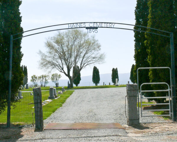
This is an Oregon Historic Cemetery. Legend has it, in the early 1890’s James Oliver Maxwell was at a funeral at the Rock Creek Cemetery, where rocks had to be added to the burial site to keep the coffin from floating. He thought, “good night, this is terrible”, and so he went looking for a better spot for a burial site for his family. James Oliver Maxwell bought the existing site that overlooks the Power River for fifty dollars. Maxwell died in 1917; the cemetery was passed on to his ten children. When walking the cemetery, look for the gravesites of the Maxwells. [Oregon Geneology]
When We Like to Ride This
This route “goes” most of the year, except the deep winter months. It is particularly beautiful in the spring when the creeks are full, and the fields are green. But … we would give this a go almost anytime from early spring to late fall.
Terrain & Riding
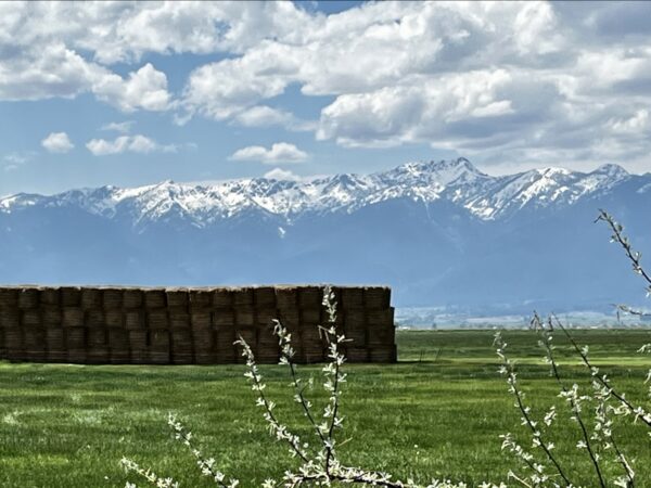
The Powder River Valley offers a mix of quiet paved roads and gravel farm roads with stunning views of the Wallowa and Elkhorn mountains. The terrain is mostly flat with light traffic, making it a peaceful and enjoyable experience. Along the route, you will see majestic hay fields, historic buildings, cows, horses and cowboys, which will give you an authentic taste of the rural countryside.
The Start
Historic park at the intersection of Front and 4th Streets in Haines. Flush toilets.
Food & Water
- None
Route Notes
Please ride with respect! Portions of this ride are through rural working ranch and farming country. Please give way to trucks, tractors, and combines. That may mean stopping as a group and letting a large combine pass, or it may be as simple as riding in a tight single file line when an oncoming truck with trailing is approaching. To help alert you to traffic from behind, we recommend a rear-looking radar detector like a Garmin Varia. Also, give a listen to our podcast with a local rancher who talks about the challenges cyclists create for them and how we can be better visitors.
Route Options
If 40 miles feels a bit too short or a bit too long, consider these two options, the Whiskey & Gold 60 and the Whiskey & Gold 20.
Love Where You Ride! Learn More
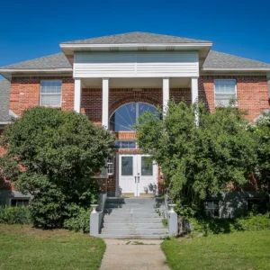
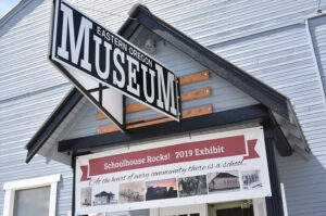 Visit the Eastern Oregon Museum in Haines. This little gem of a place is worth the effort. A donation gets you in, and once there, you are bombarded with the past. All of the items are housed in what was once a school gym, so it’s one huge room. There are items from logging and mining, ranching, cowboys, the Oregon Trail, and WW1. There is a wing of the museum (the old railway depot) adjacent that houses historic carriages. We spent about an hour at the museum, loved every minute of it.
Videos
The Ride! Whiskey & Gold 40
A quick 2-minute video of what to expect on your ride!
Podcasts
Tractors, Bulls and Lycra
In this podcast, we talk with Daarla K who is a rancher and farmer in northeast Oregon. She and her husband operate a 1000-acre farm that has been in his family since 1886. Learn how to safely pass by big tractors and combines, how to get through a cattle drive, and what aggressive behavior [...]
Keep it Local! Learn More
Ridden and Reviewed by:


 Behind every route is scouting, mapping, storytelling, and a whole lot of pedal power.
Have you ridden this route? Got a question? Join the discussion!