Skull Hollow


Highlights & Remarkable Spots
Crooked River Gorge & High Bridge / ~ Mile 5.5
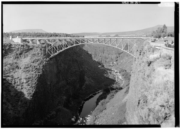
The Crooked River Gorge is a 500-foot-deep gorge through which the Crooked River flows., The cliffs are made of columnar basalt eroded by the Crooked River since the Newberry volcanic eruption 1.2 million years ago.
The Crooked River High bridge is 464 feet long, and at 295 feet above the river it was the nations single highest arch span when constructed. Oregon’s famous bridge engineer, Conde B. MCCullough, designed the bridge to blend gracefully with the regions rugged landscape — harmonizing with the Oregon Trunk Line Railway bridge of 1910, just downstream. [from on-site kiosks]
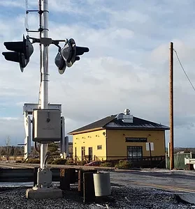
Crooked River Railroad Bridge / ~ Mile 5.5
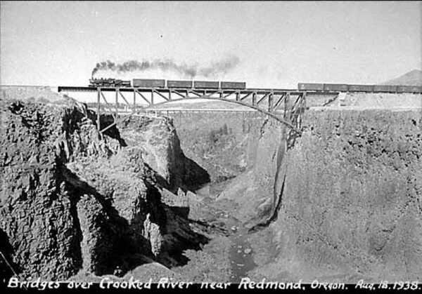
This bridge was designed by the famous bridge architect, Ralph Modjeski, who also designed the San Francisco–Oakland Bay Bridge. The bridge was a critical juncture in the Oregon Railway wars which had two competing rail lines building track from the Columbia River to Bend, Oregon. When it was completed in 1911, it was the second-highest railroad bridge in the United States. It is a steel two-hinge arch span with a total length of 460 feet.
Click on the image, in the foreground you will see the railroad bridge, in the background is the High Bridge.[Wikipedia]
McPheeters Turf Farm / ~ Mile 8
An ongoing working sod farm and nursery that is an exemplar of family farming in Central Oregon. In Central Oregon, there are approximately 2500 farms on 1.7 million acres of land producing an agricultural market value of $141 million dollars each year.[Oregon.gov, Oregon State University]
Big Views of the Cascade Mountains / ~ Mile 11
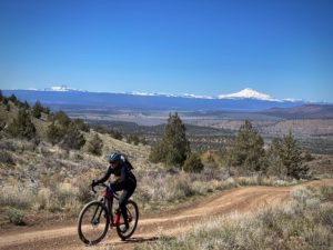
Here you will get some of the best views of the Cascade Mountains in all of Central Oregon including the Three Sisters and Mt Jefferson. The Three Sisters (“Faith”, “Hope”, and “Charity”) are closely spaced volcanic peaks in the U.S. state of Oregon. They are part of the Cascade Volcanic Arc, a segment of the Cascade Range in western North America extending from southern British Columbia through Washington and Oregon to Northern California. Each is over 10,000 feet in elevation, they are the third-, fourth- and fifth-highest peaks in Oregon.
McCoin Orchard / ~ Mile 12.7
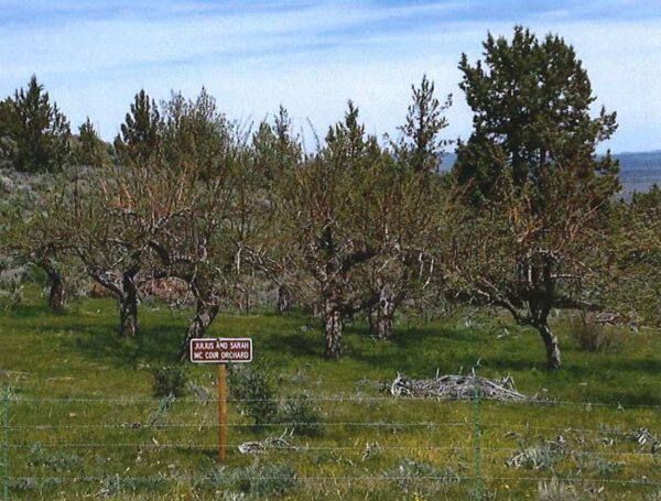
This area was first homesteaded in the 1880s and eventually 700 homesteads were established (i.e., the McCoin homestead). But by the 1930s, a 10-year drought and the Great Depression caused farms to fail and the homesteaders to abandon their land. By 1935, federal land banks and private mortgage banks had taken over 35 percent of the homesteads in foreclosures. The federal government then began to buy the land back from the remaining homesteaders under the authority of the Resettlement Administration and Bankhead-Jones Farm Tenant Act.
Management of the land was transferred from the Soil Conservation Service to the Forest Service in 1954. Originally known as the Central Oregon Land Utilization Project, the name was changed to the Crooked River National Grassland in 1960.
Skull Hollow / ~ Mile 15
It is believed that this area was first travelled in 1845 by Stephen Meek, a wagon master and guide when leading an ill-fated splinter group of wagons looking for a way across the Cascades. The water holes he had seen on previous trips had all dried up.
In 1864 (19 years later) US soldiers came across the remains of 40 burned out wagons, china, and human remains (skulls) of 200 people. It is believed that a “horrific” struggle took place between the Indian peoples of the area and the people of the Meeks Wagon train.
Smith Rock State Park / ~ Mile 24
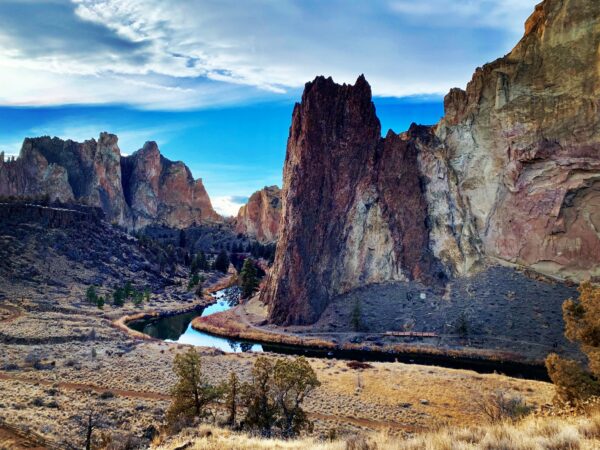
At ~ mile 24, we strongly recommend you make the right to Smith Rock state park. It is only a mile out of the way and the views are amazing and its fun to diverge a bit and watch the climbers moving over the vertical walls of stone like little ants.
This landscape of rock spires, cliffs, and canyonlands lies along the northern edge of the Crooked River caldera, a 26-mile long, 17-mile wide volcanic depression formed through a series of super-volcanic eruptions between 29.7 and 27.5 million years ago. Eruptions from the Crooked River caldera deposited massive volumes (>140 cubic miles) of tuff and rhyolitic lavas, dikes, and domes. All of these volcanic features are now well exposed in the rock walls of Smith Rock State Park.
When We Like to Ride This
Spring when the Cascade mountains are snow capped. Fall when the colors are changing. The route is rideable almost anytime of the year, but the area can be very busy in the summer. Avoid when wet.
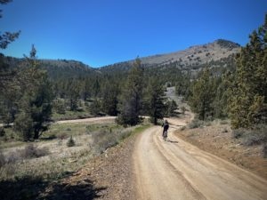
Terrain & Riding
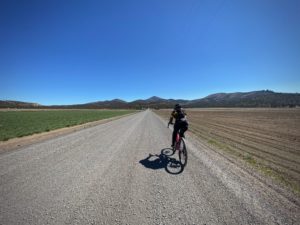
A mix of terrain, from ranch and farmlands to punchy hills overlaid with grasses and scattered Junipers on the north shoulder of Gray Butte. But this route is also chock full of history and big views; the Central Oregon Cascade Mountains to the west and buttes to the north and east including Haystack butte, Grizzly Butte, and Gray Butte.
The route is more pavement than gravel, but don’t be fooled into complacency. The gravel roads are of the primitive forest service type with a bit of gnar and the Grey Butte climb and descent are steep, which will push the limits of some (Can you say “hike-a-bike”?).
The biggest navigation challenge of the day is making your way across the Crooked River Gorge and Highway 97, at mile 5.5. At the dead end circle, pass between a set of rocks marking the road boundary, go straight for 25 yards on a dirt path to the knee high rock wall marking the cliff to the Crooked River Gorge. Take the paved path to the right to the High bridge. Cross it and then continue to follow the paved path to Highway 97. Cross the highway, and then proceed north along the highway for 20 to 40 yards. To your right you will see the old highway, or as it is called today the Culver highway. This is the road you want. Look for the concrete barriers and barb wire fence. Just to the right of the barriers is an opening in the fence that you want to take.
The Start
Across the street (north) from the Terrebonne Depot restaurant, on the dirt road. This is 16th street and public; it is a short section of dirt road gets no traffic. Do not use the Terrebonne Depot restaurant parking lot, but do get a burger and beer there after the ride!
Food & Water
- None
Route Notes
Do not ride when wet. It looks like this could be the real sticky kind of mud, of the ‘hike a bike” variety.
We recommend the use of a red blinky light with rear looking radar detector, like a Garmin Varia. Several roads have light to moderate traffic.
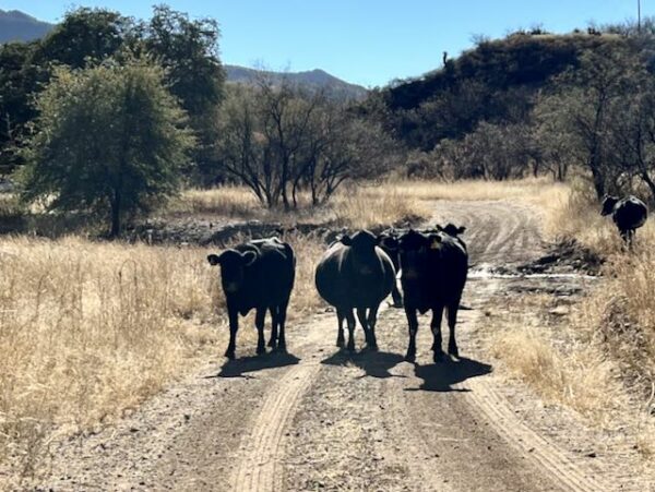
Expect open grazing. Learn more about how to pass by cows safely (for both you and them!). Take a minute to read through our “Cows!” resource page.
Route Options
If you are looking for a longer ride that is really, really good we recommend Haystacks & Skulls.
Love Where You Ride! Learn More
 The northern tier of this ride is through the Crooked River National Grasslands. Between 1880 and 1930 much of this land was tilled up for farming after it was mistakenly reported that the land was suitable for dryland farming. By 1930, after a 10 year drought, nearly 700 homesteaders had moved out. The grasslands were returned to government ownership through the purchase of non-performing homestead lands in 1960s.
Today, the grasslands provides habitat for 375 species of wildlife including deer, elk, antelope, mountain lion, songbirds, waterfowl, and raptors including the threatened Northern Bald Eagle and the endangered Peregrine Falcon.
One of the lead organizations working to protect these lands and others like it is Discovery Your Forests. Check them out!
Videos
The Ride! Skull Hollow
A quick 2-minute video of what to expect on your ride!
Be Informed!
Keep it Local! Learn More
Ridden and Reviewed by:


Have you ridden this route? Got a question? Join the discussion!