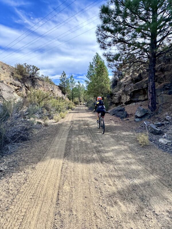
OC&E (Yonna Valley Meadows)
We can no longer recommend this route due to open cattle grazing and limited maintenance.
 - 1")
 - 2")
 - 3")
 - 4")
 - 5")
 - 6")
 - 7")
 - 8")
 - 9")
 - 10")
 - 11")
 - 12")
 - 13")
 - 14")
 - 15")
 - 16")
 - 17")
 - 18")
 - 19")
 - 20")
 - 21")
 - 22")
 - 23")
 - 24")
 - 25")
Caution! We do not provide turn-by-turn directions in our GPX files. Those are auto-generated by your bike computer and are usually less than 70% accurate. Learn more.
For help loading a GPX file onto your bike computer, go here.
DownloadHighlights & Remarkable Spots
Snowdowzer / @Start
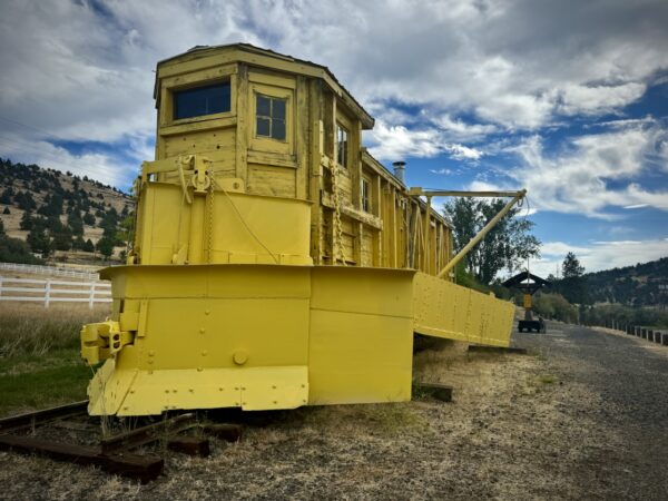
Built by Weyerhaeuser in 1941, this 90,000-pound Snow Dozer was one of three powerful plows tasked with keeping the OC&E Railroad clear between Klamath Falls and Bly. The lightest of the trio, it often struggled against the deep snow, especially compared to its heavier counterparts. Still, it played a crucial role in ensuring log trains could move timber from the forests to the mills.
Olene Gap / ~ Mile 0.5
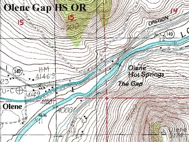
The OC&E Railway reached Olene in 1918, using this natural passage as its route. At the time, the gap was just wide enough to accommodate both the railway and the Lost River.
Clicking on the map to the left will give you a better view of the topographic lines that highlight the Olene Gap—a distinct cut in the landscape.
Lost River Gap / ~ Mile 0.5
The Lost River Gap, also known as Olene Gap, is a natural constriction in the Lost River. This narrow passage has historically served as a vital crossing and meeting point.
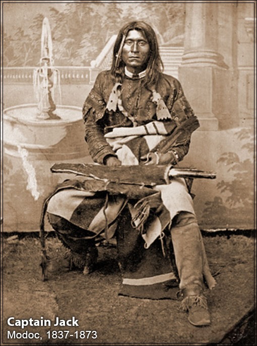
It was here on April 3, 1872, Major Elmer Otis of the US Army held council with Modoc leader Kintpuash, also known as “Captain Jack” by the American public, to address tensions between settlers and the Modoc people. Unfortunately, the summit did not provide resolution.
Tensions escalated when the U.S. government attempted to forcibly relocate the Modoc to the Klamath Reservation, leading to the Battle of Lost River on November 29, 1872. This skirmish marked the beginning of he Modoc War (1872–1873), a significant conflict between the Modoc people and the United States Army.
Explore this historically significant war in depth in this NPR documentary.
Olene Flume / ~ Mile 0.5
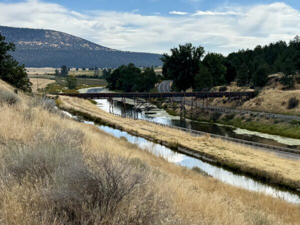
Constructed in the early 20th century, the Olene Flume was designed to support the irrigation needs of the region’s expanding agricultural activities. Its construction enabled the diversion of water from the Lost River to previously arid lands, transforming them into productive farmland.
This was all part of the Klamath Reclamation Project, a bold effort to reshape the landscape and fuel economic growth. Learn more about its impact and history here.
Swede Cut / ~ Mile 5.5
For its first thirty miles, the OC&E Railroad follows gentle grades, gradually climbing into the forests of the eastern Klamath Basin. To reach Pine Flat (just beyond this point), engineers carved the railroad’s deepest cut here, blasting through 40 feet of ancient basalt with dynamite. The curved right-of-way took weeks of labor to complete.
The origin of the name “Swede’s Cut” remains uncertain. Some believe it honors Swedish immigrants who worked on the construction crew, while others say a Swede was killed by a train at this site.
[Ref: On-site kiosk]
Dairy / ~ Mile 9.5
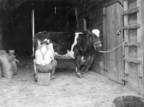
The region surrounding Dairy has a rich history of dairy farming (go figure!) and agriculture. In the late 1800s and 1900s, Dutch settlers established dairy farms to supply milk, butter, and cheese to the growing population. The community’s name, was chosen by pioneer settler William Roberts, who named it after a previous hometown in the eastern United States. Roberts served as the first postmaster of the area beginning in 1876.
By 1927 the OC&E railway had reached Dairy, facilitating transportation and contributing to the area’s development.
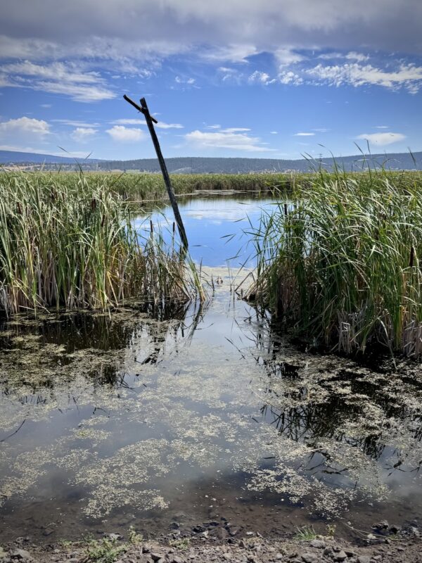
Yonna Valley Meadow / ~ Mile 12.5
This area was originally known as Alkali Valley and later renamed Yonna Valley in the language of the Klamath people (Klamath Indian Tribe). The name “Yonna” may derive from the Klamath word “yana,” meaning “below,” referring to the valley’s location.
“Alkali” refers to soils and water with a high pH (>8.5), often appearing white or gray due to surface salt deposits. These soils contain high sodium levels, which disrupt soil structure by dispersing clay particles. As a result, they have poor drainage, low permeability, and form hard, crusty surfaces when dry. Alkali soils are common in arid regions with high evaporation, where minerals accumulate as water evaporates.
Credits & Acknowledgements
This route guide was funded in part by a grant from Travel Oregon.

When We Like to Ride This
The OC&E Trail is rideable most of the year, but it’s important to keep in mind that this region was originally wetlands—long before the construction of canals for the Klamath Basin reclamation project. As a result, the trail can become muddy or uneven in the spring, particularly after winters with heavy mountain snow and spring rainfall. Frost-heaved soil can also make certain sections difficult to ride. 
In early spring (April through early May), the trail surface often develops a rough, uneven texture due to a natural winter process known as frost heaving. As moisture in the ground freezes and expands, it gradually pushes the soil upward. Repeated freeze-thaw cycles break up the surface—almost like slow-motion tilling—leaving behind a soft, lumpy tread. This can make riding tricky until the trail settles with warmer weather and regular use. That’s why spring trail condition reports are especially valuable.
That said, on sunny days during a mild winter, the trail can still offer a great ride.
Terrain & Riding
The route traverses a mix of juniper and sagebrush landscapes, open farmlands, and offers views of surrounding hills and valleys.
Also noteworthy is that this area is a birding paradise, known for its birds of prey, including Bald Eagles, Golden Eagles, Red-tailed Hawks, and Northern Harriers.
The trail is a mix of wide double-track, old railroad grade with gravel fill, and some short sections of gravel road (access roads used by local farmers and ranchers). The gradients are gentle and there are no technically challenging spots. The trail is very suitable for adaptive bike riders on trikes or quads (the trail width is in excess of 48″).
The turn around spot is at a small, vibrant meadow. Currently, there is no kiosk sign or sitting bench, but we are working with Oregon Parks and Rec to make this happen.
The Start
At Olene. There is a makeshift dirt parking lot on the north side of the highway. Look for the big yellow train snow dozer. No facilities.
Food & Water
- None
Route Notes
Click here for the OC&E trail map by Oregon State Parks.
Route Options
Shorter
Turn around at Swede’s Cut. There is a small kiosk there. This option is 10.5 miles with 350 feet of gain.
Longer
Continue on the OC&E trail to switchback hill. This option, round trip, is approximately 50 miles with 1500 feet of gain.
Point to Point
Shuttle to Sprague river and ride back to Olene or even Klamath Falls proper. This is a point to point ride, that we think is one of the best ways to ride the OC&E trail. This option is 29 miles with 800 feet of gain. Add 7 more miles if ride into Klamath Falls.
Love Where You Ride! Learn More
The Modoc War (1872–1873) was a significant conflict between the Modoc people and the United States Army, primarily occurring along the California-Oregon border. Tensions escalated when the U.S. government attempted to forcibly relocate the Modoc to the Klamath Reservation, leading to the Battle of Lost River on November 29, 1872. This skirmish marked the beginning of the war, resulting from an attempt by the U.S. Army to compel a band of Modoc to return to the reservation.
 Following the battle, the Modoc, led by Chief Kintpuash (Captain Jack), sought refuge in the rugged terrain of the Lava Beds south of Tule Lake. Utilizing their knowledge of the landscape, approximately 50–60 Modoc warriors effectively resisted a U.S. force that grew to as many as 1,000 troops. The conflict included notable events such as the assassination of General Edward Canby during peace negotiations on April 11, 1873, marking the only instance of a U.S. general being killed in an Indian war.
The war concluded in June 1873 with the capture of Captain Jack and other Modoc leaders. They were subsequently tried and executed for war crimes, and the remaining Modoc were relocated to Indian Territory (present-day Oklahoma) where they were held as prisoners of war until 1909. Some were later allowed to return to the Klamath Reservation in Oregon, while others remained in Oklahoma, leading to the establishment of federally recognized Modoc tribes in both states.
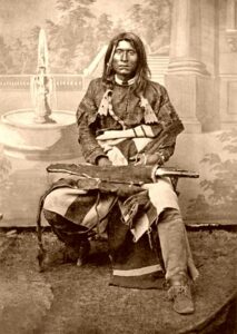
(In the image circa 1870, Modoc clan leader Kintpuash, also known as Captain Jack, poses in a photographer’s studio in Northern California. Credit: OPB)
Videos
The Ride! OC&E (Yonna Valley Meadows)
A quick 2+ minute video of what to expect on your ride.
The Modoc War
The Modoc War was one of the most dramatic American Indian wars in U.S. history. The Modoc are a Native American people who originally resided in the area which is now northeastern California and central Southern Oregon. The Modoc War began in November 1872 when the military tried to force [...]
Keep it Local! Learn More

Related Guidebooks
-

All Access Gravel Guide Eastern Oregon (Collector’s Edition!)
$12.50Now shipping! A 64-page pocket-sized gravel guide. Featuring gravel routes, art, culture and local history. A one of a kind…Add to cart -

All Access Gravel Guide Western Oregon (Collector’s Edition!)
$12.50Now shipping! A 64-page pocket-sized gravel guide. Featuring gravel routes, art, culture and local history. A one of a kind…Add to cart
Ridden and Reviewed by:


 Behind every route is scouting, mapping, storytelling, and a whole lot of pedal power.
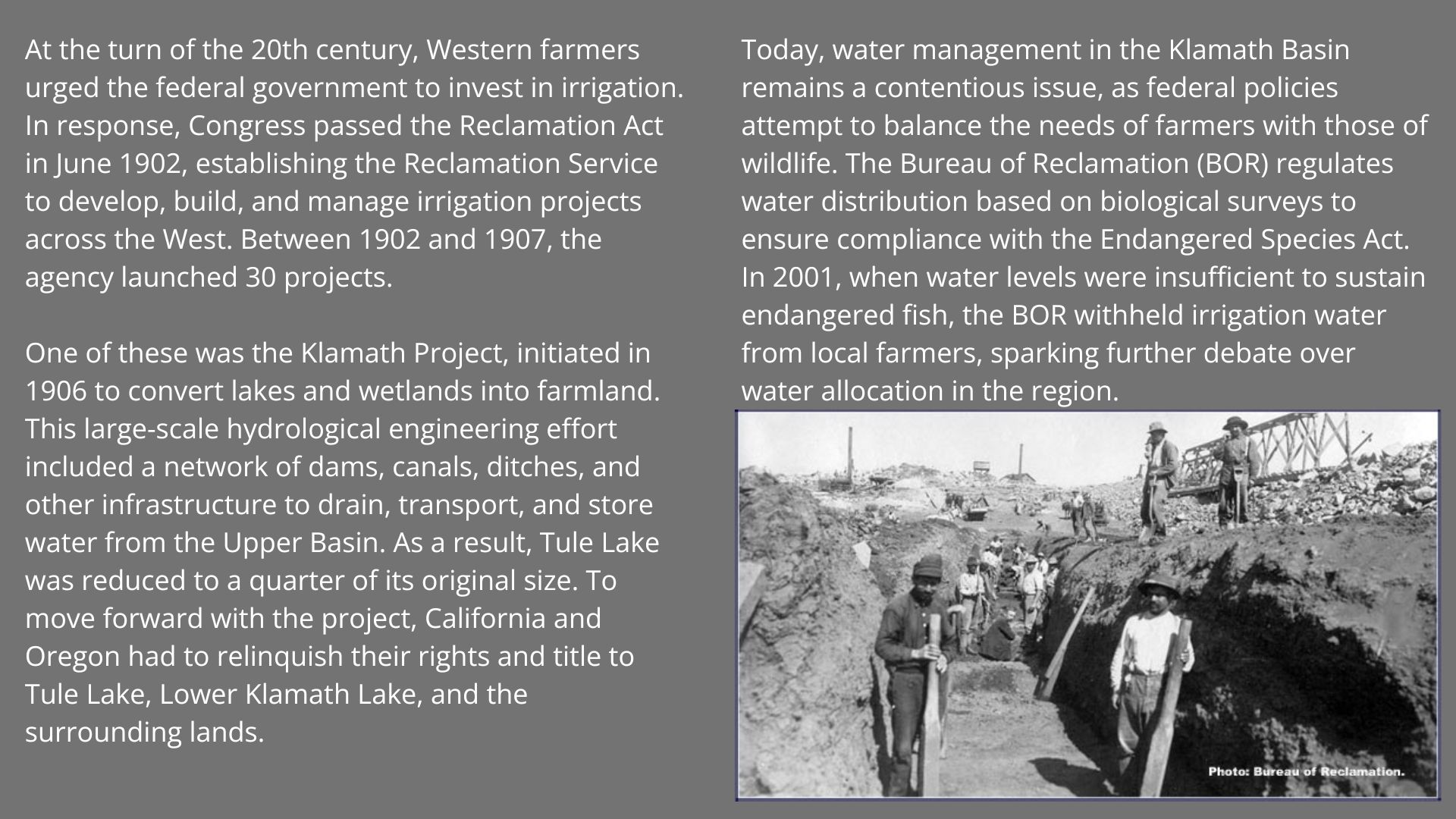
Have you ridden this route? Got a question? Join the discussion!