
McKay Creek Lollipop
This route had major damage due to the 2026 fires. See the Notes section for the impact of the fires.










Caution! We do not provide turn-by-turn directions in our GPX files. Those are auto-generated by your bike computer and are usually less than 70% accurate. Learn more.
For help loading a GPX file onto your bike computer, go here.
DownloadHighlights & Remarkable Spots
Old McKay Creek Schoolhouse / @ Start
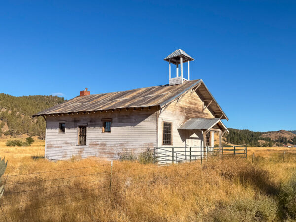
The schoolhouse was built circa 1910 and closed in 1937.
Wayne Demaris, whose family lived in the building in the 1940s, remembers it as a focal point of the surrounding community. “What I remember mostly were the dances and potlucks there. Everybody in the neighborhood would come down for the potluck—a lot of sawmill people and people who had ranches around here,” he said. Wayne’s older brother, Ray, attended school there.
Basalt Spires / ~ Mile 3.8
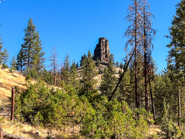
The spires here are most likely remnants of a lava flow or volcanic plug associated with the Clarno Formation (Eocene age, approx. 40–54 million years old).
Harder lava flows, or magma that hardened inside the vent (a volcanic plug), often resist erosion better than the softer surrounding rock. Over millions of years, the softer rock washes away, leaving a solitary spire like this one.
The rock type is either Andesite or Basaltic Andesite.
McKay Creek Restoration / ~ Mile 7
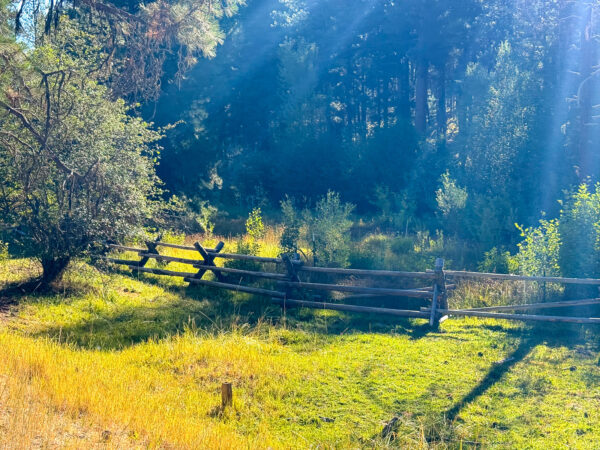
To support the restoration of McKay Creek and protect riparian habitat, fences like this have been installed to keep elk, wild horses, cattle, and other animals out of the streambed and along the creek banks. Reducing trampling and grazing along the banks allows vegetation to recover, stabilizes soil, and improves overall stream health. As a result of efforts like this, redband and steelhead trout are once again able to migrate upstream after being absent for more than 40 years.
Wildcat Caldera / ~ Mile 11.25
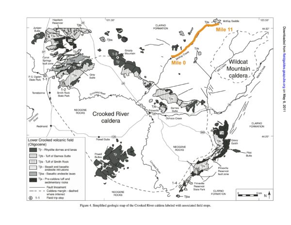
Look back toward your 5 o’clock position to see the valley. What you’re actually looking at is the Wildcat Caldera. A caldera is a large volcanic depression that forms when a volcano erupts so violently that the magma chamber empties and collapses. The ground above it then sinks. Calderas are not formed by impacts, and they are often much larger than typical volcanic craters. Over time, erosion, sediment, and later lava flows can obscure their original shape. That’s why you don’t see a clean, bowl-shaped crater here. The Wildcat Caldera is about 40 million years old and roughly 6.5 miles in diameter—approximately 10 miles wide (E–W) and 7 miles long (N–S). Click on the image for an expanded view.
Twin Pillars / ~ Mile 12.2
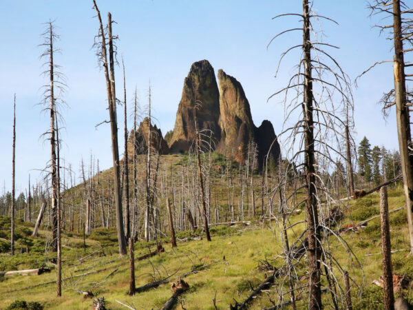
The Twin Pillars are two stark, eroded volcanic spires that rise above the surrounding forest, resembling the ruins of a stone fortress. The formation is linked to the ancient Wildcat Caldera (see above). Geologically, the Twin Pillars are best described as rhyolite intrusions associated with this caldera. Rather than forming in a single central volcanic vent, the pillars likely developed when rhyolitic magma intruded into fractures or ring faults around the caldera. Over time, erosion stripped away the surrounding, softer volcanic material, leaving the more resistant rhyolite standing as the two steep spires seen today.
Summit Wagon Road / ~ Miles 16 to 26
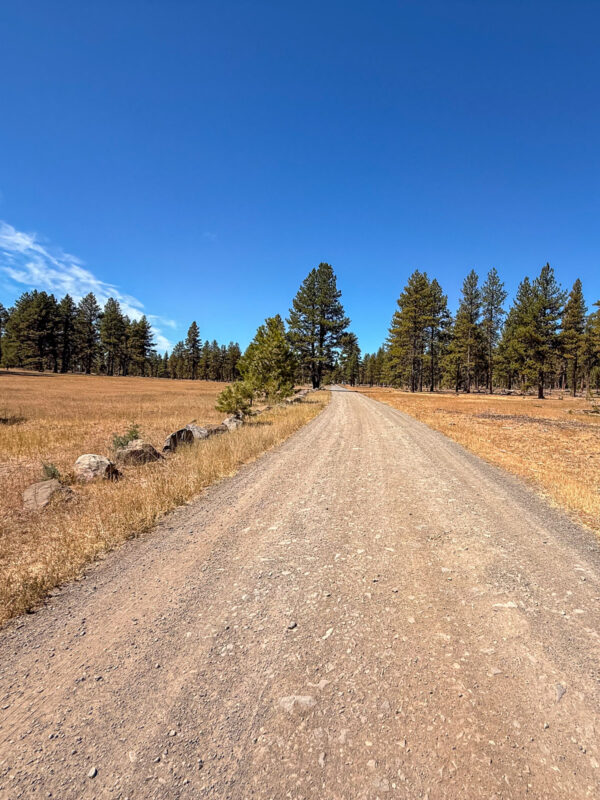
Following the crest of the Ochoco Mountains, the Summit Wagon Road stretches 70 miles from McKay Creek north of Prineville to the south fork of the John Day River. Established in 1906 as a pack trail after the creation of the Blue Mountain Forest Reserves, it later served as a stock driveway for moving sheep and cattle across the forest. The route also became an important fire-protection corridor, linking many early fire lookout sites. Along the way, watch for old blazes that once marked the pack trail, as well as insulators from telephone lines that formerly connected fire lookouts to ranger stations.
The Summit Wagon Road was part of a larger regional network of wagon routes, including the Dalles–Canyon City Wagon Road and the Willamette Valley and Cascade Mountain Wagon Road.
Mt Jefferson Viewpoint / ~ Mile 18.8
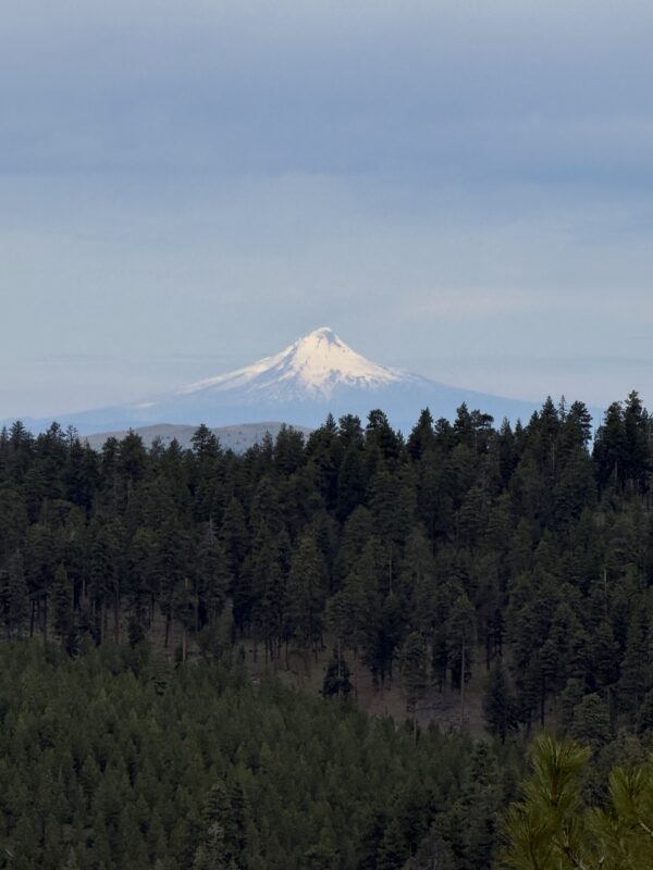
Mt Jefferson is Oregon’s 2nd-highest mountain (10,497 ft) after Mt. Hood, but it has a far more rugged and remote-feeling. It’s also one of the most eroded stratovolcanoes in Oregon. Glaciers and time have chewed it into a sharp, craggy, “horned” shaped mountain that looks more like a fortress than a smooth cone. (A stratovolcano is a tall, steep-sided volcano built from many layered eruptions, stacking lava flows, ash, and rock into a single mountain over thousands of years.) Mt Jefferson has dozens of snow-and-ice features, including multiple named glaciers (like Whitewater and Jefferson Park).
Wolf Moss / ~ Mile 25.5
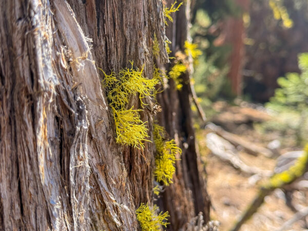
Wolf lichen (Letharia vulpina) is a bright chartreuse-yellow to yellow-green lichen commonly found growing on the bark and branches of conifer trees—especially pines and firs—in clean, high-elevation or northern forests. It’s actually a symbiotic organism, made up of a fungus and a photosynthetic partner (an alga), which together allow it to survive in harsh, nutrient-poor environments. Wolf lichen is very sensitive to pollution, so its presence often signals clean air and healthy forests. Like many lichens, it grows extremely slowly, making it a long-term marker of stable ecosystems.
Credits & Acknowledgements
This route guide is funded in part by a grant from Visit Central Oregon.

When We Like to Ride This
Late spring through late October.
Terrain & Riding
The route starts out in farm country then climbs to Harvey Gap. You will follow a beautiful ridge with deep views into the Ochoco National Forest, including a nice view of the Steen’s pillar off in the distance. Then you will enjoy a buzzing fun descent down pavement, with rollers deeper into the Ochocos. The final climb is easier than the first climb which sets you up for a long descent on gravel that shallows out onto pavement. You’ll fly back to the start, unless you hit the headwinds which are pretty common in the late afternoon.
First Sector
This is a living agricultural landscape shaped by generations of cattle and sheep grazing. Fence lines, stock ponds, and wide-open pastures tell a quiet story of persistence in a semi-arid climate where water access dictates survival.
McKay Creek supports a narrow but vital ribbon of riparian habitat in an otherwise dry landscape. Cottonwood, willow, and alder cluster along the water, creating shade, bird habitat, and a striking contrast to the surrounding grasslands. These corridors historically guided travel, ranching, and settlement.
Second Sector
Two stepped climb. Before Harvey Gap, After Harvey gap.
This climb marks a clear geological transition from creek-carved valley to uplifted basalt plateau. You’re riding out of an erosional feature and onto older volcanic layers that resisted downcutting.
From higher ground, the landscape opens into long, horizontal lines — ridges, drainages, and distant buttes. This visual style is characteristic of Oregon’s interior plateaus, where elevation changes are subtle but expansive.
Mostly Ponderosa Forest all day, near Harvey Gap scattered Doug Firs.
Third Sector
Gravity reveals geology. As you descend, you pass through the same basalt layers you climbed — now read in reverse. Drainages become more defined, vegetation thickens slightly, and the land shifts from horizontal to sculpted.
These small channels only carry water seasonally, yet they drive erosion, soil movement, and plant distribution. Over geologic time, features like these are what eventually carve valleys like McKay Creek.
Ton of vista view along entire ride. Do the ride for these views.
The third sector of gravel is the most demanding. Summit road. Feels like rock cobble. On the downhill, if the washboard is bad, deflate tires to get a better ride.
McKay and Little McKay Creeks are seasonal, will usually be dry by late August.
Fire scarred.
The Start
Park on the dirt shoulder on the north side of the intersection. There’s a big pull out area.
Lat / Long: 44.438732, -120.767978
Describe Winedown Ranch. Is this an alternate start or shorter option? Or feature in Keep it Local?
Food & Water
- None
Route Notes
This route had extensive damage due to the 2026 fires. If you ride this route, please let us know the status by leaving comments in this route guide.
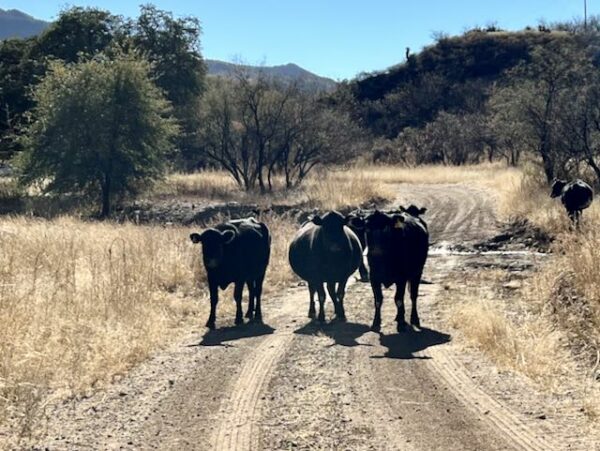
This is an open grazing area. Do not chase or yell at the cows! This only can causes them stress and anxiety and may lead to unpredictable behavior. Learn more about cows, how to safely pass them, and signs of possible aggression in this Dirty Freehub Resource Page.
This is a popular hunting area in the fall, so be aware that hunters may be nearby. We also recommend wearing bright colors. Think orange!
Route Options
The long gravel descent can be avoided and the route shortened (by one gravel segment) by continuing straight on the pavement (do not go right onto the gravel!) at mile 20.5 and continuing back to the start. This option gives a route of 33 miles with 2800 feet of ascent. It makes the final downhill rip’n fast, a quick getaway if you are getting out of bad weather. Parking at the intersection of Little McKay Rd and McKay Creek Rd makes the ride 26 miles and 3200’ of climbing (so you don’t have much warm up but it’s a shorter route.)
If you do the shorter option, add in some air to your tires at the beginning of the final paved sector. This will give better control on the downhill, especially in turns. Your front tire won’t squish and squirm under high load g’s in the turns.
Podcasts
Wolf Lichen: It's not a Harry Potter spell ... it's Letharia Vulpina
Do you ever see some bright green, shrubby looking creature on a gravel ride? This organism is likely Letharia Vulpina (and no it does not have magic or poisonous powers like a spell) which is also knows as Wolf Lichen. Bryologist, mycologist, and lichenologist Tim Wheeler works to [...]
Be Informed!
Keep it Local! Learn More

Related Guidebook
Ridden and Reviewed by:




Have you ridden this route? Got a question? Join the discussion!