Horn of the Metolius
This is a very sensitive wildlife area. Please review the principles in this post to learn what you can do to minimize your impact.


Caution! We do not provide turn-by-turn directions in our GPX files. Those are auto-generated by your bike computer and are usually less than 70% accurate. Learn more.
For help loading a GPX file onto your bike computer, go here.
DownloadHighlights & Remarkable Spots
Wizard Falls Fish Hatchery / @ Start
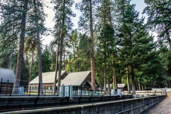
The hatchery is renowned for raising rainbow trout, kokanee salmon, and brook trout. Visitors can observe these fish at various stages of development and even partake in feeding them. The hatchery plays a pivotal role in bolstering fish populations in the Metolius River, which is prized by anglers for its fishing opportunities. Make sure to go out to the fish pond at the very far north end. It is so cool! And … has big fish. [Oregon Dept of Fish & Wildlife]
Mt Jefferson Views / ~ Miles 4 to 8
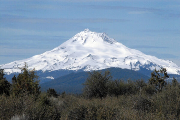
Mt. Jefferson is a prominent stratovolcano and the second highest peak in the state at 10,495 feet. The mountain is part of a larger volcanic arc formed by subduction of the Juan de Fuca tectonic plate beneath the North American plate. Mt. Jefferson exhibits volcanic activity dating back over with 100,000 years. Glaciation has sculpted its slopes, creating deep valleys and cirques. [Wikipedia]
Lake Billy Chinook / ~ Mile 25
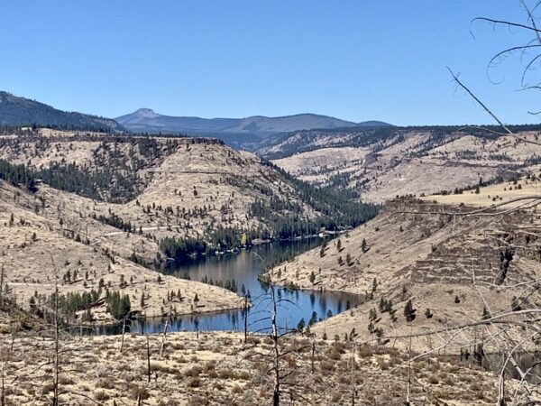
The name “Billy Chinook” is derived from a Wasco Native American chief who was prominent in the early 19th century. The lake and its surroundings hold cultural significance for the Confederated Tribes of Warm Springs, and they have continued to maintain a presence in the area.
Lake Billy Chinook was formed as a result of the construction of Round Butte Dam, which is a unique “selective water withdrawal” dam. It was designed to protect and enhance fish populations while generating hydroelectric power. The dam traps the waters of three rivers—the Deschutes, the Metolius, and the Crooked—and their confluence creates the lake.
Balancing Rock / ~ Mile 26
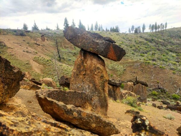
“Ancient volcanic eruptions and erosion created this geological marvel of balancing rock pillars called “hoodoos.” The pillar layers were formed by different eruptions millions of years ago. Softer unwelded layers of tuff formed at the base, while hardened welded layers of tuff formed the perched boulders on top. Over time, the softer sediment surrounding the pillars eroded by weathering. Uniquely, the balancing hardened tuff layers protected the soft pillared layers from erosion, similar to an umbrella from rain. These aspects caused the beautiful geological balancing of rocks that look like a human artistic creation.” [Bend Bulletin]
Shut-In Trail / ~ Miles 38 to 40.5
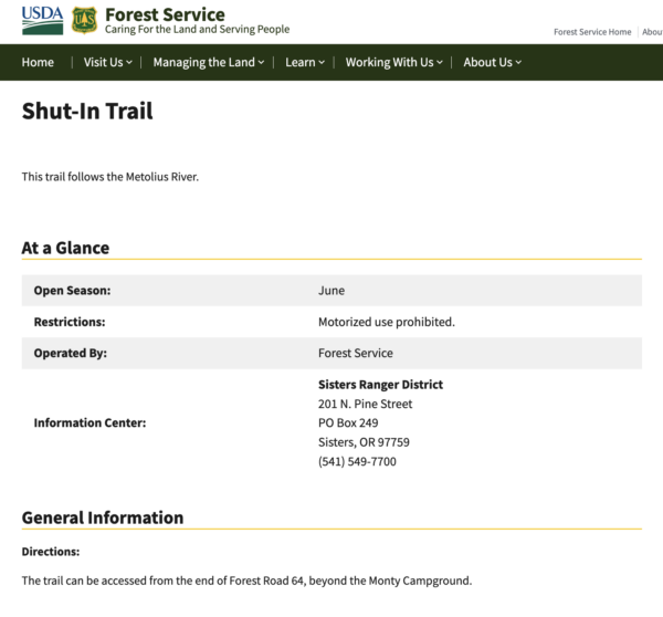
At mile 38 the road road just … ends. The Shut-In Trail will be just to your right, dropping quickly down to the river on single-track trail. The next 2.5 miles will the the crux of the day. It can be brushy and wet. There can be some treefall. And the trail get precipitously close to the river a couple of times. trail follows the Metolius River closely for much of its length. Most everybody will end up doing a bit of hike-a-bike here. [US Forest Service]
Whitewater River / ~ Mile 38.5
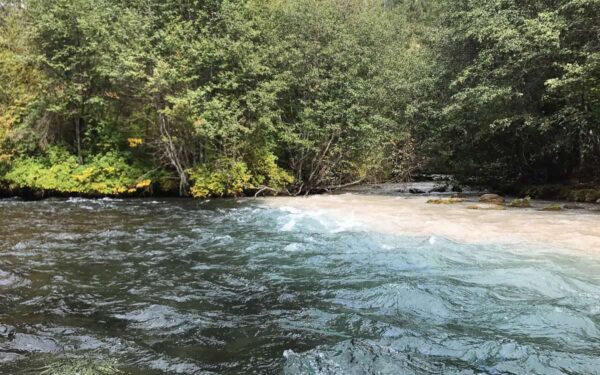
“Not far past road’s end, you come to a viewpoint of the Whitewater River where it flows into the Metolius. It doesn’t take long to see why it is called the Whitewater River. The source of the river is the Whitewater Glacier on Mount Jefferson, some 10 miles to the west. The river flows through a remote part of the Warm Springs Reservation (the Metolius forms the southern boundary of the reservation for a considerable distance), down from Mount Jefferson and into the Metolius. The color comes from glacial silt, a common trait of glacier-fed streams. Just downstream of here notice how the Metolius River seems to be split in two, with one side white and the other blue.” [Off the Beaten Trail]
Metolius River / ~ Miles 30 to 50
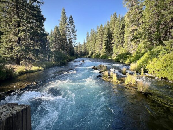
The name “Metolius” itself is derived from the Warm Springs word “Mpto” or “Mətúli”, which translates to “white fish”, likely referring to the bull trout or mountain whitefish that are abundant in the river.
Unlike many rivers, the Metolius River is spring-fed, emerging from the base of Black Butte, a stratovolcano. The river’s source is a large spring that gushes from the ground, with the river appearing almost fully formed at its headwaters. This gives it a consistent flow and cool temperatures year-round.
Warm Springs Indian Reservation / ~ Miles 30 to 50
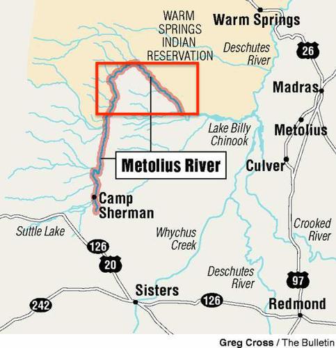
The route area is within the red rectangle and always south of the Metolius River. The Warm Springs Indian Reservation is to the north of the river.
Before European settlement, the Metolius River area was vital to Native American tribes like the Sahaptin-speaking Warm Springs and Wasco peoples for fishing, hunting, and gathering resources. However, the encroachment of European settlers’ led to the tribes’ displacement and altered the river area’s land use. This included increased recreational activities and conservation efforts, which at times conflicted with the tribes’ traditional practices.
Lemonade Stand / ~ Mile 44
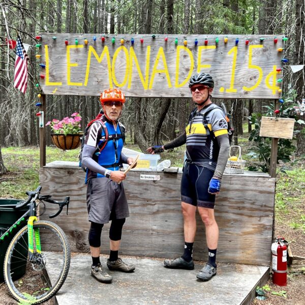
In the middle of the woods … in the middle of nowhere, you will pass by this lemonade stand. So cool! Bring some money! This also marks the end of the single-track and the beginning of a slow 1 to 2% climb on rugged road back to Lower Bridge Campground (mile 50) and ultimately the start / finish (mile 53).
When We Like to Ride This
Summer through Fall.
Terrain & Riding
This ride starts at the Wizard Falls Fish Hatchery, a lovely place to visit the fish and the Metolius River. (We recommend you go look at the fish before the ride, because you are going to be exhausted at the end.)
First, you head north, up the paved road for a few miles … then hit the red cinder dirt where you start a moderate, but consistent climb. You climb for the next 5.5 miles (1800 feet of gain) with views of Mt Jefferson to the west. Once you crest the hill, you turn into the “Horn” — the portion of land wrapped in an upside down U shape by the river. In the “Horn” you roll through lovely forests … with expanding views of lake Billy Chinook in the distance.
After exiting the “Horn”, you descend to Lake Billy Chinook. You meander along the shores of the lake, even reaching several put in spots for boaters. The roads are mix of slippery gravel and “baby heads” (small boulders about the size of, yep, a baby’s head). The riding is not easy. The road peters out when you are just parallel with the Metolius River and the “fun” is just about to begin — rugged, remote.
The route along the river is a mixture of primitive single track (i.e. 1 mile which is hike-a-bike for most people), developed single track and double track / dirt roads. After 16 miles of this, you pop out at lower bridge (stop a moment and enjoy the view). Then head back up the paved road to the start.
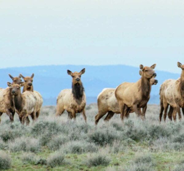
Look for bald eagles and watch out for black bears because they like the fishing just as much as the local fly fishing community.
The Start
Wizard Falls fish hatchery.
Food & Water
- ~ Mile 29: Water at Perry South Campground (May-September)
- ~ Mile 39: Metolius River (can filter water)
Route Notes
You will have an impact on wildlife by riding this route … even if you don’t see them! Please limit your group size to 4 and take a few moments to familiarize yourself what you can go to minimize your impact by reading through the Dirty Freehub Resource Page on Wildlife Impact.
This route is demanding both physically and mentally. For much of this route, you will be actively engaged in picking the best lines … the best lines around “baby heads”, through the double-track trail, or in the single-track sector. For most riders, this route will take 5 to 6 hours in ride time (including the hike a bike section). The effort expended on this ride is similar to riding the Steens Mountain Loop.
In 2023, the Dirty Freehub Dirty Roads Crew dedicated over 270 hours to clearing and brushing this route—that’s nearly seven people working full-time for a week. In 2024, we invested another 100 hours into keeping it rideable. This year, 2025, we are organizing another work party to clear ~ 20 downed trees.
With ongoing Forest Service cutbacks, it’s become more important than ever for nonprofit groups like ours to step up and take on more of the trail maintenance burden. But we can only do that with the support of the riding community.
If you’re already a Dirty Freehub Hero, thank you! If not, please consider joining in. Your donation helps cover essential costs like gas, tools, maintenance supplies, and food for the hardworking crew. Each work party on this route costs us over $500 to organize.
A contribution of around $25 per rider makes a real difference. In these trying times, your support keeps the trails open and the wheels turning. Please donate—every bit helps. Thank you!
Miles 34 to 50 are bounded by two locked green gates. This increases the complexity if a significant mechanical or medical issue arises. There is little to no cell phone reception is this area, we recommend a personal locator device like a Spot or Garmin InReach be carried.
Route Options
Shorter
An alternative option is to park at Lower Bridge Campground (pit toilets, no water), about 2 miles north of the Wizard Falls Fish Hatchery, drive past the fish hatchery. In doing so, we recommend riding the route in the clockwise direction, along the Metolius River fist. The reason being is that you will not immediately tackle the climb without a warm-up, as would be the case if you did the route in the original direction. 48 miles / 4300 feet of gain.
Start the ride from the Lower Bridge Campground, located about 2 miles north of the Wizard Falls Fish Hatchery. (Note: the campground has pit toilets but no water.) To get there, drive past the fish hatchery.
If you choose this starting point, we recommend riding the route clockwise, following the Metolius River first. Otherwise, you would be hitting the big climb right out of the gate on without any warm-up miles.
Total route: 48 miles with 4,300 feet of elevation gain.
Love Where You Ride! Learn More
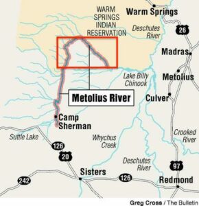 This is super special route! It takes you into a remote and exquisite area, the Metolius River watershed, the Horn! The Horn is that area of land underneath the sweeping “U” shape of the river. It is an area with few trails and roads. It is along a section of the Metolius River designated as Wild & Scenic. When riding here (the area shown in red), show respect to the lands, people and the wildlife.
Before European settlement, the area was home to several Native American tribes, notably the Sahaptin-speaking Warm Springs and Wasco peoples. They used the river and the surrounding lands for fishing, hunting, and gathering plant materials for food, medicine, and crafts. The river was a significant part of their cultural and spiritual life.
This area is also home to many big game animals: bear, cougar, elk, and wolves. By riding here you will have an impact on them, even if you don’t see them! Please limit your group size, keep your group together with no more separation than 100 yards, ride after dawn and before dusk (the most active time for animals), limit your noise imprint by only using conversational voices, wear clothing that blends into the surroundings, and if you see a big animal, stop and give it space. Do not rush it along, do not try to approach it for a better picture. Best yet, spend 5 to 10 minutes on our resource page learning how you impact wildlife when you ride and what you can do to minimize your impact.
Be Informed!
Ridden and Reviewed by:


 Behind every route is scouting, mapping, storytelling, and a whole lot of pedal power.
Have you ridden this route? Got a question? Join the discussion!