Halfway to New Bridge


Caution! We do not provide turn-by-turn directions in our GPX files. Those are auto-generated by your bike computer and are usually less than 70% accurate. Learn more.
For help loading a GPX file onto your bike computer, go here.
DownloadHighlights & Remarkable Spots
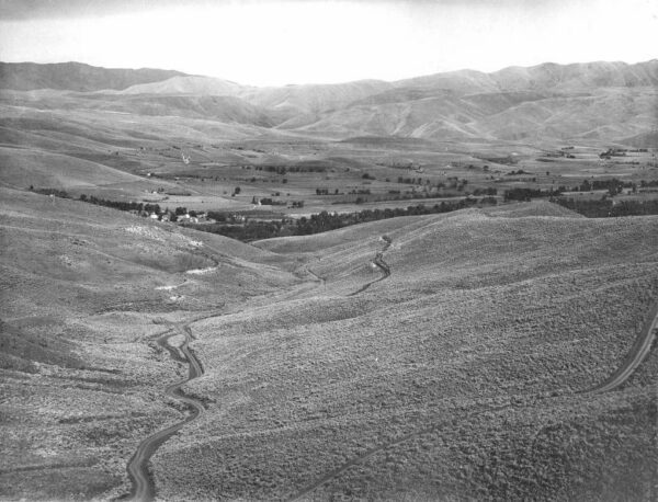
Richland - Eagle Valley / @start
Many homesteaders arrived in Eagle Valley, Oregon in the 1870s due to the growing mining and railroad industries. However, they eventually turned to farming because of the valley’s low elevation (2200 feet), which gives it a longer growing season and milder winters compared to nearby Baker City (3450 feet) and Halfway (2650 feet). The high peaks of the Wallowa mountains provide ample snow and water, making the region a “banana belt” where many fruits and vegetables thrive, including peach, apricot, apple, and cherry orchards. [on-site kiosk]
Wigwam Slash Burner / ~ mile 11.5
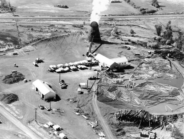
A wigwam burner is a free-standing conical steel structure ranging from 30 to 60 feet in height; it is used to dispose of waste wood in logging yards by incineration. As a result, they produce a large quantity of smoke and ash, which is vented directly into the atmosphere without filtering. [Wikipedia]
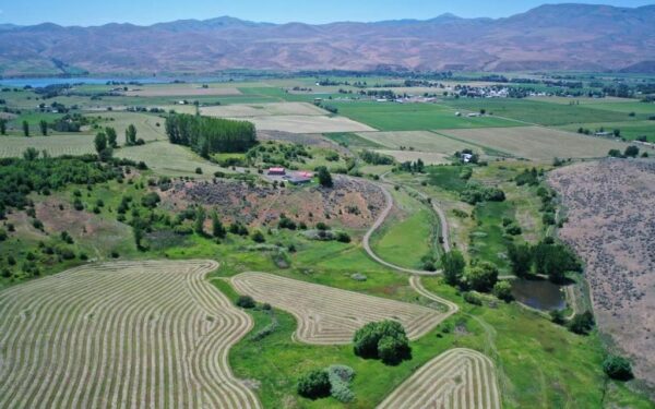
Pine Valley / ~ miles 11 to 18
Until the 1830’s the only people who had experienced the wonders of Pine Valley included the Nez Perce, Umatilla, Shoshone and Snake Indian tribes. They used to hunt, fish and gather Camas Bulbs in the area. Captain Benjamin Bonneville explored the area and published a description of it in his journal in 1837. “Pine Valley is a beautiful valley about five miles wide and fifteen miles long surrounded by snow-capped peaks and timber laden mountains with numerous mountain streams flowing through the meadowlands below.” [Pine Valley Lodge]
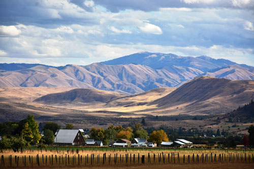
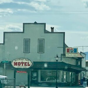
Halfway / ~ mile 13
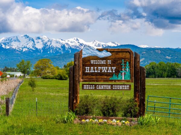
The City of Halfway was incorporated in 1909. The story of how Halfway got its name runs the gamut, but this is fairly close. A new post office was being established in 1887. As it was midway between existing post offices located at Cornucopia and Pine Town, the name “Midway” was requested. The postal officials replied that there was already a Midway, Oregon, and suggested Halfway. Halfway was located in Union County until 1901, when it became part of Baker County. Its current population is about 380. [Hell’s Canyon Chamber of Commerce]
Cornucopia / ~ 6 miles north of mile 18
This mining town was platted in 1886 following rapid growth after a gold discovery in 1884. The famous and highly profitable mine, Cornucopia, led to the name of the town. Profit brought popularity, and by 1902 Cornucopia boasted around 700 residents. At the time it was one of the ten largest mining operations in the whole country. Cornucopia’s decline began in 1929 when the stock market crash dropped the town’s population to 10 people. [Oregon Secretary of State]
Eagle Creek / Miles 32 to 35
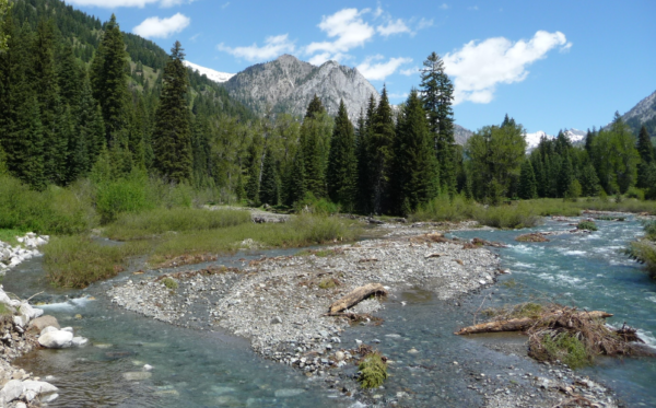
The Wild and Scenic River designation is given to rivers that meet certain eligibility criteria, including being free-flowing and possessing “outstanding remarkable values” such as scenic attraction, recreation, historical significance, and wildlife importance. The lower seven miles of Eagle Creek (included in this route) meet these criteria. The area is characterized by a mix of basalt plateaus, mixed conifer forests, grassy openings, and ponderosa pine stands, along with unique rock formations. The creek alternates between rapids, short waterfalls, smooth swift stretches, and deep blue pools.
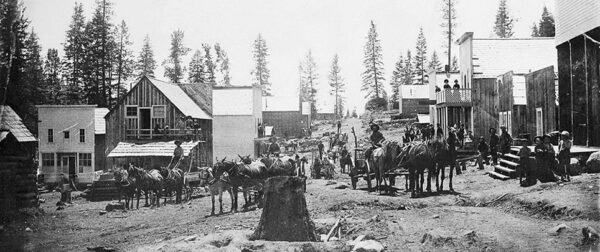
New Bridge / ~ mile 40
New Bridge was founded on the banks of Eagle Creek near an important bridge built across the stream in pioneer times. New Bridge was platted in 1908, “only after irreversible decline had set in”. New Bridge sold agricultural products from the Eagle Valley to miners near Sparta. It had a fruit and vegetable cannery, a box factory, and a packing shed for apples.The decline of New Bridge was due in part to nearby Richland being platted in 1897. Photo of New Bridge and Eagle Valley as seen from Sparta Road to the east. Circa 1900. [Wikipedia]
When We Like to Ride This
Springtime is absolutely beautiful, with green fields, flowing creeks, and snow-capped mountains. We recommend avoiding the weekends (especially in the summer) as the first 11 miles are highway riding. The route tops out at an elevation of 4900 feet; thus, this is not an early spring riding route.
Terrain & Riding
Get ready for a wild ride, my friend! The first 18 miles may fool you with their moderate paved climb up Richland Grade, but don’t be deceived! This 5-mile trek will have you soaring 1400 feet at an average gradient of 5.5%. After a quick descent into Halfway, you’ll embark on a 6.5-mile journey through rolling hills and breathtaking mountain views in open ranching and farming country.
But hold on tight, because at mile 18, things get real when you turn onto gravel into the Wallowa-Whitman National Forest. You’ll be challenged by a steep 2.5-mile pitch climbing at 8.5%. But fear not! The pitch rolls off at mile 20.5 and the route continues to climb at a manageable 1 to 2% until mile 23.5. From there, it’s mostly downhill and you’ll be surrounded by lush forests, high mountain meadows, and park-like stands of ponderosa.
At mile 26, you’ll pick up Ethel Creek and at mile 32.5, you’ll pick up Eagle Creek. Get ready for some jaw-dropping scenery with rugged rock outcroppings and extremely beautiful terrain.
This ride may have 4300 feet of climbing in 42 miles, but it won’t feel as demanding as other 100% gravel routes with the same elevation gain. So buckle up and get ready for an adventure!
The Start
Dirt parking area at the intersection of Highway 86 and New Bridge road. Directly across from the Eagle Valley Grange Community park. Picnic tables and pit toilets.
An alternate starting location would be Halfway, at ~ mile 13 along the route. This start moves the Richland grade climb to the end of the ride.
Food & Water
- @ mile 13 / Halfway. There are several options including a general store and coffee shop.
Route Notes
We recommend a red blinky light with rear looking radar detector like a Garmin Varia for the paved sector.
Route Options
Another way to approach this route is by starting in Halfway. Note, this places the Richland Grade into the last part of the ride, but it also breaks up the paved sector into two paved sectors. So you go: paved, gravel, paved.
Love Where You Ride! Learn More
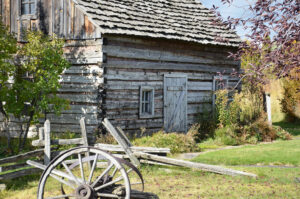 In Halfway, at ~ mile 13, is the Pine Valley Community Museum. We recommend that you make it a stop on your ride or the next time you are through Halfway. The museum is located next to Heritage Square in the heart of downtown Halfway.
The museum includes exhibits showcasing the community’s Gold Rush and agricultural history, including displays from historic businesses, a country kitchen, native American artifacts, and antique farming equipment. There is also an outdoors historic park featuring the areas first public school, Halfway’s original jail, and a pioneer smokehouse, all dating to the late 19th century.
Podcasts
Tractors, Bulls and Lycra
In this podcast, we talk with Daarla K who is a rancher and farmer in northeast Oregon. She and her husband operate a 1000-acre farm that has been in his family since 1886. Learn how to safely pass by big tractors and combines, how to get through a cattle drive, and what aggressive behavior [...]
Keep it Local! Learn More
Ridden and Reviewed by:


 Behind every route is scouting, mapping, storytelling, and a whole lot of pedal power.
Have you ridden this route? Got a question? Join the discussion!