Ghost of Ashwood


Highlights & Remarkable Spots
Crooked River National Grasslands / ~ Miles 0 to 5 and Mile 16
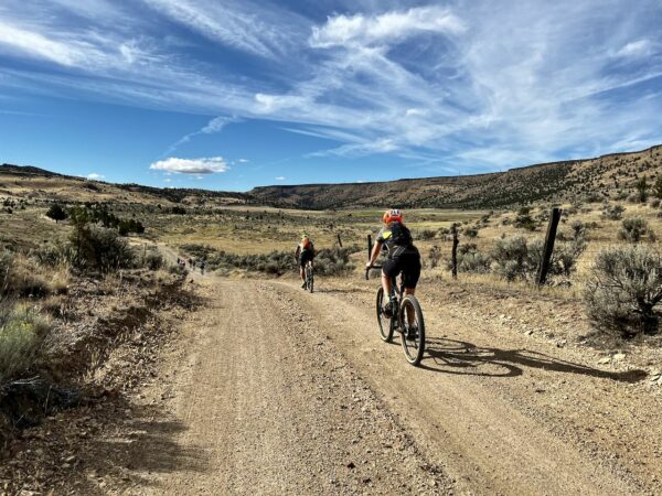
Homesteaders first settled the area in the 1880s, constructing more than 700 homes. By the 1930s, insufficient rainfall and unfavorable economic conditions led to farm failures and land abandonment. By 1935, about 35% of the homesteads were foreclosed upon by federal and private mortgage banks. The government repurchased the land from the remaining homesteaders. The Crooked River National Grassland was created by Congress in 1960 to improve range management and the forage resource. The grasslands, which cover 173,629 acres, include two National Wild and Scenic Rivers: the Deschutes and the Crooked. There are 20 national grasslands across the country, but Crooked River National Grassland is the only national grassland in the Pacific Northwest. [Ochoco National Forest]
Juniper Tree Reduction Area / ~ Miles 8 to 10
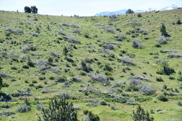
In an effort to restore the disappearing sagebrush range, private landowners have partnered with the Bureau of Land Management to remove young juniper trees from historic shrublands. Juniper tree encroachment erodes rangeland health by reducing water availability, diminishing soil health, and crowding out native perennial plants that feed wildlife and cattle. As trees become more dense, they also fuel hotter, more severe wildfires. Learn more about how Juniper tree reduction programs restore range health and animal habitat.
Basalt Cliffs / ~ Mile 12
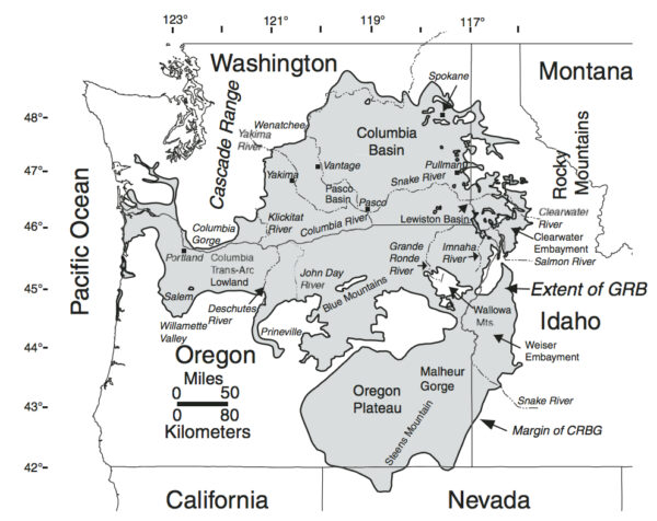
The Columbia River Basalt Group (map view) is the youngest, smallest, and one of the best-preserved continental flood basalt provinces on Earth, covering over 81,000 sq miles, mainly in eastern Oregon and Washington, western Idaho, and part of northern Nevada. Basalt exposed on the vertical walls of canyons, coulees, and buttes is visible as a closely-packed array of rock fence posts [or palisades]. These columns formed when the lava cooled and crystallized into basalt rock. When the lava cooled, it shrank. This created vertical polygons, usually five-sided, that separated from their neighbors by cracks. [Wikepedia, HugeFloods.com]
R2 Ranch / ~ Mile 20
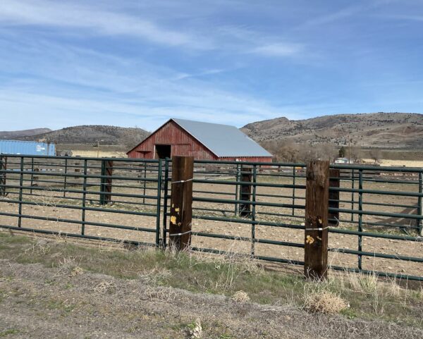
Across the highway, you will see a red barn and other outbuildings. They are part of the former R2 Ranch complex. The ranch is 47 miles long and, in some places, 22 miles wide. The ranch is built around more than 4,000 acres of irrigated land, 81,000 acres of rangeland with 150 improved springs and 7 year-round creeks and ponds, and a 35-acre lake. The ranch carries historical significance. The Cross Keys post office was established on July 8, 1879, at the mouth of Cow Canyon and the bank of Trout Creek (just north on Highway 97 at the beginning of the grade). The ranch was also a stage and freight station in the early days. [R2 Ranch]
Polka Dot Agate Mine / ~ Mile 29.5
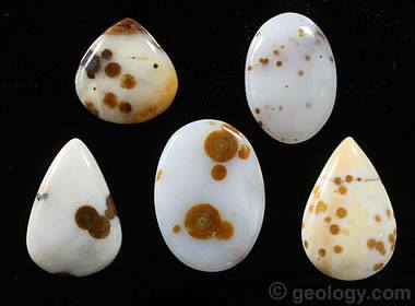
Here you will find beautiful polka dot agates and canyon rim thundereggs. The polka dot agate is a semitransparent to semitranslucent agate with suspended round “dots” of contrasting colors with an orbital flat shape. A thunderegg is a nodule-like rock that is formed within volcanic ash layers. Thundereggs usually look like ordinary rocks on the outside, but slicing them in half and polishing them may reveal intricate patterns and colors.
Century Farm 27 Bar Ranch / ~ Mile 34.5
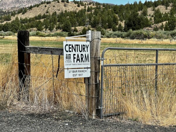
In 1911, 23-year-old William Nartz left the coal mines of West Virginia and rode west by train to build a new life on his own land. He stepped off at the end of the line in Madras and began working on local ranches, including the prosperous Priday Ranch. In 1917, he established what became the 27 Bar Ranch, which has since been recognized as an Oregon Century Ranch—an honor awarded to farms and ranches that have been continuously owned and operated by the same family for more than 100 years. Today, the ranch encompasses roughly 19,000 acres and supports about 200 head of cattle.
Ashwood / ~ Mile 35
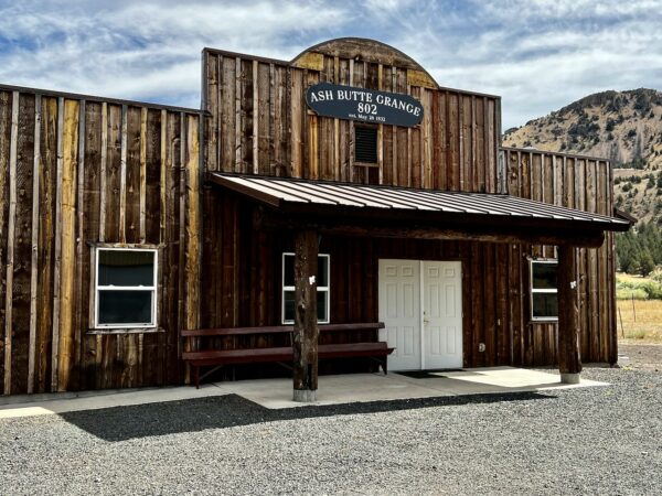
The Ashwood area (originally named Ash Butte) was first used by the Native American Sahaptin and Northern Paiute people. After the Sahaptin were forced to move to the Warm Springs Indian Reservation in the 1850s and the Northern Paiute were defeated in the 1870s, settlers moved into the area to raise cattle and sheep. Sheep ranching became an important local industry by 1900 because of the availability of the railroad in nearby Shaniko that facilitated the shipping of wool. Ashwood became a gold- and silver-mining boomtown in the 1910s. However, the minerals soon began to play out, and local residents turned back to ranching and agriculture as the mainstays of their economy.[Wikipedia]
Hay Creek Ranch / ~ Mile 51
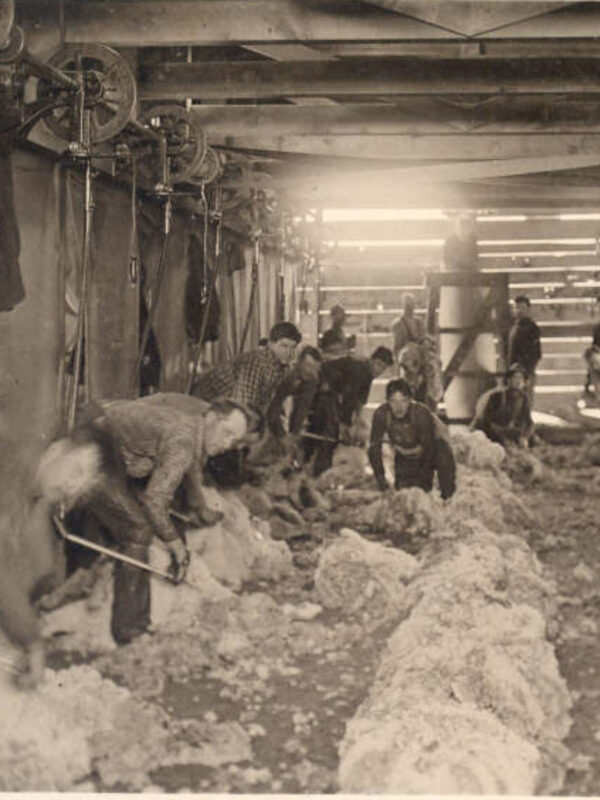
Hay Creek Ranch and its headquarters will be to your left in the distance. The ranch was established in 1873 by Dr. David Baldwin as the Baldwin Sheep and Land Company. Using Merino stock he brought from Vermont, he successfully bred sheep and became one of the first Oregon ranchers to grow alfalfa for winter feed.
Between 1900 and 1920, the ranch expanded in both acreage and breeding operations. During this period, it developed a Rambouillet–Merino–Delaine cross known as the “Baldwin sheep.” The breed gained international recognition, with sales reaching Australia, Europe, Argentina, and Russia. Baldwin sheep were bred for large size, high-quality meat yield, and abundant, high-quality wool.
When We Like to Ride This
This route is best ridden late Spring through Fall. Be careful, as the route can be muddy on the dirt / gravel road into Ashwood. This is not a wintertime route, nor a route to do after it rains. You need dry conditions. In the spring, the flowers are in bloom, the grass is green, and the young calves are wandering the fields. But … fall is not shabby either!
Terrain & Riding
{This needs to be re-written to reflect the 2.0 version.}
This ride has three unique parts. The first third of the ride is the warmup — 5 miles of flat and four short, “punchy” 100 to 300-foot climbs with gradients up to 10 % over the next 6 miles. The second third of the ride has longer climbs — 500 to 1000 feet in elevation, with gradients of 5 to 8 percent. The longest climb, 850 feet in 2.5 miles, occurs as you leave Ashwood. The last third of the ride is mostly descending (through a really cool canyon!) with a few “punchy” uphills that will keep you honest.
The roads are clay-based, hard-packed, and for the most part, fast-rolling. There are several short sections of chunk. The descent into Ashwood can be rutted in the spring. It is a technically demanding 3-mile descent, with pitches in excess of 10% and an average gradient of 7%.
On the weekends, traffic is minimal. You may not see a car for half the ride, and even then, you’d likely be able to count all the cars on both hands.
The Start
City park with ample parking. Flush toilets, water.
Food & Water
- ~ Mile 35 / Ashwood. At the old post office, there is now (as of June 2021) an honor system “store” with snacks, drinks, and ice cream. Bring small bills.
Route Notes
In January of 2026, we significantly changed the route’s start. We moved the start to Juniper Park, just outside of Prineville. It has flush toilets, water, and a nice parking area. You can still find the original route listed below as a shorter option.
This route has been impacted by the Cram Fire of 2025. It ignited on July 13, near Highway 97 east of Madras, and became the largest active wildfire in the United States, burning over 95,000 acres as of July 21, 2025. The fire destroyed dozens of homes and outbuildings. Thus, the picture deck may not reflect the landscape as you see it.
This route rides well in both directions. We would encourage you to give each direction a try!
We recommend a red blinky light with a rear-looking radar detector, like a Garmin Varia, for the paved sector.
Be aware that the outdoor water hydrants in the Ashwood area are not safe to drink from. Use the self-service store at the old post office to refuel. And be careful in that this is a seasonal store which is only open in the summer.
Route Options
Ghost of Ashwood (the Original).
Moved the start to the old highway, with room for 1 to 2 cars on the shoulder. If you have more vehicles, recommend the start just off Highway 97. This start is about 15 miles northeast of Madras. At the intersection of US Highway 97 and NW Pony Butte Road, look for the road marker to “Ashwood.” On the west side of this road, there is a red barn. Park in the dirt parking lot on the east side of the highway. There are no permits or parking fees.
With this route, as it goes from pavement to gravel, recommend airing up to road pressures (40+ psi for 45 mm tires) at the start and decreasing pressure to gravel pressures (30 psi or less) at Ashwood.
Ghost of Ashwood (the Original) / using the Ashwood Bypass
There is one bailout point at ~ mile X. To shorten the route, turn left on Wilson Creek Road, which is gravel. Here is the GPX file for the bailout route: https://ridewithgps.com/routes/42439025/.
The bypass reduces the route totals by 4.5 miles and 700 feet of gain.
Love Where You Ride! Learn More
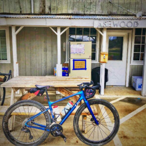 The people of Ashwood have put up a self-help store at the old post office. It has water, Gatorade, chips, and ice cream. They have also created a picnic and tenting spot with pit toilets. We encourage you to thank them for their support by dropping a bit more than what you take into the donation box. A heartfelt note of thanks is always nice too!
Videos
Columbia River Plateau Basalt
Massive lava flows covered much of the inland Northwest 17 million years ago. The basalt surged to the surface through fissures - like cracks in the bottom of a row boat. The stack of basalt layers is more than 2 miles thick at some locations. Learn a bit more about this geological feature in [...]
Podcasts
All About Basalt with the Rock Doctor
You will find these rocky columnar cliffs in Eastern and Central Oregon, but what exactly happened to form these unique structures? In this podcast, we talk with our resident rock doctor, Dr. Kim Ely.
Controversial Juniper Trees
The juniper tree is an iconic tree across Central and Eastern Oregon and yet, in some places they are being removed. Find out the real scoop about this unique tree from Gena Goodman-Campbell who is the Stewardship Director at ONDA (Oregon Natural Desert Association) where she works to engage [...]
Ridden and Reviewed by:


 Behind every route is scouting, mapping, storytelling, and a whole lot of pedal power.
Have you ridden this route? Got a question? Join the discussion!