Drift Creek Falls


Caution! We do not provide turn-by-turn directions in our GPX files. Those are auto-generated by your bike computer and are usually less than 70% accurate. Learn more.
For help loading a GPX file onto your bike computer, go here.
DownloadHighlights & Remarkable Spots
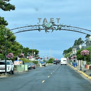
Taft (the town) / @ Start
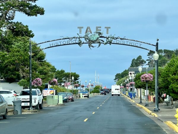
Taft became a Euro-American community in the early 1900s. Its waterfront emerged as a small trading and social center for homesteaders living nearby in relative isolation on the floodplains of Schooner and Drift creeks. With the construction of the Roosevelt Military Highway (present-day Highway 101) in the mid-1920s, North Lincoln County’s isolation came to an end. [Lincoln City, City Government Office]
Siletz Bay / @ Start
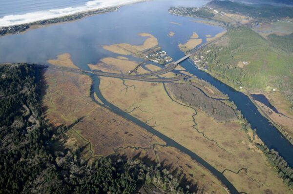
Siletz Bay is a large estuary where the Siletz River meets the Pacific Ocean. In the past, dikes were built, and the bay was drained to create pastures for cattle. However, in the early 1990s, a major restoration project began. This project removed the artificial structures to return the bay to its natural condition. As part of this effort, the Siletz Bay National Wildlife Refuge was established, protecting over 100 acres of tidal marshes.
Drift Creek Falls and Suspension Bridge / ~ Mile 15
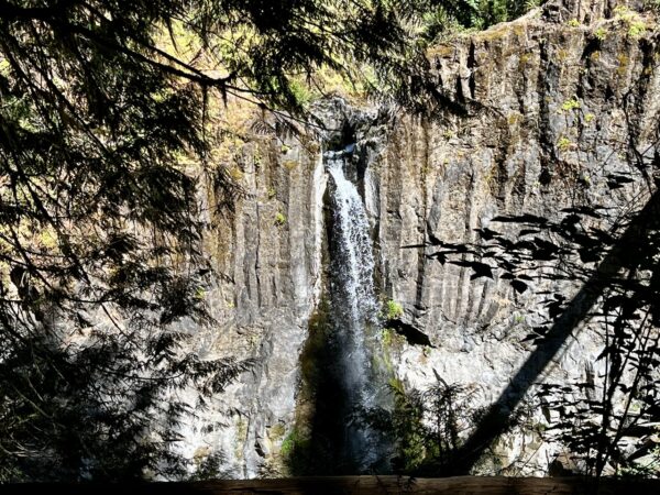
Located deep in the Coast Range, this 80-foot waterfall is accessed via a 240-foot suspension bridge (super fun!) that soars across treetops at the end of a popular 1.5 mile hike. The power and roar of the falls is best experienced in the spring. [Statesman Journal]
Fish Weirs / ~ Mile 23.6
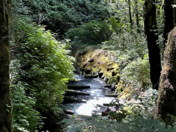
At mile 23.6, look carefully to your left. You will see a set of wooden beams lying in the creek, positioned perpendicular to the water’s flow. These structures are called weirs.
These weirs were built in 1996 to create a fish ladder, allowing coho and Chinook salmon, as well as cutthroat and steelhead trout, to migrate upstream. Before this construction, a bedrock chute had prevented fish from swimming upriver. The fish ladder was later restored in 2007. [On-site kiosk]
Taft Waterfront Park / @ Finish
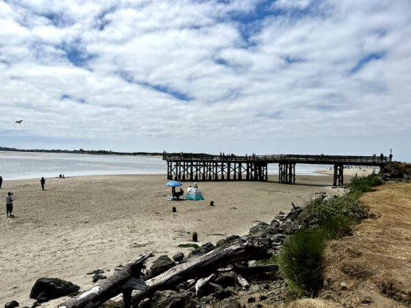
Here, you will find flat, walkable sands where you can take a stroll out on the Taft dock or admire the beauty of the Four Brothers rock formation.
The Four Brothers are the result of an ancient volcanic process known as dike formation. Volcanic dikes are sheets of igneous rock that form when magma intrudes into cracks or fissures in existing rock layers and then cools and solidifies. Over time, as the surrounding softer rock erodes away, these harder igneous intrusions are left standing as prominent features.
Credits & Acknowledgements
This ride guide was funded in part by the Oregon Coast Visitors Association.
When We Like to Ride This
The route will go almost any time of the year as its peak elevation is ~ 1500 feet. In the spring Drift Creek Falls is the most spectacular. But … this is also a great summer route when trying to escape the hot temps inland.
Terrain & Riding
This is an all-road bike kind of ride; you don’t need a burly gravel bike for it. The route is a lot more paved than gravel. We have listed the route as remote, but on a nice spring / summer day, you will have light traffic and a number of people hiking the falls.
Up to ~ mile 4, you roll out through rural countryside. After making a left at the Drift Creek Falls sign, the road becomes a single-lane paved road that climbs at 6 to 10%. The climb is ~ 4 miles and gains 1500 feet at an average gradient of 7%.
From the summit of the climb, the road rolls to a low point where the trailhead is for the hike. The hike is a simple out and back on a wide trail with a good base. No rocks, roots, etc. We did it in bike shoes. You lose about 250 feet of elevation to the falls in a distance of 1.5 miles.
After the hike, the paved sector continues for another 5 miles. Climbing ~ 600 feet and then descending that to the gravel
This paved sector of riding is within an isolated block of the Suislaw National Forest that was logged in the early to mid-1900s. You will experience classic coastal early growth to mid-growth forests. Expect some traffic on weekends and during the summer months.
The gravel sector, miles 20 to 26, is hard-packed and fast. It is a maintained, double-lane road. You will get glimpses of Schooner creek to your left. This sector is more rural than remote. The average downhill gradient is 1.5%.
From mile 27 you roll through rural country side on paved back to the start.
The Start
Taft Waterfront park. Flush toilets.
Food & Water
- None
Route Notes
The route rides well in both directions. In the mapped (counterclockwise) direction, the climb comes earlier, and the descent is on paved and gravel. Best for a hot day. In the clockwise direction, the climbing is more gradual, and you get a kick in the butt fun, paved downhill late in the ride. Exercise caution on the descent as there will be some uphill traffic, and parts of the road has divots and broken pavement.
Bring a bike lock and shoes that you can hike in for ~ 3 miles along a good dirt path.
Red blinky light with a rear looking radar detector recommended (i.e., Garmin Varia)
Riding temperates within the Coast Range forest will be moderated by the cool ocean air for ~ 10 to 20 miles inland. Plan what you wear accordingly.
Love Where You Ride! Learn More
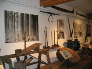 The ride finishes just blocks from the North Lincoln County Historical Museum. We encourage you to spend an hour or so learning some of the history of the peoples and the area, including that of the Native Americans, the early logging days, the early coast road, and the infamous Pixieland Amusement Park.
Videos
The Ride! Drift Creek Falls
A quick 2+ minute video of what to expect on your ride out to Drift Creek Falls. Near Lincoln City, Oregon.
The Forgotten Story of Pixieland: The Oregon Coast Amusement Park
The Oregon coast was once home to an amusement park that promised to be the Pacific Northwest's answer to Disneyland. Despite the talent and heart that went into its development, the park shut down within just a few years. This documentary tells the full story of the defunct Pixieland park (and [...]
Keep it Local! Learn More
Related Guidebook
Ridden and Reviewed by:


 Behind every route is scouting, mapping, storytelling, and a whole lot of pedal power.
Have you ridden this route? Got a question? Join the discussion!