Devil’s Dilemma


Caution! We do not provide turn-by-turn directions in our GPX files. Those are auto-generated by your bike computer and are usually less than 70% accurate. Learn more.
For help loading a GPX file onto your bike computer, go here.
DownloadHighlights & Remarkable Spots
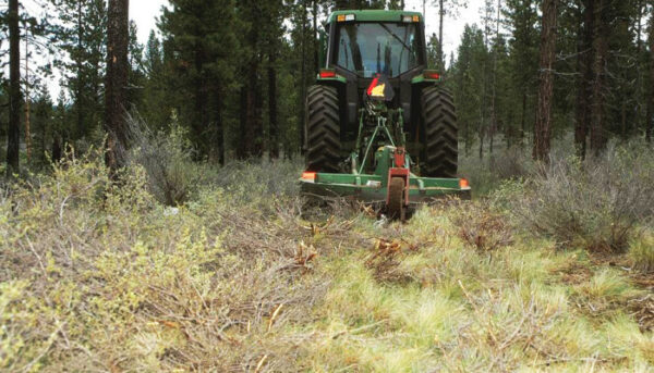
West Bend Thinning Project / ~ Mile 1 to 6
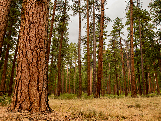
Along this section of trail you are riding through the West Bend Project, a 15-year forest management effort that includes tree thinning, brush mowing, and controlled burns. The project received Congressional funding through the federal Collaborative Forest Landscape Restoration Act. There are only 20 such demonstration sites nationwide. The goals of the Project are: to restore forest ecosystems, reduce the potential of high-severity wildfires, and provide economic and social benefits to local communities. See the resource page in the right sidebar (desktop) or towards the bottom of page (mobile).
Skyliners / ~ Mile 9
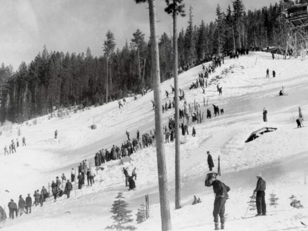
The lodge was completed by WPA workers in 1936 for the Skyliners Club, a group founded in 1927 to promote winter recreation in the central Oregon Cascades as well as provide search and rescue services. The lodge offered all the amenities needed for large competitions. The area featured two large ski jumps, an expansive cross-country trail system, and downhill skiing. [Bend Magazine]
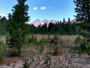
Three Sisters Wilderness / ~ miles 19 to 27
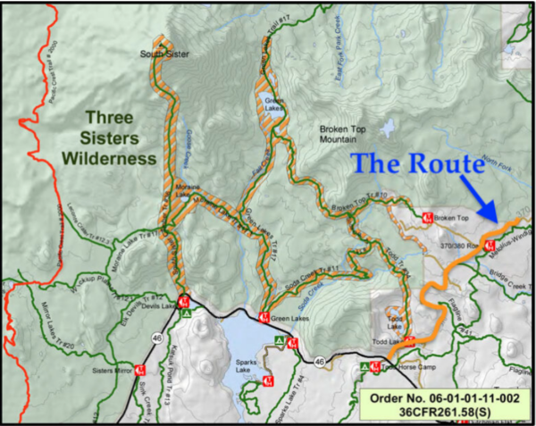
In 1964, Congress enacted the Wilderness Act, which provides that we preserve and protect designated wilderness in its natural condition. Wilderness areas are places untrammeled by humans that have been set aside for the enjoyment of future generations.
For these miles, you will be cycling along or near the edge of the Three Sisters Wilderness. This Wilderness area is especially valuable because it provides the best example of the effect of glaciation in the Pacific Northwest. [US Forest Service]
Broken Top Viewpoint / ~ mile 24

Broken Top is a complex stratovolcano whose crater measures 0.50 miles in diameter. It is located within one of the most active volcanic areas in the Cascades as well as one of the most densely populated volcanic centers in the world. Over 200,000 years of eruptions, Broken Top produced between 1.7 to 2.4 cubic miles of lava before becoming inactive roughly 100,000 years ago. [Wikipedia]
Sparks Lake / ~ mile 30
Sparks Lake was formed nearly 10,000 years ago. It was originally approximately 700 acres. Today half of that area is now meadow as streams continue to deposit sediment at the north end of the lake. The deepest parts of Sparks Lake reach a depth of 10 feet. [US Forest Service]
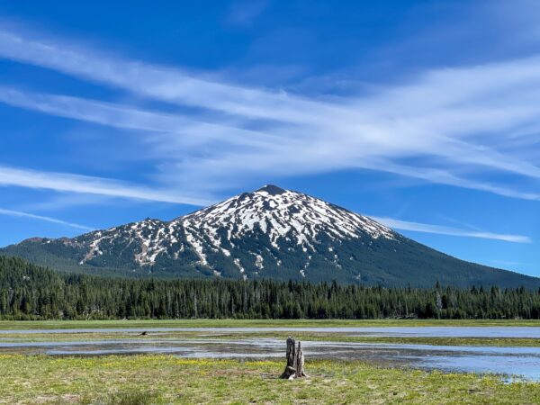
Elk Lake Resort / ~ mile 36.5
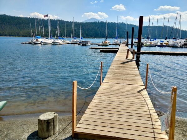
The original Elk Lake Lodge and Resort was built in the early 1920s. The lodge, which has been hugely popular with recreationists over the years, has persevered through many challenges. In the mid 1930s, the lake level began to significantly drop, which raised concerns about the lake’s long-term recreational benefit. Fortunately, the lake level was restored by a heavy snowfall in 1940. A year later, the lodge was hard hit by the breakout of WWII. Though the area regained popularity after the war, the resort suffered a year later, in 1955, when nearly 20 feet of snow destroyed many of the buildings. In 1968, 1998, and 2004, the area experienced damage from fires. Through all its setbacks, the resort has endured. To this day, the resort continues to make improvements that are enjoyed by all. [Elk Lake Resort]
Head of the Deschutes River / ~ Mile 42
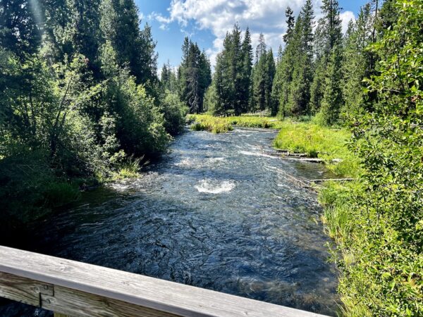
You’ll need to pedal off-route (less than 1 mile each way) to see the headwaters of the Deschutes River, but the detour is well worth it. The source of the Deschutes is Little Lava Lake, which covers 138 acres at an average depth of 8 feet. It’s hard to believe that this lake is the source of the same almighty and magnificent Deschutes River that flows through downtown Bend all the way to the Columbia River. [Wikipedia]
Fen Peatland / ~ mile 42
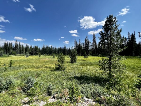
A fen is a wetland characterized by the accumulation of peat, a dense, organic soil formed from the decomposition of dead plant material. Fens differ from bogs in that they receive a steady flow of water and have a higher PH, which supports the growth of more diverse plant species. Fens are important because they support a wide array of biodiversity, store significant amounts of carbon, and regulate water flows and quality.
According to an on-site kiosk: “At this fen, peat is mostly 4 to 6 feet deep and is accumulating at a rate of less than one inch per 100 years. These are very fragile ecosystems that take a very long time to recover when disturbed.”
Ryan Ranch Meadow / ~ mile 71.5
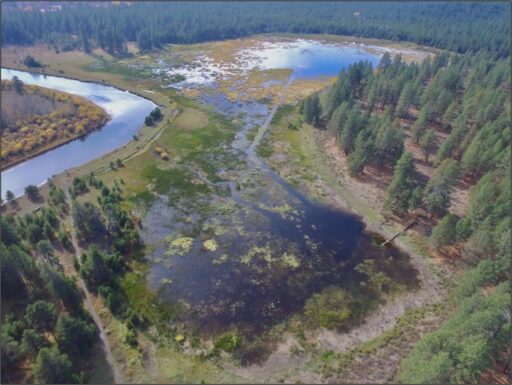
“Ryan Ranch is a historic slough floodplain of the Deschutes River that has been drained and isolated from the river for over 90 years. The area was used historically by Native Americans and more recently as pasture after being homesteaded in the late 1900’s. The Forest Service acquired Ryan Ranch in 1946 and continued grazing on site as part of a federal grazing allotment until 1989. The full ecological potential of the slough, including historic habitat for the Oregon spotted frog, has been limited by a berm that prevents the river from inundating the floodplain on a regular basis. Reconnecting the river with Ryan Ranch will benefit a wide range of terrestrial and aquatic species, including migratory and nesting waterfowl, amphibians and ungulates.” [Forest Service]
Shevlin-Hixon Haul Road / ~ miles 72 to 75
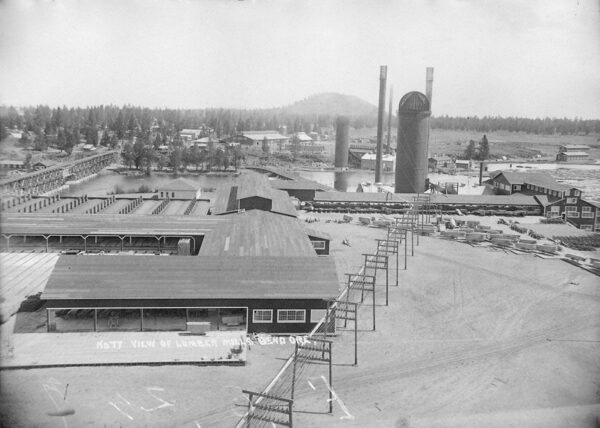
These miles follow along the old haul road, a historic railroad logging route that was used to transport logged trees to the Brooks-Scanlon and Shevlin-Hixon mills, located along the Deschutes River near the Old Mill shopping area today. The rail lines were used in place of the river on this segment due to the number of cascades and falls. Picture – Shevlin-Hixon Mill on the west bank of the river. [Old Mill District]
When We Like to Ride This
Weekdays versus weekends due to traffic. Mid to late June (in a typical year), after the snow melts out, but before the road beyond Todd Lake (NF 370) is opened to motorized use, about August 1. The route will continue to ride up until the first snows of fall. For more information, contact the Bend-Ft. Rock Ranger District at 541-383-5300.
Terrain & Riding
Miles 0 to 10 are a mix of paved roads, gravel roads, and red cinder roads. This sector is mostly forested riding with a mix of young and mature forests. The grades and inclines are not much more than 4 to 6%. Much of this area has been “restored” to healthy forest habitat through the West Bend Project.
At mile 10, you begin a 17-mile dirt road adventure through the high country, with big views and a creek crossing or two. There is also a bit of gnar that requires good bike handling skills. This section is the crux of the ride.
Miles 27 to 45 are on the “backside” of Mt Bachelor. Initially, the road descends quickly at 6% to Sparks Lake; thereafter, it rolls and undulates until you return to gravel at mile 45. This sector has big, gorgeous views of South Sister, Mt Bachelor, and several high-alpine lakes. It also passes by the headwaters of the Deschutes River (the same river in downtown Bend) that flow out of Little Lava Lake at ~ mile 42.
Miles 45 to 62 are classic Deschutes National Forest with pockets of bigger, red, older ponderosa trees. You also traverse through some stands of young sapling trees. For the most part, the roads are proper gravel roads and/or red cinder roads. The grades and inclines are not much more than 4 to 6%.
At mile 62, it gets a bit more technical again with a mix of primitive dirt roads and double-track. You are descending an unfrequented climbing route (Tylers uphill) used by mountain bikers. But use caution. We like this sector for the challenge, but some may not.
Miles 69 to 76 finish strong. Less technical but has a whole lot of beauty. Part of it is single-track along the Deschutes River (really scenic!), and part of it is on the old Shevlin-Hixon haul road that was used to bring lumber to the mills in Bend (where the Old Mill District is today).
The Start
Cascade Lakes Welcome Station (Deschutes National Forest). Pit toilets. No parking permit required.
Food & Water
- ~ Mile 36 / Elk Lake Resort
- ~ Mile 42: Lava Lake Resort (Slight detour required)
Route Notes
There are several sections of the route that use shared trail with walkers/hikers, from mile 70 and beyond. Remember, bikes give way to all other users. If coming up from behind a group, announce your presence and ask for a moment to pass. If meeting directly, yield by stopping and putting a foot down. Do not ride off the trail to make way! This increases trail width and ultimately increases trail erosion during heavy rains and spring snow melt, requiring additional maintenance.
Miles 27 to 45 are on paved road that can see significant summer recreational traffic, especially on a weekend. We strongly recommend a red blinky light with rear looking radar-detector like a Garmin Varia.
We made a major revision (v2.0) to this route in October of 2022, miles 58 to finish.
Love Where You Ride! Learn More
 You are riding through an area whose geology has both incredible history and incredible power, too. During the Pleistocene, Broken Top and its surroundings were almost entirely covered by glaciers. When the glaciers retreated, water filled the spaces left behind, creating lakes. These lakes, which are called “moraine-dammed lakes,” are more common in the Three Sisters Wilderness than anywhere else in the Lower 48 States.
Failure of moraine-dammed lakes can cause significant hazards from lahars, which are rapid flows of water, rock, and mud. On October 7, 1966, a flash flood took place at Broken Top. The event was likely triggered by glacial ice that fell into the lake and caused a large wave that breached the moraine and cascaded down the mountainside. Over the past century, at least five lahars have occurred at the Three Sisters and Broken Top due to the failure of moraine-dammed lakes or glacier-outburst flooding. [Wikipedia]
Below we have included a short video about glacial lake outburst floods. Though the video specifically discusses glacial lakes in the Swiss Alps, the same glaciology applies in the Cascades.
Videos
Glacial Lake Outburst Floods
A 4-minute video describing what glacial lake outburst floods look like.
Be Informed!
Keep it Local! Learn More

Ridden and Reviewed by:


 Behind every route is scouting, mapping, storytelling, and a whole lot of pedal power.
Have you ridden this route? Got a question? Join the discussion!