Big Summit Prairie


Caution! We do not provide turn-by-turn directions in our GPX files. Those are auto-generated by your bike computer and are usually less than 70% accurate. Learn more.
For help loading a GPX file onto your bike computer, go here.
DownloadHighlights & Remarkable Spots
Scissorsville / ~ Mile 3, look right
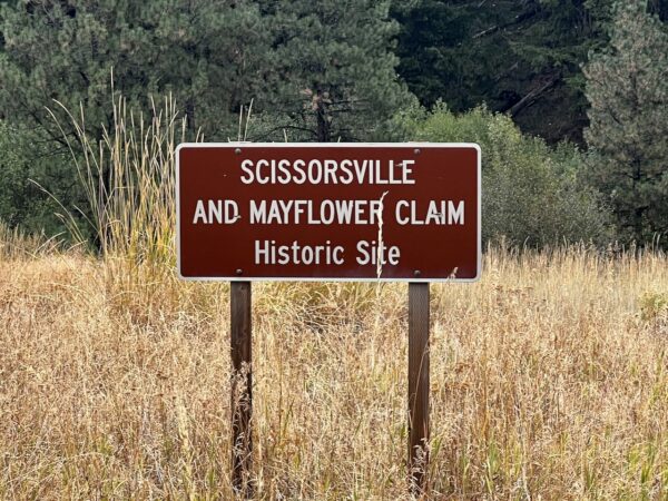
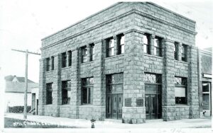
In 1871 gold was discovered at Scissors Creek, and this led to the formation of the “Howard Mining District” and later Scissorsville in 1888. Scissorville had a general store, saloon and dance hall. Mine shafts were constructed, and about $100 worth of gold per ton of ore was produced. It was not a significant amount of production and the site never became a major mining operation. Scissorsville soon became known as Howard and the mines became known as the Mayflower Mines. [Bowman Museum]
Walton Lake / ~ Mile 7
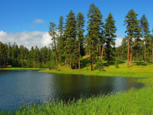
At ~ mile 7, you will pass by the entrance to Walton lake. It is not visible from the road but is only 0.3 miles to your left. The lake is a blue sparkling jewel hidden within mostly old-growth ponderosa pine forest. A small dam impounds spring-fed water that seeps from surrounding sloped meadows. Quaking aspen and tall willows add habitat diversity to make this place especially attractive to wildlife. This is a place to find a white-headed woodpecker, belted kingfisher, spotted sandpiper, cinnamon teal, American coot, Steller’s jay, yellow-headed blackbird, and Brewer’s blackbird. [US Forest Service]
Walton Lake Vicinity / ~ Mile 7
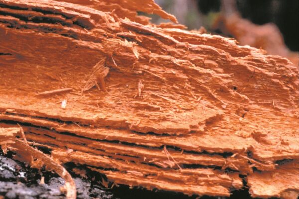
In the fall of 2023, the Forest Service began a project to selectively harvest trees in 178 acres near Walton Lake. The project’s main focus was to remove Douglas and grand firs affected by laminated root rot, a fungus that rots trees from the inside out. These trees were a public safety concern, as they could fall at any time. The restoration work, which was delayed for several years due to legal challenges, also enhanced conservation efforts by thinning certain trees to help reduce stress and competition in the mature forest. To maintain visual aesthetics, the Forest Service planted new trees resistant to root rot, including ponderosa pine and western larch. [The Bulletin]
Scott’s Corner / ~ Mile 21.5
There are several interpretive signs here that are worth the read, including information about the Summit Trail (NF 2630). This trail goes from McKay Creek (north of Prineville) to the South Fork of the John Day river, 70 miles. It started as a pack trail and was later on used as a stock-way moving sheep and cattle and later used to access many of the fire lookouts in the area.
North Fork Crooked River / ~ Mile 29
Just before mile 29 make a right onto NF-42 (paved). Cross over the North Fork of the Crooked River. From here the river, designated Wild & Scenic, flows generally south meeting up with the Crooked River near Post, Oregon. The Crooked River drains from the Ochoco Mountains and flows west-northwest through Prineville before joining the Deschutes River at Lake Billy Chinook. Sixty-eight percent of the land in the Crooked River basin is privately owned and much of that land is working farm, ranch or forest land. These working lands are the social and economic backbone of the area and also support elk and mule deer, antelope and sage grouse, redband trout, salmon, and steelhead. [Deschutes Land Trust]
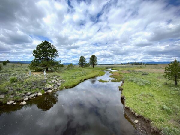
Big Summit Prairie / ~ Miles 29 to 37
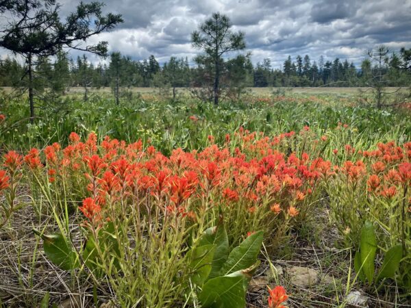
This section is a prime wildflower viewing area, with more than a hundred species of native plants, including the rare Peck’s Mariposa lily. The Audubon Society recognizes Big Summit Prairie as an important birding location, with sandhill cranes, woodpeckers, and other pine-loving bird species. A number of butterfly species frequent the Prairie during the summer, including the silver-bordered meadow fritillary butterfly, known from only three Oregon locations. Mule deer, pronghorn antelope, and Rocky Mountain elk are commonly seen in the area as well. [The Oregon Encyclopedia]
Four Horsemen Hotel / ~ Mile 39
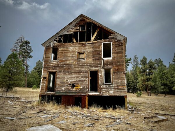
At mile 39, you will pass by the old Four Horsemen hotel (on the right). This old boarding house was part of the Blue Ridge Mining community of the early to mid-1900s. The building is said to have had a store downstairs and a brothel upstairs. Just behind the hotel are artifacts from the Blue Ridge mine, and a bit further up the road on the left-hand side, there is a standing building left from the Amity mine. These mines extracted mercury from cinnabar. [Mines of the Ochoco National Forest]
Independent & Mother Lode Mines / ~ Mile 42
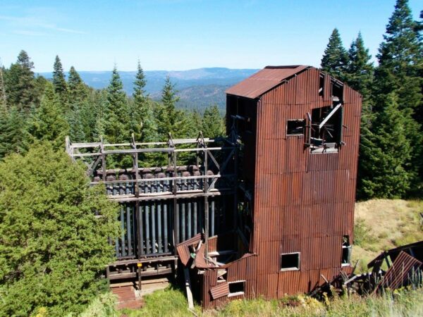
This short detour offers up some of the most intact mining buildings in the area. These mines, operational from the early 1900s to the 1950s, were used to extract mercury from the mineral cinnabar, which is sparsely but widely scattered throughout the Ochocos. Extracting mercury from cinnabar is rather simple: the rock shale is crushed, heated in a kiln, and the resulting mercury vapor is condensed and drained into a metal-lined “flask.” Mercury was used for thermometers, various instruments, amalgam tooth fillings, a topical disinfectant, laxative and a de-wormer for children. Once mercury’s toxicity was understood it was phased out of common usage, and most of the mines in the region began to shut down by the 1950s.
When We Like to Ride This
Mid-spring through mid-summer when the creeks are flowing, the wetlands are full of water and the flowers are in full bloom.
Terrain & Riding
The ride is “not too easy, not too difficult”. In looking at the elevation profile, you will see 3 distinct climbs, the first and third on pavement. The first climb is the longest at 1500 feet over 8 miles. The gravel sector has 1 climb and 2 moderate descents. All the climbs are quite moderate at grades of 4 to 6%.
What you get for your efforts are sweeping prairie views, a mix of ponderosa and juniper forests, flowing creeks and big skies.
The Start
24 miles east of Prineville at the “old” Ochoco ranger station parking lot. Water available via yard hydrant, between parking lot and road. Pit toilets.
Food & Water
- None
Route Notes
We recommend a red blinky light with rear looking radar detector like a Garmin Varia.
This area is also home to the Big Summit Wild Horse herd. Look for them, we have seen them several times.
Route Options
- For a longer ride (71 miles, 5200 feet of gain), take a look at Big Summit Prairie (Long Version).Click to download GPX file. Same start as standard ride.
- For a shorter ride (30 miles, 1800 feet of gain), take a look at Big Summit Prairie (Short Version). Click to download GPX file. Start at the intersection of NF-42 and NF-4210. Lat / Long: 44.354253, -120.304135
Love Where You Ride! Learn More
 This area of the Ochoco Mountains has a lot of interesting history ranging from old wagon roads, to gold and mercury mining, to ranching. We really recommend a stop at the Bowman Museumin Prineville to learn more. Or … check out these cool on-line posts done by the museum.
Videos
A Tour of the Independent and Mother Lode Mines
A brief history, with great visuals, of the Independent and Mother Lode mines.
Keep it Local! Learn More
Ridden and Reviewed by:


 Behind every route is scouting, mapping, storytelling, and a whole lot of pedal power.
Have you ridden this route? Got a question? Join the discussion!