Big, Big Red


Caution! We do not provide turn-by-turn directions in our GPX files. Those are auto-generated by your bike computer and are usually less than 70% accurate. Learn more.
For help loading a GPX file onto your bike computer, go here.
DownloadHighlights & Remarkable Spots
Cardinal Landing Bridge / Mile ~6
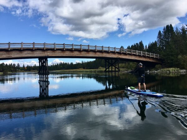
The Cardinal Landing Bridge is a footbridge over the Deschutes River. Located on the west side of Sunriver, the bridge connects walking and paved biking paths to off-road bike trails and forest service roads. This is a must stop viewpoint!
Do you know more about the history of this bridge? Let us know!
Fall River & Fall River Falls / ~ Mile 19

“What Fall River Falls lacks in stature it makes up in character. The river, placid above and below, skips down a jagged 14 foot step of what appeared to be heavily eroded columnar basalt, surrounded by grassy meadows and lodgepole pine. The Fall River is fed by a series of springs and retains a very consistent volume all year long. ” [Northwest Waterfall Survey]
Don McGregor Viewpoint / ~ Mile 20.5
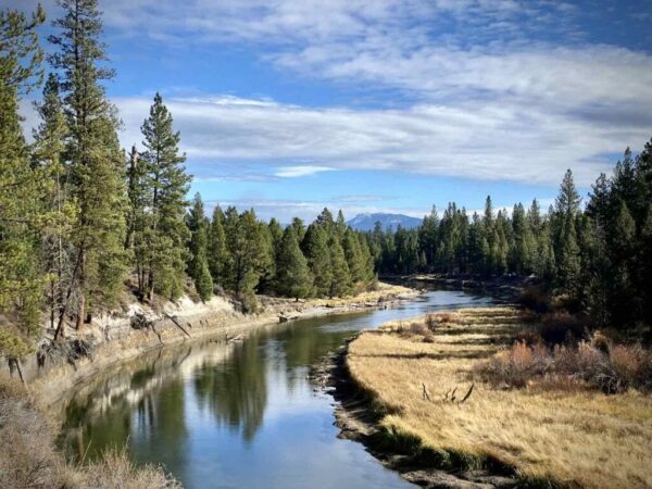
One of the best views of the Deschutes River in the park. The viewpoint is at a tight bend in the river and is named for Don McGregor who was a member of the State Parks and Recreation Advisory Committee in the 1960s and ‘70s. [The Oregonian]
Dead Slough / ~ Mile 23.5
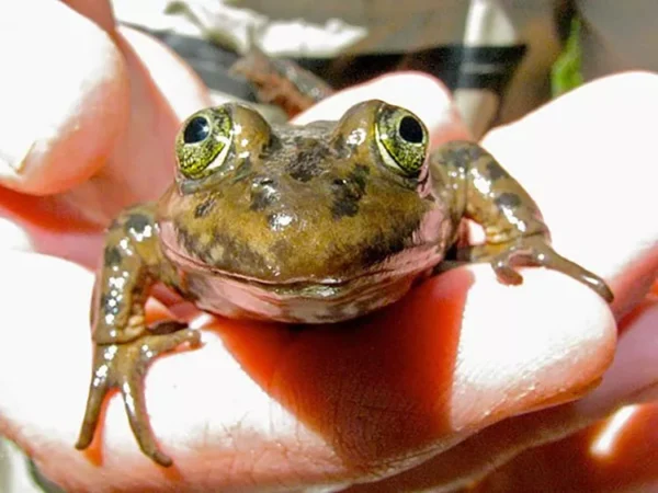
Once an arching bend in the river, at some time the river forged a new, straighter channel bypassing the bend. Thus, the Dead Slough. The slough was selected as a site to study overwinter and breeding habitat of the Oregon spotted frog. The frog, endemic to the Pacific Northwest, is noted as a vulnerable species. Keep your eyes open for these tiny critters, which range from 1.75-4 inches in length. [Deschutes River Conservancy]
Big Red / ~ Mile 24
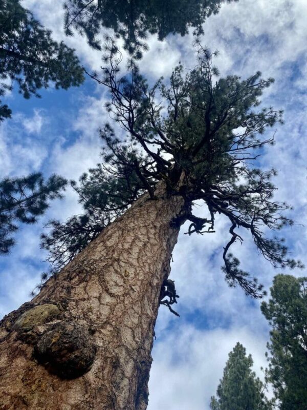
“Located about 150 feet from the Deschutes River, this big Pacific Ponderosa rises higher to the sky than all other big ponderosa trees on the nearby landscape. Many of its branches are bigger than the other, younger ponderosa trees that populate the Deschutes National Forest.
Big Red claims the crown as the biggest and perhaps the oldest of its kind ponderosa in the U.S. It’s been around longer than white settlement in North America. Tree experts have calculated its age at over 500 years and perhaps as much as 600 years old, sprouting from the seeds of a cone around the years of 1400-1500 AD.” [The Source]
General Patch Bridge & Robert D. Maxwell Veterans Memorial Bridge / Mile 31
Just downstream stood the narrow, wooden General Patch Bridge, which was built in 1944 by the Army Corps of Engineers. The bridge was named for General Alexander Patch, who trained troops at nearby Camp Abbot in the 1940s during the U.S. Army’s “Oregon Maneuver” combat training exercise. The bridge served as a footbridge until a 2006 inspection determined it to be in substandard condition. The bridge was immediately closed to all traffic and was demolished in 2008 by the Forest Service. [Wikimedia Commons]
The modern bridge, on which the Big Big Red route passes, was built in 1984. Twenty years later, the bridge was named the Robert D. Maxwell Veterans Memorial Bridge. Robert Dale Maxwell (1920-2019) was a US Army combat soldier and a recipient of the Medal of Honor, the military’s highest decoration, for his heroism in France during WWII. Patch, who commanded the U.S. Seventh Army during the war, had recommended Maxwell for the Medal of Honor. [Wikipedia]
Sunriver / ~ Mile 40
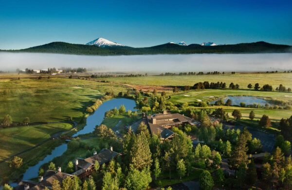
Highway 97 and Mt. Bachelor ski area put Central Oregon on the map in the 1950s, helping the local economy transition from timber to tourism. In the 1960s, real estate lawyer Don McCallum had a wild idea for an ecologically sound resort community. With architect Robert Royston and naturalist Jim Anderson on board, Sunriver came to be in 1968. Critics were skeptical at first, but the area grew quickly, boasting a lodge, condos, golf course, stables and more by 1971. Today, Sunriver continues to be a thriving resort community.
Slough / ~ Mile 47
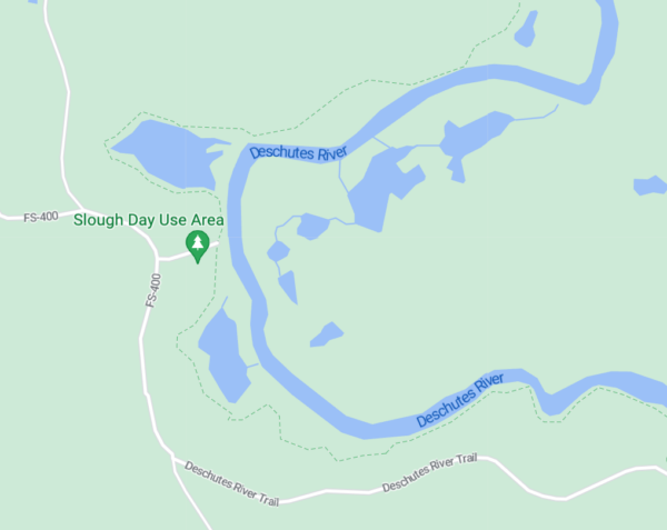
A slough is an area that only gets filled with water every now and then. This particular slough, situated at a massive bend in the Deschutes River, is nestled below a mature stand of ponderosa pines. The slough is home to all sorts of water-loving critters. Keep your eyes peeled, and you very well may spot one of those creatures!
Do you know more about the importance or history of this slough? Let us know!
When We Like to Ride This
We really like this route before Memorial Day and after Labor Day. During the summer, it has a “pinball wizard” feeling as you navigate through Sunriver during the height of tourist season.
Terrain & Riding
A highly scenic ride meandering along the Deschutes River through big Ponderosa trees on a mix of gravel/ dirt roads, single-track and paved bike path. Overall, the terrain is mostly flat, with a couple of short pitches uphill and downhill.
There are three single-track sectors. The first and third sectors, a couple of miles each, are true mountain bike trails. They are rated easy+ to intermediate-. There is nothing too rocky or demanding. Skilled riders will ride it clean; others may need to walk 25 yards or so.
The middle single-track sector is on wide trail with some tighter corners and close in trees. This may sound daunting, but is easily rideable and is rated mountain bike easy. Gravel Girl calls it big-smile fun and some of the best single-track riding in the area.
The navigation can be tricky, and most of us will miss a turn or two. We do it all the time! We recommend that you keep your bike computer on map display to help you recover quickly from these mistakes. The positive? It is easy to recover from a missed turn.
We love this ride for its highly scenic payback and for how close it is to town.
The Start
Dirt parking area just before the intersection of Conklin Road (FS 41) and Benham Falls Road (FS 400). On the west side of Conklin Road (FS 41). No parking permit required.
Food & Water
- ~ mile 22: LaPine Start Park. You will need to slightly detour to the campground.
- ~ mile 37: Sunriver. You will need to detour to the Village at Sunriver. See this map.
- ~ mile 42: Sunriver Marketplace. On route. A gas station with a convenience store.
Route Notes
We have made a major revision (v2.0) to this route as of March 2023. The structure is no longer a dumbbell, but a loop.
It is helpful to have this map of Sunriver with you. It will help you navigate all the “crazy” roundabouts in Sunriver, locate food/ water stops and points of interest.
Route Options
The route can also be started in Sunriver and ridden as a lollipop. 29 miles, 750 feet. (GPX Download)
“I love ❤️ Dirty Freehub’s Big, Big Red route. The alternate route (simply “Big Red“) is a little too short for my preference. Additionally, this time of year (summer) much of the initial part of Big, Big gets really sandy. My solution, a hybrid route that gives you a moderate distance and avoids the sand traps.” Don Rothaus
Love Where You Ride! Learn More
 This route really highlights the upper Deschutes River, a natural jewel in the heart of the Central Oregon community. But many of us are unaware that the river upstream of Bend is in big trouble. Its ecology is at a tipping point and showing steep declines in fish, wildlife and vegetation. We must act now before it is too late. Take a moment to learn more on the Deschutes River Conservancy website.
Videos
The Ride! Big Red
A quick 2-minute video of what to expect on your ride!
Act Now to Save the Deschutes River
A 2-minute video detailing the threats to the river and what we can do to help. Get educated and advocate!
Keep it Local! Learn More


 Behind every route is scouting, mapping, storytelling, and a whole lot of pedal power.
Have you ridden this route? Got a question? Join the discussion!