Bee Line


Caution! We do not provide turn-by-turn directions in our GPX files. Those are auto-generated by your bike computer and are usually less than 70% accurate. Learn more.
For help loading a GPX file onto your bike computer, go here.
DownloadCredits & Acknowledgements
This ride guide was made possible in part by funding from the Oregon Coast Visitors Association.
When We Like to Ride This
This is a go to route for us when looking for something shorter with less commitment. Further, it is a route that can be ridden most of the year. The maximum elevation is 1000 feet. Thus, on a sunny winter day in the mid 40s it is a possible go for the more “hard-core” rider.
Terrain & Riding
This ride is a mix of Oregon Coast terrain: lakes, rural farmlands, and Coast Range Forest.
The Stick Sector of the Lollipop / Miles 0 to 7
This is a very deceptive sector. It starts out super fun on some wide single-track trail winding through Honeyman State Park that is forested with big old trees. But when you gain the road proper, thinking it will be easy, it is not. The terrain rolls and undulates, with short, steep pitches of up to 10%, though you never gain more than a few hundred feet at a time.
A couple of ride/navigation notes:
- ~ Mile 0.4: Just past the amphitheater turn left onto the bike paved path. If you turn to early, you turn into the amphitheater.
- ~ Mile 2.5: Once you pass Clear Lake Road the traffic volume decreases significantly.
The Loop Sector / Miles 0 to 6
At first you follow Maple creek with farmlands dotted by dairy cows. At mile 9 veer slightly slightly left and up beginning the climb into classic Coast Range forest. Doug-fir, Red Cedar, and Big Leaf Maple trees. Thick, green understory, hanging moss, and dappled light.
The climb is on a single-lane gravel road that is two stepped with a respite at about the midpoint. The total climb is just over 2.5 miles gaining 950 feet. The last third of the climb is on a super-cool small paved road. After topping out at mile 12.5, you begin a fun descent on the same paved road. It twists and turns. But be cautious and do not override your sight lines. There are dips, holes, and debris.
At mile 16.5 you intersect the stick of the lollipop and begin your journey back.
The Start
Honeyman State park, sand dunes parking area. Flush toilets. Water. Parking permit required, available on-site.
Food & Water
- None
Route Notes
We recommend a red blinky light with a rear looking radar detector, something like a Garmin Varia. This is very helpful along the stick of the lollipop.
Log trucks! This is the Coast Mountain range, a region where logging trucks are commonly encountered. Signs indicating logging activity include CB channels posted, mile markers, truck tracks in the dirt, pink ribbon, thinning activity, and a well-maintained gravel road. For safety, we recommend riding single file, using a rear red blinking light, and a front white blinking light. It’s important not to exceed your sight lines, and avoid listening to music, as hearing is crucial to detecting approaching trucks. If you encounter a truck, whether it’s coming towards you or overtaking, stop and place a foot on the ground instead of trying to ride through. Additionally, a friendly wave to the truck driver is always appreciated.
There are several options for camping:
- Honeyman State park (limited cell reception).
- Port of Siuslaw Campground near Old Town.
- Lane County Park (Harbor Vista) on north side of jetty.
- Along with several private campgrounds.
Love Where You Ride! Learn More
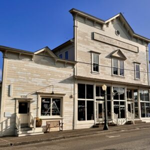
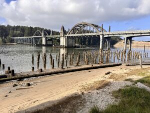 Florence captivates us with its natural beauty and rich history, offering various ways to immerse in each. To experience its natural allure, consider hiking through the dunes at Honeyman State Park or exploring the Siuslaw River jetty from the parks located on both its north and south sides. For a taste of history, take a leisurely walking tour of Old Town. Here, you can visit unique shops, stroll through charming pocket parks, admire local art, and learn from informative kiosks. Additionally, don’t miss the opportunity to visit the Siuslaw Pioneer Museum, just a block away from Old Town.
Videos
Beauty out of Chaos: Sand Dunes
Learn all about sand dunes! How they form. How they move. What sand is. This is a fascinating and informative watch. 16 minutes.
Podcasts
Oregon Sand Dunes
Dr. Win McLaughlin, a geology professor at Southwestern Oregon Community College, provides us with a deep understanding of the geology, history, and ecology of the Oregon coast. The Oregon coast is filled with unique geology which is characterized by its young age and the presence of sand [...]
Keep it Local! Learn More
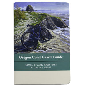
Related Guidebook
Ridden and Reviewed by:


 Behind every route is scouting, mapping, storytelling, and a whole lot of pedal power.
Have you ridden this route? Got a question? Join the discussion!