Ash Meadows


Caution! We do not provide turn-by-turn directions in our GPX files. Those are auto-generated by your bike computer and are usually less than 70% accurate. Learn more.
For help loading a GPX file onto your bike computer, go here.
DownloadHighlights & Remarkable Spots
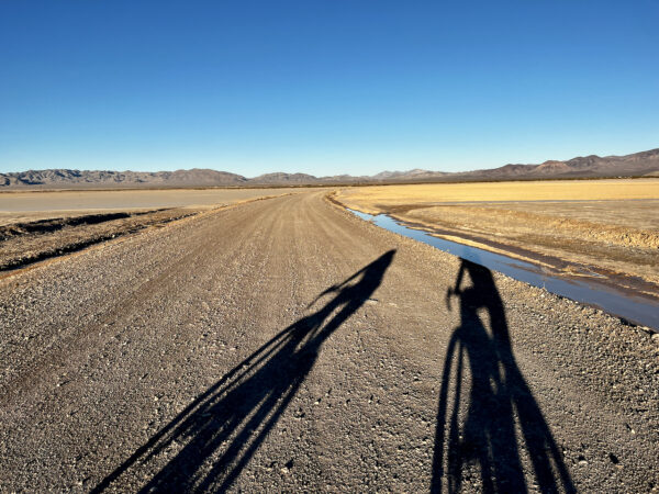
Amargosa Flats / ~ mile 4
The Amargosa Desert is an arid desert habitat and an ecotone between the northern Great Basin and southern Mojave Desert. Ancient campsites have been found that date back at least 10,000 years, to the end of the last ice age. Archaeological remains in the valley imply more extensive use by aboriginal peoples than had been previously estimated. During the nineteenth century, two groups of Native Americans occupied the Amargosa Valley: the Southern Paiute and the Western Shoshone. Both were extremely adept at extracting a living from their marginal environment, subsisting on wild plant foods and supplemented by wild game.
Sepiolite Pit Mine / ~ Mile 6
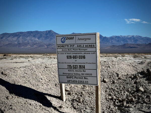
Sepiolite clay has been mined from the Amargosa Valley since 1972. Sepiolite is renowned industrially for its water-holding and absorptive capacities. It is used in absorbents, polyesters, asphalt coatings, paints, anticaking agents, plastisols, rubber, detergents, cosmetics, and grease thickeners. [Lhoist]
Ash Meadows National Wildlife Refuge / ~ mile 9 to 33
Despite being located in the hottest and driest corner of the United States, Ash Meadows National Wildlife Refuge is home to the second greatest concentration of endemic species in North America. In just under 24,000 acres live 26 species found nowhere else on Earth. That’s because approximately 10,000 years ago, as the climate warmed, aquatic species survived by seeking refuge in receding and fragmenting wetlands. Isolated for millennia, the survivors evolved into new species in separated “islands of water” scattered across a sea of desert. Nearly all of Ash Meadows’ endemic species live in or around its 50 springs and seeps.
Devils Hole / ~ mile 9.5

At first glance this site looks like a top secret government facility with fences encircling the hole, antenna arrays, and multiple cameras. This area is actually run by the NPS, and it’s all to protect the one of a kind Devil’s Hole Pupfish. From the viewing area over the hole, it is very hard to see the actual fish; they are dark blue and only 2-3 inches long.
Devils Hole itself is a water-filled cavern cut into the side of a hill. The cavern is over 500 feet deep and the bottom has never been mapped. Devils Hole provides its resident pupfish with conditions of constant temperature (92°F) and salinity.
Longstreet Springs and Cabin / ~ mile 16.5

An old stone cabin built by famed gunslinger Jack Longstreet. Built into a mound above an underground spring the cabin is cooler than outside temps and was used for food storage by Longstreet. The spring pool near this cabin is sometimes called the boiling spring because fine white sand bellows up from the depths gives it a ‘boiling’ appearance.
Rogers Spring / ~ mile 17.5
Rogers Spring is a 30-foot-diameter spring pool that is surrounded by mesquite, salt cedar, and ash trees. The spring is a good place to see desert species when they come for water. Look for finches, sparrows, warblers, quail, and Mourning Doves. Not many people come out to the spring, and this is where we saw the pupfish.
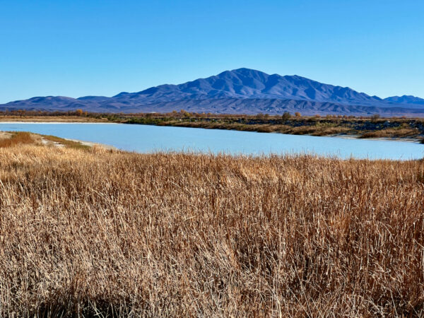
Peterson Reservoir / ~ mile 21
Peterson Reservoir is a remarkably clear reservoir held behind a low earthen dam along the western and southern sides. The reservoir is surrounded by cattails and bulrushes, which obstruct much of the view of the water, but you can walk the dam and watch birds on the water and in the marshland below the dam.Note, the reservoir is to your right as you are walking in.
Crystal Reservoir and Marsh / ~ mile 25

A beautiful Caribbean-blue spring pool which is feed by Crystal Spring. This spring produces 2,800 gallons of water a minute.
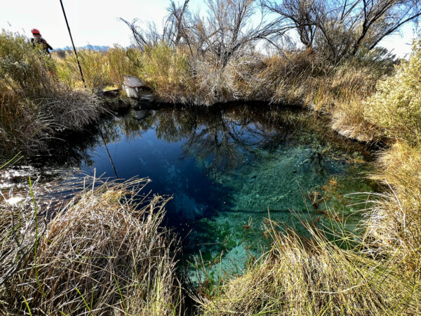
Point of Rocks Springs / ~ mile 29

Point of Rocks boardwalk winds through groves of mesquite trees to Kings Pool and where the Amargosa pupfish live in the crystal blue waters. This species of fish has survived in these waters since mammoths roamed the area and this is the only place in the world they exist. Along the boardwalk, if you look closely, you will see Native American Paiute grinding holes used in the cracking of nuts and milling of flour.
Credits & Acknowledgements
Route by Mark Duncan of Team Hammersaw.
When We Like to Ride This
Late fall and early spring are the best, the temps are moderate and pleasant. June through September are hot, with daytime highs well over 105-110 degrees. Winter months tend to be quite cold and windy.
Terrain & Riding
Start by heading across the large dry lake bed of the Amargosa Flats. Completely amazing and beautiful.
After leaving the Flats, you’ll start climbing gradually, and the road surface gets a bit rougher and loose. There are some washboard sections, so “line surfing” will be key to finding that firm, smooth track. The same goes for descending down this road on your way back. Keep your weight back, speed up, and pedal through the soft stuff for that good line!
Once topped out on this gradual climb, make sure to look behind you at the vista of the Amargosa Flats and the distant mountains; again, an otherworldy sight! Continuing on, you will drop down to the border of the Ash Meadows National Wildlife Refuge (NWR). Make sure to stop and see the Devil’s Hole Pupfish, the first point of interest.
In the Refuge, you will be treated to smoother roads with very minimal climbing. You can follow the route as planned or make up your own route. But make sure to stop and see the visitor center, where they have bathrooms, a water fill station, and on-duty rangers.
The terrain is so varied! Desolate desert, a dry lake bed, small hills, distant mountains, reservoirs, marshes, blue pools of water.
The Start
Crystal, Nevada city park. No services.
Park near Crystal Road in the gravel lot. The north half of the lot is BLM land. The south half of the lot is private land.
Food & Water
- ~ mile 12.5 / Ash Meadows National Wildlife Refuge Visitor Center. Water, snacks.
Route Notes
We recommend taking a photo of this park map for reference on your ride and taking a look at this informational handout.
Boardwalks lead out to Longstreet Springs and cabin, Crystal Reservoir and marsh, and Point of Rock Springs. Bikes are not allowed on the boardwalks. Bring shoes that you can walk in and a bike lock.
Make sure you give yourself enough time for this adventure. Our ride time was ~ 3.5 hours, but with the stops, walks and tour of the visitor center, it took us nearly 6 hours. A 2-hour additional time buffer is a must!
Love Where You Ride! Learn More
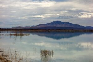 Much of this route is through the Ash Meadows National Wildlife Refuge, a haven for rare fish, plants, snails, and insects, many of which are found nowhere else on earth. The Refuge encompasses over 23,000 acres of spring-fed wetlands and alkaline desert uplands. The name Ash Meadows refers to the abundance of Ash trees once found in the area. (Photo by USFWS.)
Videos
The Ride! Ash Meadows
A quick 2-minute video of what to expect on your ride!
All About Pupfish!
This video is for kids, but the content in really, really good.
Ancient Grinding Hole
Confused like us about this ancient kitchen technique, have a look!
Keep it Local! Learn More
Ridden and Reviewed by:


 Behind every route is scouting, mapping, storytelling, and a whole lot of pedal power.
Have you ridden this route? Got a question? Join the discussion!