Madera Canyon (via Box Canyon)


Caution! We do not provide turn-by-turn directions in our GPX files. Those are auto-generated by your bike computer and are usually less than 70% accurate. Learn more.
For help loading a GPX file onto your bike computer, go here.
DownloadWhen We Like to Ride This
Almost anytime of year. Summer, go early! Spring has the creeks running full. Fall has the changing colors. And winter, mid-day, can be gorgeous when the peaks are snow capped and the sun is out.
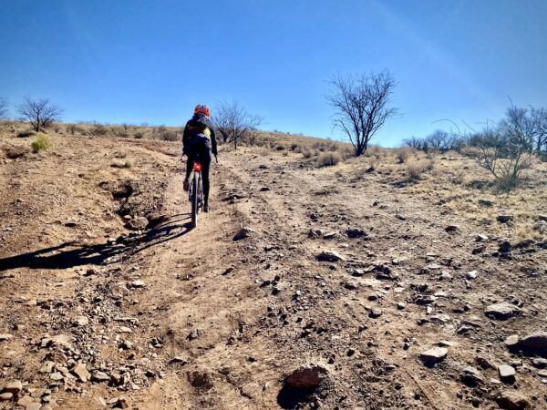
Terrain & Riding
The ride starts at a makeshift dirt parking lot just off Highway 83. The first few miles wind through farmland on a “paved” road (you know the type, Arizona paved) that is slightly uphill. It’s an easy climb that doesn’t buy you much elevation gain, but is a perfect warm-up. At mile 3.5 you switch to a gravel road, which leads you through Box Canyon. We loved the green cottonwoods and silver barked sycamores trees, the stream below us, and the waterfall. (Ok, it wasn’t a GUSHING waterfall, but still fun.) The views get bigger as you twist and turn your way down, down through the canyon.
You then reach a long, straight, gravel road (with a bit of washboard) that has a 1 to 2% click down. Yes, more down … but don’t you worry, you have plenty of climbing when you hit what we call powerline road. This is a wonderful paved road that takes you into the Coronado National Forest, up Madera Canyon. It feels longer than it is because the grade isn’t tooooo steep, but steep enough to slow you down. When you reach the Proctor Visitor kiosk the fun begins. (Including a short hike out to a “secret” waterfall.)
Along the way, we skipped the gift stores and the picnic pull outs and headed straight for the top. The road slices through the trees, twisting and turning, and getting steeper and steeper as you go. At the top Mt. Wrightson and Mt. Hopkins loom large in the background along with Jack Mountain and Pete Mountain. There are picnic tables and nice places to take a break …. and a simple loop to test those brakes for the wonderful downhill.
Yes, test those brakes! You you will need a handful near the top of the descent at the off camber right hand turn over the nondescript concrete bridge at Sprung Spring. Captain O nearly “over cooked” this turn and went ditch bound.
From here … it is a “blasting” down through the forest and down the powerline grade (no brakes required here). Yeeehah…. When you make the right hand turn onto the gravel road, you have an easy climb back through the open grasslands. The climb back up through Box Canyon seemed to go faster than we thought … plenty of nice views of Box Canyon seem to keep you distracted from the climb. And … there are a number of short breaks in the climb.
Once you hit mile 35, you have an easy 4.5 left to go… back on that “paved road” … and back to your car.
The Start
At gravel pad on the NW corner of Sonoita Road (Hwy 83) and Greaterville Road. This is just before the Border Checkpoint on Sonoita Road about 15-16 miles south of I-10.
Food & Water
- ~ Mile 18.8: Santa Rita Lodge
- ~ Mile 19: Drinking fountain on east side of road
Route Notes
Riding in the desert southwest is often very different from riding in Colorado or Oregon, with terrain that is noticeably more rugged and challenging. For tips and advice, check out our Resource Page: Riding in the Desert Southwest.
The Box Canyon sector can get washboarded. Check the comments and/or post a request on the Facebook Group: Riding Arizona Gravel, looking for the latest conditions.
Be Informed!
Ridden and Reviewed by:


 Behind every route is scouting, mapping, storytelling, and a whole lot of pedal power.
Have you ridden this route? Got a question? Join the discussion!