Las Cienegas (Gunsmoke)
April 1 to June 30, group size should be limited to 4 due to Pronghorn fawning.


Caution! We do not provide turn-by-turn directions in our GPX files. Those are auto-generated by your bike computer and are usually less than 70% accurate. Learn more.
For help loading a GPX file onto your bike computer, go here.
DownloadHighlights & Remarkable Spots
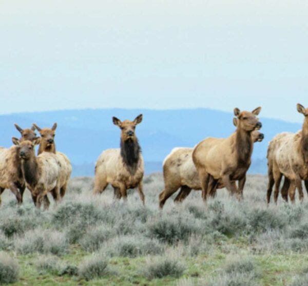
Pronghorn / ~ stick of lollipop
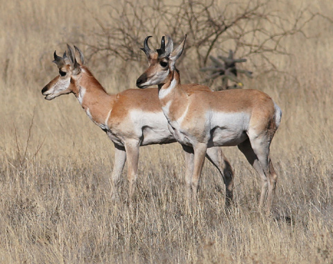
The southern grasslands of this route are the grazing and fawning grounds of the Chihuahuan Pronghorn. Unlike deer, Pronghorns are not fence jumpers, so livestock fences can be harmful, impenetrable barriers to them, keeping the Pronghorns from food and water unless these fences are properly constructed to allow the Pronghorns to safely crawl under them. Sadly, the widespread fencing of the American west has contributed to the decline in the numbers of these native North American animals. [The Firefly Forest]
Black Tailed Prairie Dog / ~ Mile 8.5

Black-tailed prairie dogs were eradicated in Arizona in 1960, but wildlife agencies and partners have since worked to reintroduce the species across their historic range. In Arizona, three colonies have been established at Las Cienegas since the species was first reintroduced in 2008. Prairie dogs are a keystone species that play a vital role in their grassland ecosystem, providing food and shelter for other species. The successful reintroduction of black-tailed prairie dogs at Las Cienegas National Conservation Area is a positive step towards restoring a healthy and diverse ecosystem. [Arizona Important Bird Areas Program]
South Ridge of North Canyon / ~ Miles 13 to 17
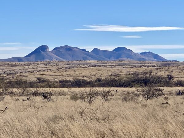
As you climb this undulating ridge of grasslands, several of the Sky Island Mountain ranges come into view, including the Whetstones (east), the Empires (north), the Santa Ritas (west) and the Mustangs (southeast – pictured). These grasslands are key to connecting landscapes that allow for the migration of animals from range to range. The Sky Islands are one of America’s hotspots for wildlife diversity, hosting more than twice as many mammal species as Yellowstone National Park.
Empire Gulch Birding Area / ~ Mile 20

This tall stand of Cottonwood trees is the densest in many miles, making it an Audubon Important Birding Area. A variety of neotropical migratory birds and resident birds find great nesting and perching sites among these tall trees. However, the skies of Las Cienegas belong to the raptors, including Red-Tailed hawks and Northern Harriers (pictured).
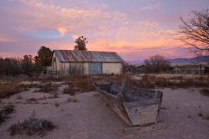
Empire Ranch / ~ Mile 20.5
The Empire Ranch was originally established in the 1860s as a homestead ranch of 160 acres with a flat-topped four-room adobe ranch house and adjoining adobe-walled corral. Over the next 20 years, as a part of the historic expansion of ranching, railroads, and mining in the West, Walter Vail and various partners expanded the original land holdings to include over 100,000 acres. The Total Wreck silver mine was discovered and developed, adding to ranch prosperity. The Ranch House became an extended complex with more than 29 rooms and a number of outbuildings and structures. [Empire Ranch Foundation]
Giant Sacaton Grass / ~ Mile 23.5
The Cienega Watershed is home to some of the region’s largest remaining stands of sacaton grass, an important type of grassland that provides valuable ecosystem services, such as absorbing floodwater, controlling erosion, and capturing and holding soil. These grasslands have deep, silty soils that make them highly productive, providing food and habitat for wildlife and livestock. However, some of the sacaton flats in the region are suffering from erosion caused by wind and water, which can lead to the loss of productive soil and create hazards such as silt in streams and dust storms. Efforts to improve the health of these grasslands are underway by the BLM, The Nature Conservancy, and others. [Borderlands Restoration Network]
When We Like to Ride This
Fall through spring. Las Cienegas means wetlands in English; thus, beware! We can envision times in the spring and during the monsoon season (June – September) when this could be a muddy mess.
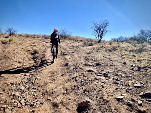
Terrain & Riding
This route dishes up a bit of everything. Fast, hard-packed dirt roads, some soft sandy sections, short sectors of rocky and rugged, and several short steep pitches. Some will find it necessary to walk the more technical sections (20 to 40 yards), but it is all rideable! The roads are mostly single-lane primitive dirt roads, but near the ranch, the roads are well-maintained and double-wide.
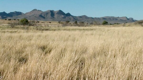
The terrain is rolling grasslands and cienegas (i.e., seasonal wetlands). The views of the encompassing mountain ranges are spectacular! Some of the best in the area.
The Start
Dirt parking area just past cattle guard.
Route Notes
From April 1 to June 30, group size should be limited to 4 due to Pronghorn fawning. If you do encounter Pronghorn, stop, put a foot down, and wait. Keep your distance. Let them move off at their discretion. See this resource page for more information on the impact that you have on wildlife as a gravel cyclist.
We recommend 50 mm+ tires for this route, but a strong technical rider could make do with a 45 mm tire. However, the sand sections (variable by season) will be a power suck with a narrower tire. Whatever your choice, you will want a tread with good bite for the short, steep uphill pitches.
Riding in the desert southwest is often very different from riding in Colorado or Oregon, with terrain that is noticeably more rugged and challenging. For tips and advice, check out our Resource Page: Riding in the Desert Southwest.
There is open grazing within the Conservation Area. Please leave each gate that you cross through (~ 10) in the same state that you find it. Closed gates should be closed. Open gates should be left open. Also, please review this resource page on riding near cows.
Route Options
Two other routes to consider are:
- Las Cienegas (Inner Loop): A shorter ride without the ridge climb.
- Las Cienegas (Outer Lollipop): A longer ride that is highly scenic but much more rugged. For some, mountain bike rugged.
Love Where You Ride! Learn More
 The Las Cienegas Conservation Area is a protected area in Arizona’s Pima and Santa Cruz counties that spans more than 45,000 acres of rolling grasslands, woodlands, and oak-studded hills that connect several of the Sky Island mountain ranges. It is home to a diverse plant and animal community, and its lush riparian corridors and perennial stream, Cienega Creek, provide vital resources for the area. The Conservation Area was at risk of being developed for housing and commercial purposes, but thanks to the efforts of local governments, elected officials, and the public, it is now publicly owned and managed by the Bureau of Land Management (BLM). In addition to its ecological value, the area is also rich in history and culture.
Videos
The Ride! Las Cienegas (Gunsmoke)
A quick 2-minute video of what to expect on your ride!
The Empire Ranch Homestead
A historical look at the ownership and the headquarters building of Empire Ranch. It started as a 4-room adobe structure that transitioned into a 29-room ranch home. All built in the late 1800s.
Sky Islands: What You Should Know
Learn the basics of the Sky Islands. Stuff you should really know! The geography, the lands, the plants, the animals. And their super-duper importance.
Giant Sacaton Grass
A quick 2-minute video about this important but endangered grass. Well worth the watch!
Be Informed!
Ridden and Reviewed by:


 Behind every route is scouting, mapping, storytelling, and a whole lot of pedal power.
Have you ridden this route? Got a question? Join the discussion!