Patagonia 30


Caution! We do not provide turn-by-turn directions in our GPX files. Those are auto-generated by your bike computer and are usually less than 70% accurate. Learn more.
For help loading a GPX file onto your bike computer, go here.
DownloadHighlights & Remarkable Spots
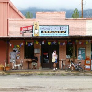
Town of Patagonia / @ Start
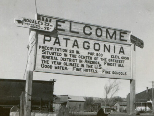
In the late 19th century, Patagonia, Arizona thrived as a mining hub, supporting silver, lead, and zinc operations in the Patagonia Mountains. The arrival of the New Mexico and Arizona Railroad in 1882 further cemented its role as a critical transportation and commerce hub. As mining waned in the early 20th century, the town evolved into a haven for artists, conservationists, and outdoor enthusiasts. Patagonia is located in the biodiverse Sonoita Creek Valley, home to one of Arizona’s few year-round streams and vital habitats for numerous species.
Arizona Trail / ~ Mile 3
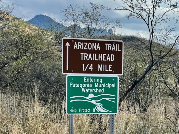
One of only 11 National Scenic Trails in America, the Arizona Trail (AZT) is an 800-mile-long non-motorized trail that traverses the state of Arizona. On May 27, 2024, Austin Killips set the new fastest known time (FKT) for completing this trail by bike, riding 800 miles through a wide range of landscapes in 8 days, 23 hours, and 27 minutes. Read her story here.
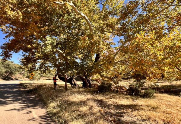
Spirit Tree / ~ Mile 4
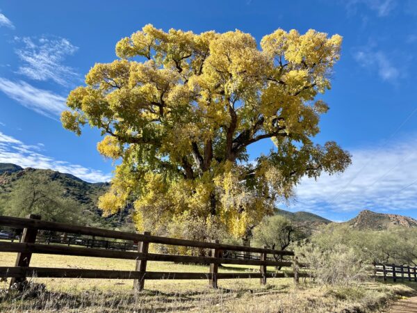
As you ride past the Spirit Tree Inn, you will see a massive Fremont Cottonwood tree . “It symbolizes what this special property is all about. Solid, deeply rooted in the earth, reaching up and out, it takes only what it needs from the environment and returns comfort and shelter to those who encounter it.
In the days before water came in plastic bottles, the sight of a cottonwood tree signaled the presence of precious water to those who lived in the southwest. It was known by many as “the water tree,” pointing to an oasis where life could be sustained and spirits refreshed.”
This is the namesake tree that the Spirit World Gavel Grinder event was named after.
Harshaw Creek / ~ Miles 1 - 13
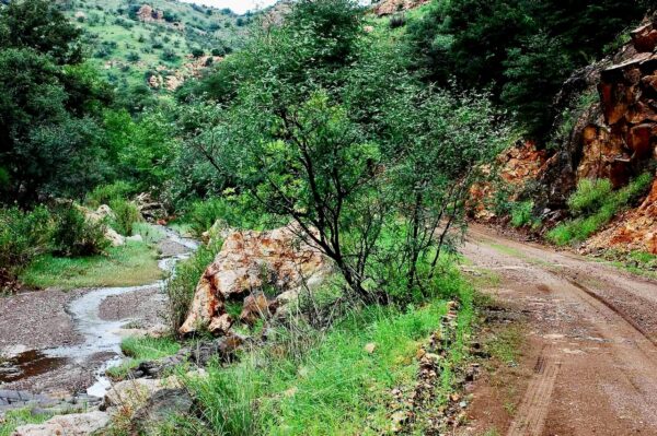
With giant cottonwood trees, a deeply burrowed canyon, and intriguing history, Harshaw Creek is primarily an ephemeral stream, sustained by groundwater during baseflow conditions and experiencing larger flows during storms. Large-scale mining activities began in the Harshaw Creek Basin in the mid-1800s and continued for about a century. These historic mining operations left behind waste rock piles, adits, and shafts, which contributed to environmental issues. In 2016, the U.S. Forest Service remediated the waste rock piles and addressed several adits and shafts to mitigate these impacts.
Harshaw Townsite / ~ Mile 10
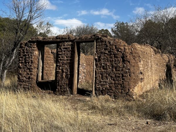
The ghost town of Harshaw offers a glimpse into the state’s mining past. Established in the late 19th century and named after prospector David Tecumseh Harshaw, the town flourished during Arizona’s silver boom, centered around the Hermosa Mill. By the 1880s, it boasted a thriving community with businesses, schools, and saloons, but the silver market crash led to its decline and eventual abandonment. Today, brick walls are all that remain to mark this once bustling town.
Giant Sycamore Trees / ~ Mile 10
Giant sycamore trees in Arizona, particularly the Arizona sycamore, are vital to the state’s riparian ecosystems, providing soil stabilization, water purification, and essential habitat for wildlife. Their broad canopies create cool microclimates in arid landscapes, and their striking white bark makes them iconic symbols of resilience in desert environments. As keystone species and indicators of riparian health, these trees play a crucial role in maintaining biodiversity and ecological balance in Arizona’s waterways.
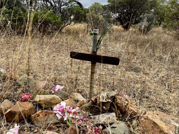
Harshaw Cemetery / ~ Mile 10
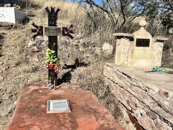
Originally from Placer, California, Angel Soto moved westward in the late 19th century, seeking opportunities in the mining industry. Settling in Harshaw with his wife, Josefa T. Soto, he became part of the community’s early development. Murdered by cattle rustlers in 1899, Angel Soto’s grave is one of the best-preserved markers in the Harshaw Cemetery and has become a poignant symbol of the town’s history. Soto’s grave, along with others marked by weathered headstones and simple markers, tells a story of resilience and the cultural heritage of the community that called Harshaw home.
Hermosa Mine / ~ Mile 11
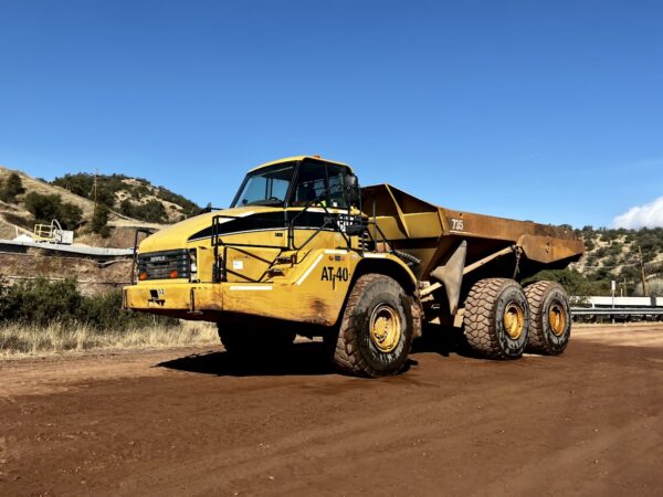
Large-scale silver mining operations ceased in this area when silver prices crashed in 1893. But in 2024, South32, “a globally diversified mining and metals company,” proposed reopening production mining for silver, zinc, and manganese. According to the company, “Hermosa has the potential to become a globally significant producer of metals critical for a low-carbon future.” Opponents of the project cite many threats from the mine, including over consumption of water, water pollution, and an estimated 591 million pounds of carbon dioxide pollution annually.
Matus Family Cemetery / ~ Mile 16
Cynthia Matus Morris was interviewed in 2011 by the Arizona State Library. In this interview, she talks about her family history through grandparents, their holiday celebrations, get-togethers with family, friends, and neighbors, and changes to the Patagonia region over the last 50 years. Her great-grandparents were Florentino Matus and Josefa Cruz, immigrants to the Harshaw area in the mid-1800’s. The Matus Family Cemetery, known to Cynthia as the Mowry Cemetery, stands to this day among the desert landscape.
San Rafael Valley / ~ Mile 18
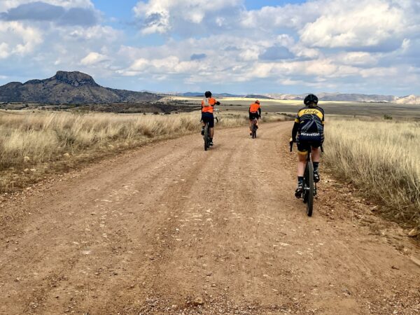
At mile 18, you drop into the western edge of the San Rafael Valley, a high-altitude grassland basin nestled between the Patagonia Mountains and the Huachuca Mountains. Recognized for its ecological significance, the 90,000 acre valley is a relatively undisturbed, intact, and un-fragmented landscape. Portions of the valley are protected through private ranching conservation easements and public land management, ensuring its unique character and biodiversity remain intact.
When We Like to Ride This
Fall to spring when the skies are clear and the temps are moderate. We would avoid this route in summer as it is very exposed to the sun. Wind could also make this route brutal. And … if it has recently rained, give it several days to let the roads dry, they are of a clay base and can turn into super sticky mud.
Terrain & Riding
The Mowry sector, named for an old mining ghost town, mile 14 to mile 19 ( ~ 5 miles) is unique to this route. This section is fast, slightly downhill, hard packed gravel riding. [Micro-video]. It starts in the cover of oak trees and gradually opens into views of the San Rafael Valley.
For a great overview of the riding in the Patagonia area, give a read to “Patagonia, A Gravel Utopia”, by Caffeine and Watts.
The route goes very near the Hermosa Project mine (~ mile 10). Yes, the project is controversial, but we encourage you as riders to be courteous and give way to mining trucks (i.e. stop and put a foot down). There are other and better forums for debating the merits of mining than on a gravel road.
Tricky turn to Matus cemetery.
The Start
Patagonia Town Park. Street side parking on McKeown Avenue. Flush toilets. Water.
Food & Water
- None.
Route Notes
Riding in the desert southwest is often very different from riding in Colorado or Oregon, with terrain that is noticeably more rugged and challenging. For tips and advice, check out our Resource Page: Riding in the Desert Southwest.
Specific to this route, most of the gravel roads in the San Rafael Valley are hard-packed and fast. However, over the last 5 to 7 years the roads (as most in southern Arizona) have become more rugged due to increased vehicular usage. Thus, our tire recommendations have changed to 50 mm+.
Many riders are finding this route more enjoyable in the opposite direction of what mapped here. Ride ti clockwise. That is because of the increased usage of the roads, more washboard, and the mining traffic. If you do the ride in the opposite direction, leave us a comment and let us know what you find.
The area is actively patrolled by Border Patrol. As a general rule, when we come across Border Patrol for the first time in the day, we stop and ask if “there’s anything we should be aware of” and we provide them our route.
Expect little cell phone coverage and to see a few vehicles on your journey. However, the area is dotted with active ranches, some weekend getaway homes, and dispersed campers. We have classfied the route as rural due, versus remote, due to all the activity in the area.
Route Options
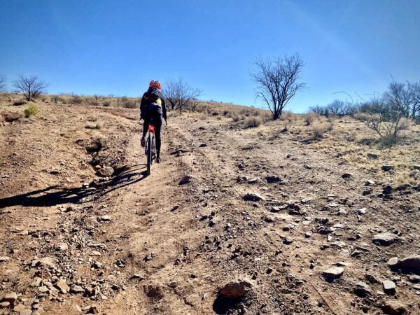
You can also add to this route by doing the Guajolote Flat extension (map, extension in black). This adds ~ 5 miles and 500+ feet of gain, giving ride totals of 33 miles and 2200 feet. This loop completely changes the character of the ride. It is remote, steep (20% pitches, two), loose, rocky and rutted. Best tackled with 50 mm tires or better. Captain O would do it again, Gravel Girl not so much. However, it has a couple of excellent viewpoints.
Love Where You Ride! Learn More
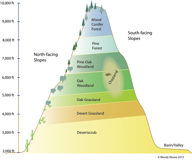 Patagonia, Arizona, sits in the Sonoita Valley, nestled between the Patagonia and Santa Cruz mountain ranges, part of the Sky Island region. Sky Islands are isolated mountain ranges in southeastern Arizona and northern Mexico. Some peaks rise over 6,000 feet above the desert floor, creating striking contrasts between the lush, cool mountain ecosystems and the arid deserts below. These mountains are called “islands” because their unique plants and animals cannot survive in the surrounding desert, making the desert like a “sea” around them. The Sky Islands host seven different biomes: desert scrub, desert grasslands, oak grasslands, oak woodlands, pine-oak woodlands, pine forest, and mixed conifer forests. (Click on image to right.)
Thye Sky Islands contain some of the most rugged and remote lands in the southwest and feature some of the highest levels of biodiversity in the world. More than 7,000 species of plants and animals—including over half of the birds in North America—can be found here. Other animals unique to the Sky Islands are the Mexican Spotted Owl, the Elegant Trogon, the Chiricahua Leopard Frog, the Mexican Fox Squirrel, the Jaguar and Ocelot, and the twin spotted rattlesnake.
Videos
The Ride! Patagonia 30
A quick 2-minute video of what to expect on your ride!
Sky Islands: What You Should Know
Learn the basics of the Sky Islands. Stuff you should really know! The geography, the lands, the plants, the animals. And their super-duper importance.
Be Informed!
Keep it Local! Learn More
Ridden and Reviewed by:


 Behind every route is scouting, mapping, storytelling, and a whole lot of pedal power.
Have you ridden this route? Got a question? Join the discussion!