Presumido Stage Stop
Permits Required. See Notes & Options tab (below) for more details.


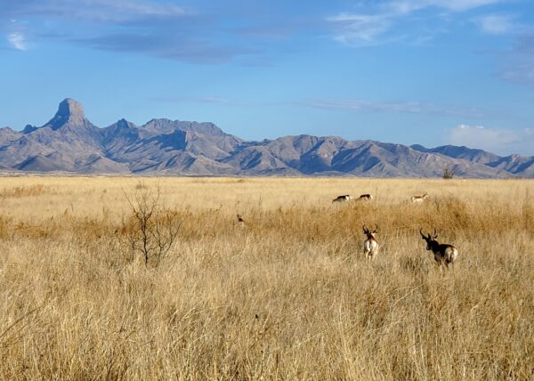
With a touch of imagination, this ride will take you back … way back. The Wild West era. Your destination is an original stage coach stop that is nestled into a canyon lined with tall saguaros. If only those cactus could talk, they sure could tell a story or two. For a bonus, you will see continuous views of the Baboquivari Peak with its own history. And you will ride through parts of the historic Santa Margarita Ranch, which means you will be dismounting your steady steed to open and close gates. With a touch of luck, you will see the pronghorn either at the start or finish, not too far from where you park at the Buenos Aires National Wildlife Visitor Center.
 Buenos Aires National Wildlife Refuge depends on a volunteers to staff the visitor center, do yearly bird counts, trash pick up, and general grounds work. The organization making this all happen is the Friends of Buenos Aires. Thus, when you visit we recommend stopping in at the Visitor Center and making a contribution to their organization, something like $10 per person. Let’s keep this place special!
Caution! We do not provide turn-by-turn directions in our GPX files. Those are auto-generated by your bike computer and are usually less than 70% accurate. Learn more.
For help loading a GPX file onto your bike computer, go here.
DownloadHighlights & Remarkable Spots
Buenos Aires Ranch / @ Start
Between 1909 to 1985, Buenos Aires Ranch changed ownership numerous times, becoming a prominent livestock operation in Arizona with award-winning quarter horses and purebred Brangus cattle. In 1985, the U.S. Secretary of the Interior declared Buenos Aires Ranch a national wildlife refuge, with a focus on protecting the endangered masked bobwhite. Since then, refuge personnel, biologists, volunteers, and collaborators have worked together to revive the native semidesert grasslands and reintroduce indigenous wildlife to their historic environment.
Mesquite Clearing / ~ Mile 3
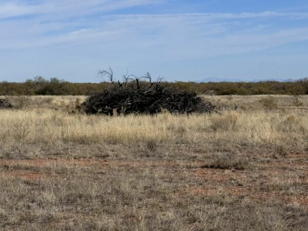
Historically, the Altar Valley thrived as grasslands with abundant pronghorn herds. However, with the emergence of settlements in the 1860s, the balance of the ecosystem was disrupted. Overgrazing stripped the land, and the disappearance of grass and the suppression of natural fires allowed mesquite to dominate. The Altar Valley Conservation Alliance is working on a mesquite clearing project on the semi-desert grassland in the southern portion of the Altar Valley. You may see piles of mesquite during your ride. [NPS]
Prickly Pear Cactus / ~ Mile 7
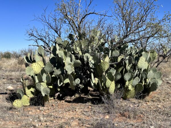
With over 180 species, prickly pear cactus thrive from southern Canada to Patagonia. Members of the cactus family, prickly pear are vital food sources for various animal species including deer, insects, birds, rodents, javelinas, and coyotes. These cacti have also been utilized since ancient times by humans, with at least 15 species extensively consumed by humans. The Aztecs selectively bred certain species over millennia, yielding spineless varieties with exceptionally sweet, high-sugar content fruits.
Soaptree Yucca / ~ Mile 8
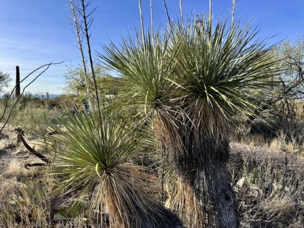
The Soaptree Yucca has a multitude of uses. Indigenous communities utilized the fiber from the leaves of this yucca species for a variety of items like sandals, belts, cloth, baskets, cords, and mats, while also consuming its flowers. Within the plant’s trunk and roots lies a soapy substance rich in saponins, historically employed as soap and shampoo. And, the flowers of the genus Yucca are the state flowers of New Mexico!
Ocotillo / ~ Mile 10
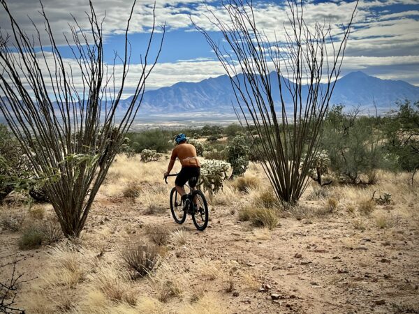
These large spiny plants are actually members of the shrub family. A long-lived desert plant, Ocotillos (oh-koh-TEE-yohs) have been known to reach over 100 years old. Pollinated primarily by carpenter bees and hummingbirds, this giant shrub blooms spectacularly during desert rains. The origins of the name in fact mean “torch” in Nahuatl, the language of the Aztecs, most likely due to the brilliant orange and reds of the blooms.
Saguaro Cactus / ~ Mile 11
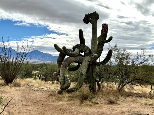
Saguaros, the largest cacti in the United States, can reach over 200 years in age. Their accordion-like ribs store hundreds of gallons of water during rainfall, stretching their skin to accommodate more water, increasing their weight substantially. A fully hydrated saguaro can exceed a ton in weight. If you encounter a saguaro with drooping arms instead of upright ones, it likely experienced freezing temperatures for over 36 hours, causing tissue damage and weakening the connection between the arm and main stem.
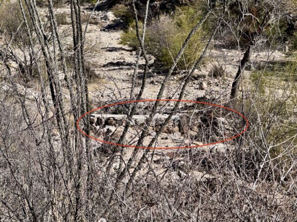
Stage Stop Ruins / ~ Mile 12
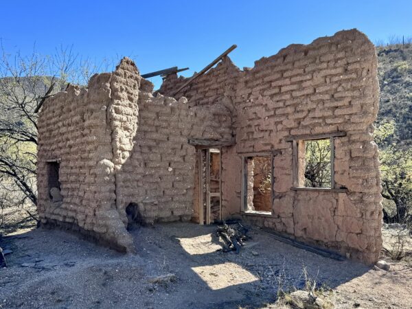
Local lore tells a story that William Sturgis built a hacienda during Rancho de la Osa’s prosperous cattle operations in the late 19th century. Sturgis wed a woman named Doña Leonora. She ran a trading post catering to the Tohono O’odham people. The legends speculate that these structures, situated just beyond tribal boundaries, are remnants of her trading post and a stage stop. [Rancho de la Osa]
Tohono O'odham Reservation / ~ Mile 12
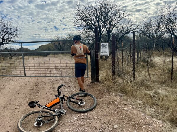
This gate signifies the transition onto reservation lands of the Tohono O’odham Nation, comprising approximately 28,000 members in Southwestern Arizona. Please do not ride beyond the gate.
The O’odham historically occupied a vast region known as Papagueria, spanning from Sonora, Mexico, to Central Arizona, and from the Gulf of California to the San Pedro River. Since the early 18th century, their land was subject to foreign rule, first by Mexico and then divided by the Gadsden Purchase of 1853 between the United States and Mexico. Despite promises by the United States to honor land rights under the Gadsden Purchase, the influx of settlers, mining, and railroad development led to the gradual loss of O’odham land.
Today, approximately nine O’odham communities in Mexico lie proximate to the southern edge of the Tohono O’odham Nation. Prior to 2020 and the building of the border wall the O’odham people were able to freely travel their lands.
Check Dams / ~ Miles 12.5 to 14
As you exit the ruins, examine the creek bed closely, you will notice several check dams. These structures have been constructed to manage erosion and to capture or decelerate the water’s movement during intense rainfall. This strategy encourages the growth of vegetation, which not only aids in further slowing and dispersing the flow of water during rainstorms but also contributes to the creation of more habitats for wildlife, provides feed for livestock, enhances erosion control, increases organic matter and soil fertility, and offers shade, cooling, and shelter for the high desert environment.
Desert Mistletoe / ~ Mile 17.7
Desert mistletoe has a native habitat spanning from the deserts of southern Nevada and California to central Baja California and southern Sonora in Mexico. Characterized by dense clusters of brittle stems, desert mistletoe relies on its host, typically mesquite, ironwood, and paloverde trees, for up to 80% of its carbon and all of its water and nutrients. Yet, being a parasite does not mean a species is lacking in positive qualities. It provides a crucial resource for Sonoran fauna in the fall and winter, particularly for the phainopepla, a crested black bird adapted to eating mistletoe berries.
At this mile mark, as you cross a wash, to your right is a distinct example of mistletoe hosting on an Ironwood tree.
Baboquivari Peak / ~ Mile 19
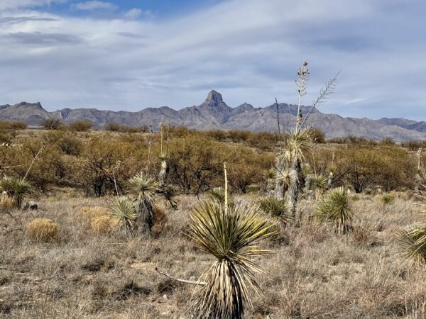
At an elevation of 7,730 feet, Baboquivari Peak holds profound significance for the Tohono O’odham people as their most sacred site. It serves as the focal point of their cosmology and is believed to be the dwelling place of their creator, I’itoi. According to tribal legend, I’itoi resides within a cave located beneath the mountain’s base.
When We Like to Ride This
This route “goes” year-round. However, the summer months can be very hot!
Terrain & Riding
The Terrain
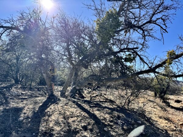
This is one of the most beautiful desert canyons we have ridden. Presumido is slang for “to boast or be boastful”. A great description for this ride. Expect a diversity of landscapes. From grasslands with mesquite trees, to hills with saguaro and ocotillo cactus, and Presumido canyon with scattered oak trees.
The Riding
Expect everything from fast hard-packed gravel to rugged jeep track with loose rock and washouts.
There are several short steep pitches of 10, 12, and 15% gradients. The longest climb of the ride is leaving the stage stop ruins to the top of Presumido Canyon, 660 feet of gain over 3.8 miles with an average pitch just over 3%.
The Start
Water. Flush toilets.
Food & Water
- None
Route Notes
Two different permits are required for the ride: an Arizona State Land permit (~ $20 for full year access) and a Santa Margarita Ranch Access Pass (no fee). Please be responsible and obtain the permits/access passes.
You may encounter Border Patrol on your ride. We did.
On each and every ride, when we first encounter Border Patrol we stop and talk with them. We ask: “Is there anything we should know about that may be going on in the area?” They cannot tell you not to ride, but they can “hint” that it may not be the best day to ride. If we sense this, we leave the ride for another day. Also, we let Border Patrol know our route and ask them to pass this information along to other agents that may be in the area.
Gates. Leave them as you found them. If closed, close the gate. If open, leave open. This is customary ranch practice. There are 5 gates in a several mile span.
This is a ride where having a group is better; for crossing through the gates and for safety. The canyon, in spots is narrow, encroaching and with limited sight lines. It can feel a bit spooky. To leverage off the safety in numbers principle, keep your riding group together. Maybe no more than 100 yards from first rider to last.
You can do this ride with less tire. If you are super skilled technically, you could get by with a 40 mm tire. But … the ride will be more harsh.
Love Where You Ride! Learn More
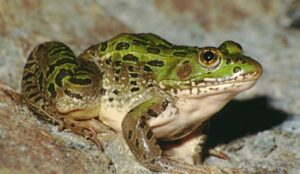
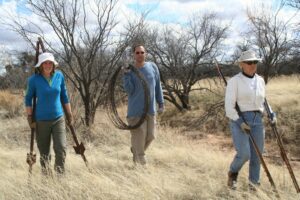
At Buenos Aires National Wildlife Refuge, a collaborative effort aims to save the Chiricahua leopard frog. Threatened by habitat loss and invasive species like bullfrogs, researchers are catching and tagging these frogs to study their movements and life cycle. They play a vital role in the ecosystem, including as prey for various animals. During breeding season (April-September), their distinctive snoring-like calls can be heard as they migrate up to 8 miles in search of suitable ponds. Remember to brake for frogs on the roads during the rainy season! During your time in this area, make sure to go into the Visitor Center.
Videos
The Ride! Presumido Stage Stop
A quick 3-minute video of what to expect on your ride!
Keep it Local! Learn More
Ridden and Reviewed by:


 Behind every route is scouting, mapping, storytelling, and a whole lot of pedal power.
Have you ridden this route? Got a question? Join the discussion!