Winchuck Wicked


Caution! We do not provide turn-by-turn directions in our GPX files. Those are auto-generated by your bike computer and are usually less than 70% accurate. Learn more.
For help loading a GPX file onto your bike computer, go here.
DownloadHighlights & Remarkable Spots
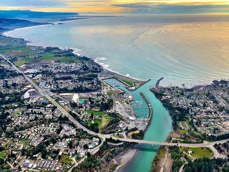
Brookings-Harbor / Mile 0
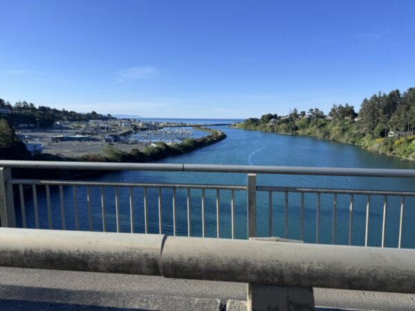
The harbor in Brookings, Oregon, is uniquely positioned with a south-facing orientation, providing natural protection from harsh ocean conditions. This alignment, combined with the shelter offered by the Chetco River’s mouth and strategically placed jetties, creates a calm and secure environment for boats.
The harbor was built in 1912 by the Brookings Lumber and Box Company, which also founded the town of Brookings. The initial construction included a deep-water harbor and a wharf completed in 1917.
Harbor Brookings Bench / ~ Mile 1.5
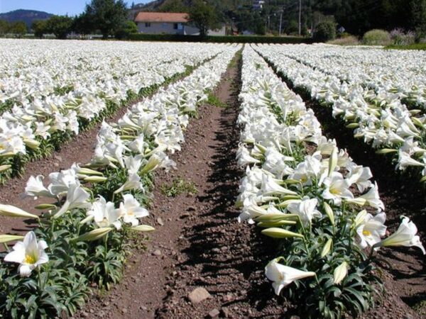
Nestled along the Pacific Coast at the Oregon-California border lies the Easter Lily Capital of the World. This unique region, spanning the Harbor-Brookings bench in Oregon and Smith River in California, produces over 95% of the world’s potted Easter Lily bulbs. The industry began in 1919 when Louis Houghton brought hybrid lily bulbs to the region. During World War II, Japan’s dominance in Easter Lily bulb exports was disrupted, cutting off U.S. supplies. Local growers stepped in, and the region’s ideal climate and rich soils proved perfect for cultivation for growing these iconic trumpet-shaped flowers. Today, ten dedicated farms ensure these iconic flowers brighten homes worldwide.
Winchuck River / ~ Miles 4.5 to 11.5
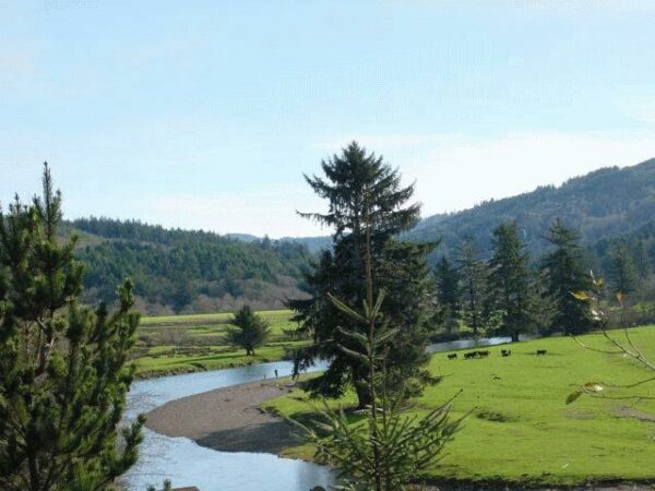
The Winchuck is the southernmost river on Oregon’s coast and one of many important salmon streams that flow out of the Siskiyou Mountains. It is also home to most of Oregon’s last remaining ancient redwood forests. Though small by Oregon standards, the Winchuck’s 71-square-mile watershed is an important coastal fishery, supporting healthy runs of steelhead, sea-run cutthroat trout, chinook, and coho salmon.
J.P. Wheeler gravesite / ~ Mile 12
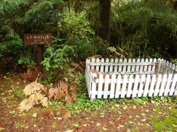
At mile 12, you’ll come across the gravesite of J.P. Wheeler, one of the first white settlers in the Winchuck Valley. Wheeler passed away in 1903 at the age of 63. His homestead was located several miles northeast of this site, across Wheeler Creek from the present-day Ludlum House. The homestead’s location is now marked by an old apple orchard.
Mt Emily / ~ Mile 17
Mount Emily is a 2,926-foot peak in the southern Oregon Coast Range. Known for its scenic views and lush forests, it also holds a unique place in history. During World War II, it became the target of an incendiary bomb dropped by a Japanese plane on September 9, 1942—the first air raid on mainland America. The bomb, intended to ignite forest fires, caused little damage due to damp conditions. Decades later, the pilot, Nobuo Fujita, visited Brookings, offering an apology and donating his family’s samurai sword as a gesture of reconciliation. The site of the bombing is the destination of another Dirty Freehub ride, The Bombsite.
Mt. Chetco / ~ Mile 17
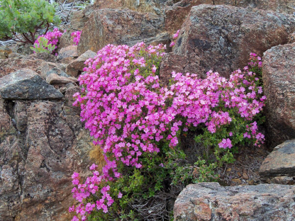
Chetco Peak, a 4,618-foot summit in southwestern Oregon, is located within the ecologically diverse Kalmiopsis Wilderness, an area that boasts unique plant life, including the rare Kalmiopsis leachiana.
The Kalmiopsis leachiana is considered one of the most primitive members of the heath family (Ericaceae), which includes well-known plants like rhododendrons, blueberries, and cranberries. Its designation as a “primitive” plant is due to its ancient lineage, which dates back to the Cretaceous Period (approximately 145 to 66 million years ago), and its distinct evolutionary traits that connect it to some of the earliest flowering plants (angiosperms).
Chetco River / ~ Miles 21.5 to 27.5
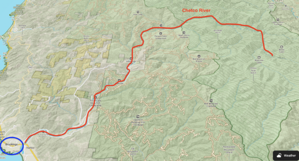
Over its 55.5-mile length, the Chetco drops from 3,700 feet to sea-level as it empties into the Pacific Ocean between the towns of Brookings and Harbor, about five miles north of the California border. In the upper section, the river floor is fairly narrow and boulder-strewn with numerous falls and rapids. As the river leaves the wilderness, its character gradually changes. The terrain becomes less dissected, the river gradient gradually becomes less steep, the river bottom widens, and the surrounding hills become more densely forested. The upper 45 miles of the river have been designated Wild and Scenic since 1988. (Click on map to left.)
Chetco Indian History Kiosk / ~ 27.5
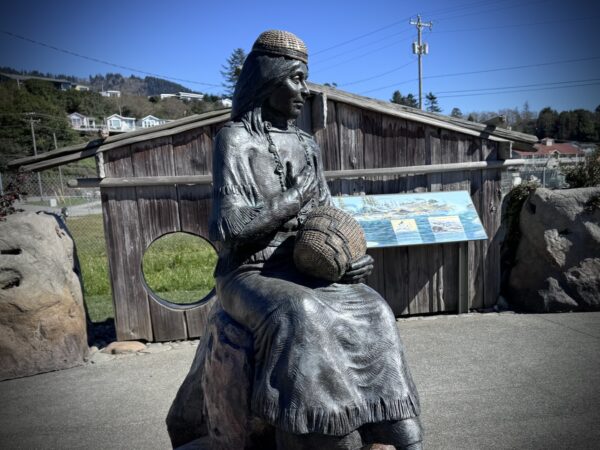
Near the end of the ride, there is small sign pointing towards the harbor and a display of Chetco Indian history. We recommend that you go and spend a few minutes. “In 1856, the U.S. Army forcibly removed the Chetco people to the Siletz Reservation. The Chetco had to travel two hundred miles north over rough terrain and swim the rivers with their children and elderly in tow. Some were abused by soldiers, and many died on the long, grueling march. Families were not allowed to stop to bury their loved ones and were forced to keep moving. The journey brought heartbreak and trauma to those who survived. [On-site kiosk]
Credits & Acknowledgements
This route was funded in part by a grant from the Oregon Coast Visitors Association.
When We Like to Ride This
This route will go most of the year. We prefer a sunny day with light winds. During summer, early mornings can be particularly magical, with coastal fog lifting and sunlight streaming through the tree canopy along the gravel sector.
Terrain & Riding
Harbor Brookings Bench Sector / Mile 0 to 4
This sector is flat and on smooth pavement. The road does not have a shoulder but when we rode it there was very little traffic. This sector is filled with farm fields and frequent coastal views.
Winchuck Road Sector / Miles 4 to 12
Similar to the first sector, Winchuck Road has good pavement, no shoulder and light traffic. There are some small rollers and one climb with an average grade of 2.5% over three quarters of a mile with a maximum gradient of 10%. You will have frequent views of the Winchuck River to the right as you ride past farm pastures and into the woodlands.
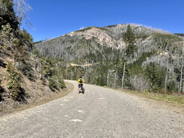
Rogue River-Siskiyou National Forest Gravel Sector / Miles 12 to 21
The biggest challenge of the day comes soon after you turn onto NF 010. You start out on pavement but once you hit gravel the road pitches steeply up. The climb ascends 1,300 feet over the next 3 miles at an average gradient of 9% with a maximum grade of 20%. The gravel is good and generally doesn’t make the challenge harder.
At approximately mile 17 your efforts are rewarded with views of the Coast Range Mountains including Mount Emily to the north and Chetco Peak to the northeast. At mile 18 a gentler climb rises up ascending 80 feet over a little under a mile at an average grade of 2% and a maximum grade of 8%.
The descent to the Chetco River begins in earnest at mile 18 and continues until approximately mile 21. The maximum gradient on the descent is 11% and the gravel continues to be mostly good.
This sector lies entirely within the Rogue River-Siskiyou National Forest, offering a diverse mix of tree species. You’ll encounter pine, fir, and cedar trees, along with deciduous species like bigleaf maples and white and black oak. Most of the trees are mid-growth, indicative of past logged areas. You’ll also pass through several recently logged areas, which open up the landscape and provide distant vista views of the surrounding mountains.
Chetco River Sector / Miles 21.5 to Finish
As you ride west along the Chetco River, you’ll roll up and down with 450 feet of climbing and 550 feet of descent, all on paved roads. While the pavement is mostly in good condition, there are a few areas where the road has slipped or sunk.
This rural stretch is dotted with small farms and homes, with the Chetco River flowing to your right. The road is framed by bigleaf maples and pines.
Once you return to the harbor, take a short detour to visit the Chetco Indian kiosk. Yes, this is worth your time!
The Start
Brookings Harbor / Beachfront park. Flush toilets.
Food & Water
- None
Route Notes
We recommend a red blinky light with a looking radar detector for this route. Something like a Garmin Varia.
During your ride, you may encounter active timber harvesting operations. To ensure your safety, the safety of the timber workers, and to avoid conflicts, please familiarize yourself with the following guidelines .
Signs of Active Logging:
– Signage (i.e. CB channels, mile markers, etc.)
– Gates open
– Tire tracks
– Fresh gravel in-lay
– Brushing and mowing alongside the road
– Orange ribbon marking road obstacles or hazards
– NoiseWhat You Should Do as a Cyclists:
– Remember that hauling log trucks always have the right of way! Uphill or downhill.
– Move to side of road. Stop, put a foot down. Wave!
– Use lights. A flashing white front light and a red flashing rear light with radar detector (Garmin Varia, Trek CarBack)
– Do not over ride your sight lines.
– Keep your group size small and together; reducing your riding footprint.
– Listen and be observant.Lastly, when access is temporarily closed, do not “sneak through”. Logging operators are not trying to keep you out, they are trying to keep you safe. And they may keep you out, to keep you safe.
Route Options
This route can be ridden in either direction—counterclockwise (as mapped) or clockwise. The counterclockwise route offers the best views but the climbing is more difficult. When deciding which direction to ride, be sure to check the coastal winds. We recommend riding with the wind if it’s strong.
If you’re using an e-bike, we don’t recommend the clockwise direction due to the steep descent on Forest Road 010.
Longer
The route can be added onto the last leg of The Bombsite route to create a proper loop. We call this the Bombsite Wicked ride: 55 miles, 6800 feet of gain, 65% gravel. Note, this ride is mapped in the clockwise direction, but could be ridden in either direction.
- Route: Bombsite Wicked
- GPX File: Download
- Start: Same as Winchuck Wicked
Love Where You Ride! Learn More
 Brookings has evolved from its early roots as a timber town into a dynamic coastal destination. While the town’s origins are closely tied to the Brookings Lumber and Box Company, its modern identity reflects a remarkable ability to adapt and diversify.
The town’s harbor has long been central to its development. Initially serving as a hub for shipping lumber, the port later became a cornerstone of the local economy through commercial and recreational fishing, particularly for salmon and crab. As the timber industry declined in the mid-20th century, Brookings embraced new opportunities, turning to tourism and agriculture as key economic drivers.
The Port of Brookings Harbor is one of the most active recreational fishing hubs on the Oregon Coast, drawing anglers and visitors alike. Nearby Harris Beach State Park offers dramatic coastal views, tidepools, and opportunities to experience the region’s rich natural heritage.
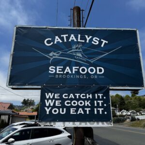
Keep it Local! Learn More
Related Guidebook
Ridden and Reviewed by:


 Behind every route is scouting, mapping, storytelling, and a whole lot of pedal power.
Have you ridden this route? Got a question? Join the discussion!