Tum Tum
Starker Forest permit required. See the Notes tab for details.


Caution! We do not provide turn-by-turn directions in our GPX files. Those are auto-generated by your bike computer and are usually less than 70% accurate. Learn more.
For help loading a GPX file onto your bike computer, go here.
DownloadHighlights & Remarkable Spots
Mary's River / ~ mile 6.4, 12.4, 15.7, and 33.7
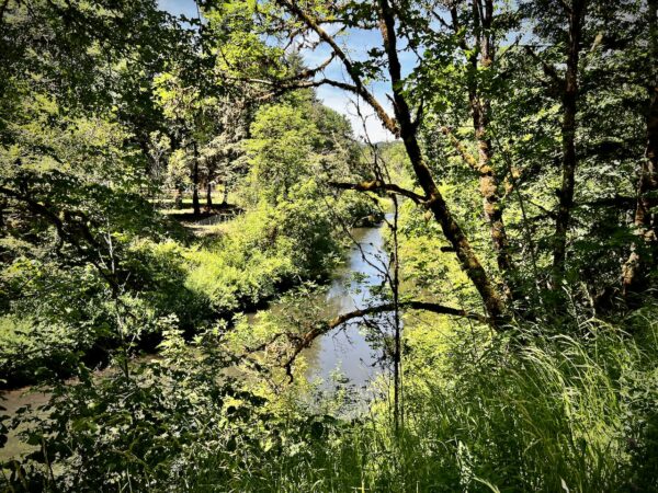
The Mary’s River is crossed multiple times along the route. In 1847, Joseph C. Avery began laying out a town at the confluence of Marys River with the Willamette River, and the place was called Marysville. In 1853, the legislature changed the name of the town to Corvallis, a compounding of Latin words meaning heart of the valley.[Wikipedia]
Cardwell Hill Cellars / ~ Mile 8

Cardwell Hill Cellars is a certified sustainable agriculture vineyard. They compost and work back into the soil all grape skins, seeds and stems; annual planting of cover crops provides additional natural organic matter. At the end of each season, the canes are cut back and mulched with a special machine to enhance the rate of decay, thus adding nutrients back into the soil.
In accordance with biodynamic standards, the vineyard is dry farmed; that is, there is no irrigation systems. Each vine develops an extensive root system that seeks out underground moisture and mineral uptake. The root system stops growing when it has achieved just the right level of water uptake.
Historic Log / ~ Mile 12.2
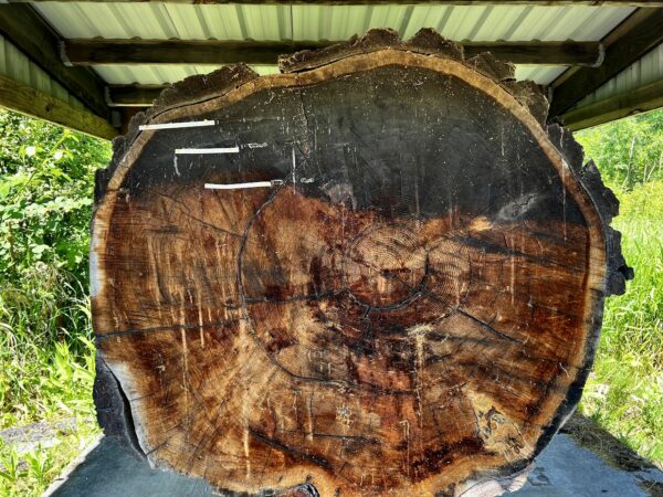
Just before the Harris Bridge, on the left side of the road, is a section of log from a living tree in the area that is ~ 500 years old. Marked on the rings of the log are the Declaration of Independence, the assassination of Abraham Lincoln, and Charles Lindbergh’s solo non-stop transatlantic flight.
Harris Covered Bridge / ~ Mile 12.3
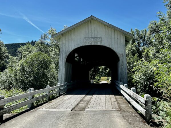
The bridge was built by H. W. Fiedler circa 1930. The bridge has a rounded portal design, narrow windows below the roofline to light the bridge interior, and longitudinal deck planks. The siding is board and batten style, and the roof is shingled. Covers over bridges were designed to protect the bridge itself. Constant exposure to sun, snow, and rain left wooden bridges with a useful life of about a decade.
"Feuerstein's Castle" & Eclectic Art / ~ Mile 17.2
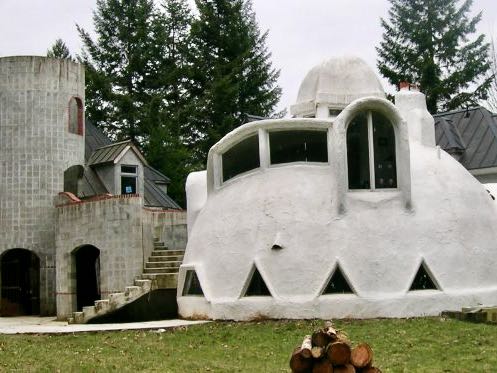
A series of eclectic art pieces and a unique private home owned by Gary Feuerstein, an architectural engineer. If you have further information about this home, we would love to hear from you!
C2C Trail / ~ Miles 22 to 32
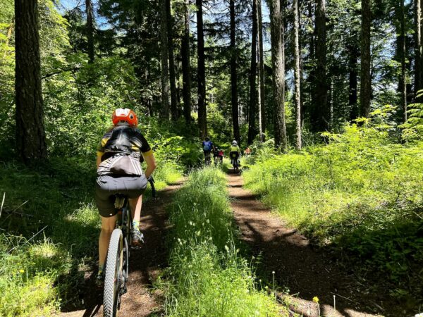
The Corvallis-to-the-Sea (C2C) Trail links the Willamette Valley to the Pacific Ocean. It provides an opportunity to enjoy the Oregon Coast Range by foot or bike. You will experience deep forests and open vistas; a wide variety of trees, shrubs, and flowers; signs and sounds of wildlife; and activities associated with local economies and timberland management.
Credits & Acknowledgements
Route and research By Nelson Binggeli of Mid-Valley Backroads Bicycling. Writing and media by Kevin English of Dirty Freehub.
When We Like to Ride This
This route rides most of the year, but spring and fall are special. The Mulkey Ridge trail, miles 1 to 5.5, is closed to bikes between October 31 and April 15. During those times use the Cardwell Hill Wagon Road option detailed in the “Notes & Options” section.
Terrain & Riding
The terrain is a mix of classic Coast Range forest, timberlands, Christmas tree farms, vineyards, grazing lands, and hay fields. The riding is a mix of wide single-track trails, hard-packed gravel roads, loamy logging roads, double-track, and paved bike path. Expect Classic Coast Range pitchy rollers and undulators at grades exceeding 10%, but never too long. At times the route is rural; at other times, it feels remote.
In the first 4.5 miles, you will gain 1000 feet on beautiful but pitchy single-track. Be ready! At ~ mile 18, you reach the longest and most sustained climb of the day, the Tum Tum climb. 5 miles with 1200 feet of gain. But, halfway through, you get a short respite.
The Start
Benton County Fairgrounds. Dirt parking lot. The route starts from the southwest corner. (An alternative start that we really like is Mary’s River Park in Philomath.)
Food & Water
- ~ Mile 34.5 / Town of Philomath
Route Notes
A Starker Forest permit is required. Permits are available by phone by calling 541-929-2477. If you are getting a permit for the first time, you must visit their office (7240 SW Philomath Boulevard) to view the map and review the rules and regulations.
We recommend a red blinky light with rear looking radar detector (i.e. Garmin Varia) for the paved sectors.
Route Options
The Mulkey ridge trail sector (miles 1 to 5) is closed to bikes between October 31 and April 15. But, you can still ride most of the route using Cardwell Hill Wagon Road as an alternative.
Videos
The Ride! Tum Tum
A quick 2-minute video of what to expect on your ride!
Podcasts
Single-Track Trail Etiquette (Who has the right of way?)
Ever wonder who has right of way on those single-track trails? Downhill rider? Uphill rider? The runner? Who? In this episode of The Connection, we speak with Emmy Andrews the Executive Director of the Central Oregon Trails [...]

 Behind every route is scouting, mapping, storytelling, and a whole lot of pedal power.
Have you ridden this route? Got a question? Join the discussion!