Lost!


Caution! We do not provide turn-by-turn directions in our GPX files. Those are auto-generated by your bike computer and are usually less than 70% accurate. Learn more.
For help loading a GPX file onto your bike computer, go here.
DownloadWhen We Like to Ride This
This is a ride we really like to do when the skies are clear and the views are big. The route tops out at 3700 feet, thus there may be that exceptional day in the winter when the route would go. But … for sure, there are spring and fall days that would be splendid along with many summer days.
Terrain & Riding
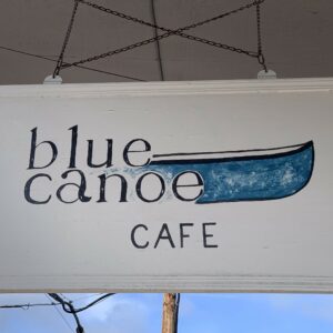
The route starts in the agricultural town of Parkdale, which has a gas station, supermarket, pub, barbecue spot, and a super awesome coffee shop. There’s also a museum and a historic hotel.
After your morning coffee at the Blue Canoe, the ride begins by an easy winding downhill paralleling Trout Creek (850 feet lost in 5.5. miles). At Dee you make a hard left turn and begin climbing through orchards with Mt Hood looming in the background. At mile 10.5 your turn left onto the first of many forest service roads for the day. As you go, the roads just keep getting smaller and smaller.
At mile 15 your veer left onto Lake Branch road, which is a single lane road with turnouts that cuts deep into the forest. In 8 miles you reach the famous Lost Lake. Fingers crossed you can see the mountain which doesn’t appear until you bike past the general store and to the end of the parking area. Do not skip this; your Facebook fans need another picture of you with a bike helmet and an amazing backdrop.
Turn around, fuel up at the general store because you have some big climbing coming up. But first …
… the little road! Continue through camping area, keep going until you hit a huge log and boulders blocking the road. Crawl over the log and boulders (ok you can sneak around them) and continue on this narrow path / road. Eventually you end up on a gravel / paved logging road with “sweet” views of Mt Hood.
After several miles and a drop in elevation, you intersect Lost Lake Road. Get into the drops and ride the 1 mile descent to the next Forest Service road, NF-18, a sharp right. Drop a bit more until you cross the West Fork of the Hood River. Now, begin the 2000 ft climb to Vista Ridge. The climb is of stair-stepped fashion giving you short flat areas of recovery, but as you climb each of these flat is shorter and shorter in distance.
At ~ mile 41 the ridge is gained and the road undulates up and down for the next 8 miles with mile 41 and mile 49 being at nearly the same elevation of 3600 feet. The ridge offers up distant views of Mt. Adams and final “in your face” view of Mt. Hood. Now, test your brakes and get ready for the Red Hill descent (a drop of 1700 feet in just under 5 miles for an average gradient of 6.4%).
It’s a bombing downhill that twists and turns with distant views of Parkdale Lava flow. You will twist one way to see Mt Adams, the opposite way to Mt Hood. Eventually you end up back in the orchards … and back to Parkdale.
Now the decision is, do you hit the barbecue place or the brewery! Or back for more food at the Blue Canoe. (The brewery has tremendous outdoor seating in the back, in case you didn’t get enough big views of Mt Hood.)
The Start
Red Barn park in Parkdale. Parking is along side Clear Creek road. Water & Flush toilets.
Food & Water
- ~ Mile 23: Lost Lake General Store
Route Notes
This route route has very little, true gravel road. Maybe 5 miles or so. But there are ~ 20 miles of paved forest service roads that have areas of broken pavement, dips / depressions, and washouts. Thus, we recommend a gravel bike, with at least a 32 mm tire up to a 40 mm tire.
Also, this route is easy to modify and turn into either a loop or a a lollipop. Look at mile 10 and you will see a road that lets you cut back to your original road. This means you can adjust accordingly. (The best part is going out to Lost Lake.).


 Behind every route is scouting, mapping, storytelling, and a whole lot of pedal power.
Have you ridden this route? Got a question? Join the discussion!