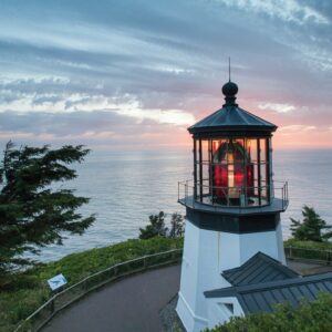
CheddarHead

")

")
")


")


Caution! We do not provide turn-by-turn directions in our GPX files. Those are auto-generated by your bike computer and are usually less than 70% accurate. Learn more.
For help loading a GPX file onto your bike computer, go here.
DownloadHighlights & Remarkable Spots
Dairy Lands / Tillamook Cooperative / ~ Miles 0 to 9

Holstein cows, with their distinctive black and white markings, are what most people picture when thinking of dairy cows. These iconic cattle make up the majority of Tillamook County’s cow population, accounting for about 60%. Jersey cows are the second most common, representing roughly 30% of the local dairy cows. They typically have a light brown or fawn-colored coat, ranging from a pale tan to a deeper reddish-brown. Keep an eye on the dairy cattle as you pedal by and see if you can identify the Holsteins versus Jerseys.
Trask River / ~ Miles 9 to 15
The Trask River is one of five coastal rivers that flow into Tillamook Bay. These rivers, which include the Wilson, Kilchis, Miami, and Tillamook, contribute to the area’s mild climate. During your journey, you’ll ride alongside three of these rivers: the Trask, Wilson, and Kilchis.
The Trask River, like many coastal waterways, is renowned for its steelhead and salmon migrations. However, these fish populations are at risk due to habitat loss, a common issue in coastal river systems. The Trask River Fish Hatchery (at ~ mile 8.8, but on the other side of the river) helps address this threat and maintain fish numbers. The hatchery is open to the public and would make an interesting side trip. Directions.
Tillamook State Forest / ~ Miles 16 to 83
Spanning 364,000 acres, it is a testament to resilience and regeneration. Between 1933 and 1951, a series of devastating wildfires, known as the Tillamook Burn, ravaged the area. In response, one of the largest replanting efforts in U.S. history was launched. From 1949 to 1972, a billion Douglas-fir seeds were dropped from helicopters, and over 72 million seedlings were planted by hand, with about a million planted by young volunteers. In 1973, Oregon Governor Tom McCall officially designated “The Burn” a State Forest.
Today, it boasts diverse ecosystems, including old-growth stands, salmon-bearing streams, and rugged coastal mountains. Oregonians should care about this forest because it serves multiple crucial functions: it’s a vital carbon sink, helps maintain water quality, provides habitat for numerous wildlife species, offers extensive recreational opportunities and supports local economies through timber production. [Wikipedia]
Wilson River Toll Road / ~ Miles 44 to 55
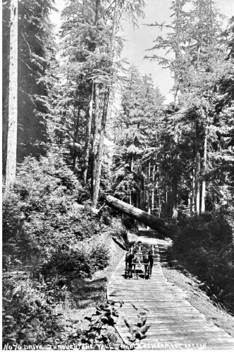
Several times in this sector, you ride the old Wilson River Toll road that opened in 1893. People from Forest Grove and Portland traveled to the Wilson River to find peace, solitude, and a connection to nature.
“The first night our necks ached with constant looking up. The big trunks of these conifers, single or in groups, rise majestically like pillars in a mighty cathedral. At night, through the opening in their foliage, burn the stars with a brightness enhanced by their dark setting … dining room, kitchen, and pantry are wholly under the sky, and the two tents serve as bedrooms.” Travellers diary. [On site kiosk]
Smith Homestead / ~ Mile 55
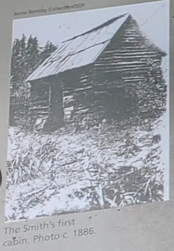
This area was homesteaded in 1886 by Walter and Alice Smith. To get to the homestead area, you will need to cross the Wilson River by bridge. A 0.1 course deviation.
The Smith’s first winter was especially cold and harsh, and their food supply ran out. Snowed in and faced with starvation, they felled a cedar tree on the homestead and hand carved a canoe to carry them down the Wilson River to Tillamook. The children were three and one, and Alice was pregnant with Toby. The family battled the icy river and dangerous rapids, but the canoe held and they made it safely to Tillamook two and a half days later. [On-site kiosk]
Tillamook State Forest Visitor Center / ~ Mile 56
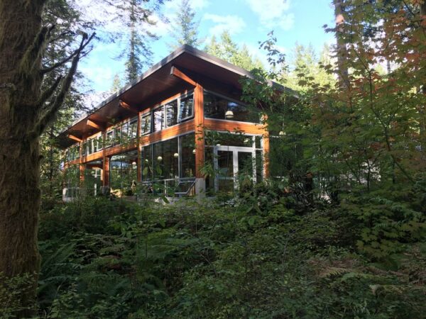
What a great resource this is! Whether you do a detour enroute or you stop in later, the Tillamook State Forest Visitor Center is a must visit site on your Tillamook trip.
To learn all it has to offer, from organized programs, exhibits, and events to self-guided visits, check out its fantastic website and plan your stop on your Tillamook adventure.
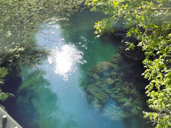
Hidden Waterfall / ~ Mile 71
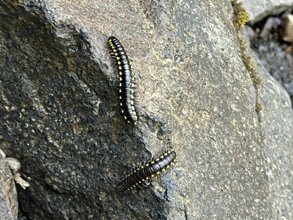
We will save the “WOW” factor of this waterfall for that moment when you turn the corner and come across it on your bike ride. Instead, let’s draw your attention to what you will find at the foot of the falls. Thousands of little crawlies known as the yellow-spotted millipede. This critter is critical to the health of PNW forests. They eat decaying material and excrete it as highly bio-available matter that contributes to the soil ecology. But there is something cooler still about them. Those bright yellow spots mean “stay away! I am toxic.” These guys exude cyanide as a defense mechanism. Not enough to seriously hurt humans but you should still just admire them from a distance and leave them alone to play their role in forest health. *Read the linked article. It is fascinating!*
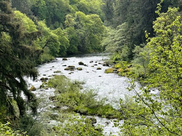
Kilchis River Viewpoint / ~ Miles 76 - 85
The river is named after Kilchis, one of the most well-known figures among the Tillamook people. Kilchis was a large man with some African features, known for his exceptional skill in resolving conflicts. He claimed to be a descendant of a crew member from the Spanish treasure ship the Manila galleon Santo Cristo de Burgos that wrecked in 1693 on Nehalem Spit, referred to as the Beeswax wreck. White settlers often referred to him as ‘Chief Kilchis’, and it is recorded that he was the leader of the Tillamook people in the early to mid-1800s.
Return to Dairy lands / ~ Miles 85 - 91
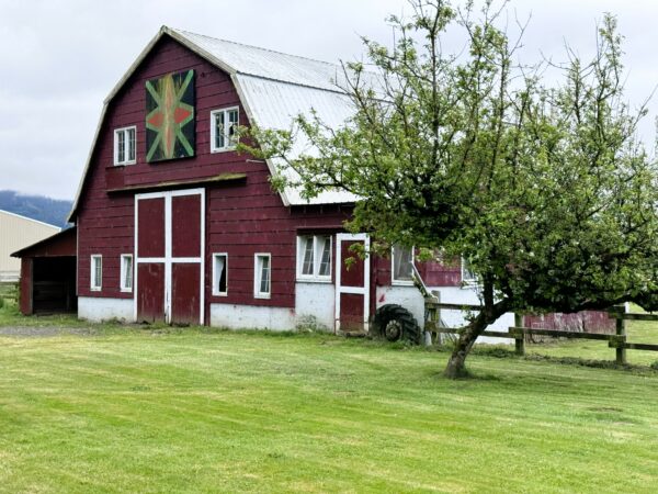
Keep an eye out for barns sporting quilt blocks. These buildings are part of Tillamook’s Quilt Trail. There are 104 of these quilt blocks in total and are part of a self-guided tour you can do as a fun post-ride activity.
Credits & Acknowledgements
This route is a variation of the Odyssey of the VOG Northern Tier Weekender bikepacking route by Seth and Ben. Seth and Ben are the sole creators of the Odyssey of the VOG Triple Crown of routes. They spent hundreds of hours pouring over maps, riding into dead ends and rerouting, checking in with timber companies about land use, and the list goes on. A very special thanks to them for allowing us to share out this variation of their work!
This ride guide is funded in part by the Oregon Coast Visitors Association.
When We Like to Ride This
Anytime the weather allows it; in the springtime when everything is in bloom, in the summer when it is shady and lush, or in the fall when the maples and alders are a riot of color.
Do not ride when wet. Muddy. Slippery roots.
Terrain & Riding
Dairy Lands / ~ Miles 0 to 9
- Green pastures, farms & cows.
- Paved roads.
- Some traffic.
Trask River Sector / ~ Miles 9 to 15
- Parallel Trask River. Scenic.
- Smooth, undulating paved road with rollers.
- Some traffic.
Tillamook Forest Timberlands Sector / ~ Miles 15 to 43
- Terrain
- Actively managed forest. From recently harvested clear-cut areas to early and mid-growth sections, and stands of tall, thick mature trees.
- Some ridge riding with open sweeping views.
- Beautiful crossing of Jordan Creek at ~ mile x.
- End of sector marked by following the South Fork of the Wilson River for 2.5 miles.
- Climbs and Descents
- Hembre Ridge Climb (~ mile 14.5): Sustained at 8% for 4.5 miles, 1900 feet. A significant climb, but not the most difficult of the ride.
- Hembre Ridge Descent (~ mile 26): Very steep! -15% gradient for 3.0 miles. Can be loose.
- Endless Bummer Hill (~ mile 30): Named for a road in the area. +15% gradients. Average 8% grade for 3 miles.
Wilson River Trail / ~ Miles 43 to 64
- Terrain
- Gorgeous scenery: deep green forest, ferns, mossy trees, creeks.
- Very spectacular at mid day when the sun is to your back, the shadows big, and the light darting between the trees.
- Riding
- This sector is the crux of the ride. It is very demanding and slow going. ~ 4 to 7 mph moving speed.
- Multiple, shallow creek crossings.
- Expect some hike-a-bike. It unavoidable even for strong, technical riders. Varies from short stream crossings to a 1/2 mile.
- At times, there is a significant drop (i.e., exposure) on left edge. A fall could have serious consequences.
- In places, dense ground foliage obscures trail.
- Two challenging climbs with gradients in excess of 20%. The first is short at 0.25 miles in length. The second is nearly 2 miles in length.
- Recommend downloading the Wilson River Trail map.
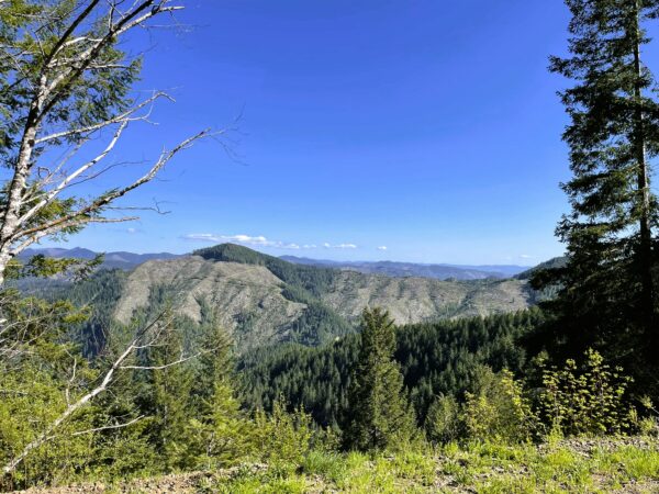
Cedar Butte Climb / ~ Miles 64 to 69
- Exceptional vista views.
- A 5-mile climb with a sustained average of 4.5%.
- The first 0.5 miles is very steep, sustained gradient 12%.
Kilchis River Road / ~ Miles 69 to 88
- The road is smooth dirt/gravel, descending at a 3% average gradient over 19 miles, making for easy and quick spinning. Big smiles!
- At the waterfall, you leave behind recently harvested timberlands and begin the Kilchis River corridor. Highly scenic. You have Red Alders, Big Leaf Maples, the rushing river and lush dense forest.
- Numerous creeks flow into the river, cutting perpendicular across road. Very impressive in spring time when they are running full and fast.
The Conclusion / ~ Miles 88 to 91
- Dairy lands.
- Paved roads.
- A short stretch (0.7 miles) along Highway 101, be alert and careful.
Route Notes
As a 1-day adventure this is a very, very demanding ride! For the best riders, an average speed of 10 mph will be exceptional. Expect at least a 10 to 12 hour day.
During your ride, you may encounter active timber harvesting operations. To ensure your safety, the safety of the timber workers, and to avoid conflicts, please familiarize yourself with the following guidelines .
Signs of Active Logging:
– Signage (i.e. CB channels, mile markers, etc.)
– Gates open
– Tire tracks
– Fresh gravel in-lay
– Brushing and mowing alongside the road
– Orange ribbon marking road obstacles or hazards
– NoiseWhat You Should Do as a Cyclists:
– Remember that hauling log trucks always have the right of way! Uphill or downhill.
– Move to side of road. Stop, put a foot down. Wave!
– Use lights. A flashing white front light and a red flashing rear light with radar detector (Garmin Varia, Trek CarBack)
– Do not over ride your sight lines.
– Keep your group size small and together; reducing your riding footprint.
– Listen and be observant.Lastly, when access is temporarily closed, do not “sneak through”. Logging operators are not trying to keep you out, they are trying to keep you safe. And they may keep you out, to keep you safe.
Portions of this ride are through rural working ranch and dairy farming country. Please give way to trucks, tractors, and combines. That may mean stopping as a group and letting a large combine pass, or it may be as simple as riding in a tight single-file line when an oncoming truck with trailing is approaching.
We recommend a red blinky light with a rear looking radar detector for the paved sectors of this route. Something like a Garmin Varia or Trek Car Back.
For more to do in the Tillamook Bay Area, check out the Heritage Route.
Some may be tempted to cutoff / bypass part of the Wilson River Trail using Cedar Creek Road at ~ mile 56.5 or Wolf Creek Road at ~ mile 60. Be forewarned, both of these roads have several miles of climbing that is sustained about 15%. We tested each and were not able to ride the entire sectors. Each had about 30 minutes of hike-a-bike for us.
We strongly encourage you to carry a personal locator beacon like a Garmin InReach or Spot device with you on this ride. This ride is super demanding and remote.
Route Options
2-Day Credit Card Tour Option
- Start at Elk Mountain Trailhead, an hour west of Portland. Marked on the map as an Alternate start (Lat/Long: 45.607289, -123.461700) Stay the night in Tillamook.
- Day 1: 48 miles, 4900 feet of gain, 5800 feet of loss.
- Day 2: 43 miles, 5300 feet of gain, 4400 feet of loss.
3-Day Bikepacking Option
This approach breaks up the demanding single-track into 2 days and gives a water stop in each area.
- Day 1: To Jordan Creek campground. 30 miles, 3500 feet of gain, 2700 feet of loss.
- Day 2: To Tillamook Forest Center / Jones Creek Campground. 25 miles, 3700 feet of gain, 4000 feet of loss.
- Day 3: To Tillamook. 36 miles, 3000 feet of gain, 3600 feet of loss.
Shorter Loops
We are also working two shorter loops. A west loop, called the Timberlands, that focuses exclusively on the Tillamook State Forest. Its history, fire, and timber workings. The east loop, called The Whole Wilson, takes in all the great, but demanding Wilson River single-track, into a day ride.
Videos
The Ride! CheddarHead
A quick 2+ minute video of what to expect on your ride in the Tillamook State Forest. North Coast of Oregon.
The Tillamook Creamery
A quick 3-minute video tour of Tillamook Creamery's 38,500-square-foot visitor center and processing plant on the Oregon coast. Watch, learn, and get ready to go!
Making Ice Cream
Take a peek behind the scenes at the Tillamook Creamery and learn how they make their delicious ice cream!
Keep it Local! Learn More
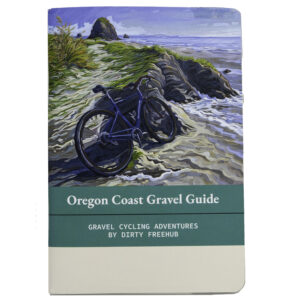
Related Guidebook
Ridden and Reviewed by:

Have you ridden this route? Got a question? Join the discussion!