Harriman Trail


Caution! We do not provide turn-by-turn directions in our GPX files. Those are auto-generated by your bike computer and are usually less than 70% accurate. Learn more.
For help loading a GPX file onto your bike computer, go here.
DownloadHighlights & Remarkable Spots
Sawtooth Visitor Center/ ~ Start/End
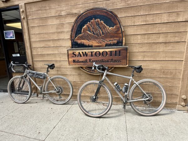
The The Sawtooth National Recreation Area Visitor Center offers focused natural-history exhibits and short interpretive films that introduce the region’s human and ecological story. One highlight is the history of the Tukudika, or “Eaters of Mountain Sheep,” a mountain-adapted band of the Shoshone. Wildlife displays cover species encountered in the Sawtooths, including gray wolves and mountain goats. Botanical exhibits help riders identify dominant forest types—Douglas fir, lodgepole pine, subalpine fir, and Engelmann spruce—as well as riparian cottonwood and aspen stands. Seasonal wildflower panels feature lupine, fireweed, elephant’s head, and alpine forget-me-nots. ardian buckwheat.
Boulder Peak View / ~ Mile 5
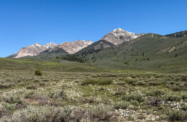
Boulder Peak comes into view along the route. At nearly 11,000 feet in elevation, Boulder Peak is the most visible of the Boulder Mountains. The area drains to the Big Wood River via creeks like Boulder Creek. While it is only the 127th tallest peak in Idaho, it is steep and rugged and provides a stunning view into the deep wild areas of the Sawtooth National Recreation Area.
Easley Hot Springs / ~ Mile 7
Open seasonally from Memorial Day to Labor Day, Easley Hot Springs have soothed aching muscles for a very long time. Originally dug out by John V. Easley, there was a log house to provide miners a place to stay and clean up. With the decline in mining, the hot springs fell into disrepair. Then, in 1919, a Baptist Convention noticed the hot water in the river, and eventually petitioned the Forest Service for a permit in order to rebuild the facilities. Over the next century, Easley Hot Springs has seen many renovations as time and nature have taken its tolls. Nevertheless, it’s worth a stop to feel the warm water.
Galena / ~ Mile 19
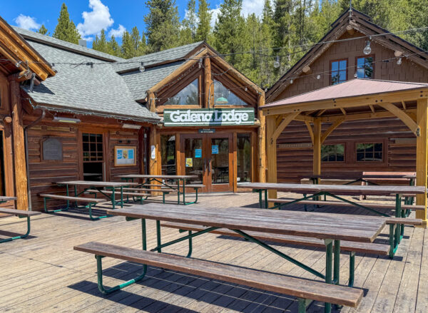
Founded as a mining town in 1879, Galena served the Wood River Valley with several hotels, stables, a meat market, and the Daisy Saloon. But when the veins of ore dried up in the 1890s, Galena was abandoned and left virtually a ghost town. In the early 1900s, with interest in outdoor recreation growing, the Galena Store served folks coming to visit the “Switzerland of America.” It became a Lodge in the 1960s, catering to skiers and other visitors. Continuing this tradition today, Galena Lodge offers guests a quiet place to enjoy the scenery, eat good food, rent gear, or stay overnight.
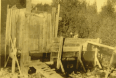
Russian John Guard Station / ~ Mile 27
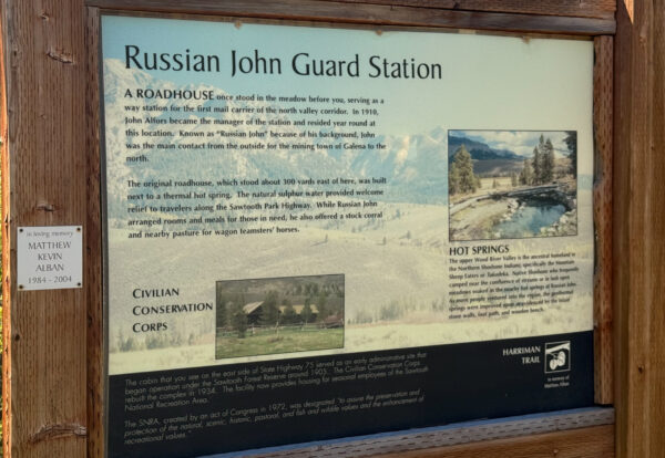
“A roadhouse once stood in the meadow before you, serving as a way station for the first mail carrier of the north valley corridor.” According to local legend and lore, the ghost of Russian John visits campers and, as he is apparently a prankster, rearranges their campsites.
Pioneer Mountains View/ ~ Mile 29
The Pioneer Mountains are home to America’s first Backcountry ski hut. Built in 1937 by Averell Harriman, the Pioneer Cabin was modeled after the high-country touring huts used in the European Alps. Around the same time that the cabin was built, Harriman also began construction of Sun Valley Lodge and Resort, complete with groomed trails, and the world’s first modern chair lifts.
When We Like to Ride This
Late spring and early fall are ideal. In late May, when we rode this, the wildflowers were in bloom, the trail was free of snow, and the Big Wood River was running strong.
In the early fall, the early miles of the route would be spectacular with the change in the color of the leaves of the Cottonwood and Aspen trees.
Terrain & Riding
The Harriman Trail winds gently through the heart of the Sawtooth National Recreation Area, following the Big Wood River beneath towering peaks. The trail is dirt and gravel double track that rolls fast climbing gradually all the way to Galena Lodge. You will encounter wide-open stretches and pass through shady forest corridors. The views shift between alpine meadows and rugged ridgelines. It’s feels both expansive and intimate.
The Start
Water & flush toilets. No parking fee.
Lat / Long: 43.815168, -114.609114
Shorter Option: 11.5 miles, 900 feet of gain. Dirt parking lot.
Lat / Long: 43.784161, -114.556546
Shorter Option: 21 miles, 1500 feet of gain. The parking area is on the north side of Highway 75, you’ll cross over the highway to get to the Harriman Trail. Dirt parking lot. Pit toilet.
Lat / Long: 43.776974, -114.499202
Shorter option. 28 miles, 1800 feet of gain. Dirt parking lot.
Food & Water
- ~ Mile 19: Galena Lodge (opens mid June)
Route Options
If a 38-mile ride is not what you’re interested in, there are many options to choose from.
Shorter
We have detailed 3 alternative start points in the Ride Details tab, ranging from 11.5 to 28 miles round-trip.
Longer
There are 2 trails that take you up to Galena Pass Summit. The Titus Lake trail is a single-track on the south side of the road, and the Galena Summit Toll Rd is a single-track on the north side of the road. For more information about the trails around Galena Lodge, check out this map. If you do either of these options, drop us a comment and let us know how it went.


 Behind every route is scouting, mapping, storytelling, and a whole lot of pedal power.
Have you ridden this route? Got a question? Join the discussion!