White Tank


Caution! We do not provide turn-by-turn directions in our GPX files. Those are auto-generated by your bike computer and are usually less than 70% accurate. Learn more.
For help loading a GPX file onto your bike computer, go here.
DownloadHighlights & Remarkable Spots
Maricopa Trail / ~ the stick of the lollipop
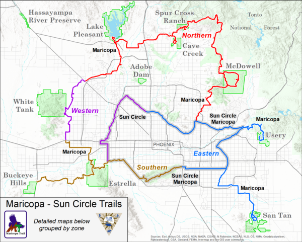
The Maricopa Trail is a 200+ mile loop that connects the regional parks surrounding the city of Phoenix in Maricopa County. The non-motorized trail system (detailed map) was developed over a period of five years and links together the regional parks of Lake Pleasant, White Tank, Spur Cross Ranch Conservation Area, Cave Creek, McDowell Mountain, Usery Mountain, San Tan, South Mountain Park, and Estrella Mountain.
Trilby Wash / ~ Miles 0 to 5
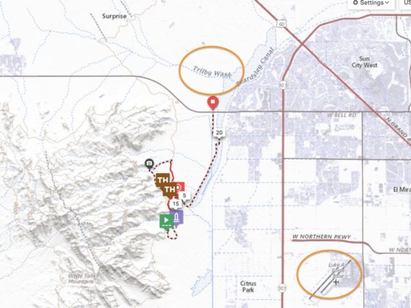
Just to the east of the trail is Trilby Wash and McKickon Dam. If you look closely, you will see a high embankment. In the 1950s the Maricopa County Flood Control District altered the natural course of the Trilby, running west to east, and created an earthen dam to protect Luke AFB, further to the southeast, from flooding.
White Tank Regional Park / ~ the loop

The park is home to eleven different archaeological sites and was inhabited by the Hohokam people from 400-1100 AD. It is nearly 30,000 acres making it the largest regional park in Maricopa County. Most of the park is made up of the White Tank Mountains with deep ridges and canyons. You can see many rock drawings, or Petroglyphs, some believed to be almost 10,000 years old. [Maricopa County Parks]
Waterfall Trail / ~ Mile 10
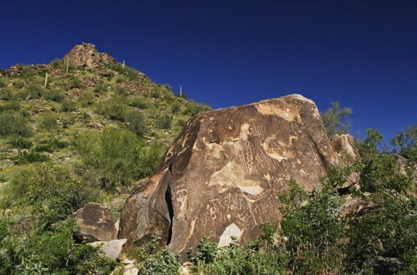
Ann ~2 mile out and back trail to the waterfall. When visiting an ancestral rock art site, you may notice many designs and a “Rosetta Stone” to interpret the designs. The development of written languages is usually over three stages but there are an infinite number of words that can be created from those 26 symbols. This is why the Rosetta Stone was so important to unlocking the mysteries of ancient Egyptian hieroglyphics. The informational kiosk shares some local petroglyph themes. [Onsite Interpretive Sign]
Black Rock Short Loop Interpretive Trail / ~ Mile 10.5
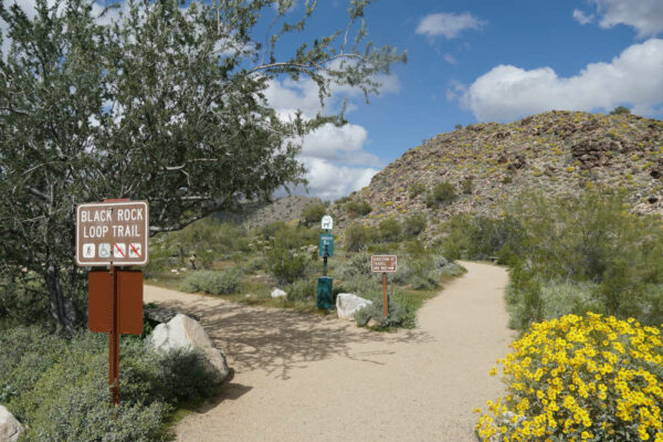
An ~1 mile Interpretive Trail with educational stations about the surrounding flora and petroglyphs. The trail reinforces the habitats, geological stories, flora, and fauna interactions that take place within the ecosystem.
White Tank Nature Center / ~ Mile 14
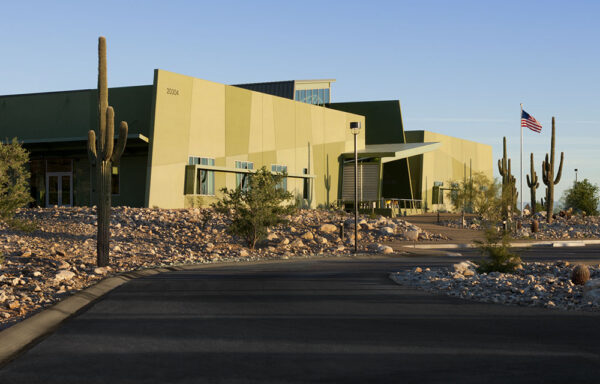
The park has a beautiful and educational library/nature center that is certainly worth checking out. The on-duty staff is super helpful, and the center has a great exhibit of snakes, scorpions, and indigenous artifacts.
Native Lands of the Hohokam / ~ throughout the ride
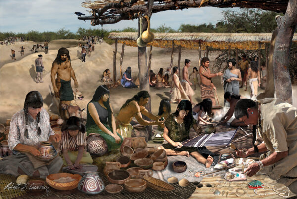
There have been three known Native American cultures that inhabited the White Tank mountains: the Archaic, the Hohokum, and the Yavapai. The Hohokum occupied the area from 100 AD to 1200 AD. They were not only agriculturalists but also hydrologists, creating canals and manipulating surface water to cultivate crops. At the Nature Center, you can learn more about these indigenous people and see some of the artifacts. [Nature Center kiosk]
When We Like to Ride This
The best time to ride in this area is October-May. In the summer months, go early when it’s coolest and bring plenty of water!
Terrain & Riding
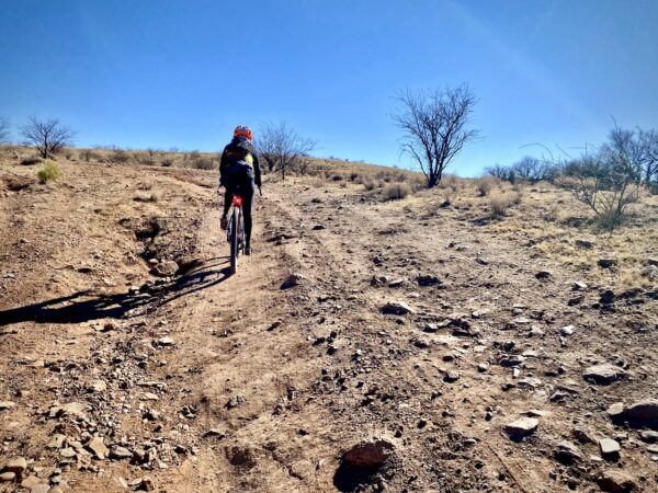
The Maricopa Trail, the trail outside of the park (miles 0 to 5.5 and miles 16 to the finish), is smooth, fast, flowy, and flat and is rated mountain bike easy. However, once in the park, the route gets a bit gnarlier with sections of embedded rock, loose rock, and a (relatively) short climb up the side of one of the hills. The toughest section, the Mule Deer Trail, beginning just after mile 12, is about 4 miles long, with a max grade of 8% and a lot of rough, rocky terrain.
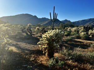
Throughout, you will enjoy your standard fare of Sonoran Desert flora – Saguaros, Ocotillos, and Chollas aplenty as well as Palo Verdes, Mesquites, and Creosote amongst others.
The Start
Dirt parking lot on the south side of West Bell Road.
Food & Water
- ~ Mile 14 / Visitor Center
Route Notes
This route is more than a ride, it is a living history lesson! To get the most out of your day, do the hikes and stop at the Visitor Center. Thus, plan on some extra time (1 to 2 hours additional) and bring a bike lock and use riding shoes suitable for a short hike.
You can knock this route out with just about any setup, but you will be more comfortable on the rocky sections in the park if you have a bit more rubber. We have ridden this cleanly on 40 mm tires but had so much more fun the second time on 50 mm tires with some front suspension (i.e. our desert adventure set-up of a Salsa Cutthroat with 2.1″ 29’er tires and 100 mm travel fork).
Route Options
For a shorter option start at the Visitor Center and do just the loop.
Love Where You Ride! Learn More
 The loop of this route is within White Tank Regional park, which features the rugged and beautiful White Tank Mountains. The range is deeply serrated with ridges and canyons rising sharply to a peak at over 4,000 feet. Infrequent heavy rains cause flash floodwaters to plunge through the canyons and pour onto the plain. These torrential flows, pouring down chutes and dropping off ledges, have scoured out a series of depressions, or tanks, in the white granite rock below, thus giving the mountains their name. We are lucky to have such great places to ride, and we encourage you to support local parks like this! Thus, pay the entrance fee or get a yearly permit.
Videos
The Ride! White Tank
A quick 2-minute video of what to expect on your ride!
The Waterfall Trail
A quick hike of the waterfall trail to one of the white tanks, a depression in the white granite rock caused by heavy rains and the water action of waterfalls.
The Hohokam People
An exceptional video on the culture, history and heritage of the Hohokam people.
Be Informed!
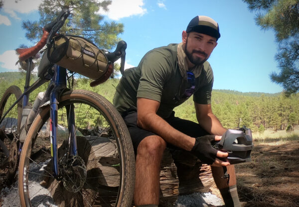
Ridden and Reviewed by:


 Behind every route is scouting, mapping, storytelling, and a whole lot of pedal power.
Have you ridden this route? Got a question? Join the discussion!