Dirty Freehub
Favorites Sign In Search
  • Search
  • Donate
  • Gravel Routes
    • Explore by Region
    • Explore by Type
    • Explore by Collection
  • All Access®
  • Stories
    • Bike Life
    • Culture & History
      • Central Oregon
      • NE Oregon
      • Bend Trails
      • Death Valley
    • People & Places
    • Lands
      • Arizona
      • Central Oregon
      • NE Oregon
    • Love Where You Ride
  • Events
  • User Guide
    • Route Types
    • How We Rate Routes
    • Using the Map
    • Loading a GPX File
    • Glossary
    • FAQs
  • Inside DF
    • The Team
    • Our Missions
    • Impact Reports
    • Press
    • Sponsors
  • Store
    • Gravel Guides
    • Merch
  • Donate
  • Cart
  • Sign In
  • Favorites

Mingus Mountain

5 Star Route / Sedona, Arizona / Published: Oct 2021 / Directions
Save to Favorites Remove from Favorites
Gravel road outside of Cottonwood, Arizona.
Leading out! / May 2021
Gravel cyclist heading up road towards Mingus Mountain.
Just getting going on the gravel.
From gravel road, looking back towards Cottonwood, AZ.
Looking back, early on.
Rough gravel road near Mingus Mountain in Arizona.
Going up! Rough cobble.
Gravel cyclist on dirt road in Prescott National Forest.
Two gravel bikes along a rock.
The machines of choice for the day.
Pink flowers in Prescott National Forest.
The winding gravel road leading up to Mingus Mountain from Cottonwood, Arizona.
Some really difficult chunky section of gravel road.
Some of the chunky stuff. Pick a good line!
Gravel cyclist nearing the summit of Mingus Mountain.
Green Mingus
Bike rider getting some water from wilderness spout.
Copper Chief spring, mile 8.8.
The deep green forest of the Prescott area.
Gorgeous flat reprieve, miles 7 to 10.
Red dirt road near the summit of Mingus Mountain.
Nearing the summit.
Smooth gravel road near Jerome, Arizona.
Happy to be on smooth gravel, starting mile 15.8.
The Mingus Mountain rest stop area of off Highway AZ 89A.
Mingus rest area, at intersection with 89A. Mile 19.5
Cyclist taking a break while descending AZ 89A near Jerome.
Enjoying the views on the descent.
Cyclist fastly descending 89A.
Descending 89A.
Cyclist entering the town of Jerome, AZ.
Entering the town of Jerome.
*
Route:
Loop | 36 mi
*
Gain:
4,800 ft
*
Surface:
50% gravel / dirt road, 50% pavement
*
Technical Difficulty:
Very Demanding
*
Navigation:
Attention Required
*
Locale:
Remote
*
Tire Suggestion:
48 mm+
*
Options:
---

Mingus Mountain is at the heart of the eastern portion of Prescott National Forest and towers over the historic mining town of Jerome reaching up to 7800 ft at its peak.

This is a climbers route! The texture of the terrain is perfectly variable. Just when you think you can’t take any more chunk, a smooth section of gravel will come out of nowhere to provide you with some relief!

Read More
Map
Brown = gravel / dirt road
Blue = single track
Red = paved road
Purple = paved bike path
GPX Download   Version 1.0

Highlights & Remarkable Spots

Mingus Avenue (aka Forest Road 493) / Gravel / ~ Mile 0 to 6

This initial section of road is chunky with mostly embedded rock but it also some loose areas. The average grade is about 8%, with max grades over 20%. This is the most difficult portion of the route, however there are some sections of nicer dirt that will be a welcome reprieve before encountering the next bit of chunk.

Forest Road 413 / Gravel / ~ Mile 6 to 9

This section of the route flattens out and the road becomes much more smooth. You’ll also notice a vegetative shift as you enter the mountainous forest of Ponderosa Pine trees.

FR 413 / Gravel / ~ Miles 9 to 10.5

Intense climb, average grade over 9%, including a section where you will likely need to hike briefly.

FR 413 / Gravel / ~ Miles 10.5 to 19

The final ascent up Mingus with an overall much more manageable incline, but still some sections over 10% grade. During the last 1300 ft. of climbing you’ll also discover some excellent dispersed camping areas (keep this in mind for future visits or for crashing the night before the ride!).

Arizona Highway 89A / Paved / ~ Miles 9 to 35

This is an absolutely epic descent (14.5 miles, 3700 feet, with an average gradient of 4.5%) that goes through Jerome, a historic (and haunted) mining town with charm for days. The views throughout are incredible and most of the time you’ll be moving fast enough to avoid any traffic from behind so that you can simply enjoy.

I would highly encourage you to stop in Jerome. Explore the town, it’s history (read more) and grab lunch. It is all downhill from here!

Ride Details

When We Like to Ride This

We rode this in mid-May during a temperate stretch of weather. We started out of Cottonwood at about 9 am and it was a bit warm until we gained about 1000 feet of elevation and the air started to cool. By the time we got to the top, the temps were amazing and refreshing.

This route will be best enjoyed during the shoulder months (March-May and September-November) but could still be ridden during winter (although you could encounter a bit of snow up on Mingus!).

Terrain & Riding

This route begins in the neighboring city of Cottonwood (elevation 3300) to the east and immediately sends you up Mingus Avenue heading west to begin the ascent. The mostly chunky climb up (about 17 miles and 4500 feet of gain) could bring you to your knees – but while you’re down there be sure to turn around and enjoy the expansive views of the city of Cottonwood (immediately below you), Verde Valley (all around you), and the majestic red rocks of Sedona (off in the distance!).

After conquering the mighty Mingus Mountain, one of the premier hang-gliding destinations in the Western United States, the payoff is an iconic descent down 89A through the historic mining town of Jerome. Soak in the incredible views and enjoy the hard-earned fruits of your labor!

The Start

Lat / Long: 34.737302, -112.0242460

Cottonwood Recreation Center

Food & Water

  • ~ Mile 7.8: Running Water Spout – Bring filter!
  • ~ Mile 26: Jerome - Water, Food, Restaurant, Bar, etc.
  • ~ Mile 31.5: Clarkdale Gas Station - Water, Food, Convenience Store
Notes & Options

Route Notes

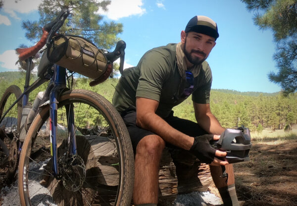
  1. I tackled this on a Salsa Warbird with 48mm Rene Herse Oracle Ridge tires, a fast rolling knobby tire. I wouldn’t want anything less, possibly more.

  2. Recommend a red blinky light with rear looking radar detector for the paved descend.

  3. Vanlife: Excellent free dispersed camping along FR 413. Mingus Mountain Campground is only a small fee of $6/night.

Comments

Have you ridden this route? Got a question? Join the discussion!

Go Local!

On the way down the long paved grade, make sure to stop in the town of Jerome. It has a “wicked” history of mining, drinking, and prostitution.

We highly recommend visiting the Douglass Mansion / Jerome State Historical Park. “The Douglas Mansion has been an eye-catching landmark in Jerome since 1916, when James S. Douglas built it on the hill just above his Little Daisy Mine. This former home is now a museum devoted to the history of the Jerome area and the Douglas family.” (Lat / Long: 34.753479, -112.110569). We have included it on the route map.

Videos

Jerome State Historic Park, Arizona

The Wickedest City in the West!

Keep it Local! Learn More

Jerome Historical Society

Also, we recommend that you check out Jerome Historical Society on 200 Main Street. Here you will learn how the “Wickedest Town in The West” got its name and how men who sought their fortunes in this billion dollar mining camp lived, played and fought.

Ridden and Reviewed by:

JoshV

JoshV / Team Dirty Freehub (Alum)

JoshV (J-Bird) was a route ambassador for the Southwest region, where he developed, documented, wrote about, and tested routes. And each winter kicked Captain O’s butt on the bike. (2018 – 2022)

Sign Up for the Dirty Freehub Newsletter

info@DirtyFreehub.org
Terms of Service Privacy EEO Policy Our Values
Dirty Freehub is 501(c)3 non-profit organization.
©2025 Dirty Freehub :: All Rights Reserved :: Website Design
Cleantalk Pixel

We Need Your Support!

Dirty Freehub is a 501(c)3 nonprofit funded by generous donations from riders like you!

  • $25 Keeps the lights on (web hosting, technology tools, insurance, etc.)
  • $50 Keeps lights on + up to date route conditions
  • $100 Continued route development
  • $200 Fully documented route guide
  • $200+ Gravel Girl giggle of gratitude

Donate Today