… by Kevin B English
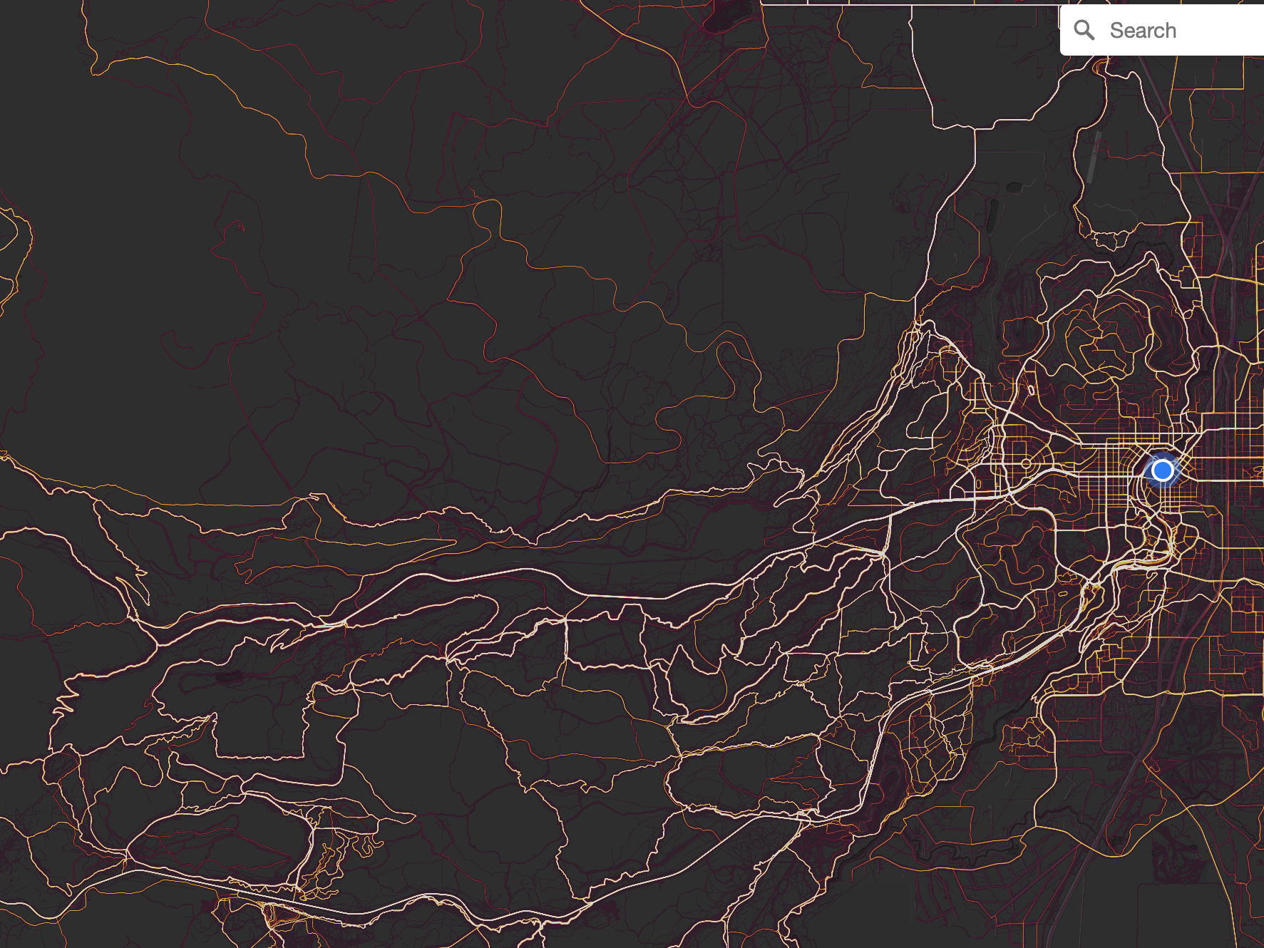 Strava is a “social network for athletes,” it offers a space for individuals to track their exercise, share their achievements, and engage in friendly competitions. For me, Strava and other social networks like Ride With GPS do a great job of inspiring me to get outside and exercise. Recently Strava and other similar social platforms added features to help riders find routes and areas to ride. Routes from other riders are suggested via an automated algorithm, or one can explore heat maps and build their own routes. (A heat map shows where others have recently ridden. The more riders on a particular trail or road, the more intense the heat, a color coding scheme from light blue to hot red). This data collection and sharing is automatically turned on in Strava. If you do not wish to share your data, you must take steps to turn off sharing. Hmmm?
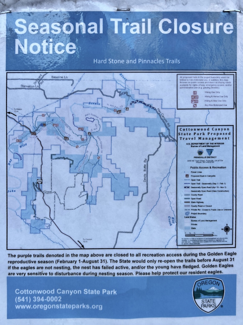
I mostly ride in the National Forest or on BLM lands. Some parts of the national forest are off-limits to recreational use for part of the year due to things like eagle nesting in the spring. Some parts of the forest are critical wildlife habitat corridors. Some riding areas require a permit. And within the forest, there are interspersed areas of private land.
But, when you load a route into your bike computer from Strava, these issues are not evident. There are no warnings, cautions, or notations suggesting wildlife impact, private property, or permit required.
 Consider the case when the Forest Service last year decommissioned the “COD Wimp Out road” within the Phil’s network (Bend, Oregon area) to re-establish a wildlife corridor. It didn’t work because there was a lot of heat on that road. From this, people unknowingly rode the track back into shape. Within 6-weeks of decommissioning, a community trail was in place.
Further, heat on a Strava map is persistent for 2 years. Thus, it is nearly impossible to decommission a trail or road in the forest. As people continue to ride the community trail (i.e., rogue trail), more heat is generated, and the cycle perpetuates. Ugh!
Or, consider the case when you are 40 miles into your ride and encounter a private property sign. Do you turn around and respect private property rights or do you continue and hope for the best?
As another example, consider the Upper Flagline trail near Mt. Bachelor (Bend, Oregon area again). It is closed until August 15th due to elk fawning. But a tourist may not know that and unknowingly load that Strava route into their bike computer. A route, most likely, generated by a local rider and a route with a lot of heat. That tourist may stop and turn around when they see the closed sign, or they may continue to ride through. We know both happen.
So, am I really suggesting that you quit Strava? No, not really. Strava can be a great tool in some instances, like finding the best paved roads to ride in Central Oregon or, in the Midwest, finding the best county gravel roads to ride. Here in the West though it has unintended adverse effects.
What I am advocating is that you: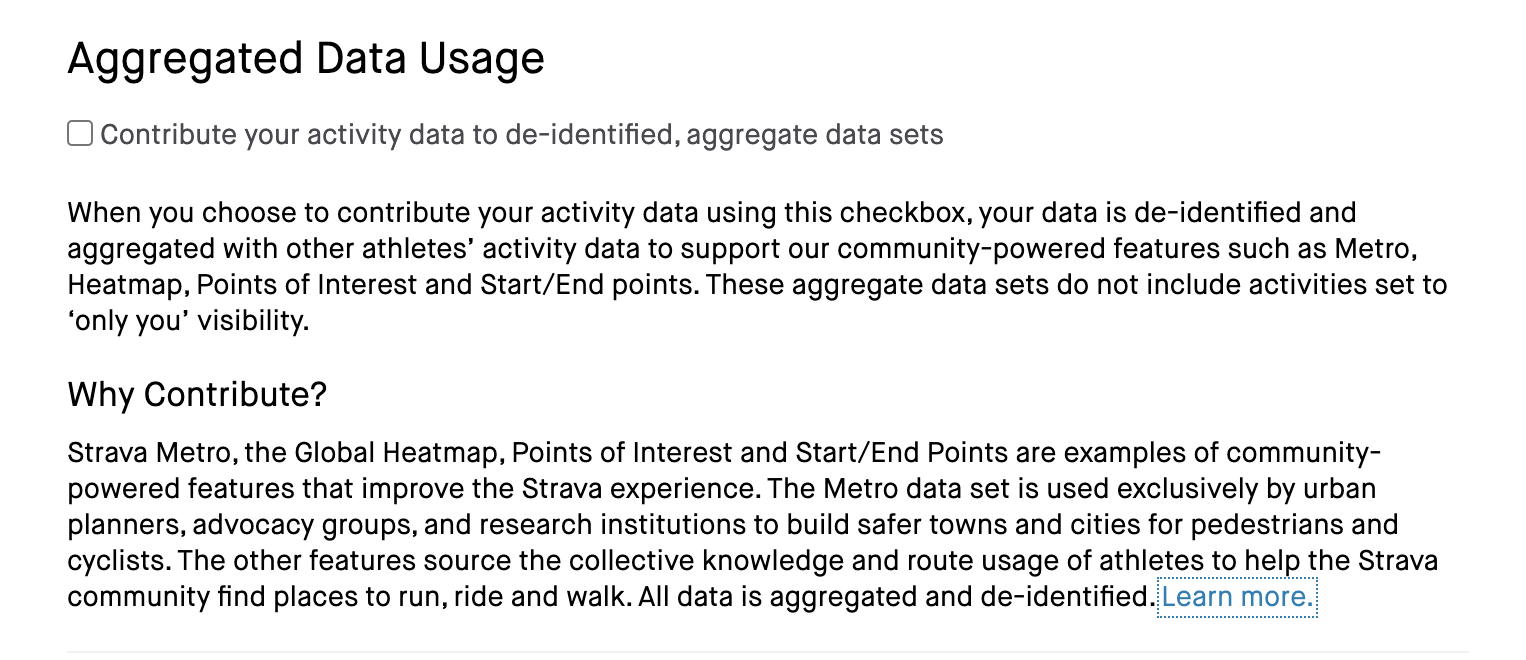
- Do not share or make your ride data public when riding in national forests, or
- Don’t share routes and rides in areas where you know there are season closures or may be high impact areas to wildlife, or
- In the comments section of the route block within Strava make a comment of closures, wildlife impact, permits required, etc. or provide a reference link out to a source that curates and provides up to date route information.
For me, I made the choice to quit Strava.
Kevin is one of the co-founders of Dirty Freehub and is currently the Director of Routes & Technologies. Kevin’s passions are the outdoors, his friends, and most recently learning about the culture, history, and heritage of where he rides.
