
Dark Skies
Closed to public access: road is washed out and unrideable. See Notes & Options tab for details.














Caution! We do not provide turn-by-turn directions in our GPX files. Those are auto-generated by your bike computer and are usually less than 70% accurate. Learn more.
For help loading a GPX file onto your bike computer, go here.
DownloadHighlights & Remarkable Spots
Millican Valley / @Start
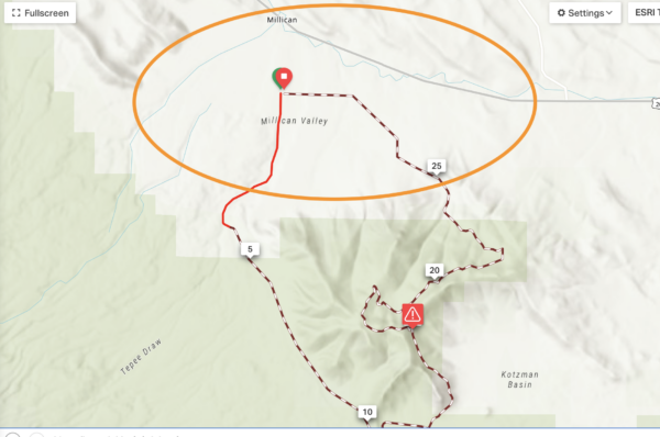
Millican’s history began in the 1880s when George Millican founded a ranch 25 miles east of Bend. Soon after, a small township bearing his name emerged, and by 1913, it became an official town with its own post office. With the construction of US Hwy 20 in the 1930s, most of the town’s population moved out in search of a better life, leaving only one man, Billy Rahn, to run the post office until it closed in 1942. After World War II, a businessman named Bill Mellin bought and ran the old gas station, store, and post office, but he was later murdered by his only employee. Since then, several families and businesses have bought and sold the town, none keeping the land for long. Millican is now a ghost town with no inhabitants. [Oregon Secretary of State]
Great Basin Viewpoint / Mile 6.1
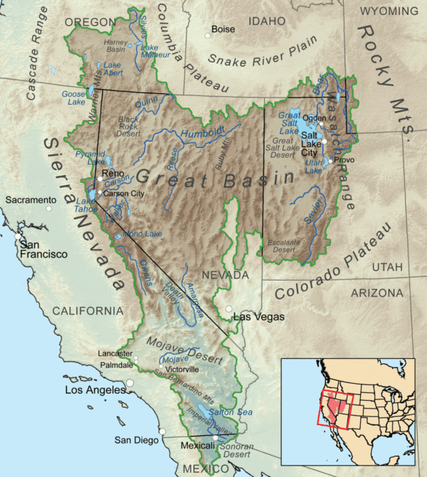
The Dark Skies route is at the northern edge of the Great Basin, a 209,162-square-mile area that once drained internally. This means that rivers, streams, and creeks found no outlet to either the Pacific Ocean or the Gulf of Mexico; all precipitation in the region evaporated, sank underground, or flowed into lakes. With the construction of the Los Angeles Aqueduct, which broke ground in 1908, large amounts of water were diverted outside of the area, forever altering the landscape. [Wikipedia]
Pine Mountain Observatory / ~ Mile 6.5
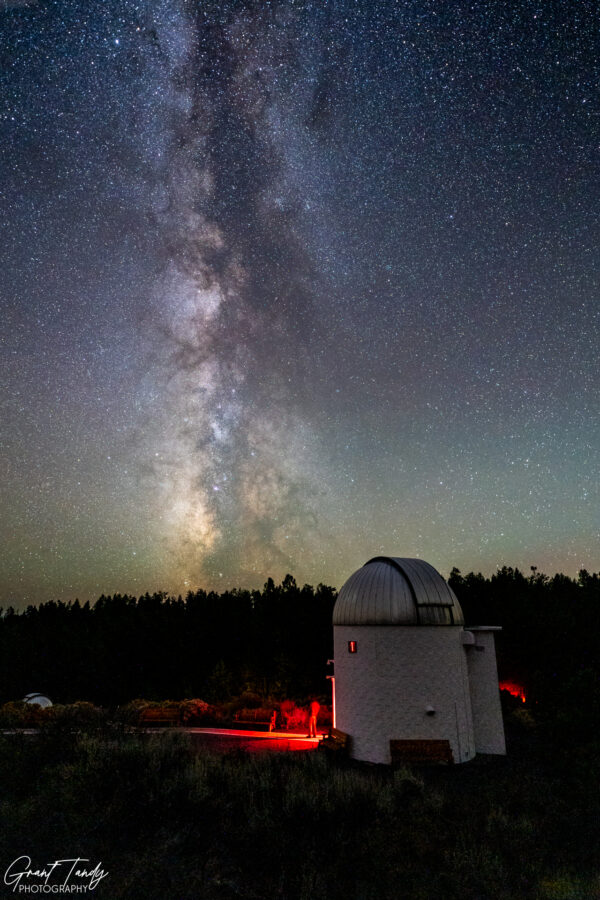
“Pine Mountain Observatory, located 34 miles southeast of Bend, is perched atop a mountain at an elevation of 6,300 feet. The observatory’s location is well placed to make the most of the dark skies that the Eastern Oregon high desert provides.
The observatory is operated by the University of Oregon Department of Physics under a special use permit from the Deschutes National Forest. The observatory’s primary function is research and other astronomical observations, including basic and advanced scientific research. However education at all levels is also an important function and objective of the observatory.” [Pine Mountain Observatory]
Photo Credit: Grant Tandy
Fecker Telescope / ~ Mile 6.5
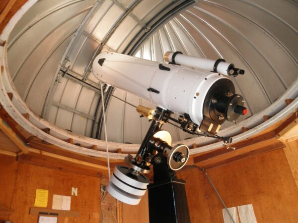
The Fecker 15″ Cassegrain telescope is known as “The Matriarch of the Mountain” due to its long and important history in the development of the observatory. Back in 1950, the University of Oregon bought the telescope and placed it on top of a building in Eugene. In 1961, Dr. E.G. Ebenhausen took the telescope up to Cache Mountain to study the atmosphere. Views were subpar, and so in search of drier weather and clearer skies, he moved the telescope to Pine Mountain. And thus the observatory was born! The Fecker got its own dome in 1968 and was a high performer until the 90s when it fell into disrepair. In 2012, a volunteer named Alton Luken found the telescope tucked behind some insulation and spent three years restoring it. Since 2015, the Fecker has been used to help University of Oregon physics students develop their communication skills and teach the public about the universe. [Wikipedia]
Photo Credit: University of Oregon
Boller & Chivens Telescope / ~ Mile 6.5
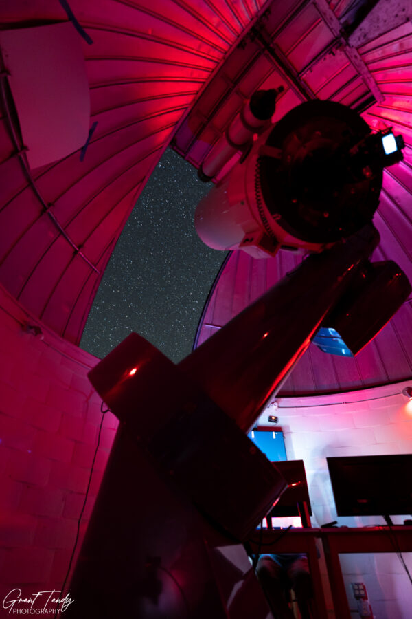
The Boller & Chivens 24″ dome was the very first building constructed at the Pine Mountain Observatory. It was completed in summer 1967, after getting a special use permit from the Deschutes National Forest. In August of that same year, the telescope was installed, and the grand opening of observatory was held on September 17, 1967. That was a big night because it was also the first time the telescope saw its first light. This telescope was a big deal back in the 70s and 80s, doing cutting-edge astronomy research such as discovering magnetars in 1970. Even today, it’s still one of the most important telescopes at the observatory as it is used for all sorts of undergraduate research, technology development, and public outreach events. [Wikipedia]
Photo Credit: Grant Tandy
Planewave Telescope / ~ Mile 6.5
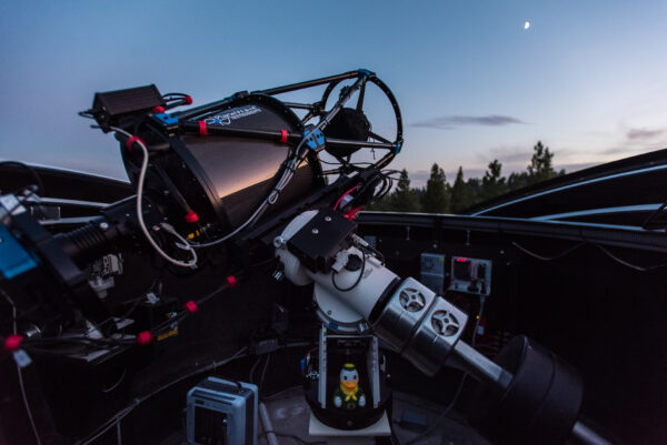
The Planewave 14″ Corrected Dall-Kirkham, also known as “the Robbins,” is the newest telescope at the Pine Mountain Observatory. Construction started in 2015 and after two summer seasons of commissioning, the telescope was finally ready for observations in Fall 2018. This telescope is unlike any others at the observatory because it uses a camera system instead of the traditional eyepiece. Plus, it can be operated remotely from the University of Oregon campus or other institutions near or far. Even though it’s smaller than the other telescopes at the observatory, it’s one of the most powerful instruments because of its top-of-the-line optics, electronics, and camera system. [Wikipedia]
Photo Credit: University of Oregon
Ponderosa Forest / ~ Miles 8.5 to 14
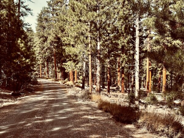
Along this sector is a beautiful, healthy Ponderosa Forest. Do you know this about Ponderosa Pines and fire? (1) They have exceptionally thick bark, which acts as a protective shield for the tree’s sensitive cambium layer, which is essential for nutrient transport and growth. (2) They have resin ducts that produce a sticky, resinous substance that during a firee melts and flows down the trunk, creating a fire-resistant barrier that shields the tree from the heat and flames. (3) They self-prune their lower branches as they grow, leaving fewer branches close to the ground. This reduces the “ladder fuel” that can carry ground fires into the tree’s crown.(4) They can resprout from the cambium layer beneath the fire damaged bark can quickly regenerate, often with multiple trunks growing from a single base.
Credits & Acknowledgements
This route guide was funded in part by a grant from the Deschutes Trails Coalition and Deschutes County.

When We Like to Ride This
The route rides well all year long. If you go in the spring or fall, not that the route tops out at just over 6000 feet.
Terrain & Riding
What You Will See & Experience
Pine Mountain Observatory sits on the eastern edge of Oregon’s Cascade Range, where the landscape transitions from mountain forest to high desert. That contrast defines the area and this ride.
Around the observatory itself, the terrain is dominated by open Ponderosa pine forest. The trees are widely spaced, with tall, straight trunks and reddish bark. The understory is relatively sparse, made up of bunchgrasses, sagebrush, bitterbrush, and low shrubs. Volcanic soils and scattered lava rock outcrops are common, reflecting the region’s geologic past.
At the turn around point you view the Great Basin. This region is defined by its basin-and-range topography—broad, arid valleys separated by low ridges and distant mountain ranges. Vegetation is sparse and adapted to low moisture: sagebrush, rabbitbrush, bunchgrasses, and hardy desert wildflowers in spring. The climate is noticeably drier than on the mountain.
As you descend along Pine Mountain Ridge, the forest begins to thin and open up. You get broader views, and the vegetation becomes more clearly “high desert”—less dense forest, more shrubs and grasses, and an increasing sense of exposure to wind and sun. Western juniper becomes more common here, dotting the landscape with dark, gnarly forms of old junipers.
The end of the ride brings you back into Millican Valley. This is classic Central Oregon high desert: a wide, open basin with rolling terrain, dry washes, and a patchwork of sagebrush steppe. The colors shift to muted greens, grays, and tans.
The Riding
The Pine Mountain Observatory Road—the main route to the observatory—is a well-maintained gravel road, though it can develop washboard conditions during the summer. The climb to the observatory is steady at about a 5% grade over 5.5 miles, gaining roughly 1,600 feet in elevation.
We recommend riding past the observatory to the Great Basin viewpoint first. On your way back, stop at the observatory before beginning your descent.
About 2 miles into the descent, turn right onto a Forest Service road. This section takes you onto Pine Mountain Ridge and includes an additional climb of about 500 feet. At the summit, a short spur road to the left leads to a scenic viewpoint that’s well worth the quick detour. Continue along the route, descending through Ponderosa forest until you reconnect with the main gravel road about a mile from where you started.
The Start
A dirt parking area just of the main road leading up to the observatory.
Food & Water
- None
Route Notes
The access road (Forest Service Road 2017) to the Pine Mountain Observatory is closed indefinitely due to severe damage and washouts caused by late-May thunderstorms. Both the observatory and the Pine Mountain Campground are inaccessible to the public. The U.S. Forest Service crews are coordinating repairs, but no official reopening date has been set.
As of March 2026, we have made a major revision to the route. Look for version 2.0.
The route tops out at 6200 feet. Be ready for it to be colder and windier at the observatory. Should you wish to visit the observatory for a night viewing, know that temperatures can drop near or below freezing even in the summer.
If you visit the observatory for an evening viewing, keep in mind the etiquette about red lights and night vision. This applies to cell phones, bike lights, and other sources of light.
“In the dark, the pupils of your eyes open up to admit more light, and your retina also becomes more sensitive. This is what gives you ‘night vision’ so you can see faint objects on the ground and in the sky. If the eyes encounter a white light, the pupils close down again and may take twenty minutes or more to fully open, and for your retina to regain full sensitivity. At Pine Mountain, we are very protective of night vision. Do not operate any white lights on the hill while observing is in progress. We have red cellophane that you can affix to the front of white flashlights with rubber bands and/or tape. Gentle red light aimed down will allow you to see your way around, but will not trigger the pupil sensor.” [Pine Mountain Observatory]
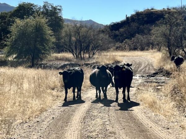
There is open grazing along this route. Be sure to check out our “Be Informed!” page on how to best pass by cows (for your safety and theirs).
Route Options
The Night Option
Riding this route at night is a super special way to see the skies. But, we recommend you do it in the opposite direction to that mapped. Ride it in the clockwise direction. This will make the descent from the observatory more straightforward. Also, bring a good light and trust your navigation device.
Love Where You Ride! Learn More
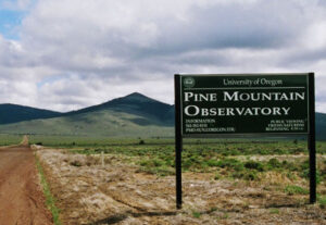 For an unforgettable journey through the cosmos, plan to visit the Pine Mountain Observatory. At first glance, the observatory may look like a few insignificant domes, but those domes contain the eyes to the universe. It’s best to visit the observatory when the skies are clear and ideally moonless. Aim to arrive just after sunset, as this is when the viewing festivities begin. As the sky darkens, expert guides will point state-of-the-art telescopes at various celestial objects, explaining their significance and answering any questions you may have. Whether you’re a seasoned astronomer or just looking for a unique experience, the observatory will transport you to the stars and beyond.
For an overview of the observatory and a hint at the magic you might see through the telescopes, watch the video below.
Videos
The Ride! Dark Skies
A quick 2-minute video of what to expect on your ride!
Pine Mountain Observatory: Stargazing Oregon’s Dark Sky
A 15-minute video describing the Pine Mountain Observatory and showing views that can be observed from the telescopes under dark skies.
Podcasts
Pine Mountain Observatory: Exploring the Cosmos
Welcome to Pine Mountain Observatory, nestled in the serene landscapes of Oregon about 34 miles southeast of Bend. In this episode, we unveil the highlights of the night sky with our guest, “astro monk” Alton [...]
Be Informed!
Keep it Local! Learn More

Ridden and Reviewed by:


Have you ridden this route? Got a question? Join the discussion!