Destination Milkshake!


Caution! We do not provide turn-by-turn directions in our GPX files. Those are auto-generated by your bike computer and are usually less than 70% accurate. Learn more.
For help loading a GPX file onto your bike computer, go here.
DownloadHighlights & Remarkable Spots
Trail Kiosks
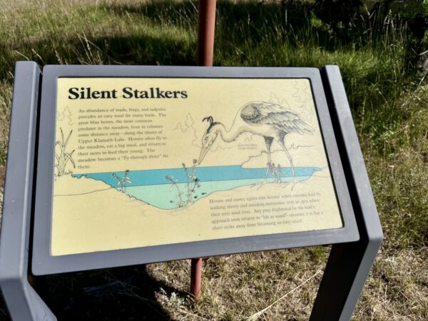
There are over ten kiosks along this trail, and we’ve highlighted a few below. However, some are best experienced in person, as they describe features you’ll see along the way. We encourage you to stop and explore each one. Additionally, we’ve included several other noteworthy points of interest below that are not covered by kiosks.
Great Meadow / ~ Mile 0 to Mile 1.5
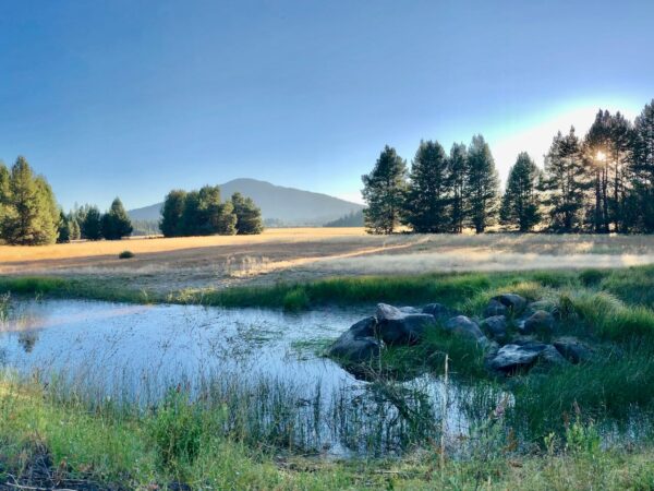
Many centuries ago this area would have been underwater year-round – a part of Lake of the Woods. And, as recently as the 1920s (before drainage ditches were dug), the lake overflowed during wet years and covered the meadow to a shallow depth.
Throughout the late 1800s, Great Meadow provided welcome feed for the livestock of travelers on the original Ashland-to-Klamath-Basin wagon road (now known as Dead Indian Memorial Road), located just east of here.
Lake of the Woods / ~ Miles 1.8
Unlike many lakes fed by large rivers, Lake of the Woods primarily receives water from underground springs and seasonal snowmelt from the Cascade Mountains. Three small tributary creeks also contribute to surface inflow. However, with no major river feeding it, the lake relies heavily on precipitation and snowpack, making it particularly vulnerable to drought. Water leaves mainly through subterranean seepage and several small creeks that drain into Great Meadow, which connects to Seldom Creek and eventually Upper Klamath Lake.
Riparian Area / ~ Miles 1.5 to 2.5
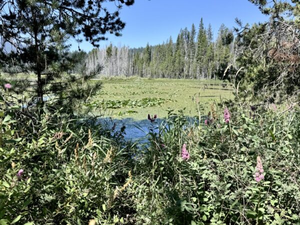
The riparian zone around Lake of the Woods is a vibrant transition between land and water, teeming with towering pines, leafy willows, and wetlands buzzing with life. These areas act as nature’s filters, trapping pollutants to keep the water clean. The deep-rooted trees and shrubs stabilize streambanks, preventing erosion and flooding. Plus, they provide cool shade, keeping the water just right for fish and other aquatic creatures. Trees like Douglas-fir, lodgepole pine, big-leaf maple, alders, and Oregon white ash and shrubs like red osier dogwood, western birch, hawthorn, alder, and chokecherry all perform an invaluable job supporting both wildlife and the lake’s health.
Ridges & Fissures / ~ Mile 5.5
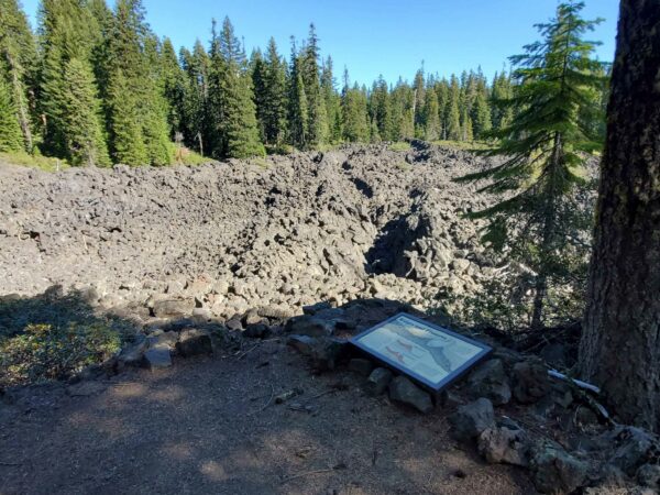
Andesite lava, thicker than basalt, oozes rather than flows. As it erupts, its high viscosity causes it to pile up, forming steep-sided ridges and dome-like features. As the cooling outer layer solidifies, the still-molten interior can exert pressure, leading to cracks and fissures on the surface. These cracks, often perpendicular to the flow direction, can create dramatic patterns on the solidified lava ridges, revealing the immense forces at play during the eruption. This process gives andesite flows their characteristic rugged and fractured appearance. A fissure over 200 feet long is present at approximately mile 5.5 of this ride.
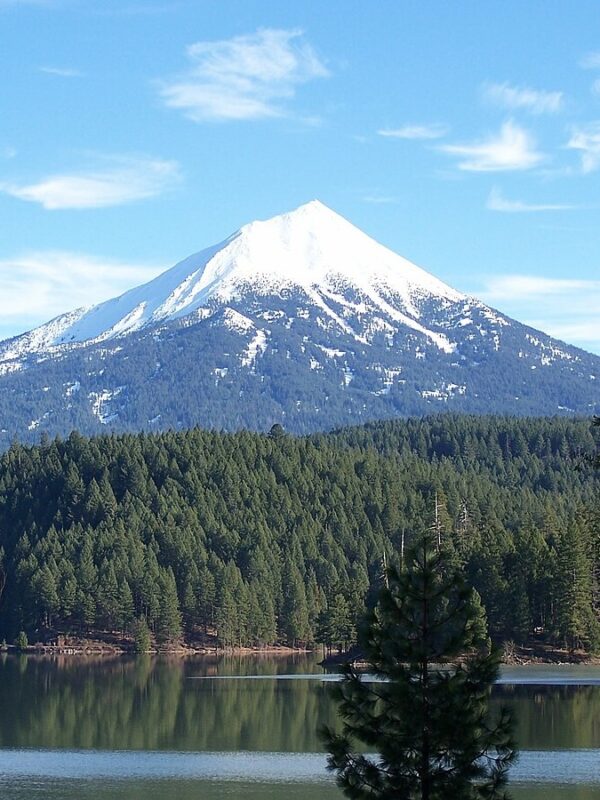
Mt McLoughlin / ~ Mile 6
Though John McLoughlin never set foot on the peak that bears his name, his influence looms as large as the mountain itself.
One of the most powerful and polarizing people in Oregon history, John McLoughlin championed the Hudson’s Bay Company’s (HBC) business interests in the Pacific Northwest. He was a striking figure, with steel blue-grey eyes, a ruddy complexion, a tall, muscular frame, and shoulder-length white hair. George Simpson, the HBC’s Northern District governor, described him as “a man of strict honour and integrity but a great stickler for rights and privileges,” and one who possessed an “ungovernable Violent temper and turbulent disposition” that frequently led to conflict. Read the entire compelling story here.
Douglas Pine Squirrel / ~ Miles 7 to 11
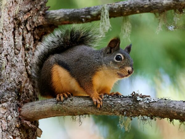
The Douglas pine squirrel, or chickaree, is a territorial tree squirrel known for its sharp, rapid calls. “Chickaree” is an onomatopoeic term reflecting how a word imitates a natural sound. It is thought that early settlers or the Indigenous people heard its shrill “chick-a-ree” calls and named it accordingly. The pine squirrel has reddish-brown fur, a pale underbelly, and a bushy tail with a black-tipped edge. These squirrels play a key role in forest regeneration by burying conifer seeds, unknowingly planting future trees.
Pacific Crest Trail / ~ Mile 7.5
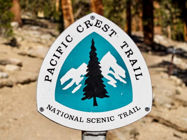
The Pacific Crest Trail (PCT) was first envisioned in 1932 by Clinton C. Clarke as a continuous route from the Canadian to the Mexican border, connecting existing trails in Washington and California with Oregon’s Skyline Trail. The trail section at this mile marker was once part of that original vision. Today, the PCT spans 2,650 miles. Each year, 800 to 1,000 people complete the journey, representing about 15% to 35% of those who attempt the thru-hike.
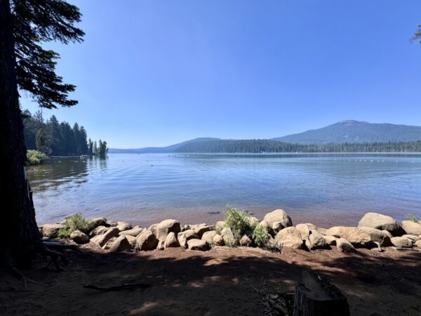
Fish Lake / ~ Mile 9
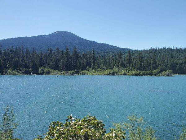
Fish Lake, the region’s largest and deepest lake, is fed by underground volcanic springs. Originally a small natural lake, it was expanded in the early 1900s to support agriculture in the Rogue Valley. Between 1902 and 1908, workers using horses and wagons built dams and canals to increase its size. In 1915, the Cascade Canal was completed, diverting water from Fourmile Lake across the Cascade Divide to further boost the lake’s inflow. This ambitious project turned Fish Lake into a vital irrigation reservoir while maintaining its natural beauty. (Read more about the Cascade Canal’s bold construction.)
When We Like to Ride This
This route rides well spring through fall. If you plan for the spring check snowfall levels before going (campgrounds in the area open late May). We like this route best in the summer when the elevation may provide a respite from summer heat elsewhere and getting on or in the lakes can be added to your day.
Terrain & Riding
Great Meadow Sector / Mile 0 to 1.5
This sector is flat and rolls in and out of the woods on forest loam along the south side of Great Meadow. The trees are mid-growth and provide a nice canopy. There are openings with expansive views of Great Meadow and Mt. McLoughlin and kiosks with information about the meadow’s birds, plants and the surrounding forest.
Lake of the Woods Sector / Mile 1.5 to 5
At ~ mile 1.5 you arrive at Lake of the Woods and roll into Aspen Point Campground – there is a bathroom at the boat launch. As you roll around the north side of the lake you can enjoy the riparian zone of the lake and views to Brown Mountain.
At ~ Mile 3 stay right (don’t take the road to the left).
The first 5 miles of this ride have a total gain and loss of elevation of approximately 100 feet. The trail is smooth forest loam and wide. There are posts on the trail at approximately mile three that restrict the width of the trail to 44 inches.
Lava Field Sector / Mile 5 to 7
At ~ Mile 5 you enter the lava field. The trail here becomes compacted gravel. It remains smooth and wide but the climb in this section is the crux of the ride. The climb averages ~ 4% over ~ 1 mile and has a maximum sustained grade of 10%. The trail has been constructed over lava rock and the compacted gravel used as surface material can leach through it leaving the occasional small hole. Some caution should be used when descending on the return leg.
The plentiful views in this sector will give you plenty of reason to stop and catch your breath. At ~ mile 5.3 is the kiosk, Ridges and Fissures. Be sure to stop and see the over 200 foot long fissure at this spot.
~ Mile 6 has a stunning view of Mt. McLoughlin over the lava field and trees. The kiosk at this location explains the flow you are looking at and the “volcanic bombs” that can be seen there.
Fish Lake Sector / Mile 7 to 9
At ~ mile 7 you exit the lava field and begin the descent towards Fish Lake. You’ll reenter the forest here and the trail surface becomes forest loam once again. The descent is ~ 3 miles long and has a maximum sustained gradient of 8%. There is one small rise to get over before you roll into Fish Lake – which you’ll appreciate on the return trip as it provides a brief respite from the longest climb of this out and back ride.
At ~ mile 8 you cross the Pacific Crest Trail.
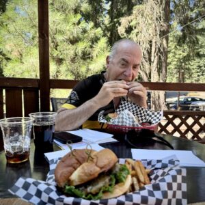
Once you reach the end of the High Lakes trail at ~ mile 9 and find pavement turn left and pedal the short distance to Fish Lake Resort. From the deck of the resort enjoy views of the pristine water and Brown Mountain.
The Start
Great Meadow Sno-Park has a big, wide open parking lot. There are no facilities at the sno-park. Park at the western edge of the lot for better views!
Food & Water
- ~ mile 9 / Fish Lake resort.
Route Notes
This route follows High Lakes Trail and does not use gravel roads. It is an approximately four foot wide trail that starts as forest loam, changes to compacted gravel and then returns to forest loam.
The Lava Fields and Fish Lake sectors have moderate grades interspersed along the route – refer to Terrain and Riding under the Ride Details tab. The entire trail is appropriate for adaptive 3 and 4-wheeled bikes, but at road crossings installed posts constrict the trail to 44 inches. A photo of one of these crossings can be found by scrolling through the photos at the top of this webpage.
This is a multi-use trail popular with hikers. The USFS webpage for High Lakes trails states, “Cyclists are expected to reduce speed and ride courteously when encountering other trail users.”
Trail etiquette for cyclists:
– Yield to hikers and other non-cyclists.
– Greet others with a friendly “hello.”
– When passing from behind, announce yourself calmly and ask to pass.
– Yield to uphill cyclists.
Route Options
This ride is part of a longer route on Dirty Freehub called High Lakes – Brown Mountain. High Lakes – Brown Mountain is a development route that has not been vetted or fully ridden by the Dirty Freehub team. It is a 25 mile loop with approximately 1,800 feet of climbing.
Love Where You Ride! Learn More
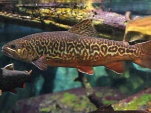 Fish Lake may look like a peaceful alpine escape, but beneath the surface, a battle for balance is underway. In 1992, the lake’s ecosystem was disrupted when tui chub—an invasive baitfish—were illegally introduced. Their rapid spread turned the once-clear waters murky, devastated the insect population, and sent trout numbers plummeting.
Enter the tiger trout—a striking hybrid of brown and brook trout, introduced to curb the tui chub’s takeover. These fish are natural predators, feeding on the invasive minnows to help restore the lake’s delicate balance. With golden-brown bodies and jaguar-like markings, they’re as beautiful as they are important. Since they’re sterile, their population stays in check, making them a valuable conservation tool. If you cast a line, remember: these fish are catch-and-release only—another way to help protect this lake’s fragile ecosystem.
Tiger trout are bred at Wizard Falls Fish Hatchery on the beautiful Metolius River in Central Oregon. The hatchery is a point of interest along another Dirty Freehub ride, Sherman’s Waltz.
Keep it Local! Learn More
Related Guidebooks
-

All Access Gravel Guide Eastern Oregon (Collector’s Edition!)
$12.50Now shipping! A 64-page pocket-sized gravel guide. Featuring gravel routes, art, culture and local history. A one of a kind…Add to cart -

All Access Gravel Guide Western Oregon (Collector’s Edition!)
$12.50Now shipping! A 64-page pocket-sized gravel guide. Featuring gravel routes, art, culture and local history. A one of a kind…Add to cart
Ridden and Reviewed by:


Have you ridden this route? Got a question? Join the discussion!