Roslyn Rocks


Caution! We do not provide turn-by-turn directions in our GPX files. Those are auto-generated by your bike computer and are usually less than 70% accurate. Learn more.
For help loading a GPX file onto your bike computer, go here.
DownloadHighlights & Remarkable Spots
Northern Exposure Sites / Route Start and Finish
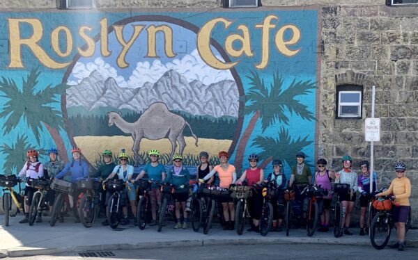
Fans of the early 90’s sleeper TV hit Northern Exposure might recognize the Roslyn Cafe mural from the opening credits of the show, where a moose casually strolled through town. Also featured prominently in the show was The Brick Saloon, which opened in 1889 and boasts a 100-year-old back bar that traveled shipping lanes from England via Cape Horn. It also has a 23-foot running water spittoon still in operation today and old jail cells in the basement where unruly drunks were reportedly held to sleep it off. [Yakima Herald]
Roslyn Historical Cemeteries / ~ Mile 0.5
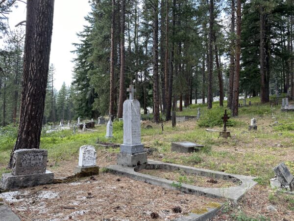
The Northern Pacific Railway Company, which began developing coal mines in Roslyn in 1886, heavily recruited men “from coal mining regions in other parts of the United States and from nations with well-developed coal industries. Forty percent of the population in 1900 was foreign-born, mostly Slavic, Italian, and English immigrants. In fact, 24 nationalities have been recorded living in Roslyn at one time. The same census year of 1900 shows 22% of Roslyn’s population was black at that time. During a mining strike in 1888, the company recruited black miners from the southeastern U.S. to take the place of the striking miners. Special trains brought in over 300 black miners and their families. This migration represented the greatest increase in the black population of Washington Territory at that date.” This diverse cultural history is reflected in the collection of 25 different ethnic and lodge-affiliated cemeteries in Roslyn today. [Roslyn Library]
Teanaway Community Forest / ~ Miles 10.8 to 28.2
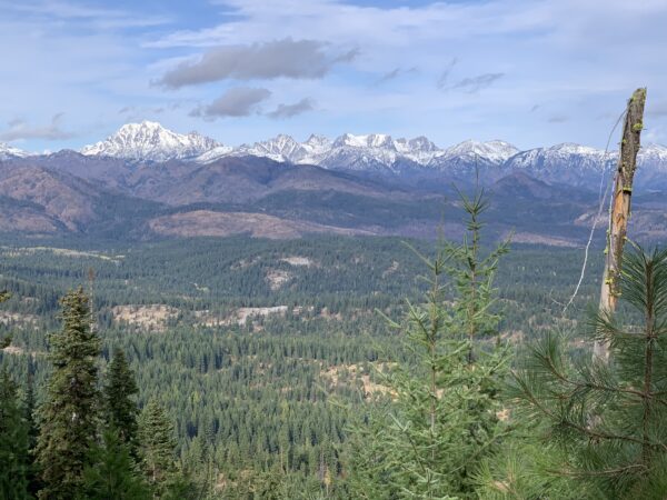
The first of its kind in Washington, “the Teanaway Community Forest demonstrates how conservation, sustainable forestry, and community partnership goals can be achieved. This beautiful 50,241-acre landscape lies at the headwaters of the Yakima Basin watershed. The state purchased the land in 2013 with funding provided by the Legislature and established Washington’s first state-owned community forest. The forest contains nearly 400 miles of free-flowing streams and prime habitat for fish and wildlife. It has a history of grazing and timber harvests and offers unique recreation opportunities.” [WA DNR]
Rock Features / ~ Miles 12, 23, 25, more!
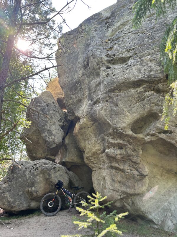
This route will take you to Mammoth Rock, Exclamation Point Rock, Cheese Rock, and Split Rock. These rocks from the Eocene epoch (56 -33.9 million years ago) predate the Cascade Mountain Range. At that time, “you would have found meandering rivers, low hills, and swamps instead of mountains. The river deposits and swamps were compressed by overlying rock and heated by the Earth to become sandstone and coal.” These rocks are Eocene sandstone from the Roslyn Formation whose eye-catching shapes formed when the surrounding weaker rocks eroded away. [WA DNR]
The holes in Cheese Rock are called tafoni and are caused by water-induced weathering.
Coal Mines Trail / ~ Miles 33 to 36
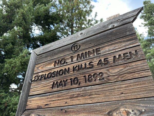
Northern Pacific Railway constructed a branch line between Cle Elum and Roslyn in 1886 and on to Ronald in 1887 that was used to transport coal as well as local residents. Although the rails are gone, the route has been preserved as a historical walk with signs identifying significant sites. Keep an eye out for markers along the trail calling attention to historical events such as Washington’s worst coal mining disaster (next to the pagoda mentioned below) and noteworthy mining infrastructure such as slag piles and mine locations.
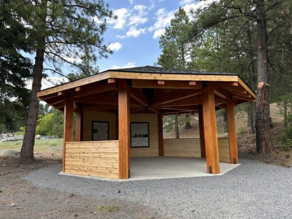
Yakama Nation Interpretive Pagoda / ~ Mile 36
An excerpt from these informative panels about Yakama Nation history and culture: “This land is the traditional territory of the Pshwánapam [who] spoke a language known as Ichishkinsinwit which translates to ‘the language that belongs to the land’. The language came to be because of the places on the land that carry a message through the wind and water. The land speaks the language and we speak it back. This creates a spiritual connection to our people through the language. It is the language that is understood by the Creator. For example, the word ‘Pshwan’ is known as rock as it is the sound that is created when a stone drops into the water.” [Read more about the Yakama Nation]
NWI Company Store and Miner Memorial / ~ Mile 36.2
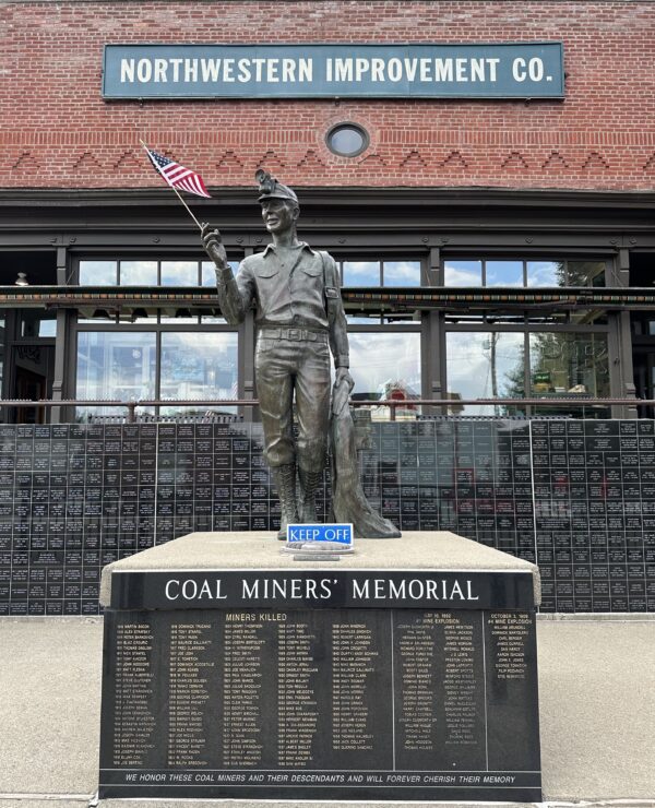
“The Northern Pacific Coal Company, a division of the Northern Pacific Railroad, owned and operated the company store that supplied goods to the residents of Roslyn in the nineteenth century. The company constructed this one-story building in the downtown commercial core at First Street and East Pennsylvania Avenue in 1889. It was one of three general stores serving Roslyn, carrying basic staples such as food, clothing, hardware, and furnishings.” [SAH Archipedia] Retail businesses and historical photos can be found inside this brick building on Pennsylvania street, which is listed on the National Register of Historic Places. Situated directly in front is a coal miner’s memorial statue erected in 1996.
When We Like to Ride This
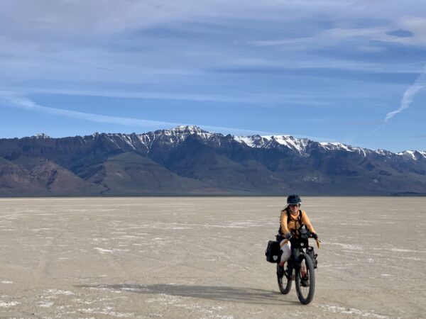
Late spring to early fall is best due to the potential for lingering (or early) snow in the Teanaway. Note that in spring there may be deadfall, and summer can mean high heat and beach sand. This route likes moisture in the soil!
Terrain & Riding
The route starts in downtown Roslyn where you can grab a coffee and breakfast from Basecamp Books & Bites, Roslyn Cafe, or the Roslyn Mercantile and get any last-minute bike needs addressed at Ride Roslyn. Note that if you do this route on one of the days the Teanaway Country Store is closed (check hours before you go), there is no potable water source for almost the entire route, so plan accordingly. We highly recommend bringing a water filter.
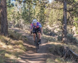
There are some steep pitches where most folks will need to hike-a-bike both up and down. Most of the singletrack is rideable on a gravel bike with a few exceptions, mostly in the Mammoth Rock/Exclamation Point Rock area where there are some technical features that may be best walked.
From downtown Roslyn, you will loop through the Roslyn Historical Cemeteries on pavement before heading away from downtown and hopping on Woody’s and then Ewok (both are singletrack trails in the Roslyn Urban Forest). At the top of Ewok, after a short detour to a viewpoint of the Stuart Mountain Range, you’ll take gravel and forest roads along the ridge where you’ll get views on both sides and a glimpse of Lake Cle Elum before dropping down in elevation and climbing back up again starting with a steep pitch at ~mile 8.5. Enjoy more views at the top before making your way over to Mammoth Rock and Exclamation Point Rock. From here, you’ll drop back down toward the river, first on singletrack and then onto easy-rolling gravel and eventually pavement for the stop at Teanaway Country Store. Some of the hardest miles are yet to come, so be sure to stock up on fluids and snacks.
Leaving pavement after the store stop, you’ll have nice forest roads as you start climbing up toward Cheese Rock, culminating in a stretch of steep singletrack just before the top. Cheese Rock is a great shady spot for a snack break with epic views. After descending back down from Cheese Rock, you’ll enjoy smooth singletrack as you head out to Split Rock and then a combination of forest roads and singletrack as you climb back up the ridge – your last big push of the day. At the top, you’ll get back on the ridge road and enjoy a fast and fun downhill on gravel all the way down into Cle Elum before hopping on the smooth and shaded Coal Mines trail back to Roslyn.
The Start
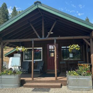
Ride Roslyn Bike & Board. A $5 all-day visitor parking pass for downtown Roslyn is available through ParkMobile (see signs in town).
Food & Water
- Start and Finish / Downtown Roslyn public bathroom, coffee shops
- ~ Mile 18.5 / Potential to filter water at river crossing
- ~ Mile 20 / Teanaway Country Store (limited hours - check first)
- ~ Mile 33.5 / Downtown Cle Elum gas station, restaurants (slightly off-route)
Route Notes
Since most of this route is on public land, there could be logging activity at any time. Thus, do not override your sight lines, and if you do encounter logging trucks, give way. Our recommendation is that you stop, put a foot down, and wave. It is super helpful if you make the pass easy and safe for truck drivers.
If you have great photos or videos (or even a 2-minute ride video compilation) that you would like to share, send them to info@DirtyFreehub.org. What we need is anything and everything that captures the essence of the ride from riding, to views, to remarkable spots, to shops, to drinking coffee. The higher the resolution, the better. This may require sending via Dropbox or a Google link. Thanks!
Route Options
Shorter Option: For a shorter option that cuts out the descent and climb back up from Cle Elum and Roslyn, park at the trailhead area where the West Fork Teanaway Road splits about a half mile west of Teanaway Campground (see POI on the route). At the T intersection with Main Ridge Road at the top of the climb up the north side of the ridge, turn right to stay on Main Ridge Road and pick the route back up at the Log with a View.
Bikepacking Option: This could be done as a two-day bikepacking trip with an overnight in Teanaway Campground at mile ~18.5 (there is no water but it is adjacent to the river so you’d be able to filter).
Love Where You Ride! Learn More
 A big part of what makes the town of Roslyn interesting is its deep ties to coal mining. Learn more about the town’s history at the Roslyn Museum. They can tell you about the history of African American culture and community in Roslyn, the famous bank robbery, the almost-certain mass gunfight that was averted by a courageous self-appointed train engineer, and much more.
Videos
Teanaway’s Tropical History
Geologist Nick Zentner digs into the incredible geologic history responsible for the rock formations in the Teanaway Community Forest. Would you believe palm trees once grew here?
Podcasts
Keep it Local!
We all know it is important to spend where we ride and to support the local economy. But do all dollars spent have the same impact? In this podcast, we explore that premise with Thomas Barr, the Vice President of Business Development for [...]
Keep it Local! Learn More
Ridden and Reviewed by:

Have you ridden this route? Got a question? Join the discussion!