Tour of the Giants


Day 0: Travel to Cave Junction
Travel to Cave Junction. The Laughing Alpaca Campground and RV Park is a good place to stage the tour from. Cave Junction, 2 miles north has services. Tent camping for cyclists is on a common grass area near the river. There are showers, restrooms, and a laundry. We experienced very few mosquitoes. Contact them for vehicle storage. They did not charge a fee and vehicles are stored on-site.
Day 1: Cave Junction to Galice
Ride with GPS Cue Sheet GPX file
There is old growth port-orford cedar and old growth douglas fir along Taylor River Valley. There are four parts to this day.
- The first 14 miles on Hwy 199. Most of the time there is a good shoulder. Sometimes there no shoulder.
- The second 8 miles are an unrelenting climb with an average grade of 5% up to 18%.
- The third section is 14 miles of mixed terrain with more hills and some nice downhill gavel.
- The last 13 miles are a descent into Galice.
Notes</strong
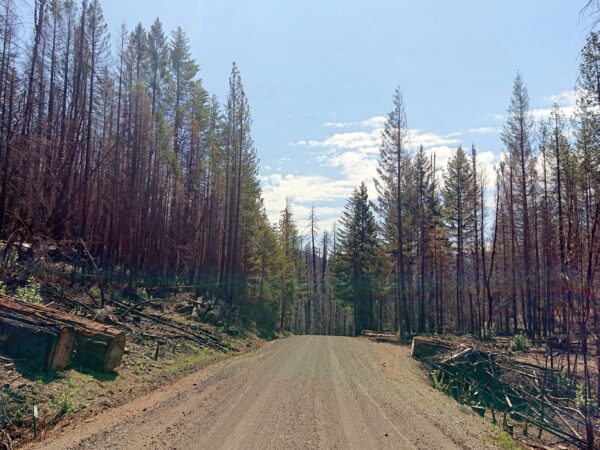
- After mile 10, in Selma, there is no water or service until Galice. There is no cell service after Selma, and there is no cell service in Galice. Water pumps listed at forest service campgrounds have been capped. There is a stream water near Briggs Camp, but it might not be safe for drinking. There was once considerable mining activity in the area.
- Camp at Indian Mary County Park. Showers. We were permitted 8 people with 8 tents at a single camp site. And, the admissions kiosk sells ice cream! The site is along the Rogue River, where there are many dry camping opportunities as an alternative.
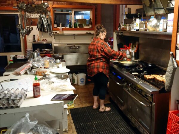
- With an advance reservation, one can dine at the Morrisons Lodge. There is also a store and the Galice Restaurant with limited dinner menu.
Day 2: Galice to Agnes
Ride with GPS Cue Sheet GPX file
A climb and a descent day.
- The first 25 miles are up hill on Bear Creek Road. This include a 7 mile section with an average grade of 7%, with short pitches up to 19%.
- The remaining 26 miles include a 20 mile descent. There are also 20 miles of good gravel on Burnt Ridge Road with incredible vistas.
Notes
- There is no water or cell service. There is also no cell service in Agnes.
- You can arrange to camp on the grass fields around the Lucas Lodge with advanced notice. They also serve a home-style dinner and breakfast. There is also a nearby RV park and dinner lodge.
Day 3: Agness to Brookings
Ride with GPS Cue Sheet GPX file
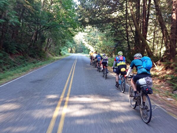
This is the longest day. It is highlighted by great ocean views. The day starts with a beautifully shaded section along the Rogue River eventually exiting onto the Oregon coast. The remaining miles are along US 101.
- 35 miles from Agnes to Gold Beach. Parts of the road are covered by a canopy of trees letting in beams of sunlight. This can make it difficult to judge upcoming road quality and to see ahead. A day-time tail light may help improve safety. After mile 7, there is a 3 mile climb with an average grade of 4%.
- 39 miles from Gold Beach to Brookings along Hwy 101 with a reasonable shoulder. There is a 3 mile climb with an average grade of 5% at mile 36.
Camp at Harris Beach State Park. There are walk in bike camping sites available on a first come first serve basis. One can reserve a campsite for up to eight people with no limit on the number of tents.
Brookings has many dining options and including the Chetco and Misty Mountain breweries. We found the Black Trumpet Bistro to offer very tasty dining, and similarly impressive was the American breakfast at the Blue Water Cafe. A local favorite.
Option 3x (Spur): Francis Shrader Old Growth Trail
Ride with GPS Cue Sheet GPX file
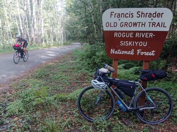
This is an optional spur and demanding spur. It takes you to the trailhead for the Francis Shrader Old Growth Trail. The one mile hiking trail loops through some of the largest hardwoods and oldest Douglas Firs in the Northwest, including Laddie Gale, a tree 10′ across. Perhaps due to its remoteness, this gently graded, lushly forested piece of hiking heaven remains a quiet sanctuary.
- At mile 24, from the main route of the day, turn left for a 2 mile climb with an average grade of 9%.
- The first half-mile is the steepest and is paved. This extreme segment has an average grade of 12% and including a crux of 20%.
- The hike is at the 2 mile mark which is the summit. There’s a pamphlet for a guided walk.
Option 3a (Alternative): Old Highway 101 / Carpenterville Road
Ride with GPS Cue Sheet GPX file
This is an alternative to the Coast Highway for miles 49 to 64. Using this option, the ride totals for the day are 69 miles with 5,376 ft elevation gain. The road has little traffic.
Day 4: Brookings to Crescent City
Ride with GPS Cue Sheet GPX file

This is an easy day in preparation for the final and hardest day of the tour. It includes a mile long loop hike at the Redwood Tree Nature Trail to see Oregon’s ancient redwoods, some 2000 years old.
- The first 19 miles are a gentle ride out & back along the Chetco River to hike the trail. Near mile 11 take a break and hike the one mile loop. There’s a pamphlet for a guided walk.
- The remaining 23 miles slowly meander away from the coast to Crescent City.
Notes
- Camp at Redwoods KOA. Showers.
- Crescent City has a variety of dinner options.
Day 5: Crescent City to Cave Junction
Ride with GPS Cue Sheet GPX file

The final day of the ride combines many aspects of the tour. There’s dirt and gravel, giant redwoods, and plenty of serious climbing with great views and wonderful descents. Stout Grove “is the world’s most scenic stand of redwoods and there is no way to get better views of the Smith River Canyon than by biking down the historic Gasquet Toll Road, a route used during the gold rush …“
- Howland Hill Drive. 13 miles.
- 6 miles of an old dirt stagecoach road through giant redwoods.
- An amazing hike through the giants of the Stout Grove. It is a ½ mile loop.
- US 199. Miles 13 to 20 can be dangerous. There is limited shoulder and sight lines and traffic can be significant. Use caution.
- Old Gasquet Toll Road. Mile 20 to 58, 29 of those miles are gravel.
- Miles 21 to 50 are unpaved with some rough surfaces including #4 sized gravel.
- Miles 21 to 24, a 3 mile climb averaging 6%.
- Miles 26 to 29 have a 3 mile climb averaging 7%.
- Miles 35 to 44, a 9 mile climb averaging 4%. The summit is at the Oregon – California border.
- US 199. The tour ends with 6 miles on the highway where there is a reasonable shoulder.
Notes
- Breakfast At Elk Valley Casino is handy because it is on the way, and the food is good. They shared the Casino will be merging with another tribe’s and that as such it will likely be moving.
- Gasquet at mile 20 has a small market.
- There is no water or services along the the Old Gasquet Toll Road.
- There is no cell service along the Old Gasquet Toll Road.
Route Notes
Hazards
- Ticks, mosquitoes.
- Goat’s Head (Tribulus Terrestris). Also known as puncturevine: limited distribution in interior areas. None observed.
You can find another great write up of the ride here, by Max Knight done in the summer of 2022.

 Behind every route is scouting, mapping, storytelling, and a whole lot of pedal power.
Have you ridden this route? Got a question? Join the discussion!