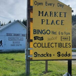
The Sixes


")
")
Caution! We do not provide turn-by-turn directions in our GPX files. Those are auto-generated by your bike computer and are usually less than 70% accurate. Learn more.
For help loading a GPX file onto your bike computer, go here.
DownloadHighlights & Remarkable Spots
Cape Blanco Lighthouse / Miles 0 and 65
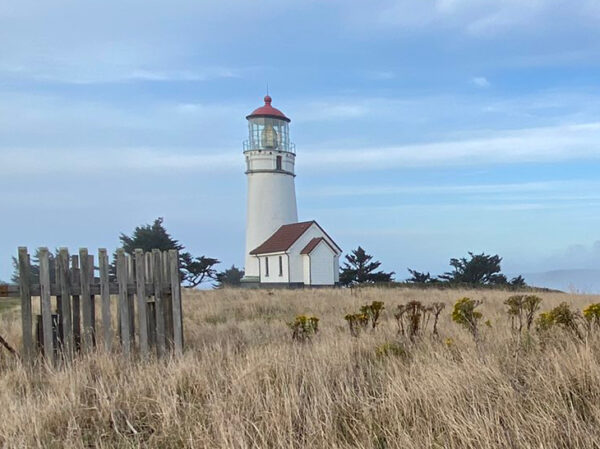
On the eve of December 20, 1870, the Fresnel lens at Cape Blanco Lighthouse was lit for the first time. This lighthouse holds at least four Oregon records. It is the oldest continually operating lighthouse, it is located the most westerly, it has the highest focal plane above the sea (approx. 250 feet), and it was run by Oregon’s first woman keeper, Mabel E. Bretherton, who signed on in March 1903.
Cape Blanco’s history is full of shipwrecks and lives saved. One notable shipwreck was the J.A. Chanslor, an oil tanker that sank in 1919. Of the 39 passengers, only 3 survived the collision with an offshore rock. [Cape Blanco Heritage Society]
Historic Hughes House & Ranch / ~ Miles 1.5 and 64
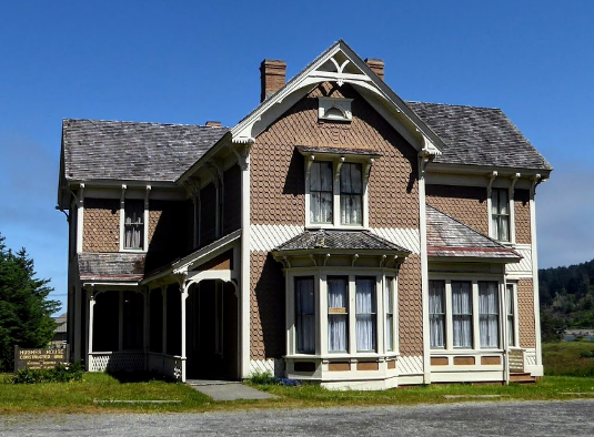
“Visit the restored 1898 Victorian farmhouse built for pioneers [and dairy ranchers] Patrick and Jane Hughes … You can learn about ranch life more than 100 years ago and about the couple’s seven children, one of whom was a longtime keeper at Cape Blanco Light Station.” This house was added to the National Register of Historic Places on November 28, 1980. [Cape Blanco Heritage Society]
Wild and Scenic Elk River / ~ Miles 6.5 to 25.5
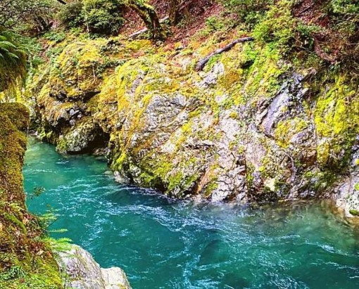
You’ll cross the Elk River twice and ride along side it between the two crossings. It is designated a Wild and Scenic River for its outstanding salmon and trout habitat and water quality. “The combination of water, color, exposed rock surfaces, dynamic flow and relatively undisturbed environment creates an interesting and beautiful landscape throughout the year.” [National Wild and Scenic Rivers System]
Elk River Hatchery / ~ Mile 14
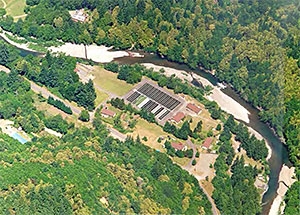
The major portion of Elk River Hatchery construction was completed in 1968. In 1971, the hatchery completed final construction on an intake and ten new ponds. The purpose of the facility is to supplement natural production of fall Chinook in the Elk and Chetco Rivers and winter steelhead in the Chetco River. The facility is used to collect Elk River fall Chinook, to incubate eggs, and to rear both natural and hatchery fall Chinook and winter steelhead. [Oregon Department of Fish & Wildlife]
When We Like to Ride This
Summer is best with better chances for slightly warmer days and some sunshine. Remember though that coast weather is unpredictable at best, so dress accordingly.
Terrain & Riding
With one section that has over 2,400 feet of gain in 8 miles and a max grade of 22.4%, this development route is only for those who love to climb! These coastal forests can be tricky terrain given the steep inclines and year-round moisture and wind. There could be roots and ruts and blow-down any time of year.
Given significant potential for unpredictability and challenge, we recommend layers with special attention towards items that will keep you warmer and drier. Don’t forget your toolkit and first aid supplies, and keep in mind that cell service may be spotty in this remote area.
The Start
Cape Blanco National Historic Site in Sixes, Oregon.
Food & Water
- Start/Finish at Cape Blanco State Park
- ~ Mile 48 / Sixes River Recreation Site
- ~ Mile 55 / Edson Creek Recreation Site
Route Options
If your looking for a shorter route, roughly in the same area, check out Elk River.
Love Where You Ride! Learn More
![]() Founded in 2000 as the Elk River Land Trust, the Wild Rivers Land Trust now currently serves 2.3 million acres on Oregon’s south coast throughout Coos, Curry, and southern Douglas counties. Its mission is to keep the irreplaceable lands and waters of the southern Oregon coast forever wild and abundant.
Founded in 2000 as the Elk River Land Trust, the Wild Rivers Land Trust now currently serves 2.3 million acres on Oregon’s south coast throughout Coos, Curry, and southern Douglas counties. Its mission is to keep the irreplaceable lands and waters of the southern Oregon coast forever wild and abundant.
Keep it Local! Learn More

 Behind every route is scouting, mapping, storytelling, and a whole lot of pedal power.
Have you ridden this route? Got a question? Join the discussion!